The best mountain hikes around Lake Caldonazzo
4.8
(12)
86
hikers
9
hikes
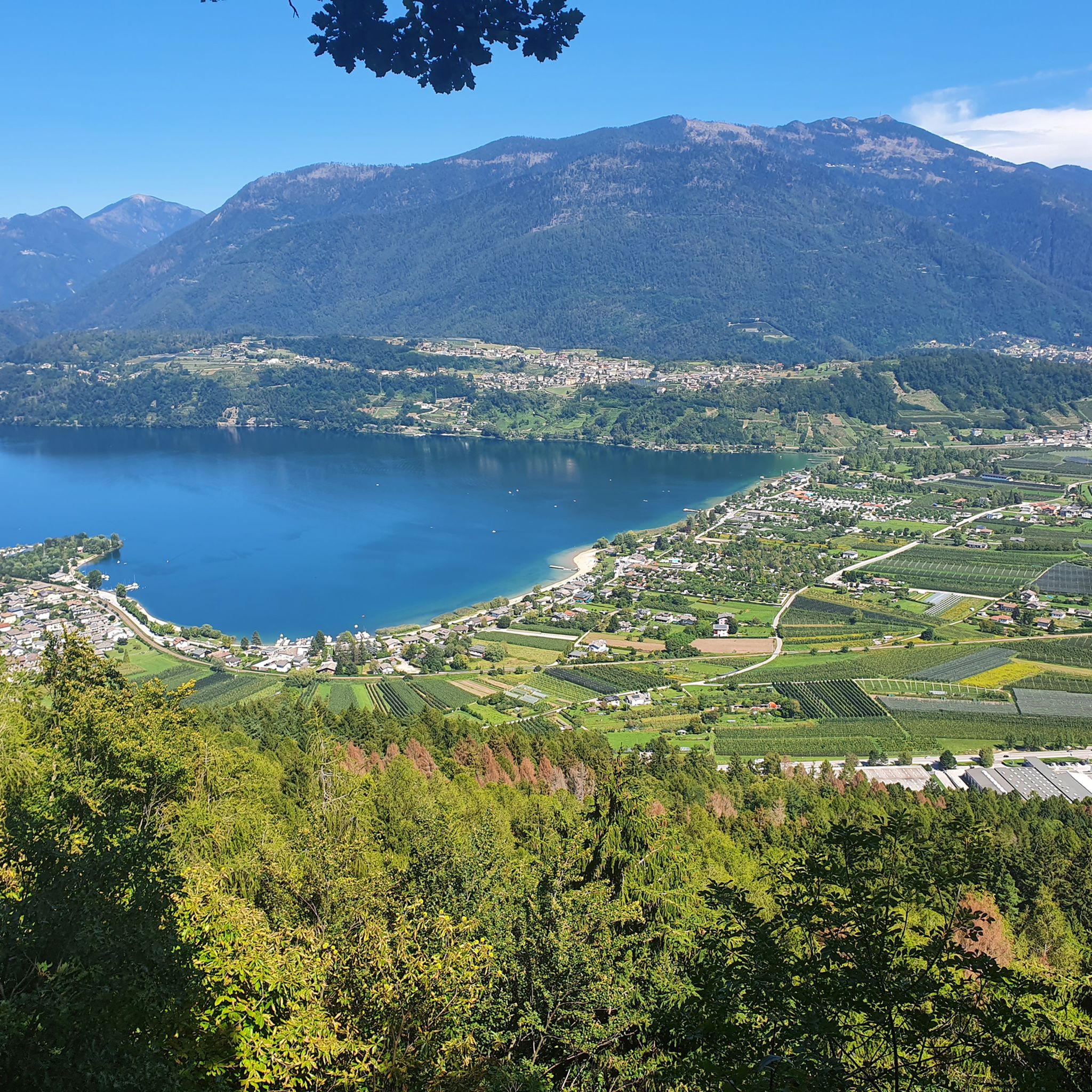
Mountaineering around Lake Caldonazzo is set within the dramatic mountainous landscape of Italy's Valsugana region. The area is characterized by a chain of mountains, including the Vigolana group and Marzola, which encircle the lake. This terrain offers a diverse range of routes through lush forests, alpine meadows, and along old carriage roads, providing varied elevation gains and panoramic views.
Best mountaineering routes around Lake Caldonazzo
- The most popular mountaineering route is Tamazol – Doss Tondo loop from Caldonazzo, a 5.3 miles (8.6 km) trail that takes 4 hours 4 minutes to complete. This difficult route offers significant elevation gain through mountainous terrain.
- Another top favourite among local mountaineers is Valimpach Via Ferrata – Cliffside View loop from Centa San Nicolò, a moderate 4.2 miles (6.7 km) path. This route includes a via ferrata section with cliffside views.
- Local mountaineers also love the Mountaineering loop from Santa Giuliana, a 5.6 miles (9.0 km) trail leading through varied mountain landscapes, often completed in about 4 hours 33 minutes.
- Mountaineering around Lake Caldonazzo is defined by mountainous terrain, lush forests, and alpine meadows. The network offers options for different ability levels, from moderate ascents to more challenging climbs.
- The routes in Lake Caldonazzo are highly rated by the komoot community with an average score of 4.8 stars from over 10 reviews. More than 80 mountaineers have used komoot to explore Lake Caldonazzo's varied terrain.
Last updated: July 6, 2026
4
hikers
8.51km
04:04
690m
690m
Hard mountaineering route. Good fitness required. Sure-footedness, sturdy shoes and alpine experience required.
4.3
(6)
27
hikers
6.70km
02:34
440m
440m
Moderate mountaineering route. Good fitness required. Easily-accessible paths. Suitable for all skill levels.

Sign up for free
5.0
(3)
14
hikers
9.36km
04:48
770m
770m
Hard mountaineering route. Good fitness required. Sure-footedness, sturdy shoes and alpine experience required.
5.0
(3)
14
hikers
11.3km
05:58
910m
910m
Hard mountaineering route. Very good fitness required. Sure-footedness, sturdy shoes and alpine experience required.
7
hikers
15.0km
05:51
940m
940m
Hard mountaineering route. Very good fitness required. Mostly accessible paths. Sure-footedness required.
Get access to more routes and recommendations from other explorers.
Sign up for free
Already have an account?
Our route recommendations are based on thousands of hikes, rides, and runs completed by other people on komoot.
Start today with a free account
Your next adventure awaits.
Login or Signup

Other adventures around Lake Caldonazzo

Tips from the Community

The stairs for MTB transport are not suitable for E-MTBs as they are very steep, partially slippery and the steps are quite high....
0
0

The suggestive and old connecting road to the village of Valle. Recommended for descent
0
0
If it were possible to have the number of people who stopped at this point to admire the fabulous panorama, it would surely be hundreds of thousands.
1
0
The second tunnel you encounter during the ascent
0
0
The Kaiserjegerstrasse tunnels dug by hand to build the military road for supplying the front line of the Great War. At the exit of the first tunnel going uphill, you can see the old road being restored for hiking and MTB.
0
0
The satisfying plateau where you forget the effort of the Kaiserjegerstrasse climb
0
0

From the Virti command post to the 1000-meter altitude line, nicely rideable from here into the gorge, Vall Centa and to the mill at least S5, continuously unrideable. Difficult to walk even without a bike!
0
0

☠️☠️☠️ The trail is in poor condition and largely unrideable. Even pushing it is dangerous; you would have to shoulder and carry the bike. There are (used to be) stairs, but they are now very broken. The descent over 600m of elevation gain in 6km, with gradients of 25-30% at times, is brutal. For inexperienced riders, the trail is (life-)threatening, even on foot.
0
0
Frequently Asked Questions
How many mountaineering routes are available around Lake Caldonazzo?
Based on komoot data, there are over 10 mountaineering routes around Lake Caldonazzo, offering a range of experiences from moderate to difficult. These routes explore the dramatic mountainous landscape of the Valsugana region.
What do other mountaineers appreciate about the routes around Lake Caldonazzo?
The komoot community highly rates the mountaineering routes around Lake Caldonazzo, with an average score of 4.8 stars from over 10 reviews. Users often praise the diverse terrain, from lush forests to alpine meadows, and the panoramic views of the lake and surrounding mountains.
Are there any mountaineering routes suitable for beginners around Lake Caldonazzo?
While many routes are challenging, there are moderate options available. For instance, the Valimpach Via Ferrata – Cliffside View loop from Centa San Nicolò is rated moderate and offers stunning views, though it includes a via ferrata section. It's always recommended to check the route details for specific difficulty and required equipment.
Where can I find more challenging mountaineering routes near Lake Caldonazzo?
For experienced mountaineers seeking a greater challenge, routes like the Mountaineering loop from Sentiero della Pace or the Sella della Marzola loop from Povo offer significant elevation gains and demanding terrain. The region also features the high Vigolana route and the Lagorai high route for advanced treks.
Are there any circular mountaineering routes around Lake Caldonazzo?
Yes, many of the mountaineering routes in the area are designed as loops, allowing you to start and finish at the same point. Examples include the popular Tamazol – Doss Tondo loop from Caldonazzo and the Mountaineering loop from Santa Giuliana, which offer varied mountain landscapes.
What is the best season for mountaineering around Lake Caldonazzo?
The best season for mountaineering around Lake Caldonazzo is typically from late spring to early autumn (May to October), when the weather is generally stable and trails are clear of snow. However, the region also offers ski-mountaineering opportunities in winter for those with appropriate experience and equipment.
What kind of natural features or landmarks can I expect to see on these routes?
The routes around Lake Caldonazzo offer diverse scenery, including lush forests, alpine meadows, and dramatic mountain backdrops. You can expect panoramic views of Lake Caldonazzo and Lake Levico from summits like Cima Vezzena. Historical sites such as Forte Vezzena and Austro-Hungarian forts near Colle di Tenna also dot the landscape. The lake itself, Lake Caldonazzo, is a prominent feature, often visible from higher elevations.
Are there any family-friendly mountaineering options near Lake Caldonazzo?
While many mountaineering routes are challenging, the broader Valsugana region offers a network of trails suitable for various hiking levels. For families, consider easier walks in the Val dei Mocheni and Vezzena Plateau, or the moderately easy walk to Colle di Tenna, which provides picturesque views and cultural points without extreme difficulty. Always check specific route details for suitability.
Are there any permits required for mountaineering in the Lake Caldonazzo area?
Generally, permits are not required for hiking or mountaineering on the established trails around Lake Caldonazzo. However, for specific activities like rock climbing or via ferrata, it's always advisable to check local regulations and ensure you have the necessary equipment and experience. For general information on the region, you can visit visittrentino.info.
What are some less crowded mountaineering routes around Lake Caldonazzo?
To find less crowded routes, consider exploring trails in the Val dei Mocheni and Vezzena Plateau, which offer extensive networks beyond the most popular spots. The Lagorai high route, leading through an unspoilt setting between 2000 and 2300 meters, is another option for those seeking solitude and a more remote experience.
Can I find cafes or pubs near the mountaineering trailheads?
The Valsugana region is well-equipped for visitors. While specific cafes directly at every trailhead might be rare, you will find various establishments in the towns and villages surrounding Lake Caldonazzo, such as Caldonazzo itself, Centa San Nicolò, and other communities. These offer opportunities for refreshments before or after your mountaineering adventure.
Most popular routes around Lake Caldonazzo
Most popular attractions around Lake Caldonazzo

Get inspired with the komoot mobile app


Explore more
Browse the best Mountain Hikes & Routes in other regions.
