The best walks and hikes around Lake Serrù
4.6
(2389)
18,323
hikers
99
hikes
Hiking around Lake Serrù, located at 2,275 meters (7,464 feet) in the Orco Valley, offers an alpine environment shaped by glacial action. The region features a large artificial lake, surrounded by high mountains between Piedmont and the Aosta Valley. Hikers can expect diverse terrain including snow valleys, waterfalls, and panoramic viewpoints overlooking other alpine lakes.
Best hiking trails around Lake Serrù
- The most popular hiking route is Lake Serrù Loop Trail, a 2.9 miles (4.7 km) trail that takes 1 hour 32 minutes to complete. This moderate route offers scenic views around the lake.
- Another top favourite among local hikers is Lago Serrù to Colle della Losa (via Trail 534), a difficult 4.3 miles (7.0 km) path. This route leads to a mountain pass, providing expansive views of the high alpine landscape.
- Local hikers also love the Colle del Carro Trail (532), a 7.1 miles (11.4 km) trail leading through high alpine terrain, often completed in about 5 hours 58 minutes.
- Hiking around Lake Serrù is defined by glacial basins, alpine lakes, and panoramic mountain views. The network offers options for various ability levels, from easy paths to challenging mountaineering routes.
- The routes in Lake Serrù are highly rated by the komoot community with an average score of 4.6 stars from over 2,300 reviews. More than 17,500 hikers have used komoot to explore Lake Serrù's varied terrain.
Last updated: June 25, 2026
4.4
(7)
47
hikers
4.67km
01:32
150m
150m
Moderate hike. Great for any fitness level. Mostly accessible paths. Sure-footedness required.
4.7
(3)
24
hikers
11.4km
05:59
960m
960m
Hard hike. Very good fitness required. Sure-footedness, sturdy shoes and alpine experience required.

Sign up for free
4.7
(7)
27
hikers
6.98km
04:29
640m
640m
Hard hike. Good fitness required. Sure-footedness, sturdy shoes and alpine experience required.
4.0
(1)
10
hikers
3.75km
01:36
140m
140m
Hard hike. Great for any fitness level. Sure-footedness, sturdy shoes and alpine experience required.
4.5
(13)
39
hikers
16.6km
05:51
780m
780m
Hard hike. Very good fitness required. Mostly accessible paths. Sure-footedness required.
Get access to more routes and recommendations from other explorers.
Sign up for free
Already have an account?
Our route recommendations are based on thousands of hikes, rides, and runs completed by other people on komoot.
Start today with a free account
Your next adventure awaits.
Login or Signup

Tips from the Community

Rifugio Savoia is located at an altitude of 2,534 meters on the picturesque Nivolet plateau, right in the heart of the Gran Paradiso National Park. Born from the renovation of a historic hunting lodge of King Vittorio Emanuele II dating back to 1860, today it offers 40 beds and a welcoming kitchen with typical dishes of the Aosta Valley tradition.
0
0


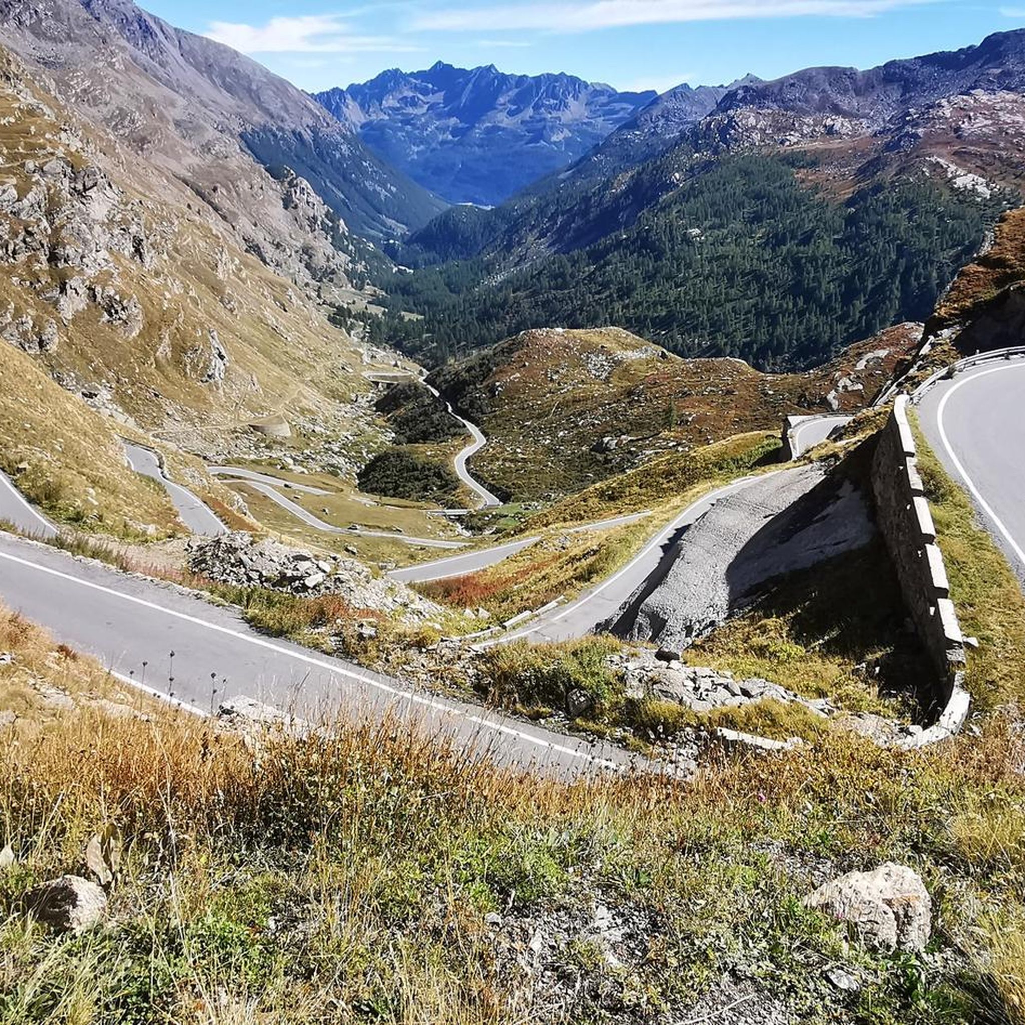
THE 18 KM CLIMB IS DEMANDING DUE TO THE GRADIENTS IT OFFERS BUT VERY REWARDING FOR THE VIEWS IT OFFERS.
0
0

The most beautiful climb in Piedmont. An Australian friend who has cycled around Europe says it is the most beautiful climb in Europe and perhaps in the world. The view from the balcony of the hill is nothing short of stunning...
0
1

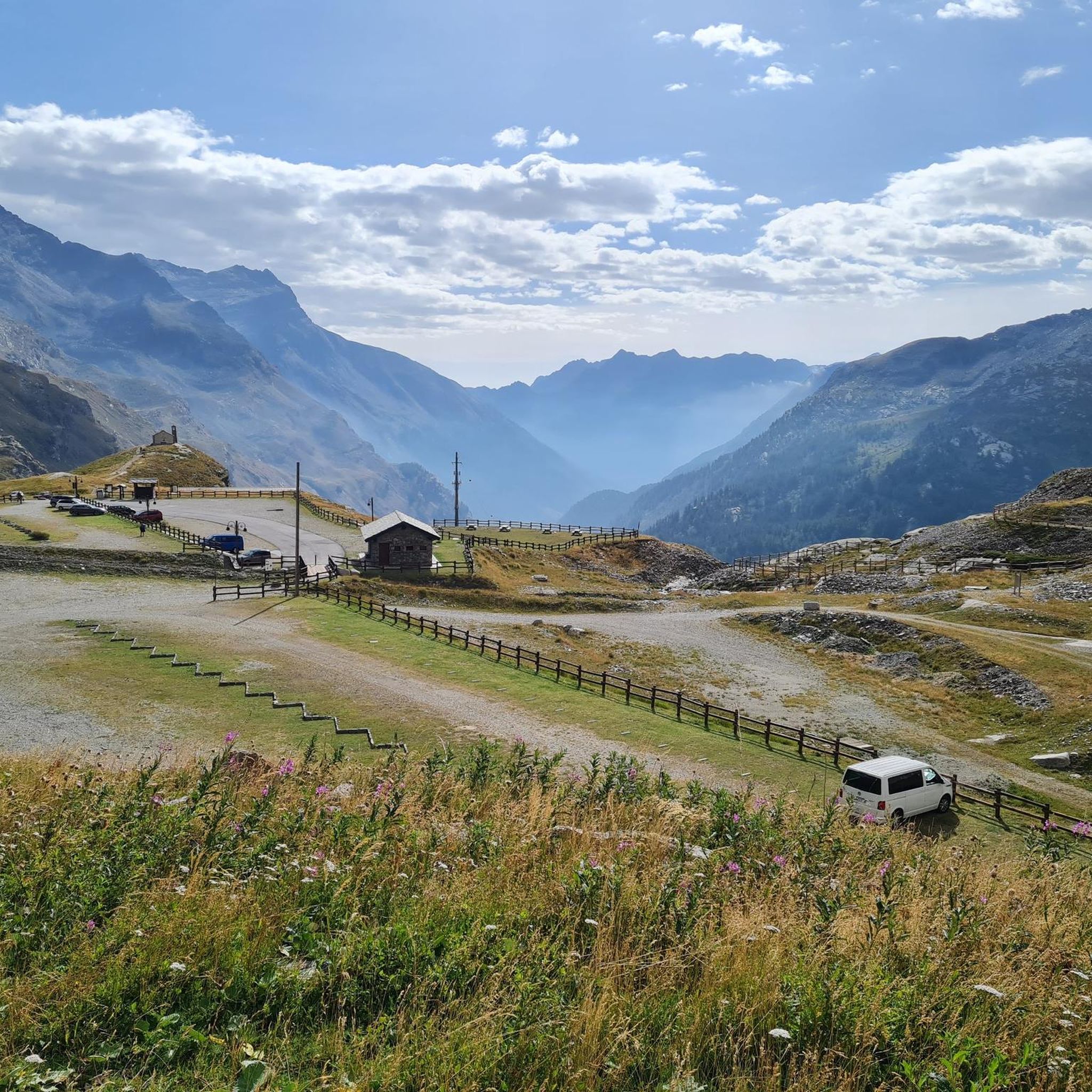
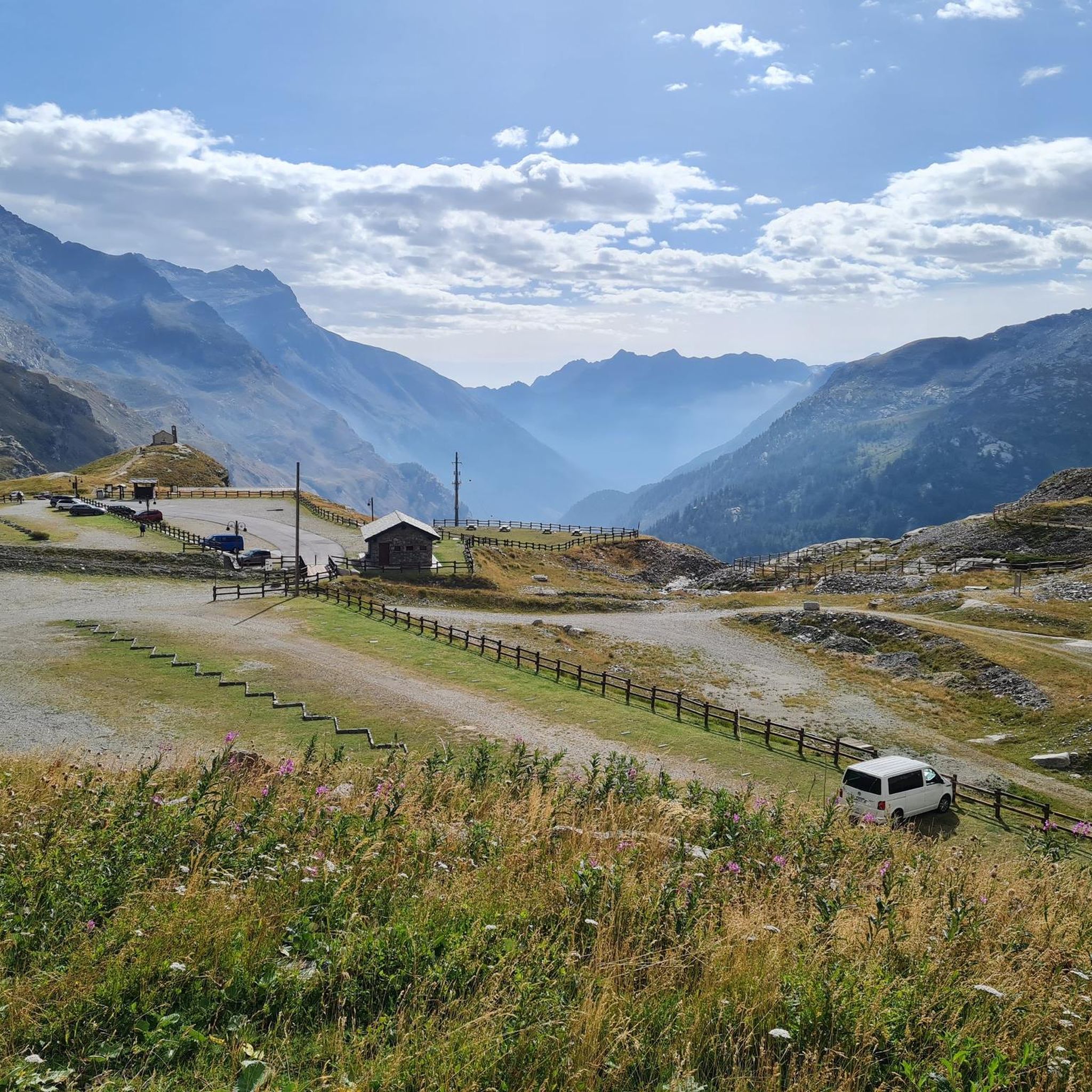
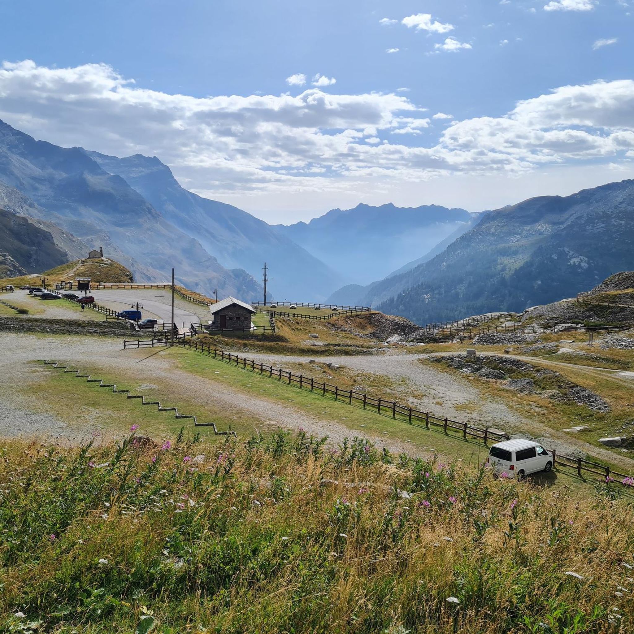
This is the photo that every cyclist wants to have of the Colle del Nivolet! The climb to the Colle del Nivolet offers many opportunities to put your foot down and enjoy wonderful panoramic views, especially from Ceresole Reale. In my opinion, the best panoramic view is from this viewing point / balcony that is located just 200 meters from the top of the pass. It is probably the most photographed view of the Nivolet and the one that we have been thrilled with when seeing it in some magazine or website. There are no words to explain the enjoyment and how one savours the views of Lake Agnel and Serrú, of the mountains, of the alpine passes on foot that cross to France, of the less frequent snowfields... WONDERFUL!
1
0

Beautiful pass with great views. Very often in the clouds, it is cool there.
0
0

Unique one-way pass with a steep slope from the south. There are several parking spaces where you can start the climb. Very busy on weekends with cyclists, motorcyclists and 'sporty' motorists driving up and down the col from the south side. It is even more beautiful to ride this col from the dead quiet north side (Valsavaranche/Aosta) with a gravel/mountain bike. Heavy climb with bike on shoulders over 3.5km from 1950 to 2350m altitude, the rest is reasonably cycleable.
0
0

At an altitude of 2625 metres, Colle del Nivolet marks the border between Piedmont and Valle d'Aosta. Going up from Ceresole Reale the road is entirely asphalted and therefore quite busy. Spectacular views 🤩🏔️
2
0
Frequently Asked Questions
How many hiking trails are available around Lake Serrù?
The Lake Serrù area offers a wide variety of hiking experiences, with over 90 routes available. These range from easy paths to challenging mountaineering routes, catering to different skill levels and preferences.
What kind of terrain can I expect when hiking near Lake Serrù?
Hikers around Lake Serrù will encounter a pristine alpine environment shaped by glacial action. The terrain includes glacial basins, snow valleys, and high mountain paths. You can expect diverse landscapes with panoramic views of surrounding peaks and other alpine lakes.
Are there hiking options for beginners or families around Lake Serrù?
Yes, there are several easy paths suitable for beginners and families. These trails typically have minimal elevation gain and are ideal for leisurely walks. For example, the Lake Serrù Loop Trail is a moderate route that offers scenic views around the lake and is a good option for those looking for a less strenuous hike.
What are some more challenging hikes in the Lake Serrù area?
For experienced hikers seeking a challenge, the region offers demanding routes with significant elevation gain. The Lago Serrù to Colle della Losa (via Trail 534) is a difficult 4.3-mile path leading to a mountain pass with expansive alpine views. Another demanding option is the Colle del Carro Trail (532), which is over 7 miles long and takes you through high alpine terrain.
Can I see waterfalls or other unique natural features on the trails around Lake Serrù?
Absolutely. The Lake Serrù region is known for its eye-catching cascades and serene streams. Many trails are designed to highlight these natural wonders, alongside other features like snow valleys and the nearby Capra Glacier. The area's glacial basin offers a unique opportunity to observe a pristine alpine environment.
Which trails offer the best panoramic views of Lake Serrù and the surrounding mountains?
Many trails in the area provide magnificent views. Routes often lead to vantage points offering expansive panoramas of Lake Serrù itself, other alpine lakes like Lago Agnel and the Nivolet lakes, and distant peaks such as Cima del Carro and Grande Aiguille Rousse. The Lago Serrù to Colle della Losa (via Trail 534) is particularly noted for its expansive views of the high alpine landscape.
Are there other alpine lakes to explore near Lake Serrù?
Yes, the area around Lake Serrù is dotted with other beautiful alpine lakes. Hikers can enjoy views of Lago Agnel and the Nivolet lakes from various vantage points. The Nivolet Lakes – View of Lago Rosset loop from Ceresole Reale is a longer, difficult route that specifically explores these stunning high-altitude bodies of water.
Are there any circular hiking routes around Lake Serrù?
Yes, circular routes are available for those who prefer to start and end their hike in the same location. The Lake Serrù Loop Trail is a popular moderate circular option that takes you around the lake, offering continuous scenic views.
Is the Lake Serrù area suitable for wildlife spotting?
The Lake Serrù area, being part of the Gran Paradiso National Park, is rich in wildlife. Hikers often have opportunities to spot ibex, chamois, marmots, eagles, and bearded vultures, adding an exciting dimension to any outdoor excursion.
Are there any refuges or rest stops along the hiking trails?
Yes, some routes include refuges that offer rest stops and amenities. For instance, the hike to Rifugio Pian della Ballotta from the Serrù dam leads to a refuge. Refuges like Rifugio Città di Chivasso can also be found along routes that pass through the Nivolet lakes area, providing places to rest and enjoy the views.
What do other hikers enjoy the most about hiking in Lake Serrù?
The Lake Serrù area is highly rated by the komoot community, with an average score of 4.6 stars from over 2,300 reviews. Reviewers often praise the stunning alpine landscapes, the diverse natural features including glacial basins and panoramic mountain views, and the variety of trails that cater to different ability levels.
When is the best time of year to hike around Lake Serrù?
The best time to hike around Lake Serrù is typically during the warmer months, from late spring to early autumn, when the trails are clear of snow and the alpine flora is in bloom. This period offers the most accessible conditions and pleasant weather for exploring the high-altitude environment.
Most popular routes around Lake Serrù

Get inspired with the komoot mobile app


Explore more
Browse the best Hikes in other regions.
