The best road cycling routes around Derrytresk
728
riders
166
rides
Road cycling around Derrytresk offers diverse landscapes, from the undulating hills and quiet valleys of the Sperrin Mountains to the tranquil natural settings around Ballysaggart Lough. The region features varied terrain, shaped by glacial flows, including dramatic landscapes like Barnes Gap and the Glenelly Valley. Small and minor roads provide hundreds of kilometers of accessible pathways for cyclists. The area also benefits from proximity to Lough Neagh, offering scenic routes with water views.
Best road cycling routes around Derrytresk
- The…
Last updated: July 11, 2026
2
riders
77.9km
03:19
390m
390m
Moderate road ride. Good fitness required. Mostly well-paved surfaces and easy to ride.
1
riders
92.6km
03:59
580m
580m
Moderate road ride. Good fitness required. Mostly well-paved surfaces and easy to ride.

Sign up for free
55.6km
02:36
440m
440m
Moderate road ride. Good fitness required. Mostly well-paved surfaces and easy to ride.
12
riders
50.0km
02:07
310m
310m
Moderate road ride. Good fitness required. Mostly well-paved surfaces and easy to ride.
13
riders
79.8km
03:19
510m
510m
Moderate road ride. Good fitness required. Mostly well-paved surfaces and easy to ride.
Get access to more routes and recommendations from other explorers.
Sign up for free
Already have an account?
Our route recommendations are based on thousands of hikes, rides, and runs completed by other people on komoot.
Start today with a free account
Your next adventure awaits.
Login or Signup
Popular around Derrytresk

Tips from the Community

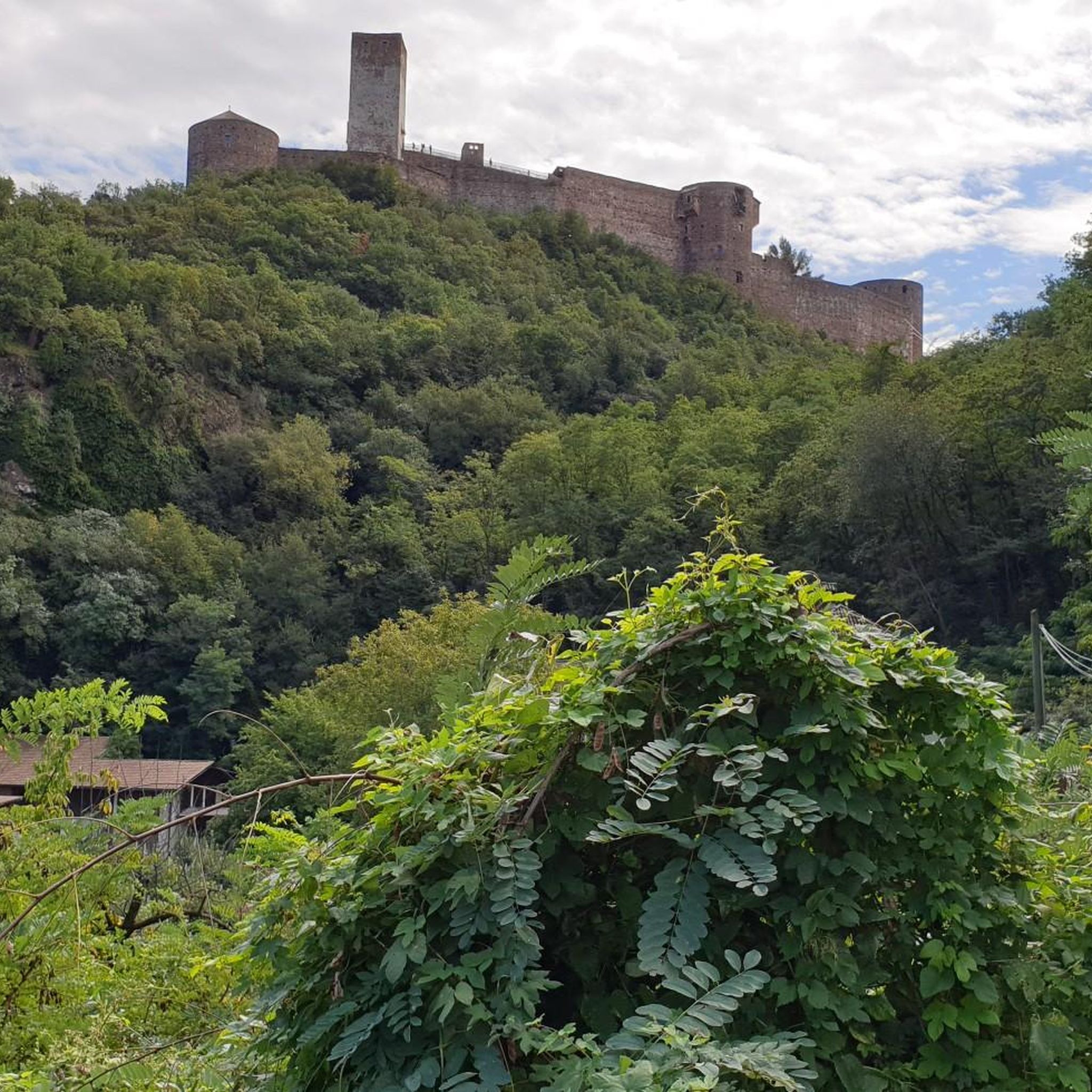
On the banks of Lough Neagh, near the village of Brockagh, you will find the impressive ruin of Mountjoy Castle. This castle was built between 1602 and 1605 by Lord Mountjoy and served at the time as a crucial military stronghold during the turbulent years of the Nine Years' War. Unique is the special combination of building materials: the lower floor is constructed from rough natural stone, while the upper floor consists of locally fired red brick. Although the castle has been a ruin since 1648, the central block and the characteristic arrow-shaped corner towers are still clearly recognizable in the landscape.
8
0
As you cycle through the rolling landscape of County Tyrone, the Wellbrook Beetling Mill is an absolute must for a stopover. Situated in an idyllic, wooded stream valley along the Ballinderry River, this 19th-century water mill provides a stark contrast to the tranquility of its surroundings. This is the last working 'beetling mill' in the United Kingdom. "Beetling" was the final step in traditional Irish linen production: using enormous wooden hammers (beetles), powered by a water wheel nearly five metres high, the linen was processed for hours until it acquired its characteristic sheen. When the mill is running, you can hear the rhythmic thudding from afar – an impressive sound that takes you straight back to the industrial heyday of Northern Ireland.
8
0

Hollie Berrie is a good place for refreshments on the route at Scarva
0
1

The small town of Scarva, nestled between green meadows and the quiet canal, offers a welcome break on my bike tour through Northern Ireland. Here you cycle on well-maintained paths past historic bridges and small villages that give you the feeling that time has stood still. The British flags fluttering along the side of the road remind you that you are in a culturally special area - a detail that reflects the identity of the region. The route is easy to cycle, the surrounding landscape is gently rolling, which makes for pleasant cycling. The view of wide fields and rolling hills invites you to slow down now and then and take in the peace and quiet. A special feature of Scarva is the annual Orange Order March, which transforms the village into a kind of open-air stage once a year and keeps the traditions of this region alive.
1
0
In the shadow of Northern Ireland's vast skies, the mysterious Mountjoy Castle rises on a hill above Lough Neagh. This ruined castle, whose Irish name "Caisleán Mhuinseo" whispers into the wind, stands like a proud sentinel in the village of Mountjoy, County Tyrone. The castle was built in 1602 by order of Charles Blount, 1st Earl of Devonshire and 8th Baron Mountjoy. But times have not always been kind to this building: as early as 1643, a devastating fire left scars on the walls of the castle. What remained is a two-story brick building with the ground floor clad in stone. The architecture speaks of a time of defense and vigilance - a central rectangular block protected by four spear-shaped towers, crisscrossed by embrasures. The north-western tower testifies to the fragility of time - partially collapsed, while the western curtain wall has lost its presence. The entrance, once on the south side of the eastern curtain wall, seems to whisper stories of days gone by, while wide windows on the upper floor capture the eyes of visitors. Unfortunately, an extension at the back keeps some of the castle's secrets hidden, and the interior area is closed to visitors' eyes. But even in its ruined state, Mountjoy Castle embodies the soul and history of Northern Ireland. Not only is it a State Care Historic Monument in the townland of Magheralamfield in the Mid Ulster District, but it is also a silent testament to time, inviting every walker to pause for a moment and listen to the whispers of history.
4
0

Scarva (from Irish: Scarbhach meaning "shallow place, rough ford" is a small village in the parish of Aghaderg, County Down, Scarva is known as the location of the "Sham Fight" Pageant on 13 July every year. The Pageant attracts thousands of members of the Royal Black Preceptory, who come to act out a symbolic dramatised re-enactment of the Battle of the Boyne.
2
0

Also known as Black Lough, it's unique habitat means it is a great place for bird watching with a number of rare species being seen. You're also likely to spot people course fishing for pike and perch. There are even eels in the water.
0
0

A mixture of wooded, paved, and gravel trails will lead you through the wonderful Lough Gall Country Park in Loughgall, County Armagh. There's a wealth of things to discover here such as bluebell and orchid-filled woodlands, a golf and football pitch, an outdoor gym and a coffee shop.
1
0
Frequently Asked Questions
What types of road cycling routes can I find around Derrytresk?
The Derrytresk area offers a diverse range of road cycling routes, characterized by undulating hills, quiet valleys, and scenic views, including those of Lough Neagh. You'll find options suitable for various skill levels, from easy to difficult, with many routes exploring wide rural areas and connecting charming villages.
How many road cycling routes are available on komoot for the Derrytresk region?
There are over 185 road cycling routes available on komoot for the Derrytresk region. This includes 19 easy routes, 151 moderate routes, and 15 difficult routes, ensuring a suitable option for every cyclist.
Are there any family-friendly road cycling routes in Derrytresk?
While specific 'family-friendly' routes are not explicitly detailed in the data, the region's development of traffic-free greenways and park cycle paths, often shared with walkers, suggests there are suitable options for families. Look for routes categorized as 'easy' on komoot for gentler rides.
What are some notable natural features or landscapes I might encounter on a road cycling route near Derrytresk?
Road cycling routes around Derrytresk often feature the wild beauty of the Sperrin Mountains, an Area of Outstanding Natural Beauty, with their undulating hills and heather-clad uplands. You might also pass tranquil spots like Ballysaggart Lough, known for birdwatching, or experience dramatic landscapes such as Barnes Gap and the Glenelly Valley.
What historical sites or attractions can I visit along road cycling routes in the Derrytresk area?
Several historical sites and attractions are accessible from road cycling routes. You could encounter the ruins of Mountjoy Castle, or the historically significant Hill of The O'Neill, which offers panoramic views. The Argory Country House is another notable point of interest in the vicinity.
Are there any routes that offer views of Lough Neagh?
Yes, several routes provide views of Lough Neagh. For example, the View of Lough Neagh – Lough Neagh loop from Clonmore is a 63.6-mile route specifically designed to showcase the Lough Neagh area. You might also pass by Maghery Footbridge at Lough Neagh or the View of Coney Island from Maghery.
What is the best time of year to go road cycling in Derrytresk?
The region's diverse terrain is enjoyable throughout the warmer months. Spring and summer generally offer the most pleasant weather conditions for road cycling, with longer daylight hours. However, the 'roller-coaster roads' of the Sperrins can be picturesque in autumn as well.
Are there any circular road cycling routes available?
Yes, many of the routes around Derrytresk are designed as loops. Examples include the Scarva, Tandragee and Annaghmore loop from Maghery, the Chicken Fillet Shop loop from Clonmore, and the Roughan Lough – Tullyleek Loughs loop from Clonoe Park & Ride.
Where can I find cafes or pubs along the road cycling routes in Derrytresk?
While specific cafes and pubs directly on every route are not listed, the region has various villages and towns that offer amenities. The An Creagán Visitor Centre, located at the foothills of the Sperrins, is a convenient stop for refreshments and cultural insights, and many routes connect through local communities where you can find places to refuel.
What is the typical elevation gain on road cycling routes in this area?
The elevation gain varies significantly depending on the route's length and terrain. For instance, a moderate 49.7 km route like the Chicken Fillet Shop loop from Clonmore has an elevation gain of around 307 meters, while longer routes like the Scarva Village – Lottie's Café loop from Clonoe Park & Ride (105.3 km) can have over 785 meters of ascent, reflecting the undulating nature of the Sperrin Mountains.
Are there any specific viewpoints or scenic spots recommended for road cyclists?
The Sperrin Mountains themselves offer breathtaking views, recognized by National Geographic for their scenic drives. The Hill of The O'Neill provides panoramic vistas extending to the Sperrins and Lough Neagh. Additionally, the Bannfoot Picnic Area and Maghery Footbridge at Lough Neagh are popular viewpoints along the water.
What do other road cyclists enjoy most about cycling in Derrytresk?
Road cyclists often praise the diverse landscapes, from the challenging hills of the Sperrins to the tranquil rural roads. The region's quiet valleys and picturesque views, including those of Lough Neagh, are frequently highlighted. The variety of routes catering to different skill levels also contributes to its appeal.
Most popular routes around Derrytresk
Most popular attractions around Derrytresk

Get inspired with the komoot mobile app


Explore more
Browse the best Road cycling routes in other regions.
