The best walks and hikes around Lago del Barbellino artificiale
4.5
(2786)
18,498
hikers
181
hikes
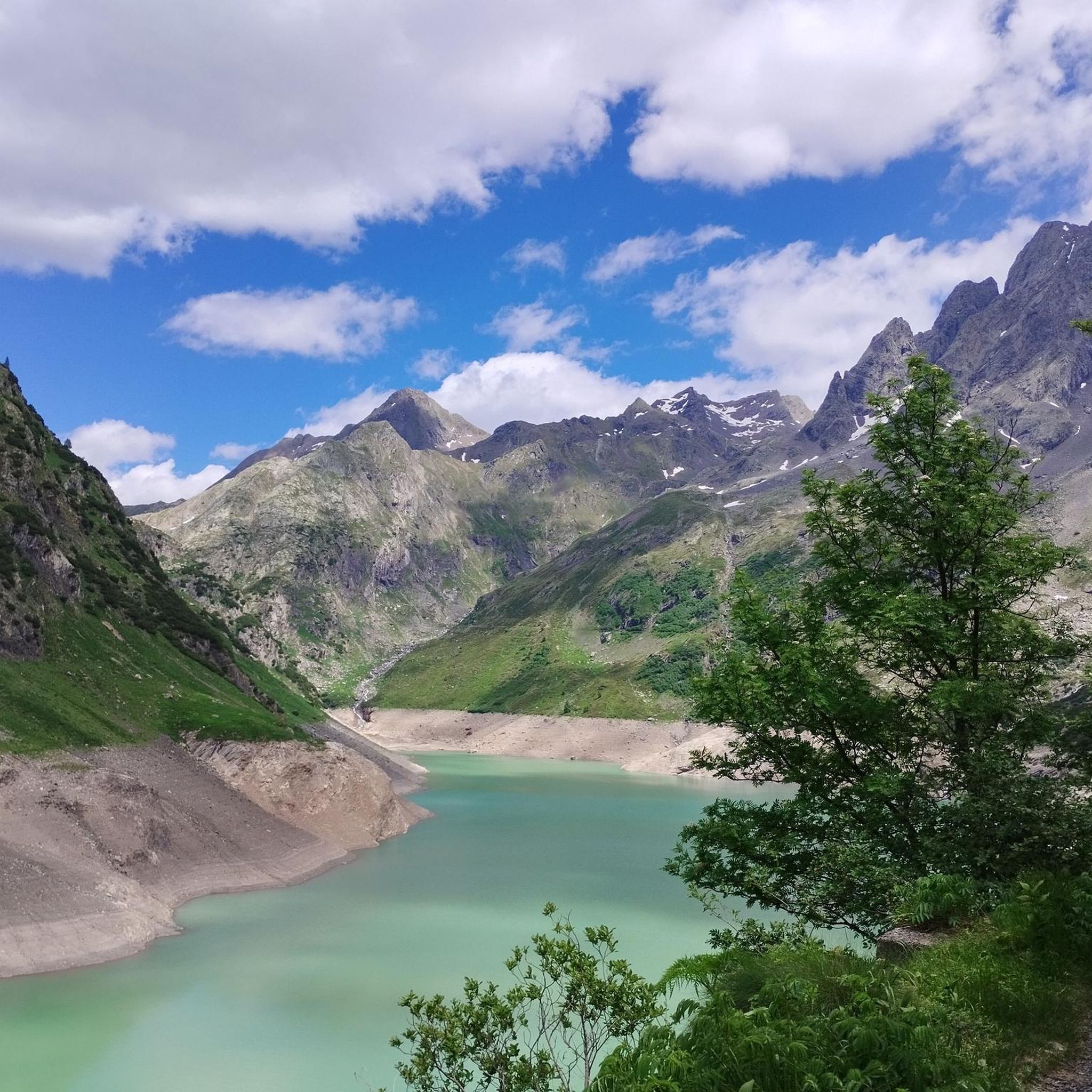
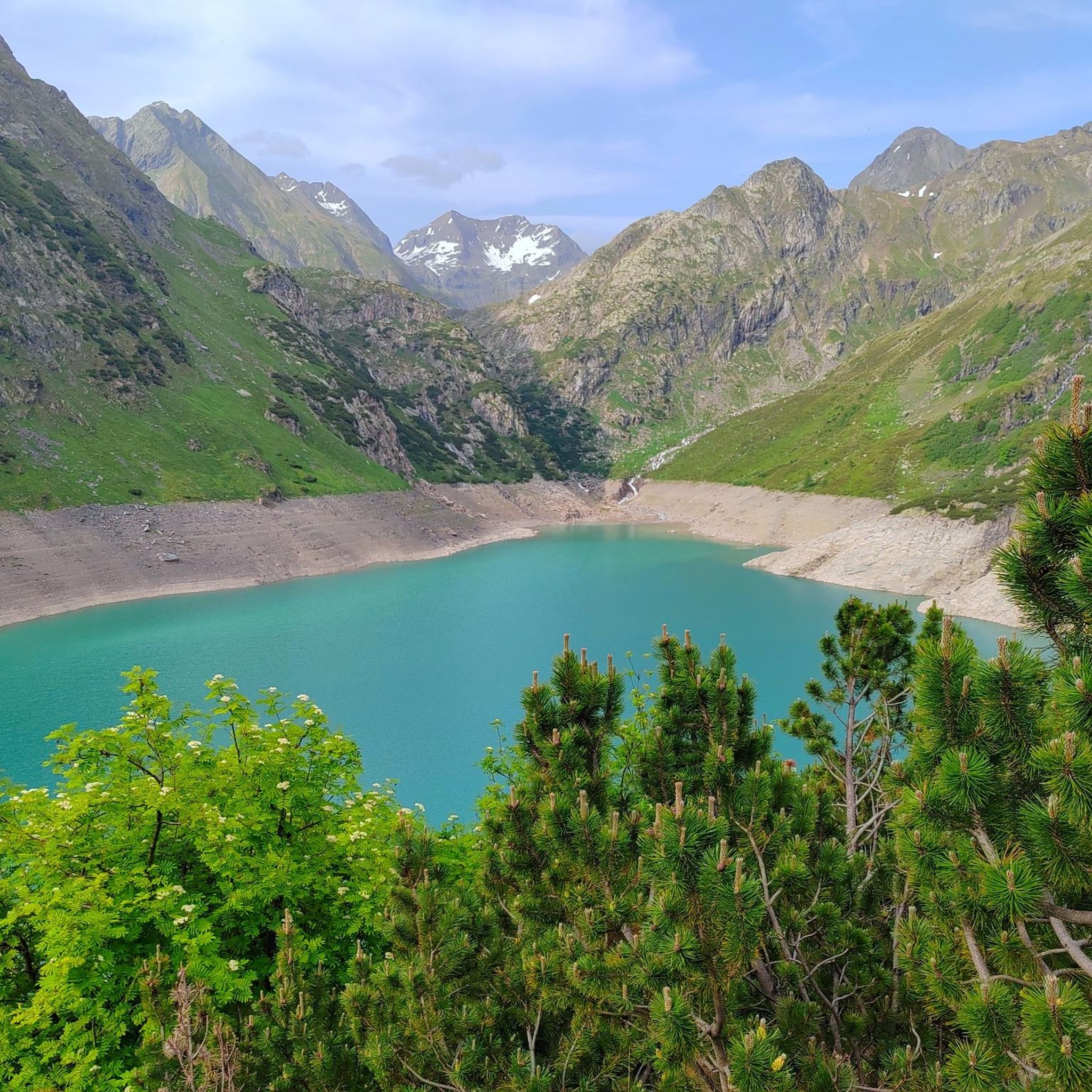
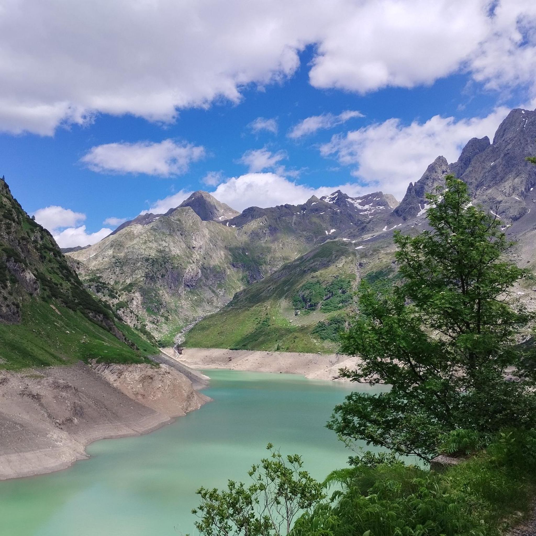
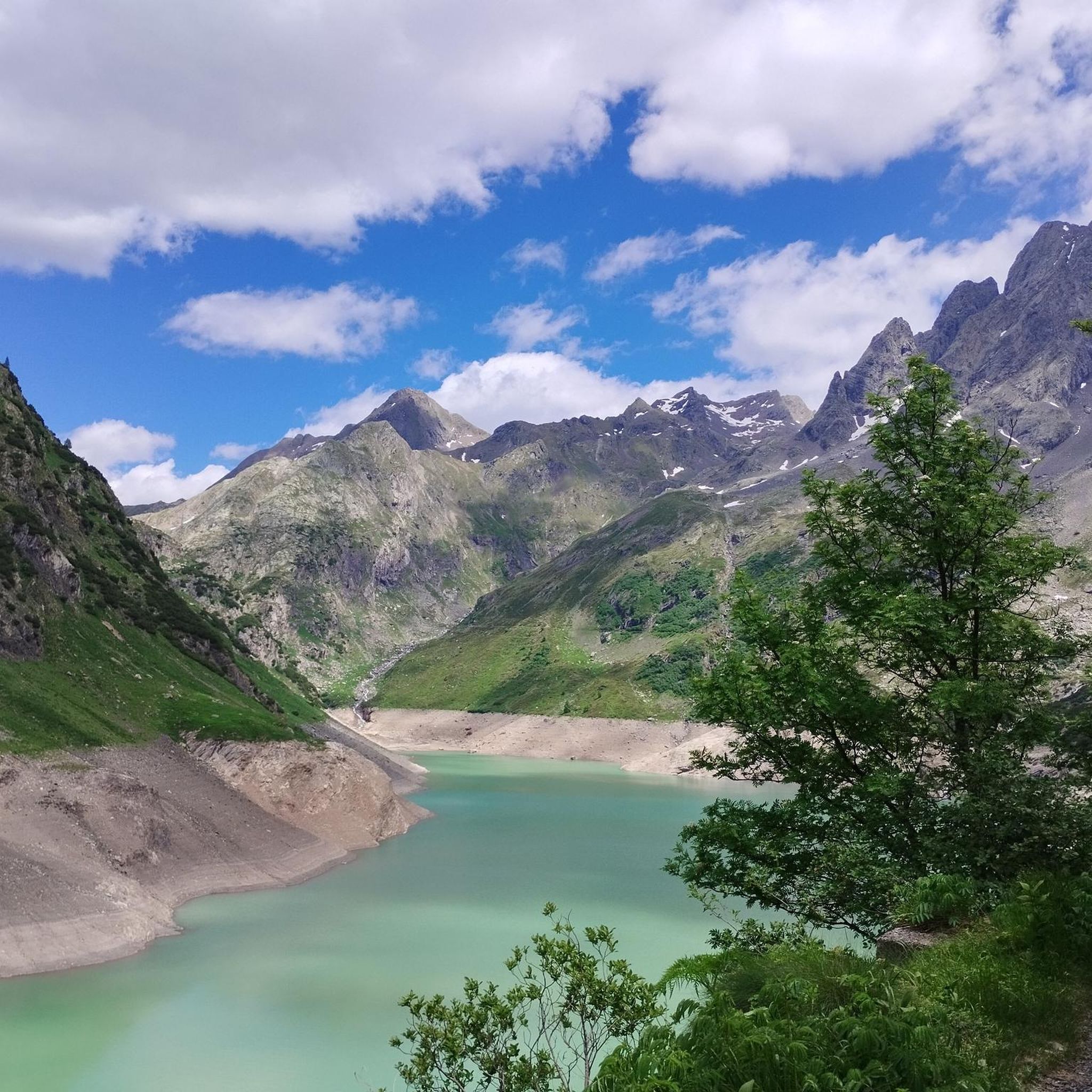
Hiking around Lago del Barbellino artificiale takes place in the Bergamasque Alps, within the Orobie Mountains of Lombardy, Italy. This high-altitude region features an artificial lake at 1,862 meters (6,109 feet) above sea level, surrounded by towering peaks exceeding 3,000 meters. The terrain includes steep shores, grazing lands, and conifer woods, offering a diverse alpine environment for hikers. The area is characterized by dramatic mountain scenery and a network of trails.
Best hiking trails around Lago del Barbellino artificiale
- The most popular hiking route is From Rifugio Antonio Curò to Laghi del Barbellino, a 5.4 miles (8.6 km) trail that takes 3 hours 11 minutes to complete. This difficult route ascends to the natural Barbellino Lakes, offering views of the alpine landscape.
- Another top favourite among local hikers is Trail 308: Rifugio Curò to Passo di Caronella, a difficult 9.2 miles (14.8 km) path. This trail features significant elevation gain and traverses rugged mountain terrain.
- Local hikers also love the Sentiero Italia, Stage D22S: Rifugio Curò to Rifugio Tagliaferri, a 10.4 miles (16.7 km) trail leading through high alpine passes, often completed in about 9 hours 20 minutes.
- Hiking around Lago del Barbellino artificiale is defined by dramatic mountain scenery, the distinctive greenish waters of the artificial lake, and impressive waterfalls. The network offers options for various ability levels, from moderate paths to challenging alpine routes.
- The routes in Lago del Barbellino artificiale are highly rated by the komoot community with an average score of 4.4 stars from over 2,600 reviews. More than 17,000 hikers have used komoot to explore Lago del Barbellino artificiale's varied terrain.
Last updated: July 9, 2026
4.7
(7)
82
hikers
8.63km
03:11
300m
290m
Hard hike. Good fitness required. Sure-footedness, sturdy shoes and alpine experience required.
5.0
(1)
18
hikers
14.8km
06:12
770m
760m
Hike the difficult Trail 308 to Passo di Caronella via Barbellino Lakes, a 9.2-mile route with 2529 feet of gain through the Orobie Alps.

Sign up for free
12
hikers
16.7km
09:20
1,530m
1,530m
Hike the difficult 10.4-mile Sentiero Italia from Rifugio Curò to Rifugio Nani Tagliaferri, gaining 5024 feet through the Orobie Alps.
4.0
(1)
9
hikers
16.3km
06:49
890m
910m
Hike the difficult 10.1-mile Eastern Orobie Trail - Stage 7, gaining 2934 feet through rugged alpine terrain and panoramic views.
5.0
(1)
18
hikers
Hard hike. Very good fitness required. Sure-footedness, sturdy shoes and alpine experience required.
Get access to more routes and recommendations from other explorers.
Sign up for free
Already have an account?
Our route recommendations are based on thousands of hikes, rides, and runs completed by other people on komoot.
Start today with a free account
Your next adventure awaits.
Login or Signup
Popular around Lago del Barbellino artificiale

Tips from the Community

Beautiful lake adjacent to the Curò refuge. The lake is famous for the famous "sword in the stone." Who knows if anyone will be able to extract it? 🤗
0
0

A beautiful lake surrounded by stunning mountains. It's definitely worth the long drive from Curò to get there.
0
0

The last few meters before the summit. Practically from the exit of the North Couloir (for those climbing in snow) and a few meters after the section with chains (for those climbing the normal route from the southeast).
0
0

A gully to negotiate to reach Pizzo Recastello. Equipped with chains, it's still not easy to negotiate. You definitely need to be in good shape and absolutely not suffer from vertigo. Keeping in mind that it's easier going up than going down.
0
0

Excellent, well-equipped refuge with food and drinks available. Excellent selection of alcoholic beverages and fast service. The Radler is truly excellent! I could have drunk three! The platter is truly rich and plentiful with truly delicious products, especially the cheeses!
1
1
A must-see for the classic souvenir hike around Lake Barbellino. The lovely little church next door offers a stunning view of the lake.
0
0

The Rifugio Nani Tagliaferri is one of the highest refuges in the Orobie Alps, located at 2,328 meters above sea level, on the border between Val di Scalve and Val Brembana. It is a much-loved destination for expert hikers for its panoramic position and authentic high-mountain atmosphere. 🥾 How to get there: The most popular route starts from Ronco di Schilpario, with a challenging but spectacular hike that crosses the Piana del Vò and the Cascata del Vò. The trail is well marked, but requires good physical training and adequate equipment, especially in case of residual snow or bad weather. 🏔️ What the refuge offers: A warm welcome in Alpine style Hot and genuine meals, perfect after the climb Overnight stay in dormitories for those who want to continue towards other itineraries such as the Passo del Vò or Pizzo Tornello
1
0
A place that even the stones know
0
0
Frequently Asked Questions
How many hiking trails are there around Lago del Barbellino artificiale?
The Lago del Barbellino artificiale area offers a wide variety of hiking opportunities, with over 170 trails available. These range from easier paths to very challenging alpine routes.
What is the general difficulty of hiking trails in the Lago del Barbellino artificiale area?
The trails around Lago del Barbellino artificiale cater to various fitness levels. You'll find approximately 12 easy routes, 63 moderate routes, and 100 difficult routes, many of which involve significant elevation gain and rugged mountain terrain. Good fitness, sure-footedness, and sturdy shoes are often required for the more challenging paths.
What kind of terrain can I expect when hiking around Lago del Barbellino artificiale?
Hikers can expect diverse alpine terrain, including steep shores around the lake, expansive grazing lands, and conifer woods at lower elevations. Higher up, routes traverse rugged mountain terrain and high alpine passes, offering dramatic mountain scenery with peaks exceeding 3,000 meters.
Are there any notable natural features or landmarks to see while hiking?
Yes, the area is rich in natural beauty and interesting landmarks. Highlights include the distinctive greenish hue of the artificial lake itself, the spectacular Serio Waterfalls (Italy's highest), and the natural Lago Naturale del Barbellino further upstream. You might also discover the captivating 'Sword in the Stone' near Rifugio Curò.
Can I see the Serio Waterfalls when hiking near Lago del Barbellino artificiale?
Yes, the Serio Waterfalls are a major highlight along the approach to Lago del Barbellino artificiale and are Italy's highest. However, they are only opened on specific dates, so it's advisable to check the local schedule before planning your visit to ensure you can witness this spectacular sight.
What is the best time of year to hike around Lago del Barbellino artificiale?
The best time for hiking around Lago del Barbellino artificiale is typically during the warmer months, from late spring to early autumn (June to September). During this period, trails are generally free of snow, and the weather is more stable, making for safer and more enjoyable alpine excursions. Winter hiking is possible but requires specialized equipment and experience.
Are there any family-friendly hiking options in the area?
While many routes are challenging, there are moderate paths suitable for families. The area around Rifugio Antonio Curò, which is easily accessible from Valbondione, can serve as a good starting point for exploring the natural valley and offers less strenuous options. Always check the specific trail details for suitability with children.
Are dogs allowed on the hiking trails around Lago del Barbellino artificiale?
Generally, dogs are permitted on hiking trails in the Bergamasque Alps, but it's crucial to keep them on a leash, especially in grazing areas and near wildlife. Specific rules may apply in mountain refuges or protected zones, so always check local signage. Ensure your dog is fit for alpine conditions and carry enough water for them.
Are there any circular hiking routes available?
Yes, there are circular routes. For example, the Antonio Curò Mountain Hut – Curò Hut loop from Alpi Orobie Orientali offers a challenging circular experience starting and ending near Rifugio Curò.
What amenities are available near the hiking trails, such as refuges or places to eat?
The area is well-served by mountain refuges. The historic Rifugio Antonio Curò is a popular and easily accessible starting point, offering refreshments and accommodation. Further up, near the natural lake, you'll find Rifugio Barbellino. The nearby village of Valbondione also provides various services, including accommodation, cafes, and restaurants.
How can I get to the Lago del Barbellino artificiale area using public transport?
The primary starting point for hikes to Lago del Barbellino artificiale is Valbondione. Public transport options, typically buses, connect Valbondione to larger towns in the Bergamo province. It's recommended to check local bus schedules, especially during the hiking season, as services might be less frequent outside of peak times.
Is parking available for hikers in the Lago del Barbellino artificiale area?
Yes, parking is generally available in Valbondione, which serves as the main access point for hikes towards Lago del Barbellino artificiale. Specific parking areas are usually designated for hikers. It's advisable to arrive early during peak season to secure a spot, as the area can get busy.
What do other hikers enjoy the most about hiking in Lago del Barbellino artificiale?
The area is highly rated by the komoot community, with an average score of 4.4 stars from over 2,600 reviews. Hikers often praise the dramatic mountain scenery, the unique greenish waters of the artificial lake, and the impressive Serio Waterfalls. The network of trails offers options for various ability levels, from moderate paths to challenging alpine routes, making it a rewarding destination for many.
Most popular routes around Lago del Barbellino artificiale

Get inspired with the komoot mobile app


Explore more
Browse the best Hikes in other regions.
