The best road cycling routes around Lake Gramolazzo
4.3
(63)
1,326
riders
55
rides
Road cycling routes around Lake Gramolazzo are set within the picturesque Garfagnana valley and the Apuan Alps Regional Park, offering diverse terrain for road cyclists. The region is characterized by its artificial lake, often called "a sea in the mountains," surrounded by lush forests and rugged peaks. Predominantly on paved surfaces, the area features routes ranging from moderate loops around the lake to challenging excursions through mountain passes, with elevation gains varying significantly.
Best road cycling routes around Lake Gramolazzo
…Last updated: July 13, 2026
7
riders
29.3km
02:09
900m
900m
Hard road ride. Very good fitness required. Some segments of this route may be unpaved and difficult to ride.
46
riders
107km
06:41
3,040m
3,030m
This difficult 66.4-mile road cycling loop from Lago di Gramolazzo to Passo del Cerreto offers stunning Apuan Alps and Apennine views.

Sign up for free
4.3
(9)
97
riders
50.4km
02:38
850m
850m
Moderate road ride. Good fitness required. Some segments of this route may be unpaved and difficult to ride.
33
riders
67.8km
04:12
1,880m
1,880m
Hard road ride. Very good fitness required. Some segments of this route may be unpaved and difficult to ride.
3.6
(8)
92
riders
Moderate road ride. Good fitness required. Mostly well-paved surfaces and easy to ride.
Get access to more routes and recommendations from other explorers.
Sign up for free
Already have an account?
Our route recommendations are based on thousands of hikes, rides, and runs completed by other people on komoot.
Start today with a free account
Your next adventure awaits.
Login or Signup
Tips from the Community

The Passo del Cerreto is an important pass in the Tuscan-Emilian Apennines, located at an altitude of 1,261 meters. It separates Tuscany from Emilia-Romagna, connecting the province of Massa-Carrara (municipality of Fivizzano) with that of Reggio Emilia (municipality of Ventasso). The pass is entirely crossed by the State Road 63 (SS 63).
0
0

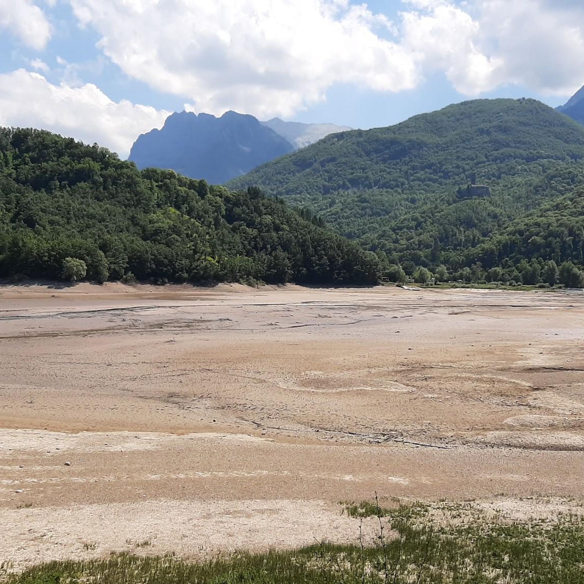
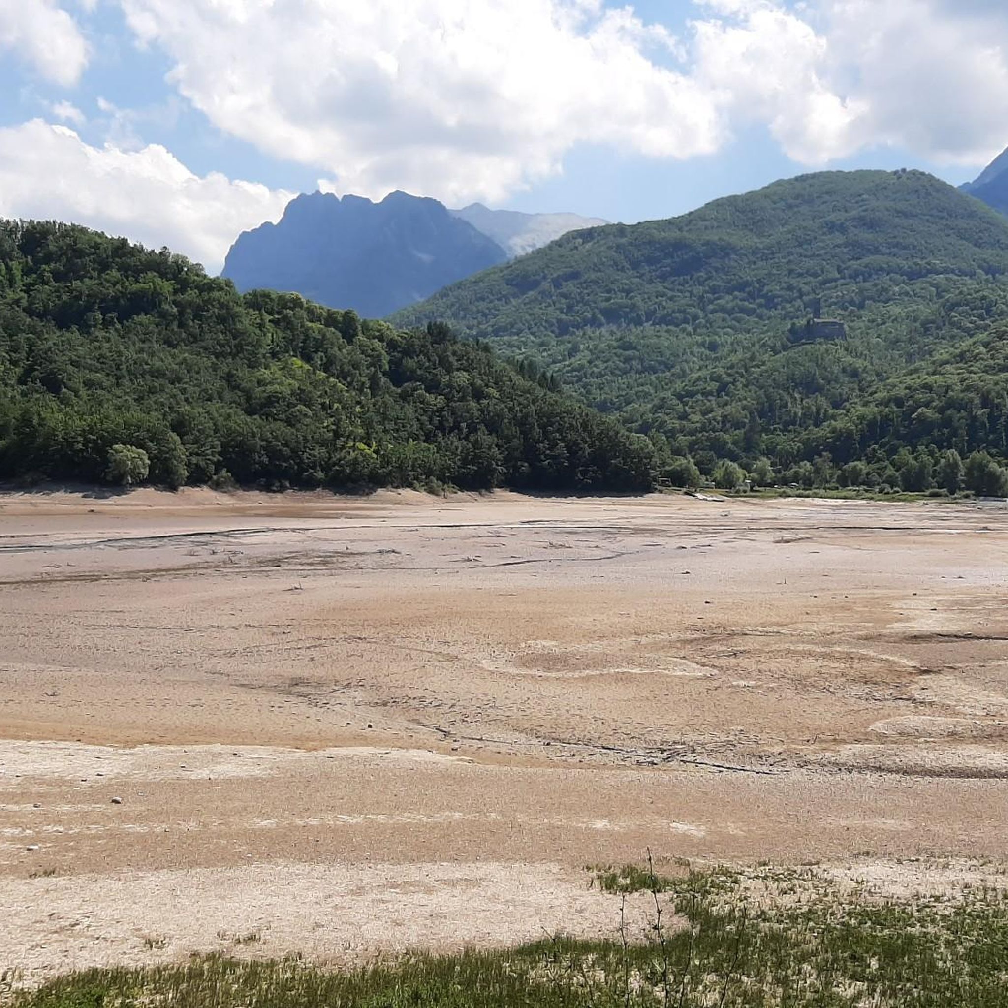
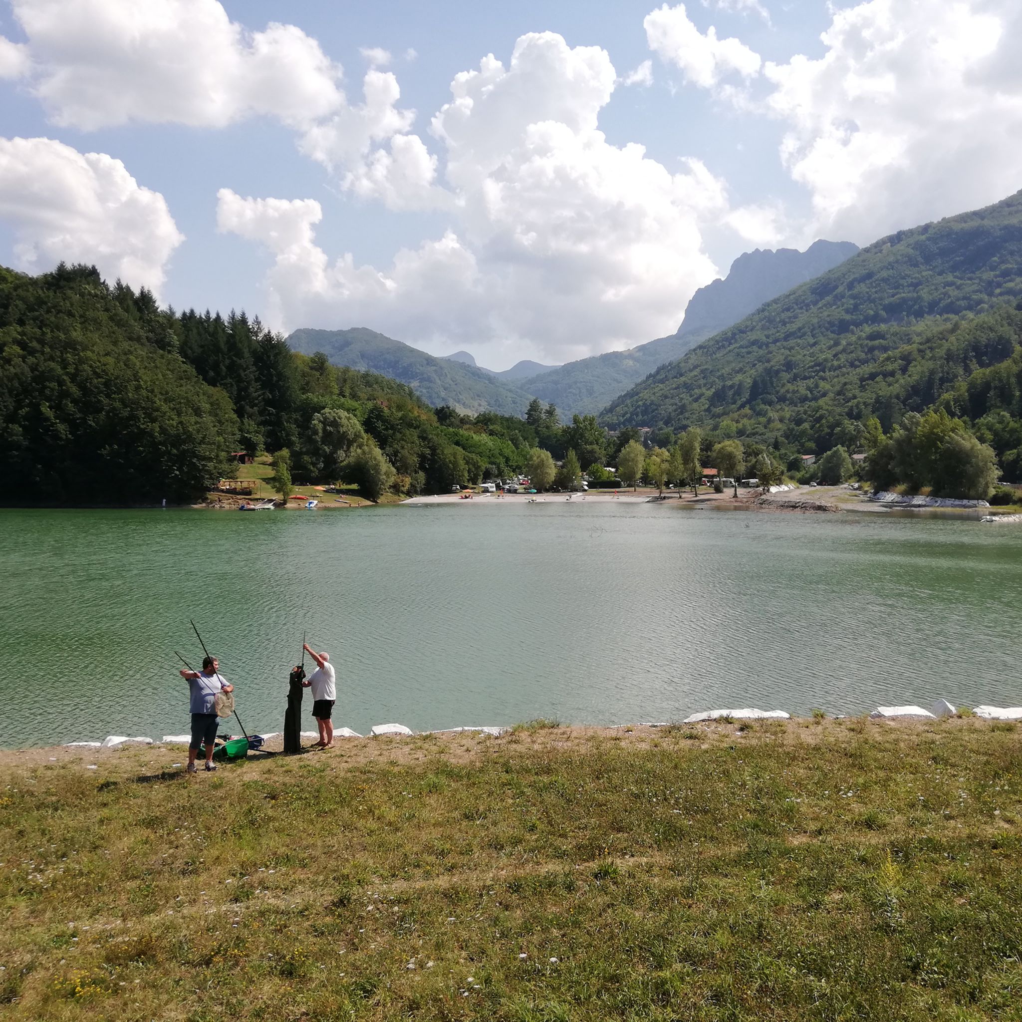
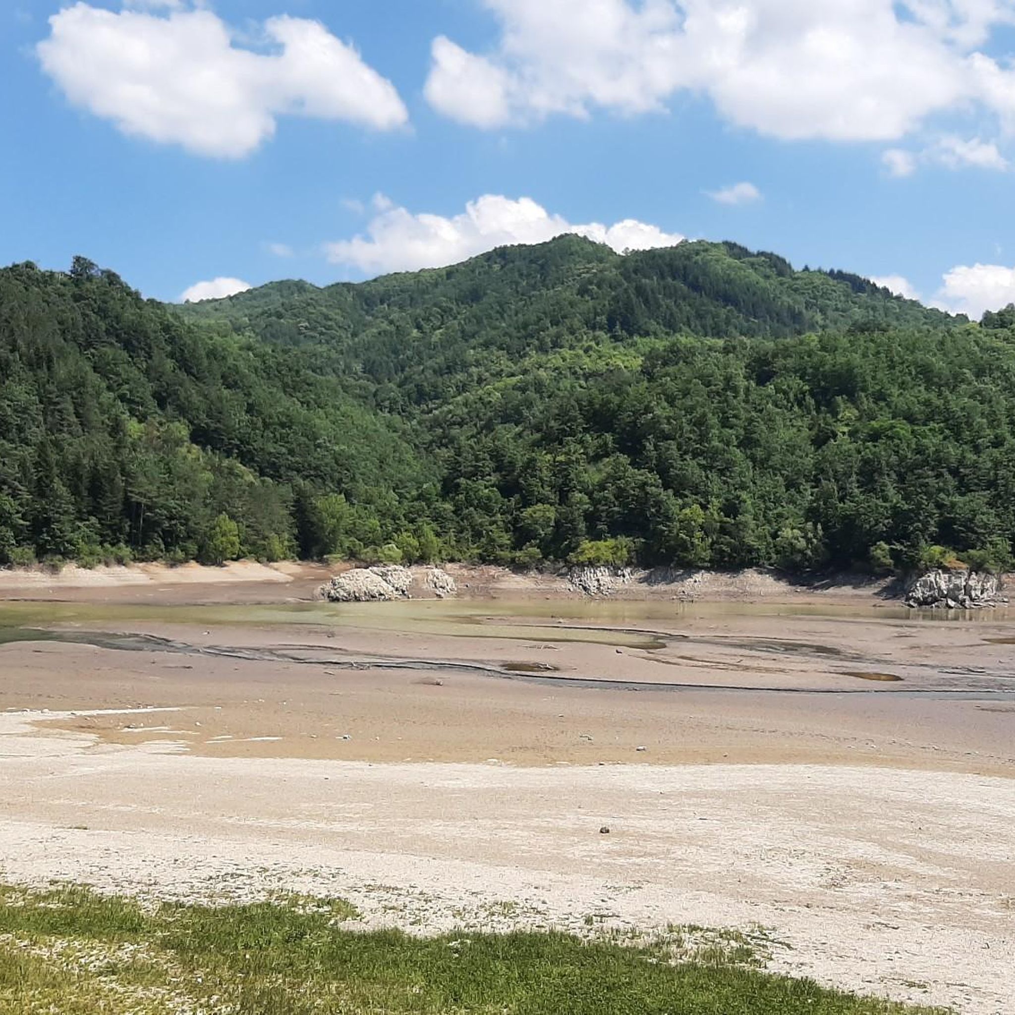
The lake of Gramolazzo is a lake in the Apuan Alps located near the homonymous village in the municipality of Minucciano. Of artificial origin, it was created in the second half of the 1900s, together with the lake of Vagli by SELT Valdarno for the hydroelectric use of the Serchio river and its tributaries. The lake, which has a surface area of one square kilometer and a volume of 3.8 million cubic meters, has both the Serchio di Gramolazzo as its inflow and outflow, one of the two branches that, joining near Piazza al Serchio, form the Tuscan river. Another important stream that flows into the lake is the Acqua Bianca stream, which coming from Mount Pisanino crosses the village of Gorfigliano. A large part of the water, however, is fed through a channel on the left bank, near the dam, which with a maximum flow rate of 20 cubic meters per second discharges the waters captured from the Serchio into the Sillano valley. The waters of the lake of Gramolazzo feed the Fabbriche power plant which in turn discharges them into the lake of Vagli.
0
0
The construction of the hydroelectric dam, designed by Count Eng. Ignazio Prinetti Castelletti, began in 1941, slowed down during wartime, and was completed in 1947 under the supervision of SELT Valdarno (now Enel). In the period 1951-53, the dam was raised by about 30 m, bringing the overall height to about 88-92 m. The ordinary arch and gravity dam, built in concrete, has a crest 150 m long and 5 m wide, while the width at foundation level is about 70 m. The crest is accessible to the public all year round. The lake, artificially formed in 1947 by damming the Edron stream, constitutes the dam's reservoir. Upon filling, the rising lake waters submerged some villages, the main one being Fabbriche di Careggine, a small village of blacksmiths from Brescia, founded in the 13th century, which re-emerges with every emptying of the basin. Since the Vajont disaster, the basin has not been filled beyond 80% of its maximum capacity. The basin holds about 35 million cubic meters of water and is exceptionally emptied in case maintenance intervention is necessary. This has happened four times: in 1958, 1974, 1983, and 1994. In the latter year, almost 1 million tourists from all over the world arrived in Vagli.
0
0
The Oasis of Campocatino is a mountain locality in the Apuan Alps, in the municipality of Vagli di Sotto, located at 1000 m above sea level, beneath the imposing wall of Monte Roccandagia. It includes a large basin of glacial origin, a testament to the extent of Quaternary glaciation in the Apennine area. Inside, we find the typical pastoral buildings called "caselli," which have been preserved with their ancient construction characteristics. Since 1991, it has become a "LIPU Natural Oasis." The coexistence of different environments and the natural integrity of the area have allowed the acclimatization of various bird species that reproduce there. Along the rocky walls, the Alpine chough and the Wallcreeper nest; in the high-altitude meadows and pastures, the Skylark, the Rufous-tailed Rock Thrush, the Wheatear, and the Greater Short-toed Lark are observed, while the woods below are populated by the Blackcap, the Goldfinch, the Chaffinch, the Brambling, the Firecrest, the Dartford Warbler, the Robin, the Eurasian Nuthatch, the Song Thrush, the Mistle Thrush, the Wren, and four species of tits: Great Tit, Blue Tit, Coal Tit, and Marsh Tit. Biodiversity is also present among the birds of prey that inhabit the area: the Tawny Owl, the Kestrel, the Eagle Owl, the Common Buzzard, the Sparrowhawk, and sometimes the Eagle soars over the area in search of prey. A little curiosity: in 1998 Campocatino was the film set for the movie "il mio west" directed by Giovanni Veronesi, starring Leonardo Pieraccioni, Harvey Keitel, David Bowie, and Alessia Marcuzzi. In memory of David Bowie's presence, a statue has been placed near the stone houses to commemorate his time there.
0
0

There are no free parking spaces, the only parking lot belongs to the bar and is reserved for customers.
1
0

A hidden and unknown lake, and therefore not overcrowded. A place surrounded by greenery and mountains where you can unwind.
0
0
Currently closed due to construction work
0
0
panoramic point
0
0
Frequently Asked Questions
How many road cycling routes are available around Lake Gramolazzo?
There are over 60 road cycling routes around Lake Gramolazzo, catering to various skill levels. You'll find a mix of moderate and difficult options to explore the stunning Garfagnana valley and Apuan Alps Regional Park.
What is the typical terrain like for road cycling near Lake Gramolazzo?
The terrain for road cycling around Lake Gramolazzo is predominantly on paved surfaces, offering smooth rides. However, some longer, more adventurous routes might include short unpaved segments. Expect diverse landscapes, from lakeside paths to significant climbs through mountain passes.
When is the best time of year for road cycling around Lake Gramolazzo?
The region is ideal for road cycling during the warmer months, typically from spring through autumn. Summer offers pleasant conditions, and the lake provides opportunities for water activities like swimming and paddleboarding after your ride.
Are there options for less experienced road cyclists or families?
Yes, there are options for all abilities. A dedicated pedestrian and cycle track runs along Lake Gramolazzo, which is suitable for families and less experienced cyclists. You can also find shorter, easier routes, such as the Lake Gramolazzo – Lake Gramolazzo loop from Gorfigliano, which offers a moderate ride around the immediate lake surroundings.
Are there challenging road cycling routes for experienced riders?
Absolutely. For experienced riders seeking a challenge, routes like the Cerreto and Pradarena Passes Loop offer significant climbs and panoramic views of both the Apuan Alps and the Apennines. The region also features routes with over 1,500-3,000 feet of elevation gain, requiring very good fitness.
What kind of elevation gain can I expect on road cycling routes here?
Elevation gains vary significantly. Shorter, easier rides might have around 500-1,000 feet of elevation gain, while more challenging routes can involve 1,500-3,000 feet or more. For example, the Cerreto and Pradarena Passes Loop features over 3,000 meters (nearly 10,000 feet) of ascent.
What natural features or viewpoints can I see while road cycling around Lake Gramolazzo?
You'll encounter stunning natural beauty. The lake itself is known as 'il lago verde' for its emerald color, reflecting the surrounding lush forests and the rugged peaks of the Apuan Alps, including Monte Pisanino. The Strada d'Arni (Provincial Road 13) offers scenic views alongside the Turrite Secca stream. You can also visit Lake Gramolazzo itself, which is a highlight.
Are there any charming villages or historical sites to visit along the routes?
Yes, the region is dotted with charming medieval villages. Gramolazzo, Gorfigliano, and Minucciano offer glimpses into local history and culture. From the village of Castagnola, which towers above the lake, you can enjoy breathtaking panoramic views. The Lake Vagli – Vagli and Campocatino loop from Gramolazzo also passes by historical sights.
Are there any specific road cycling loops that are highly recommended?
Many cyclists enjoy loop routes in the area. A popular moderate option is the Lake Vagli – Vagli and Campocatino loop from Gramolazzo, which takes you around two distinct lakes. For a more challenging experience, consider the 'Four lakes tour' which encompasses Lake Gramolazzo and other reservoirs in the Serchio river basin, detailed on VisitTuscany.com.
What do other road cyclists enjoy the most about road cycling in Lake Gramolazzo?
The area is highly rated by the komoot community, with an average score of 4.4 stars from over 50 reviews. Cyclists frequently praise the emerald-colored lake views, the dramatic Apuan Alps peaks, and the charming medieval villages encountered along the routes. The diversity of routes, from shorter loops to demanding mountain pass rides, is also a highlight.
Is there parking available for road cyclists near the routes?
Yes, parking is generally available in the villages around Lake Gramolazzo, such as Gramolazzo and Gorfigliano, which serve as common starting points for many routes. The Lake Park on the left bank also provides facilities, including picnic areas, which can be convenient for parking.
Are there places to stop for refreshments or food along the road cycling routes?
Yes, you'll find opportunities for refreshments. The Lake Park offers tourist facilities, and charming medieval villages like Gramolazzo and Gorfigliano have local establishments. For example, Bar La Dolce Vita is a highlight near the lake where you can stop.
Most popular routes around Lake Gramolazzo
Most popular attractions around Lake Gramolazzo

Get inspired with the komoot mobile app


Explore more
Browse the best Road cycling routes in other regions.
