The best mountain hikes around Lac de Bonlieu
5.0
(2)
9
hikers
3
hikes
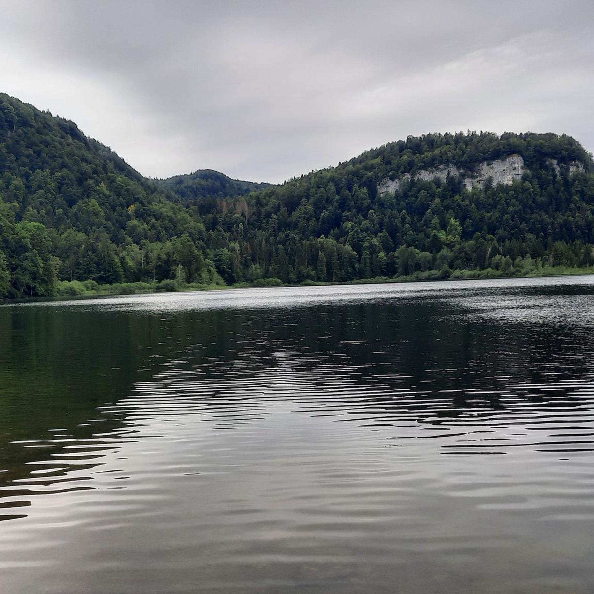
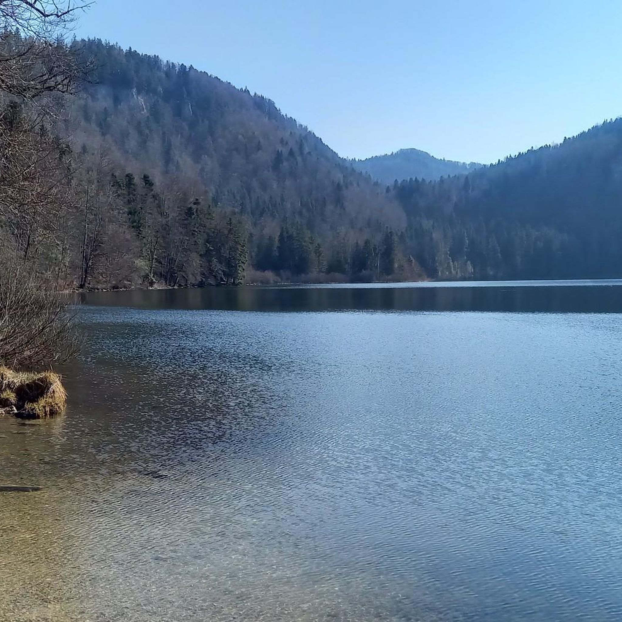
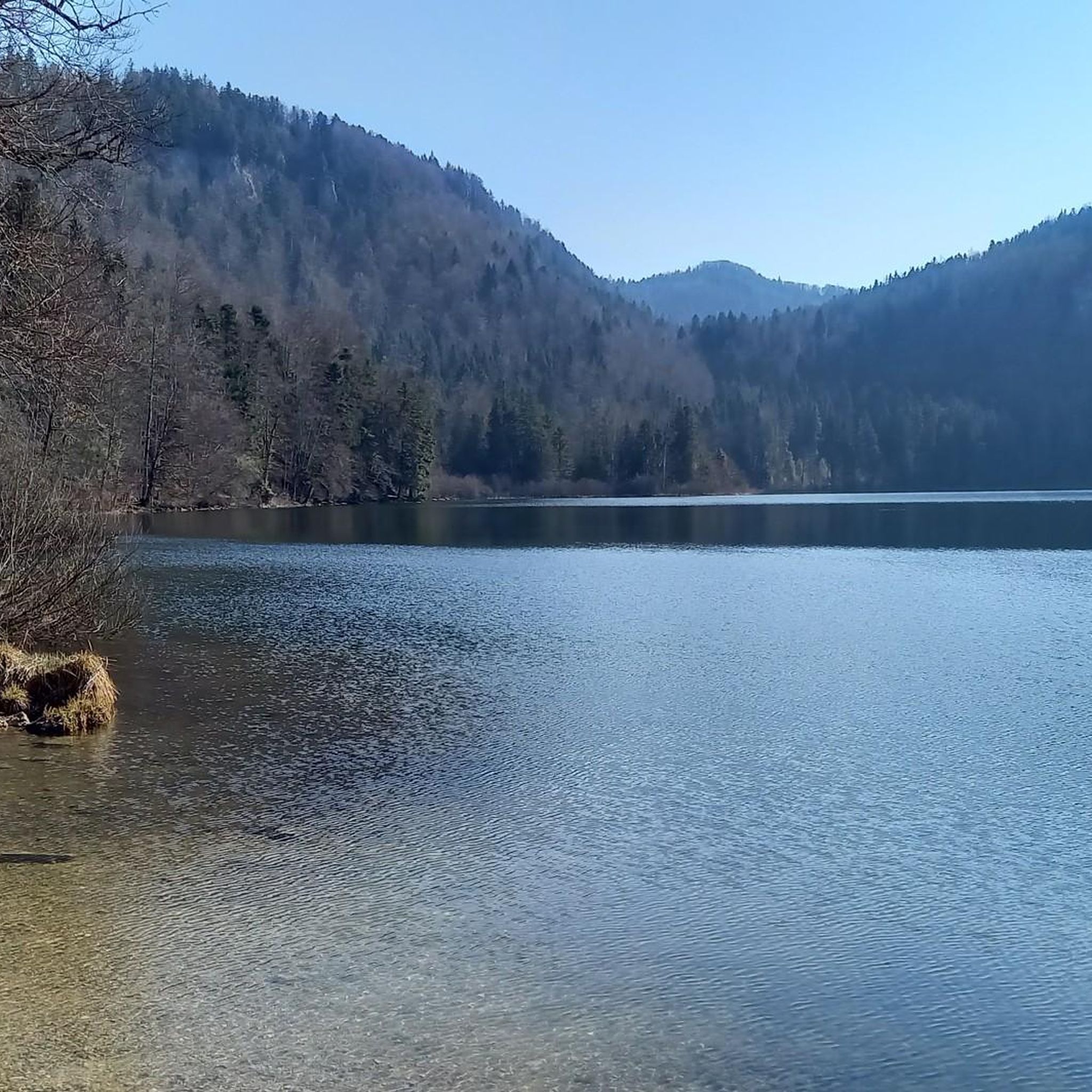
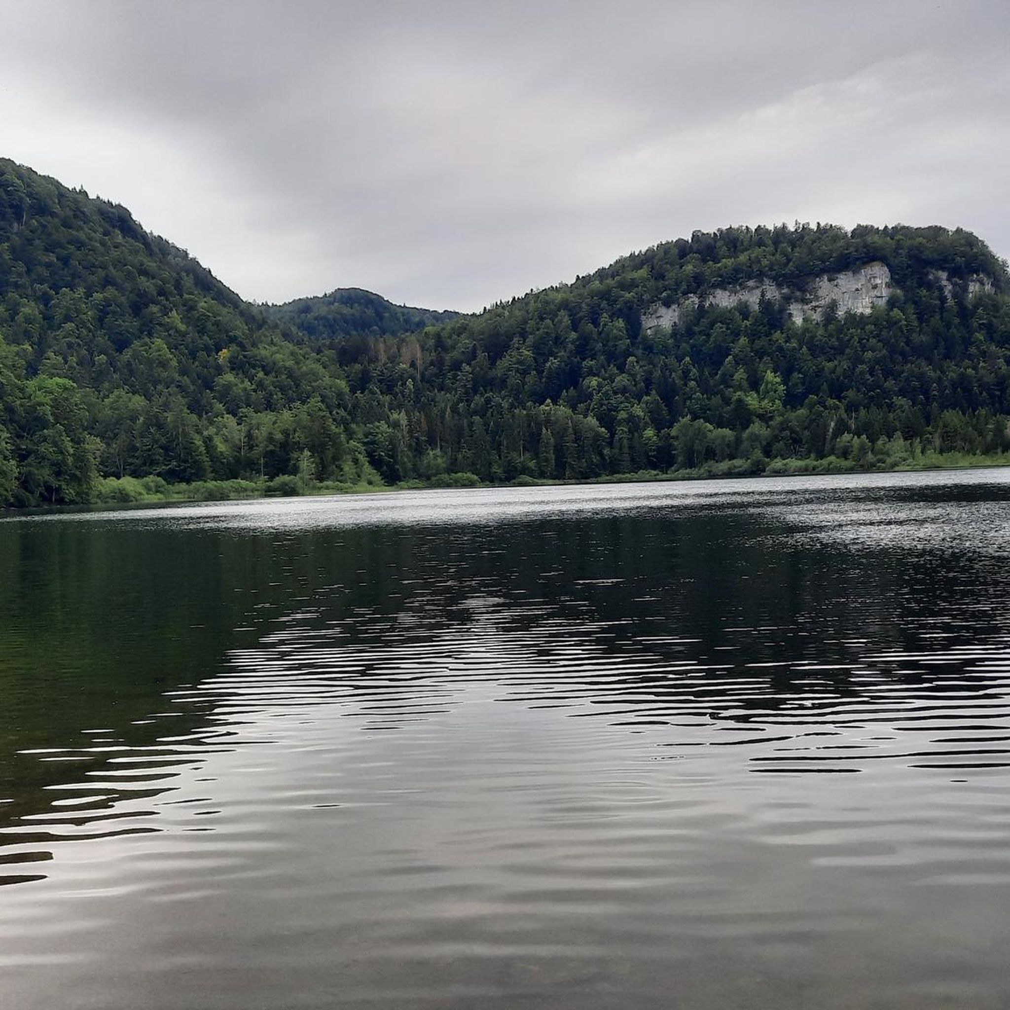
Mountaineering around Lac de Bonlieu offers routes through a landscape shaped by glacial activity, characterized by its pristine nature and diverse terrain. The region features dramatic limestone cliffs, dense forests, and rocky ridges, providing varied challenges for mountaineers. Situated at an altitude of 791 meters, the area includes unique peat bogs and offers panoramic views from several viewpoints. These physical features make the area suitable for exploring challenging ascents and scenic trails.
Best mountaineering routes around Lac de Bonlieu
- The most popular mountaineering route is Le Grand Saut – Saut de la Forge loop from Bonlieu, a 5.2 miles (8.4 km) trail that takes 2 hours 36 minutes to complete. This difficult route features significant elevation gain through forested terrain.
- Another top favourite among local mountaineers is Fan Waterfall – Le Grand Saut loop from La Chaux-du-Dombief, a moderate 7.5 miles (12.0 km) path. This route explores the area's waterfalls and offers varied forest scenery.
- Local mountaineers also love the Le Grand Saut – Saut de la Forge loop from La Chaux-du-Dombief, a 6.1 miles (9.9 km) trail leading through dense woodlands and past rocky outcrops, often completed in about 3 hours 7 minutes.
- Mountaineering around Lac de Bonlieu is defined by glacial valleys, limestone cliffs, and dense forests. The network offers options for different ability levels, from moderate paths to more challenging difficult routes.
- The routes in Lac de Bonlieu are highly rated by the komoot community with an average score of 5.0 stars from over 2 reviews. More than 9 mountaineers have used komoot to explore Lac de Bonlieu's varied terrain.
Last updated: July 6, 2026
5.0
(1)
2
hikers
8.37km
02:36
210m
210m
Hard mountaineering route. Good fitness required. Sure-footedness, sturdy shoes and alpine experience required.
5
hikers
12.0km
03:42
350m
350m
Moderate mountaineering route. Good fitness required. Mostly accessible paths. Sure-footedness required.

Sign up for free
5.0
(1)
2
hikers
9.89km
03:07
270m
270m
Hard mountaineering route. Good fitness required. Sure-footedness, sturdy shoes and alpine experience required.
Our route recommendations are based on thousands of hikes, rides, and runs completed by other people on komoot.
Start today with a free account
Your next adventure awaits.
Login or Signup

Tips from the Community

A superb hike with beautiful views of the seven waterfalls. It's quite crowded, so for a quieter return, you can take the GR 559 forest path back, which doesn't follow the water but is also magnificent in autumn!
0
0

A waterfall with a larger pool and a smaller cascade in a beautiful setting. In front of it is a small stone lynx statue.
6
0
Waterfall at the ruins of a former mill.
7
0
Larger waterfall Cascade Saut De La Forge with grotto and views directly onto the waterfall, as well as from above onto the water cascading down over smaller cascades.
7
0
Beautiful view near a crossroads of a small waterfall with cascades.
7
0
A beautifully situated small waterfall with a small pool. From the rocks in front of the waterfall, you can enjoy beautiful views of the idyllic natural setting.
7
0
View of the Cascade de L'Eventail. A small, rocky path leads directly to the waterfall.
7
0
Beautiful view of the central waterfall Cascade Du Hérisson with several cascades.
7
0
Frequently Asked Questions
How many mountaineering routes are available around Lac de Bonlieu?
There are 3 mountaineering routes detailed in this guide for the Lac de Bonlieu area. These routes offer a range of experiences, from moderate to difficult, exploring the glacial landscape and its unique features.
Are there any easy mountaineering routes suitable for beginners in Lac de Bonlieu?
While the guide features routes primarily rated as moderate to difficult, the area around Lac de Bonlieu does offer varied terrain. For a moderate challenge, consider the Fan Waterfall – Le Grand Saut loop from La Chaux-du-Dombief, which explores waterfalls and varied forest scenery. The full tour of Lac de Bonlieu itself is a popular and easier walk, though not specifically a mountaineering route.
What are the best times of year for mountaineering around Lac de Bonlieu?
The Jura region, including Lac de Bonlieu, offers stunning scenery year-round, with the surrounding forests displaying ever-changing colors with each season. While specific mountaineering seasons aren't detailed, the area is generally accessible for hiking and outdoor activities from spring through autumn. Winter mountaineering would require specialized equipment and experience due to snow and ice conditions.
Can I find routes that feature waterfalls in the Lac de Bonlieu area?
Yes, the region is known for its water features. The Fan Waterfall – Le Grand Saut loop from La Chaux-du-Dombief is a moderate mountaineering route that specifically explores the area's waterfalls. Additionally, Lac de Bonlieu is one of the sources of the Hérisson River, which feeds into the famous Cascades du Hérisson, an impressive series of waterfalls nearby.
Are there any circular mountaineering routes around Lac de Bonlieu?
Yes, all the mountaineering routes featured in this guide are circular. For example, the Le Grand Saut – Saut de la Forge loop from Bonlieu is a difficult 8.4 km trail, and the Le Grand Saut – Saut de la Forge loop from La Chaux-du-Dombief is a 9.9 km difficult route through dense woodlands and past rocky outcrops.
What kind of landmarks or viewpoints can I expect to see on these routes?
The mountaineering routes around Lac de Bonlieu offer breathtaking vistas of the lake and its surroundings. Notable panoramic viewpoints include the Belvédère de la Ronde and Le Maguenay, which provide stunning bird's-eye views. The landscape is also characterized by dramatic cliffs, dense forests, and unique peat bogs, particularly on the western and southern shores of the lake.
Is parking available near the trailheads for mountaineering routes?
While specific parking locations for each trailhead are not detailed in this guide, Lac de Bonlieu is a popular outdoor destination, and parking facilities are generally available in the vicinity of major access points and villages like Bonlieu and La Chaux-du-Dombief, which serve as starting points for many routes.
What do other mountaineers enjoy most about the routes in Lac de Bonlieu?
The mountaineering routes in Lac de Bonlieu are highly rated by the komoot community, with an average score of 5.0 stars. Reviewers often praise the diverse terrain, the pristine nature of the glacial landscape, and the challenging ascents through dense forests and past rocky outcrops.
Are there any specific permits required for mountaineering in the Jura region around Lac de Bonlieu?
The Lac de Bonlieu site is highly protected, serving as a sanctuary for diverse wildlife. While general hiking and mountaineering on established trails typically do not require permits, specific activities like climbing and hang-gliding are permitted only during certain periods. It's always advisable to check with local authorities or the regional park office for any specific regulations or permit requirements for specialized activities.
Are the mountaineering routes around Lac de Bonlieu suitable for families?
The mountaineering routes in this guide are rated as moderate to difficult, featuring significant elevation gain and varied terrain. While the area offers many family-friendly walks, such as the easy path around the lake itself, these specific mountaineering routes might be more suitable for families with older children or those accustomed to more challenging hikes. Always assess the difficulty and duration against your family's experience level.
Can I bring my dog on the mountaineering trails in Lac de Bonlieu?
The Lac de Bonlieu area is a protected natural site. While many trails in the Jura region are dog-friendly, it's crucial to keep dogs on a leash to protect local wildlife, especially given the presence of species like the lynx and peregrine falcon. Always check local signage for specific restrictions on trails or in protected areas.
Most popular routes around Lac de Bonlieu

Get inspired with the komoot mobile app


Explore more
Browse the best Mountain Hikes & Routes in other regions.
