The best running trails around Heywood
4.2
(68)
6,740
runners
387
runs
Jogging routes around Heywood offer a diverse landscape for runners, characterized by its position within Greater Manchester. The area features a mix of urban green spaces, riverside paths along the River Roch, and access to surrounding countryside. Terrain varies from flat, accessible routes suitable for casual runs to more undulating paths with moderate elevation changes. This blend provides options for different fitness levels and preferences.
Best jogging routes around Heywood
- The most popular jogging route is Westbury White Horse and…
Last updated: July 1, 2026
4.0
(2)
10
runners
21.2km
02:21
290m
290m
Hard run. Very good fitness required. Mostly accessible paths. Some sure footedness required.
9
runners
58.8km
06:31
730m
730m
Hard run. Very good fitness required. Mostly accessible paths. Some sure footedness required.

Sign up for free
1
runners
14.2km
01:38
230m
230m
Moderate run. Good fitness required. Mostly accessible paths. Some sure footedness required.
34
runners
13.4km
01:23
60m
60m
Moderate run. Good fitness required. Mostly paved surfaces. Suitable for all skill levels.
36
runners
11.4km
01:11
60m
60m
Moderate run. Good fitness required. Mostly paved surfaces. Suitable for all skill levels.
Get access to more routes and recommendations from other explorers.
Sign up for free
Already have an account?
Our route recommendations are based on thousands of hikes, rides, and runs completed by other people on komoot.
Start today with a free account
Your next adventure awaits.
Login or Signup
Tips from the Community


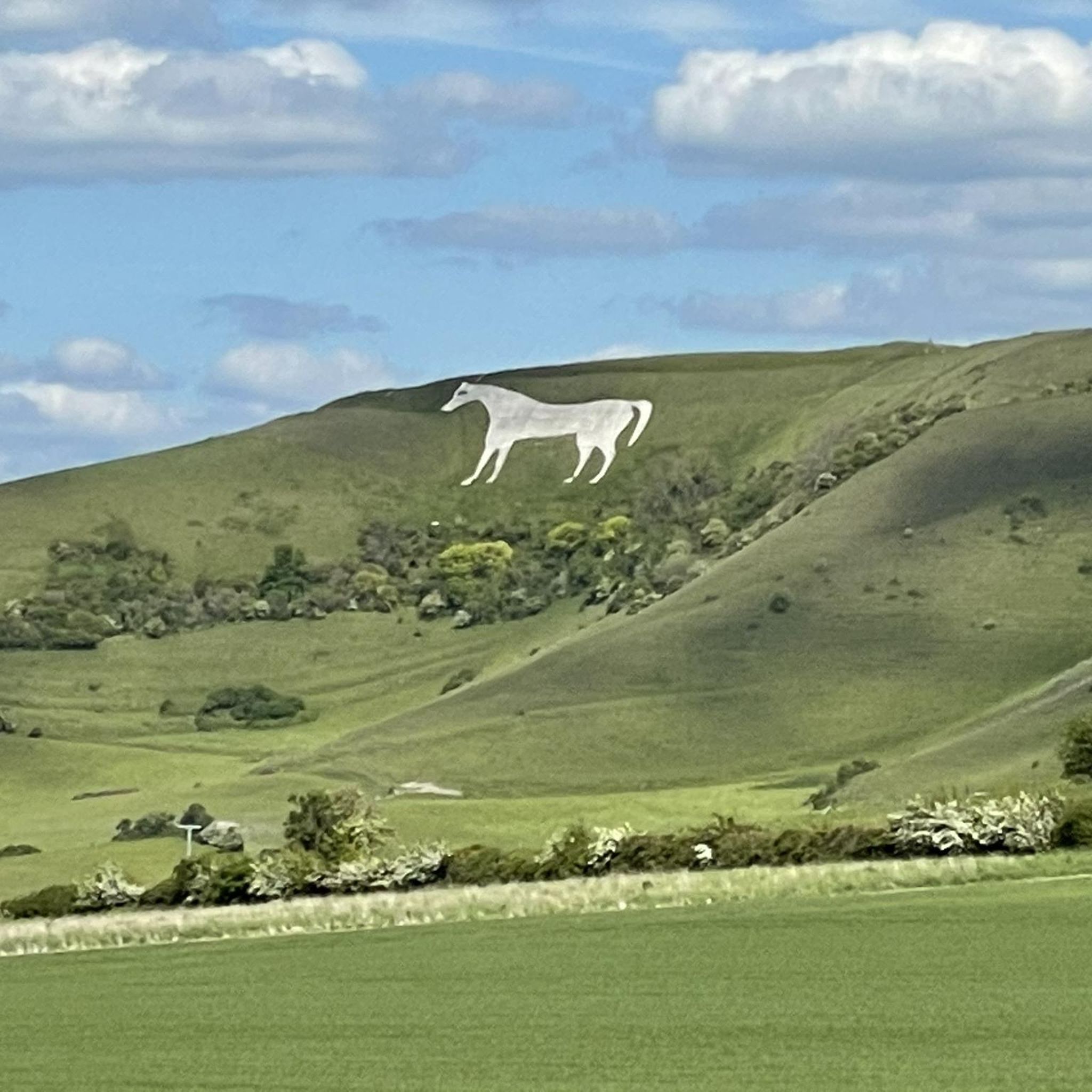
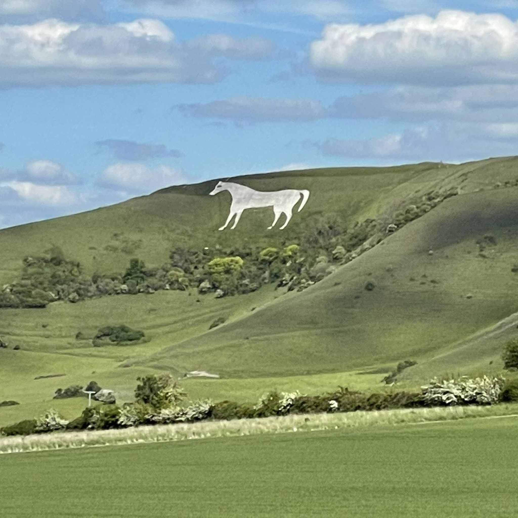
The oldest of the Wiltshire white horses this was originally cut in 1772 and restored in 1778. There was evidence of an older horse here facing the other way, but no strong evidence suggests how old that was. In 1872/1873 the horse was considered to be losing its shape, it was re cut and edging stones added. In 1957 the horse was concreted to preserve it. For the runner the trails around the top of the horse are great fun and the 33-mile Imber trail also passes here. There are nice loops from the car park above the horse or from nearby Westbury.
1
0

White Barrow is a Neolithic long barrow, its name deriving from the chalk plain upon which it is built. First described by archaeologist William Cunnington, it is one of a number of long barrows in the area and is today looked after by the National Trust. The calcerous chalk grassland here is home to many wildflowers, butterflies and other insects, incuding rare bees only found in a few sites in Britain.
0
0
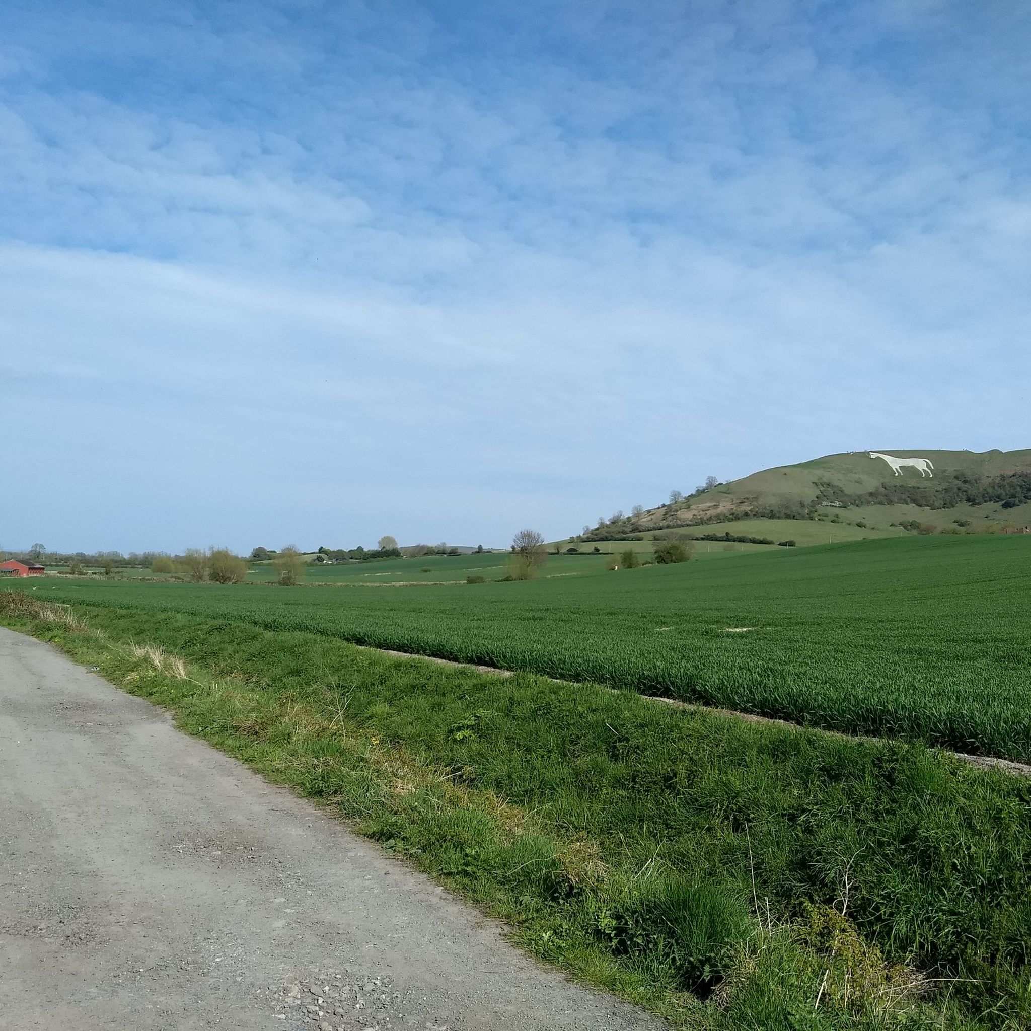
Easy running with lovely views up to the escarpment and white horse.
1
0
Located on both the Imber Range path and Wessex Ridgeway, this former quarry isn't accessible to the public but there are good views from the path. The chalk pit has been used as a location for TV and film. Overall this is a lovely area for trail running with well-maintained paths across calcerous grassland - great for spotting wildflowers and butterflies over the summer months and murmurating starlings in autumn.
1
0
The Iron Age hillfort at Bratton Camp was first carved into the chalk downland over 2000 years ago. The earthworks would have protected a settlement of round houses, granaries, storehouses and workshops. Its strategic position would have afforded residents a far-reaching view and advance warning of any potential attackers. But Bratton's human history stretches back even further than the Iron Age. Three thousand years earlier, a Neolithic long barrow existed here, and 19th century excavations unearthed human skeletons and evidence of cremations. Today, this area of chalk grassland is rich in wildlife, including many important plants that provide a habitat for insects, including the rare Adonis Blue butterfly and the scarce forester moth. Visible from many miles around, Westbury White Horse, which lies just below Bratton Camp, was probably originally cut in the late 1600s to commemorate the Battle of Ethandun, which is thought to have taken place at Bratton Camp in AD 878.
0
0

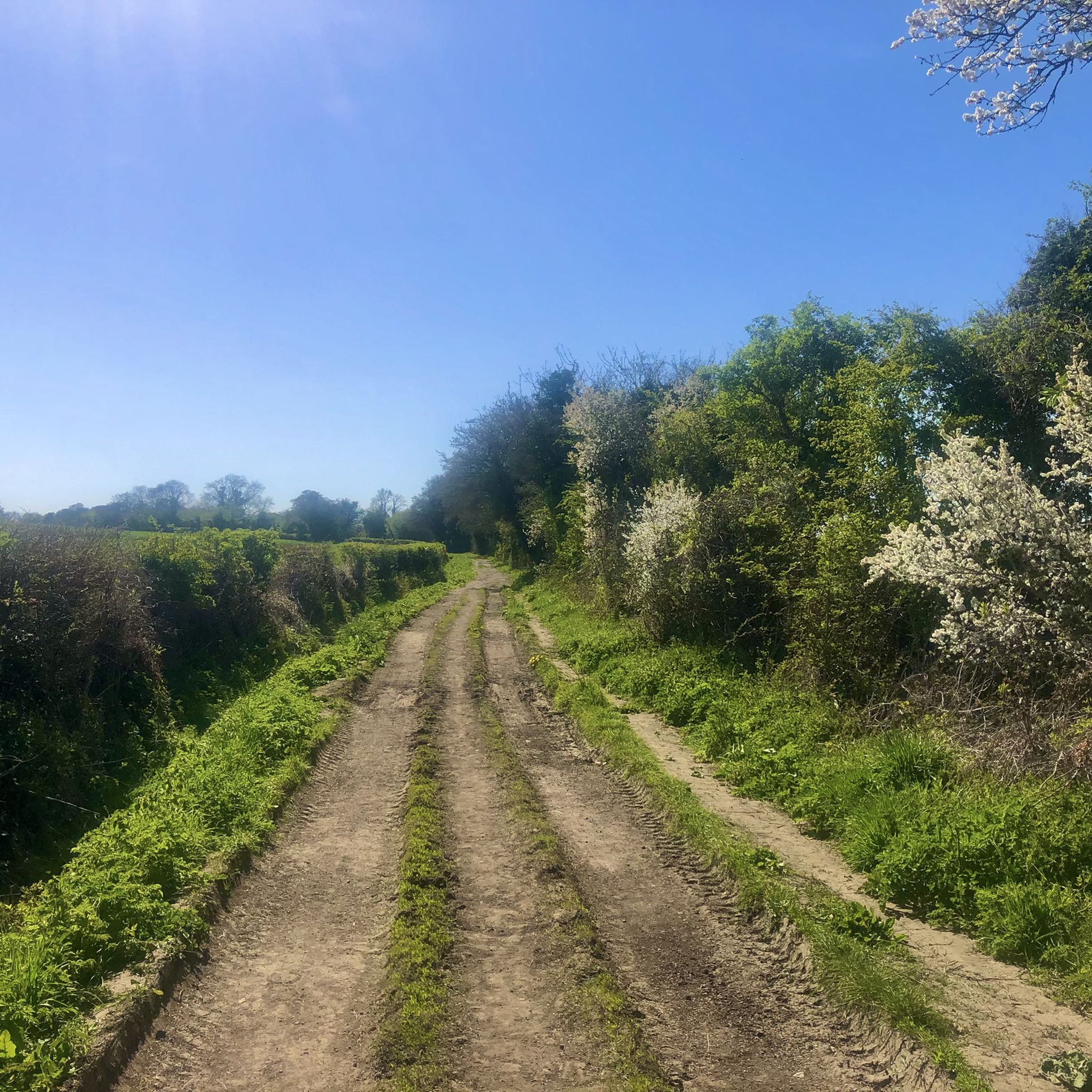
Lovely wide gravel bridleway with somewhat distracting views of the white horse and the Wilts lowlands that I had one of my worst crashes on. Deceptively smooth chunky gravel surface good for medium gravel or touring tyres. Nothing really wrong with the path excepting a few potholes and larger stones, but those potholes can make panniers bounce up and, if unsecured, said panniers can bounce into the path of one's front wheel tossing the obliviously joyful bike tourist over their handlebars and into said hard chunky gravel. One can rag their fully loaded bike down as many unsuitable trails as they please, as long as the load is secure. edit; the potholes are much bigger now.
0
0
Frequently Asked Questions
How many running routes are available around Heywood?
Komoot offers over 390 running routes around Heywood, providing a wide variety of options for all fitness levels. These include easy jogs, moderate trails, and challenging runs.
Are there running routes suitable for beginners or those looking for an easy jog in Heywood?
Yes, Heywood offers a good selection of easier routes. There are 48 routes classified as easy, perfect for beginners or those seeking a relaxed run. These often feature flat terrain along riverside paths or through local parks.
What kind of terrain can I expect on running trails in Heywood?
The terrain around Heywood is quite varied. You'll find a mix of urban green spaces, riverside paths along the River Roch, and access to surrounding countryside. This means routes can range from flat, accessible paths to more undulating trails with moderate elevation changes.
Are there any scenic landmarks or points of interest to see while running in Heywood?
While running around Heywood, you can encounter several interesting sights. For example, some routes might take you near Cley Hill or Middle Hill, which offer viewpoints or historical significance. The area also features the iconic Westbury White Horse and Bratton Camp, a prominent historical site and viewpoint.
Can I find circular running routes in Heywood?
Yes, many of the running routes in Heywood are designed as circular paths, allowing you to start and finish at the same point. For instance, the Westbury White Horse and Bratton Camp Loop is a popular circular option, offering panoramic views.
Are the running trails around Heywood suitable for families?
Heywood's diverse landscape includes many accessible trails and local parks that are well-suited for family outings. Look for routes with minimal elevation gain and well-maintained paths, often found along the River Roch or in urban green spaces.
Are dogs allowed on the running routes in Heywood?
Generally, dogs are welcome on many public footpaths and trails around Heywood, especially in countryside areas and local parks. However, it's always best to keep dogs on a lead, especially near livestock or in designated nature reserves, and to follow local signage regarding pet policies.
What do other runners say about the trails in Heywood?
The running routes in Heywood are highly regarded by the komoot community, with an average rating of 4.2 stars from over 60 reviews. Runners often praise the varied terrain, the mix of riverside paths and countryside, and the accessibility of the trails.
Is public transport available to access running trails in Heywood?
Heywood, being part of Greater Manchester, has public transport options that can help you reach various starting points for running routes. Local bus services connect different parts of the town and surrounding areas. For specific route access, it's advisable to check local bus timetables.
Are there options for parking near the running routes in Heywood?
Many running routes in Heywood, particularly those starting from parks or rural areas, offer nearby parking facilities. While some might be free, others may have charges. For specific routes, checking the route details on komoot or local council websites for parking information is recommended.
Are there any routes that offer a significant challenge for experienced runners?
Absolutely. For experienced runners seeking a challenge, Heywood offers several difficult routes. The Imber Range Perimeter Path, for example, is an extensive 36.5-mile route with considerable elevation, providing a demanding long-distance experience.
What are the best times of year to go running in Heywood?
Heywood's climate is typical of Greater Manchester. Spring and autumn generally offer pleasant running conditions with milder temperatures. Summer can be good, but be mindful of warmer days. Winter runs are possible, but trails might be muddy or icy, especially in more rural sections, so appropriate gear is advised.
Can I find places to eat or drink near the running trails in Heywood?
Yes, Heywood and its surrounding villages offer various pubs, cafes, and shops where you can refuel or relax after your run. Many routes pass through or near residential areas and town centers where such amenities are readily available.
Most popular attractions around Heywood

Get inspired with the komoot mobile app


Explore more
Browse the best Running Trails & Routes in other regions.
