The best MTB trails around Étang de Soulcem
48
riders
3
rides
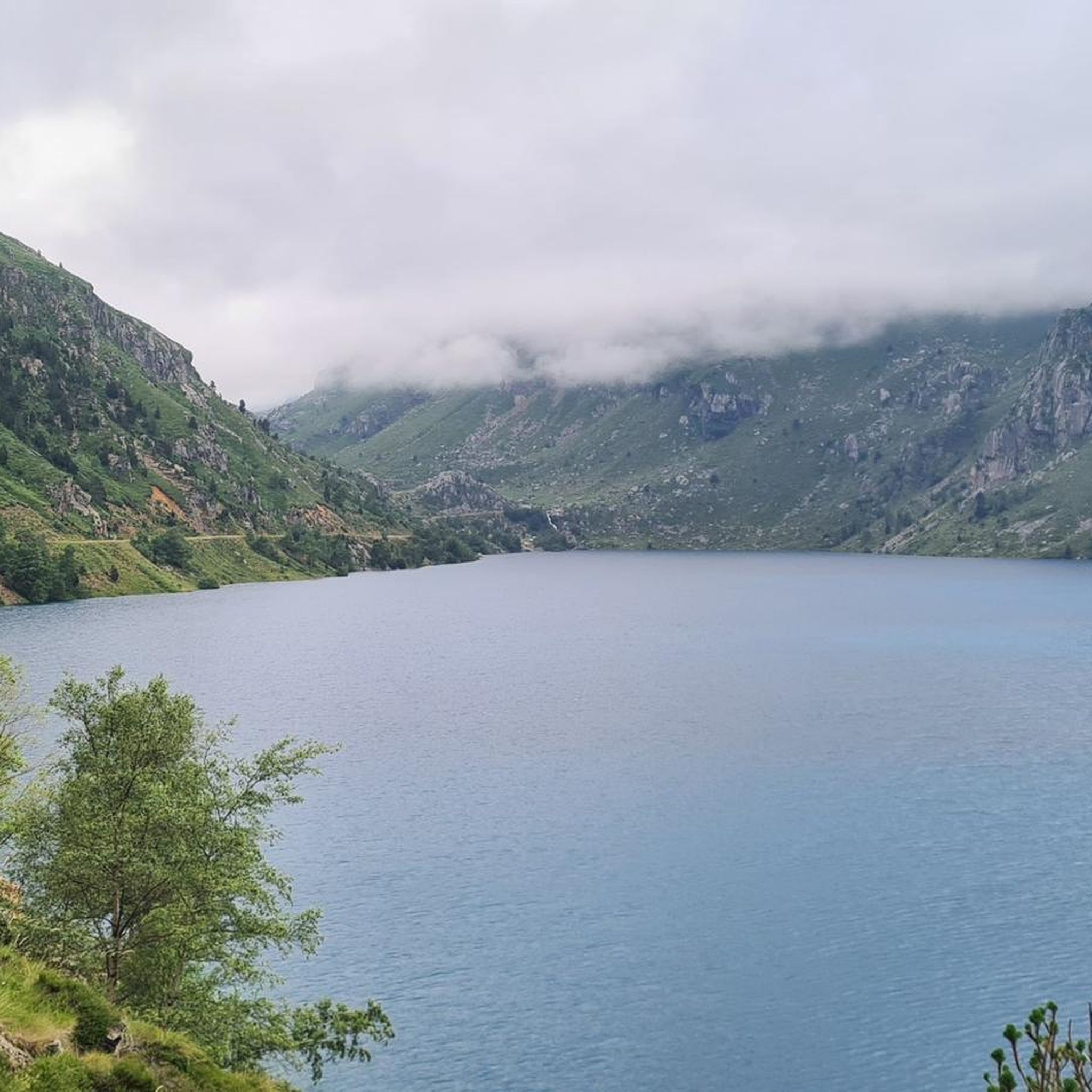
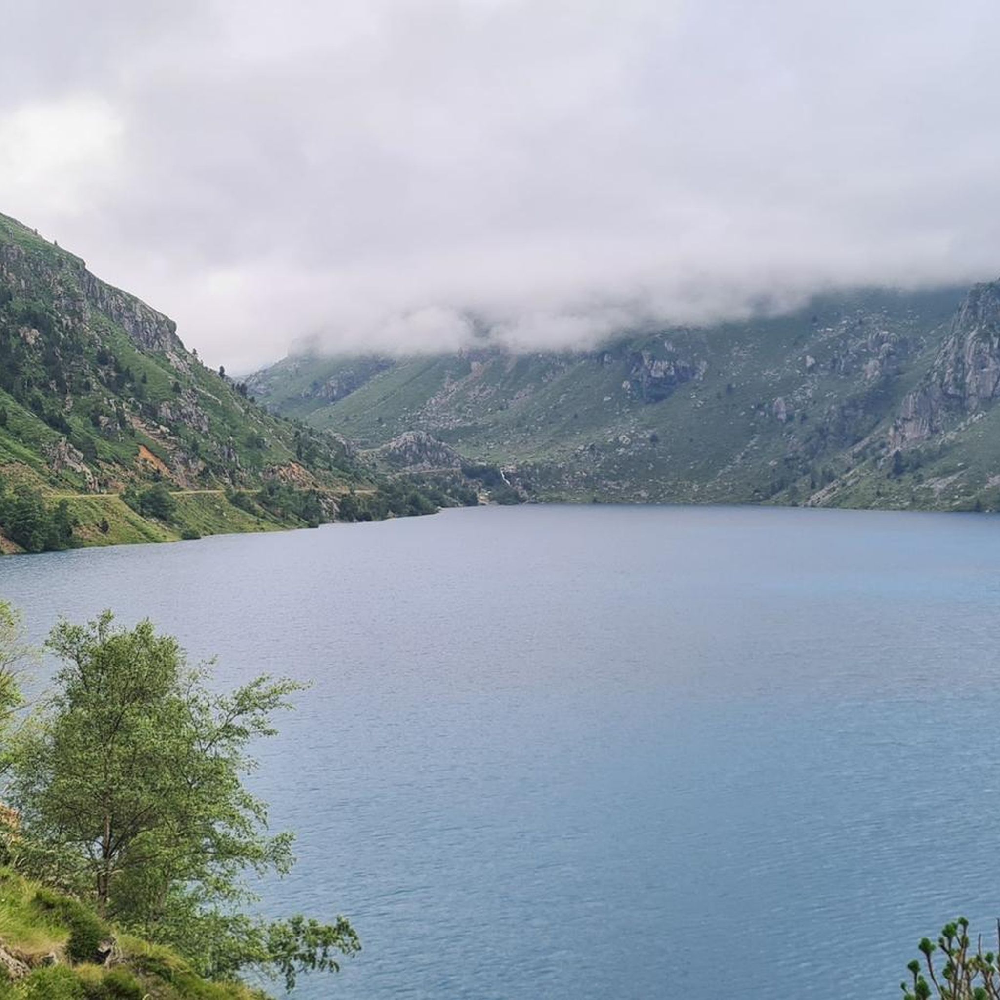
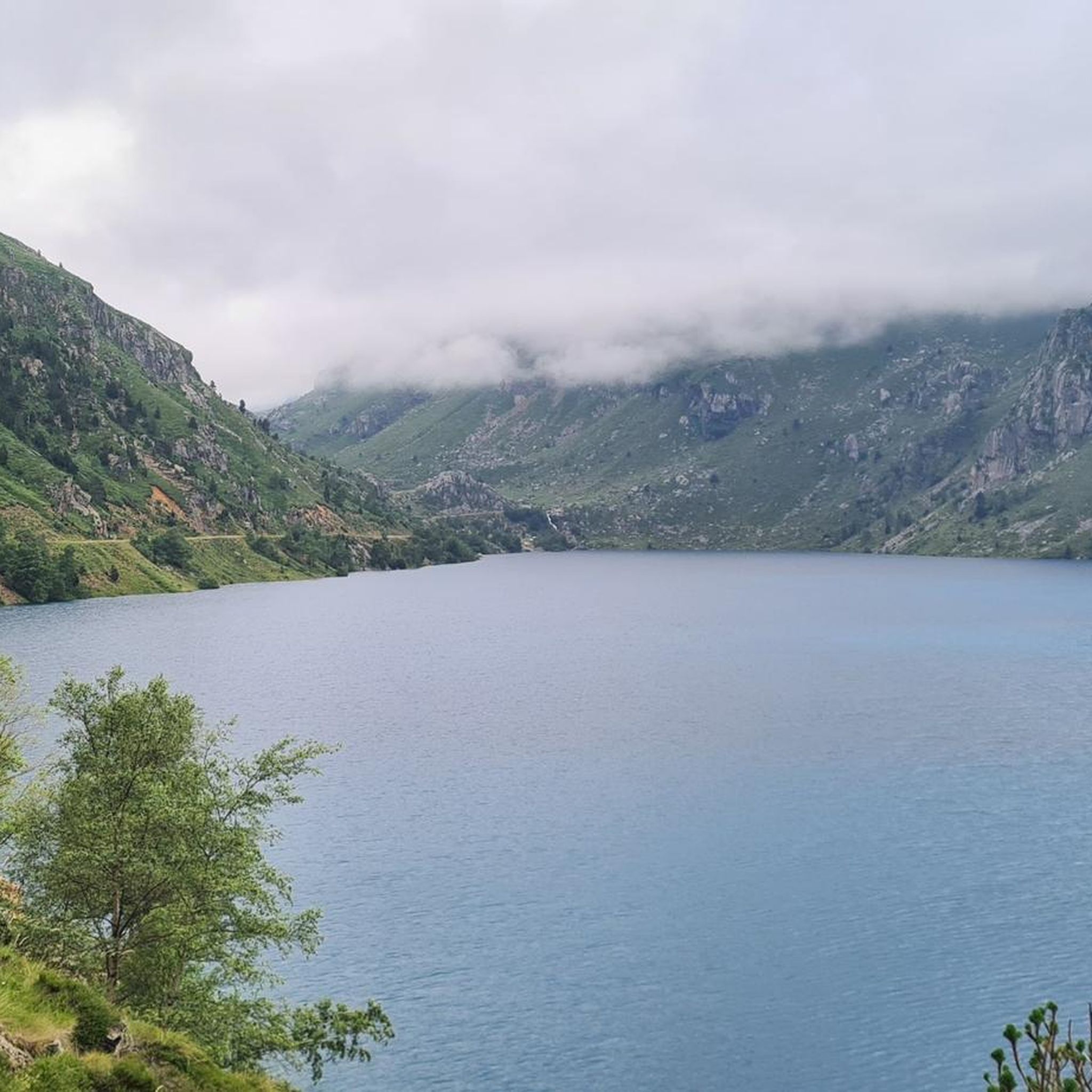
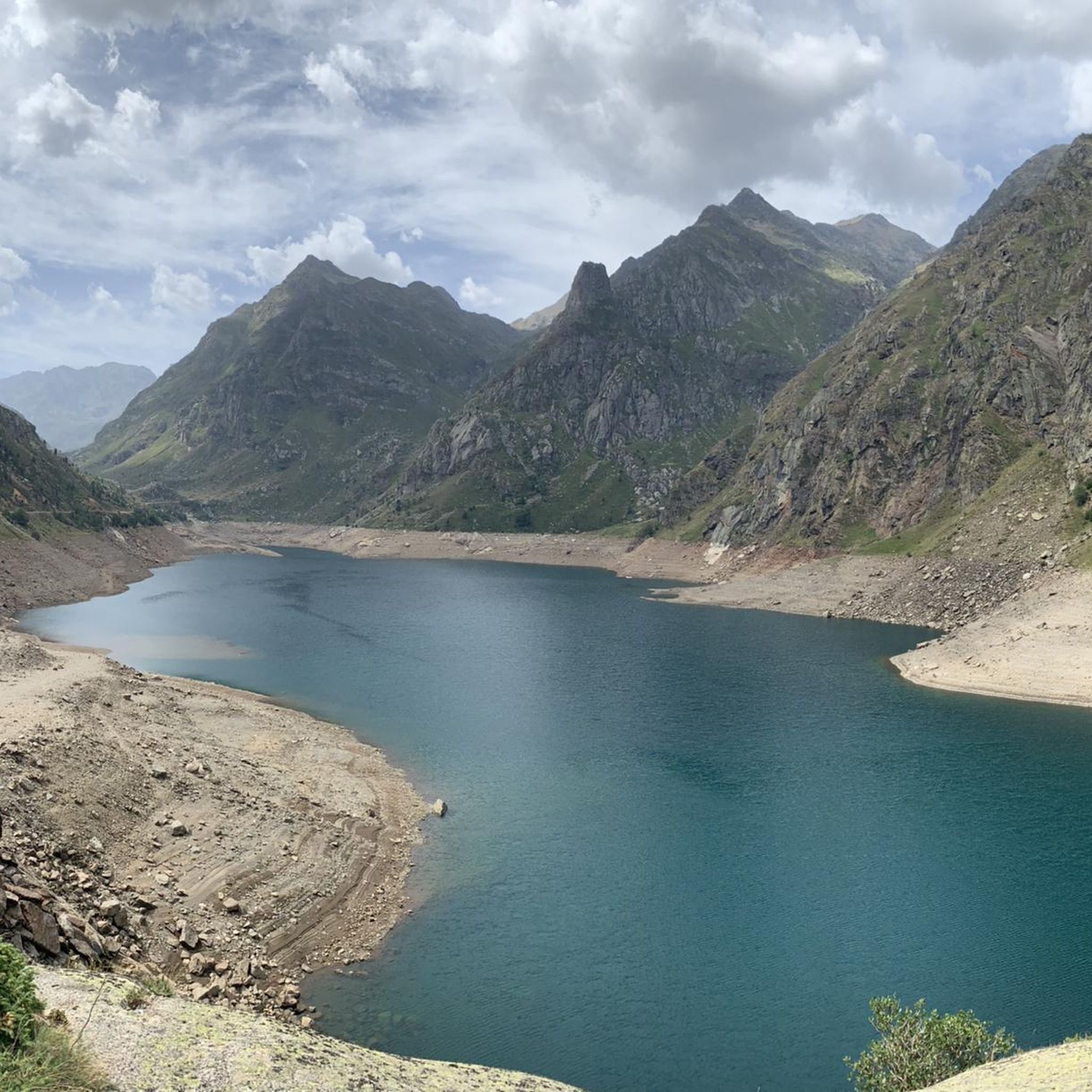
Mountain biking around Étang de Soulcem offers high-mountain landscapes and diverse terrain within the French Pyrénées. The region is characterized by dramatic glacial cirques, crystalline alpine lakes, and impressive peaks that border Spain and Andorra. Mountain bike trails Étang de Soulcem often feature significant elevation gains and rugged sections, providing a challenging experience for riders.
Best mountain bike trails around Étang de Soulcem
- The most popular mountain bike trail is Soulcem Reservoir – Étang de Soulcem loop from Marc,…
Last updated: July 1, 2026
5
riders
25.5km
02:33
910m
910m
Hard mountain bike ride. Very good fitness required. Suitable for all skill levels.
4
riders
11.4km
02:13
740m
740m
Hard mountain bike ride. Good fitness required. Advanced riding skills necessary. Some portions of the route may require you to push your bike.

Sign up for free
15
riders
14.8km
01:32
530m
530m
Moderate mountain bike ride. Good fitness required. Suitable for all skill levels.
24
riders
22.5km
02:49
1,060m
1,060m
Hard mountain bike ride. Very good fitness required. Advanced riding skills necessary. Some portions of the route may require you to push your bike.
5.99km
00:42
240m
250m
Easy mountain bike ride. Great for any fitness level. Suitable for all skill levels.
Our route recommendations are based on thousands of hikes, rides, and runs completed by other people on komoot.
Start today with a free account
Your next adventure awaits.
Login or Signup

Tips from the Community


Solar viewpoint on the Peyraguils pass or summit, a metal structure that allows a 360° view of the valleys of the Andorran Pyrenees and the Aran Valley, with views of Aneto.
2
0

Here again: Someone is rating ALL photos of highlights in this region (Northwest Pyrenees) "not accurate," even though they accurately depict the location? Why does anyone need to do that? Is it jealousy? Does someone want to drag down others' "expert" ratings? How pathetic.
1
1

Porta Estellar, or Arcalìs 91, also known as the "O" of Ordino, in reference to the name of the Parish. It is the work of the Italian Mario Staccioli.
0
0

It is one of the highest points accessible by mountain bike (MTB) and eBike in Andorra. It is a popular destination among cyclists due to its spectacular surroundings and the challenges offered by the climb. The starting point at the Ordino Arcalís ski resort to the summit of Les Portelles covers approximately 7.5 kilometers. The cumulative elevation gain is significant, reaching 700 meters of vertical ascent from the base of the resort to the summit of Les Portelles, which is located at about 2,560 meters above sea level. The terrain is varied, combining asphalt sections in the initial parts with dirt and gravel tracks as you ascend. In some places, the terrain becomes more technical, especially near the summit, where rocks and the incline add difficulty. The climb is considered high difficulty due to the elevation gain and terrain conditions. It is a demanding route for both MTB cyclists and eBike users, who will enjoy the additional challenge offered by the altitude and the changing conditions of the high mountain climate.
0
0
Arcalís 91, also known as The Ring of Ordino, is a steel sculpture created by Italian artist Mauro Staccioli in 1991. Located in the Ordino Arcalís ski resort in Andorra, the sculpture is a giant ring that symbolizes perfection and eternity. It is strategically placed to frame the surrounding mountain landscape, creating a stunning visual effect. The work represents the opposition between natural law and human law, highlighting the contrast between the simplicity of the ring and the complexity of the nature that surrounds it.
1
0
The structure is designed to mark the hours of sunlight throughout the day, allowing visitors to experience how sunlight interacts with the structure at different times. In short, the Tristaina Solar Viewpoint is a work by Rafael Galindo, built in Corten steel and inaugurated in 2021, which celebrates the sun and its daily journey, offering a unique experience in one of the most impressive natural settings in Andorra.
1
0

Beautiful small meltwater depression pond under the Pic de Creussans and the Pic de Cabanyó.
0
0
Frequently Asked Questions
What kind of mountain biking terrain can I expect around Étang de Soulcem?
The Étang de Soulcem area, nestled in the French Pyrénées, offers diverse mountain biking terrain characterized by stunning high-mountain landscapes, dramatic glacial cirques, and alpine lakes. Trails often feature significant elevation gains and rugged sections, providing a challenging experience. You'll find routes ranging from moderate to very difficult, with some sections potentially requiring you to push your bike due to the ruggedness.
Are there mountain bike trails suitable for beginners or families in Étang de Soulcem?
While many routes around Étang de Soulcem are geared towards experienced riders with good fitness, there is at least one easier option available. For example, the Pont de l'Estarell desde El Serrat — circular por el Camí de los Ríos is an easy 5.9 km route with a moderate elevation gain, which could be suitable for those with less experience or families looking for a gentler ride.
What are some notable natural attractions or landmarks to see while mountain biking in the Étang de Soulcem area?
Beyond the main Étang de Soulcem, the region is rich with natural beauty. You can explore other stunning alpine lakes like the Étangs de la Gardelle, Étang de la Soucaranne, and the picturesque Étang Rouge de Riou Blanc. The area also offers views of majestic mountain peaks such as Pique d'Estats (3,143 m) and Pic du Montcalm (3,077 m). For a cultural insight, consider the 'Chemin des Orris' (Path of the Orris) which showcases traditional shepherd huts, including the well-known Orris du Carla. You might also encounter the beautiful Cascade de Labinas, easily accessible from Orris de Carla.
What is the best time of year for mountain biking in Étang de Soulcem?
The high-mountain environment of Étang de Soulcem means that the best time for mountain biking is typically during the warmer months when trails are clear of snow and ice. This usually spans from late spring through early autumn. Always check local weather conditions and trail status before heading out, as conditions can change rapidly in the Pyrénées.
Are there any circular mountain bike routes in the Étang de Soulcem region?
Yes, there are several circular routes available for mountain bikers. A popular option is the Soulcem Reservoir – Étang de Soulcem loop from Marc, a challenging 25.5 km ride. Another circular route is the Coma d'Arcalís – Arcalís Summit (2,229 m) loop from Ordino-Arcalís, which is a moderate 15.0 km path offering high-mountain views.
How challenging are the mountain bike trails around Étang de Soulcem?
The mountain bike trails around Étang de Soulcem are generally quite challenging. Out of the routes listed, two are rated as difficult, one as moderate, and one as easy. For instance, the Ordino-Arcalís Climb is a difficult 22.5 km trail with over 1,000 meters of elevation gain, while the Mirador Solar de Tristaina y Les Portelles — circular desde Arcalis is another difficult option. Riders should have good fitness and advanced riding skills for most routes.
What do other mountain bikers say about the trails in Étang de Soulcem?
The mountain biking experience in Étang de Soulcem is appreciated by the komoot community, with over 90 mountain bikers having explored the varied terrain. While the average rating is 2.5 stars from a few reviews, users often highlight the stunning high-mountain scenery, the challenging climbs, and the wild, peaceful atmosphere that defines the region.
Are there any specific climbs that are particularly rewarding for mountain bikers in the area?
Absolutely. The ascent to Étang de Soulcem itself from Auzat is a demanding climb, stretching 14.6 km with an average gradient of 6.1% and sections reaching up to 15.7%. This route offers a rewarding experience with splendid views, especially if you continue past the dam to the end of the road. The track further up the Soulcem valley, though steep and rocky initially, also provides magnificent vistas.
Is it possible to combine mountain biking with exploring the region's pastoral heritage?
Yes, the Étang de Soulcem valley retains traces of ancient pastoral life. You can explore the 'Chemin des Orris' (Path of the Orris), which loops from Étang de Soulcem and showcases traditional shepherd huts (orris). The Orris du Carla are particularly well-known and offer a safe way to discover this cultural landscape without significant technical difficulty, making it a great addition to a mountain biking trip.
What kind of wildlife might I encounter while mountain biking around Étang de Soulcem?
The wild and peaceful atmosphere of Étang de Soulcem means you might encounter local livestock, such as sheep and cows, grazing in the pastures. The region is also home to various birds of prey, which you might spot soaring above the majestic mountain peaks.
Are there any permits required for mountain biking in the Ariège Pyrénées around Étang de Soulcem?
The provided information does not indicate any specific permits required for mountain biking in the Étang de Soulcem area of the Ariège Pyrénées. However, it's always advisable to respect local regulations, private property, and protected areas. Always stay on marked trails to minimize environmental impact.
What are the typical distances and elevation gains for mountain bike trails in this region?
Mountain bike trails around Étang de Soulcem vary in length and elevation. For example, the Soulcem Reservoir – Étang de Soulcem loop from Marc covers 25.5 km with over 900 meters of elevation gain. The Ordino-Arcalís Climb is 22.5 km with more than 1,000 meters of ascent. Even moderate routes like the Coma d'Arcalís – Arcalís Summit (2,229 m) loop from Ordino-Arcalís involve significant climbs, around 530 meters over 15 km.
Most popular routes around Étang de Soulcem

Get inspired with the komoot mobile app


Explore more
Browse the best MTB trails in other regions.
