The best walks and hikes around Lake Verney
4.5
(2467)
19,133
hikers
205
hikes
Hiking around Lake Verney offers trails through a landscape shaped by the Berwyn Mountains and extensive woodlands. The region features a large reservoir, surrounded by hillsides planted with mixed trees, and higher elevations with blanket bog and heather moorland. Rocky streams and crags are also present, providing varied terrain for outdoor activities.
Best hiking trails around Lake Verney
- The most popular hiking route is Verney Lakes to Pointe Rousse (via Route 14), a 6.3 miles (10.1 km) trail that…
Last updated: October 12, 2026
4.6
(29)
164
hikers
10.1km
04:33
580m
580m
Alpine lake-hopping adventure past sacred glacial waters with Mont Blanc panoramas and wildlife spotting.
4.5
(15)
74
hikers
9.52km
04:19
510m
510m
Hike the difficult 5.9-mile Lacs de la Pointe Rousse Trail to high-alpine lakes, gaining 1662 feet with panoramic mountain views.

5.0
(2)
15
hikers
6.31km
02:01
280m
280m
Hike from ancient Roman ruins to Lac de Touriasse via CAI trail 9, a moderate 3.9-mile route with 923 feet of elevation gain.
5.0
(4)
16
hikers
10.4km
03:34
560m
560m
Historic Roman route through Chavannes Valley where soldiers once marched to Little Saint Bernard Pass.
4.7
(36)
307
hikers
Hard hike. Very good fitness required. Mostly accessible paths. Sure-footedness required.
Get access to more routes and recommendations from other explorers.
Already have an account?
Our route recommendations are based on thousands of hikes, rides, and runs completed by other people on komoot.
Start today with a free account
Your next adventure awaits.
Tips from the Community

The Cromlech of Piccolo San Bernardo is one of the most important megalithic monuments in the Alps. The large circle of 46 stones fixed in the ground testifies to the presence of man on the hill as early as the pre-Roman era, even if the exact date of its construction is not yet known. Even today, it represents one of the most fascinating and mysterious places on the pass.
0
0
For centuries, Jupiter's Column marked this historic Alpine pass. According to tradition, it was topped by a statue of the god Jupiter; today it supports that of Saint Bernard, testifying to the profound religious and cultural changes that have affected the hill over the centuries.
0
0

Located exactly on the border between Italy and France, the Lancebranlette is 2,936 meters high and is a mountain of the Graian Alps. On the Italian side it is characterized by a wall of extremely friable rocks overlooking Lake Verney. The summit is also called "Pointe de Lancebranlette".
1
0

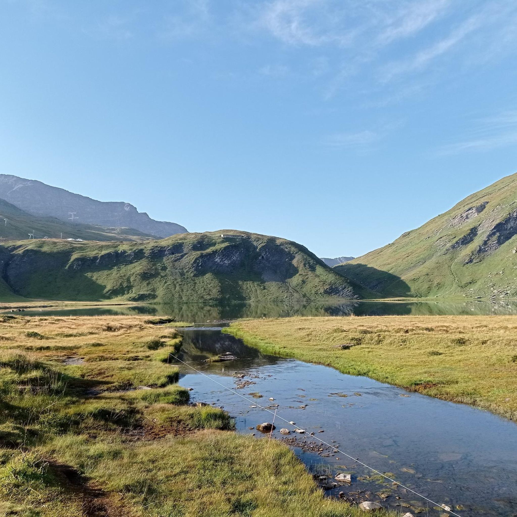
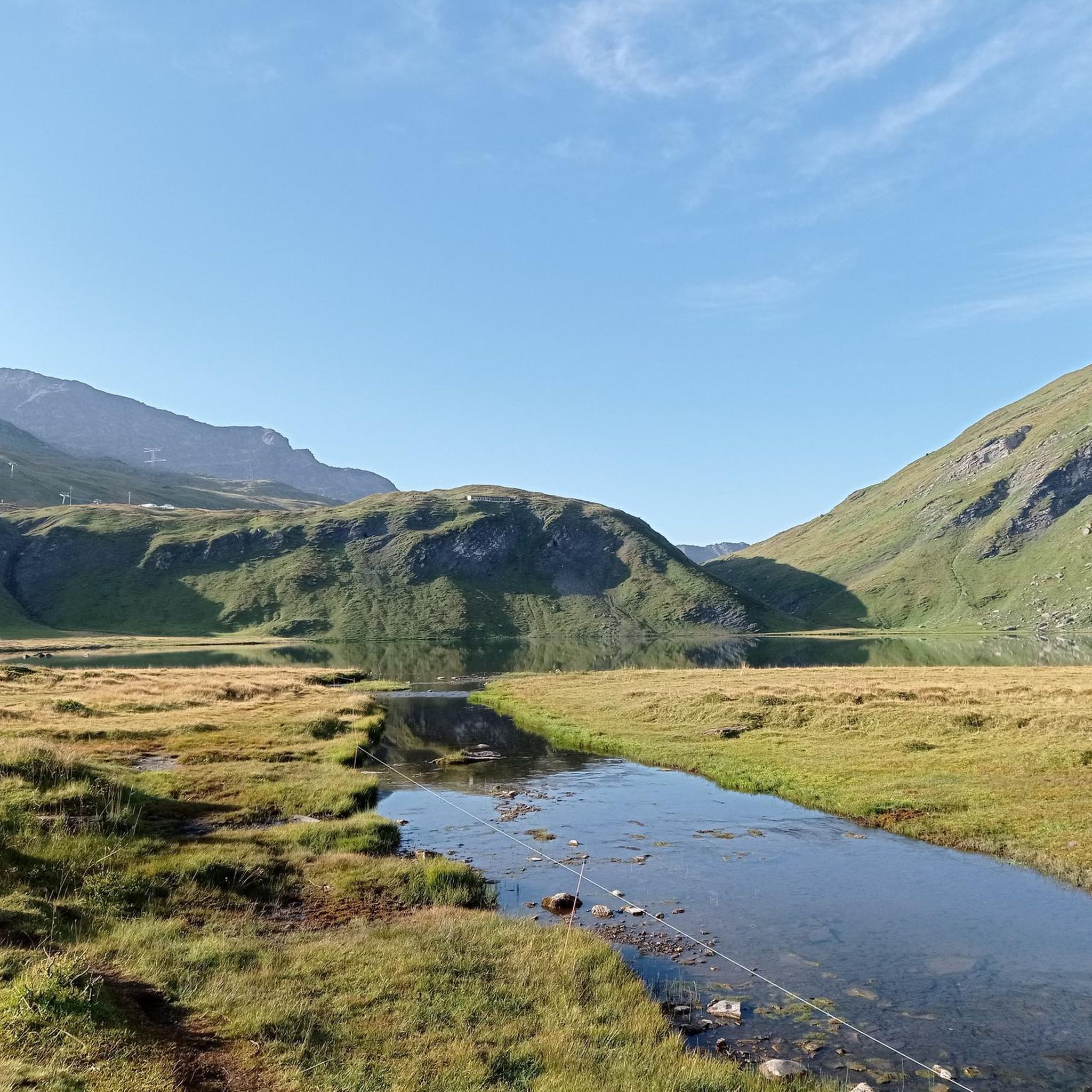
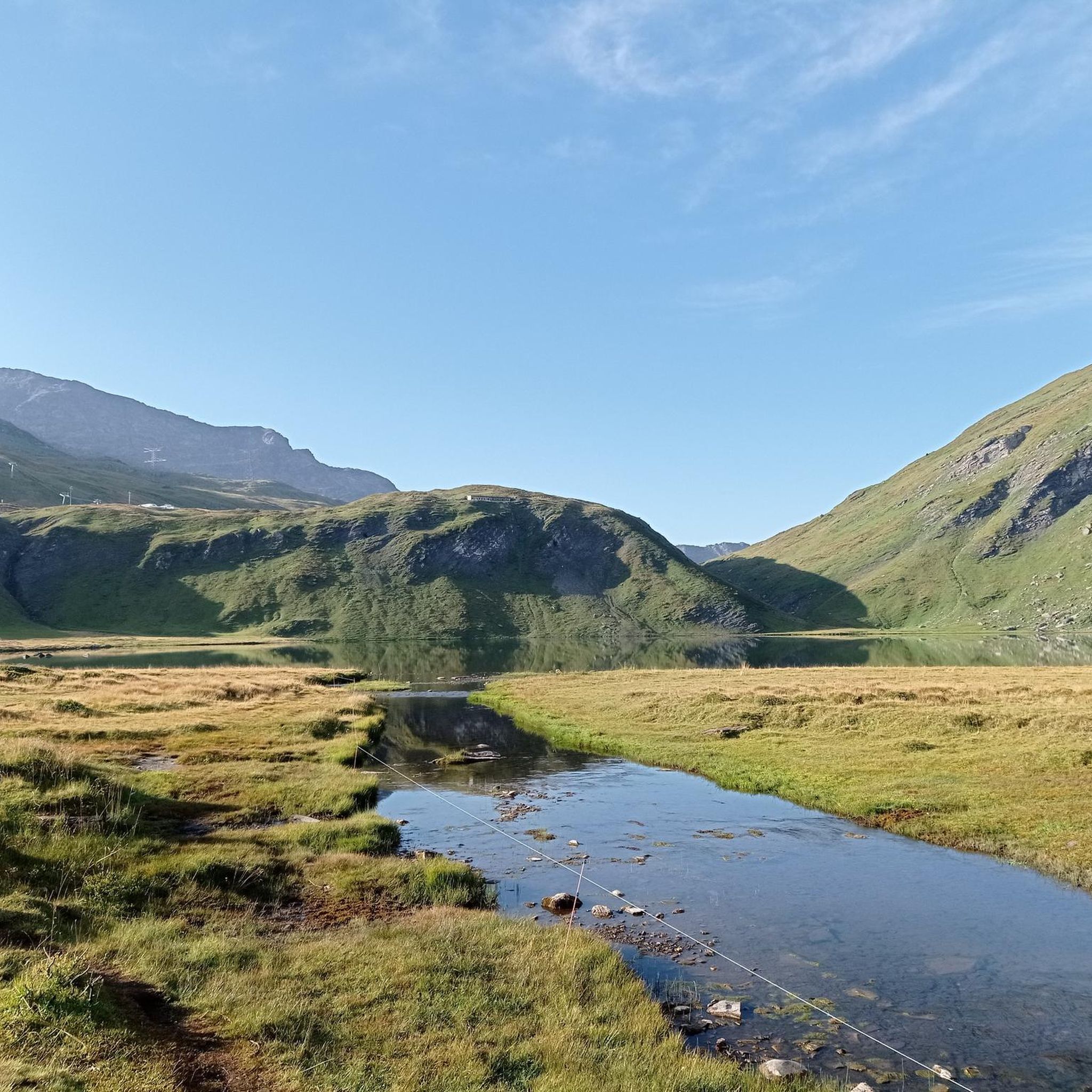
In summer this place transforms into an enchanting mountain pasture.
0
0
Pointe de Lancebranlette is located at 2,936 meters above sea level. From up here the view is nothing short of breathtaking!
1
0

Lake Verney Superiore, the younger brother of Lake Verney, is the largest natural fishing reserve in the Aosta Valley, at 2,283 meters above sea level. The path that leads to this place offers a breathtaking view of the surrounding alpine clearings.
2
0

The "Via delle Gallie" retraces the road that the Romans built in the Aosta Valley at the end of the 1st century BC. It is still practicable today from Pont-Sanit-Martin to the Great San Bernardo. In the pretty village of Pont Serrand you can still see the remains of the ancient road. Just beyond the town, on the short stretch of state road, you cross the Dora di Verney. The bridge over which you pass today stands on the same point where the Romans had built their infrastructure of which you can see evidence by looking on the orographic right of the river.
2
0
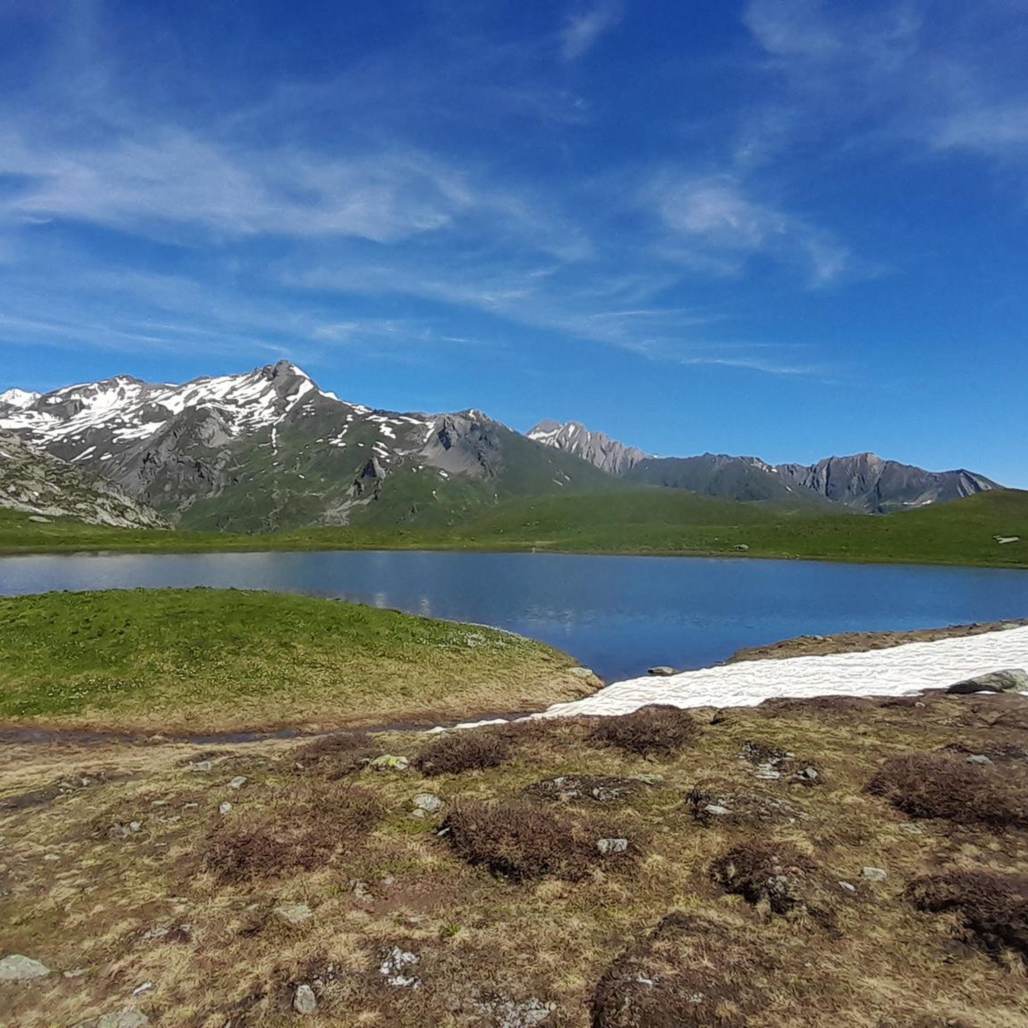
Lake Tormotta is located in the moraine area between Col d'Arguerey and Mount Miravidi and enjoys an excellent view of the Mont Blanc chain. Near Lake Tormotta you can also admire other smaller alpine lakes.
1
0
Frequently Asked Questions
How many hiking trails are available around Lake Vyrnwy?
There are nearly 200 hiking trails around Lake Vyrnwy, offering a wide range of options from easy strolls to challenging mountain ascents. The komoot community has rated these routes highly, with an average score of 4.5 stars.
Are there family-friendly hiking options at Lake Vyrnwy?
Yes, Lake Vyrnwy offers around 40 easy hiking routes suitable for families. The area also features a natural play area and themed woodland trails, making it enjoyable for children. Consider the Path of Remembrance for a shorter, accessible walk.
Can I bring my dog on the hiking trails around Lake Vyrnwy?
Many trails around Lake Vyrnwy are suitable for dogs, but as the area is a significant nature reserve managed by the RSPB, it's crucial to keep dogs under close control, especially near livestock and wildlife. Always check local signage for specific restrictions on certain paths or areas.
Are there any circular hiking routes around Lake Vyrnwy?
Yes, a prominent feature of Lake Vyrnwy is the 12-mile perimeter road that circumnavigates the lake, which can be walked or cycled, offering continuous scenic views. Many other trails also offer circular options through the surrounding woodlands and moorland.
What kind of terrain can I expect on the hikes around Lake Vyrnwy?
Hiking around Lake Vyrnwy offers diverse terrain. You'll find paths through thickly wooded hillsides, open heather moorland, and rocky streams. Higher elevations in the Berwyn Mountains provide more challenging, mountainous landscapes.
Are there any waterfalls to see on the hiking trails?
Yes, numerous streams and waterfalls feed Lake Vyrnwy, adding to its scenic beauty. "Waterfall hikes" are a popular activity, allowing visitors to explore natural cascades like the Nant y Maes Waterfall.
What are some notable landmarks or points of interest along the trails?
Beyond the natural beauty, you can explore the impressive Victorian stone dam, a feat of 1880s engineering, and the picturesque pointed straining tower in the lake. Below the dam, there's also a visionary Sculpture Park. The area is also home to the largest nature reserve in Wales, managed by the RSPB.
What do other hikers enjoy most about hiking in Lake Vyrnwy?
The area is highly rated by the komoot community, with an average score of 4.5 stars from over 2000 reviews. Hikers often praise the stunning natural beauty, the diverse landscapes ranging from woodlands to moorland, and the sense of unspoiled wilderness within the Berwyn Mountains.
Is there public transport available to Lake Vyrnwy for hikers?
Public transport options directly to Lake Vyrnwy can be limited due to its remote location within the Berwyn Mountains. It's advisable to check local bus schedules in advance or consider driving, as this offers more flexibility for accessing various trailheads.
Where can I find parking for hiking trailheads around Lake Vyrnwy?
There are several designated parking areas around Lake Vyrnwy, particularly near the visitor facilities, the dam, and various points along the 12-mile perimeter road. These are typically well-signposted, but it's always good to plan your starting point and check for specific parking availability beforehand.
What is a moderately challenging hike I could try?
For a moderately challenging hike, consider the Via delle Gallie Trail to Little Saint Bernard Pass (Trail 9). This 6.4-mile path follows historical routes and offers rewarding views of the alpine environment.
Are there any challenging routes for experienced hikers?
Yes, experienced hikers can find challenging routes with significant elevation gain. An example is the Verney Lakes to Pointe Rousse (via Route 14), a 6.3-mile trail through mountainous terrain.
When is the best time of year to hike around Lake Vyrnwy?
Lake Vyrnwy is beautiful year-round, but autumn is particularly vibrant as the mixed deciduous and coniferous trees display stunning colors. Spring brings new growth and bird activity, while summer offers longer daylight hours. Winter hiking is possible but requires appropriate gear for potentially colder and wetter conditions.
Most popular routes around Lake Verney

Get inspired with the komoot mobile app


Explore more
Browse the best Hikes in other regions.
