The best running trails around Lac d'Anterne
4.7
(65)
7,565
runners
56
runs
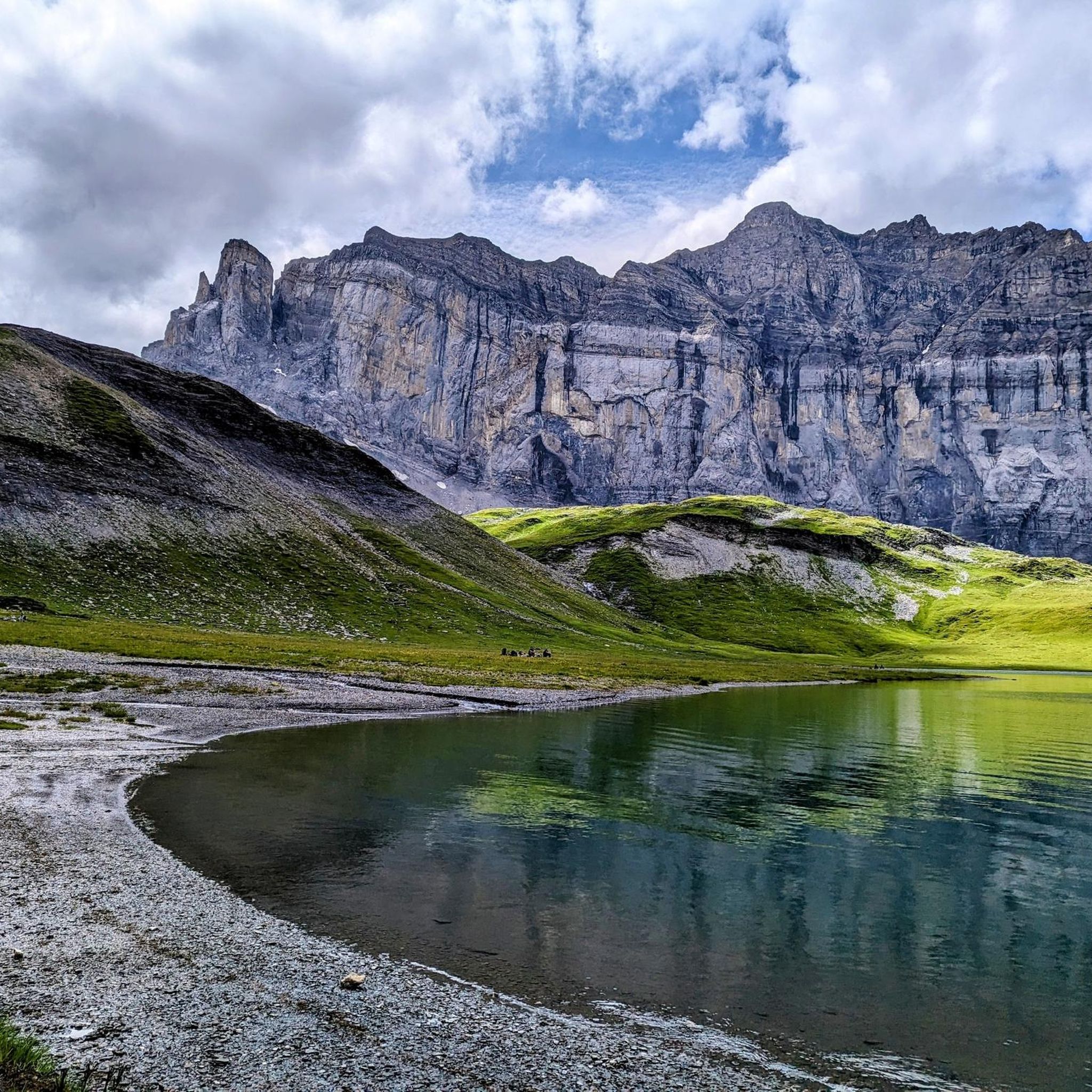
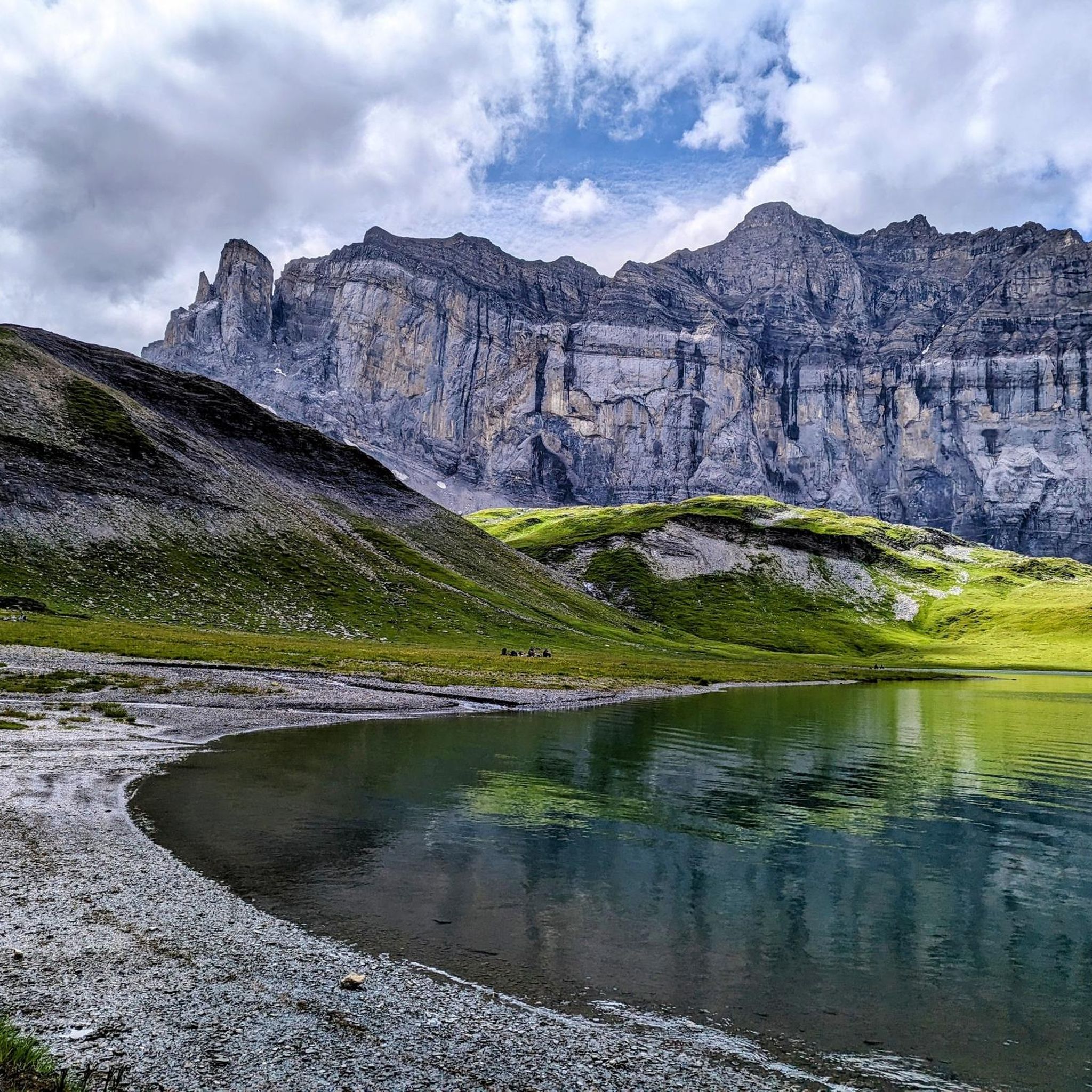
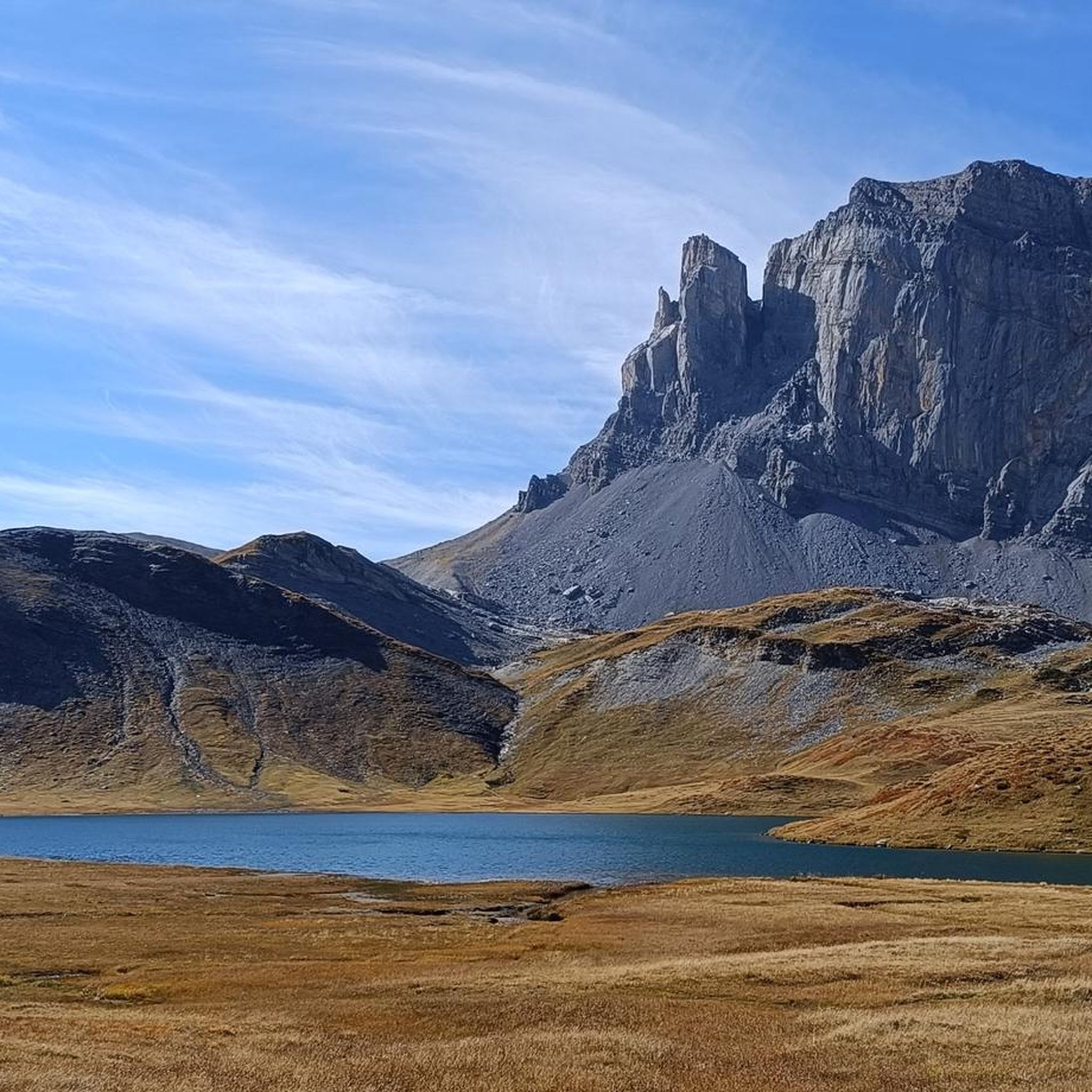
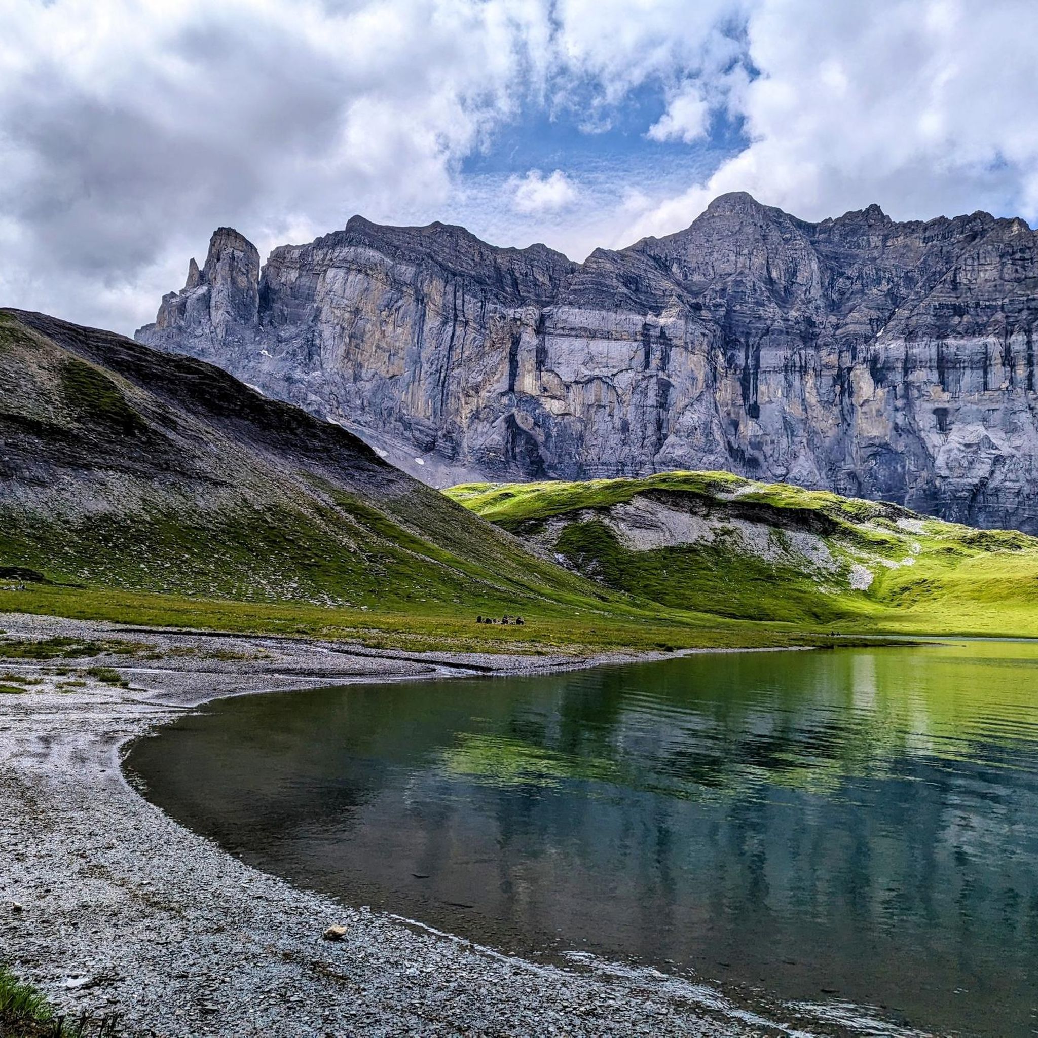
Jogging around Lac d'Anterne offers routes through a diverse alpine landscape within the Sixt-Passy Nature Reserve. The region is characterized by a glacial lake at 2,063 meters, surrounded by the towering Rochers des Fiz and other peaks. Running routes here often feature significant elevation changes, rocky sections, and paths through alpine meadows and past waterfalls. This terrain provides options for trail runners seeking challenging mountain paths.
Best jogging routes around Lac d'Anterne
- The most popular jogging route is Tines Gorge…
Last updated: August 20, 2026
94
runners
15.6km
03:10
1,060m
1,060m
Hard run. Very good fitness required. Sure-footedness, sturdy shoes and alpine experience required.
20
runners
7.20km
01:33
570m
570m
Hard run. Very good fitness required. Sure-footedness, sturdy shoes and alpine experience required.

Sign up for free
4.5
(4)
194
runners
15.6km
01:59
420m
420m
Hard run. Very good fitness required. Sure-footedness, sturdy shoes and alpine experience required.
4.0
(2)
48
runners
8.52km
01:22
440m
440m
Hard run. Very good fitness required. Sure-footedness, sturdy shoes and alpine experience required.
4.3
(3)
208
runners
19.7km
02:53
990m
990m
Hard run. Very good fitness required. Sure-footedness, sturdy shoes and alpine experience required.
Get access to more routes and recommendations from other explorers.
Sign up for free
Already have an account?
Our route recommendations are based on thousands of hikes, rides, and runs completed by other people on komoot.
Start today with a free account
Your next adventure awaits.
Login or Signup


Tips from the Community

In autumn, a room is open as a place to sleep (go up the steel stairs at the back).
0
1

The views of the ravine from this bridge are impressive.
1
0
Beautiful lake located next to the Gers Refuge and below Col Pelouse
1
0

The Cascade du Rouget, also known as the "Queen of the Alps," is one of the most impressive waterfalls in Haute-Savoie. It's a lovely place to linger, and you can park right there 🙂
1
0
Very beautiful neck of the gorge (la Giffre).
1
0

The Rouget waterfall is a waterfall in the Giffre Valley (France) which flows all year round from the Sales torrent upstream and which joins the Giffre des Fonds downstream to constitute the Petit Giffre in the commune of Sixt- Horseshoe. It is made up of three jumps: the first two upstream of the road separated by a short flat which constitutes the upstream fall and a last one downstream of the road after a short course of the torrent which constitutes the downstream fall. The upstream fall is around a hundred meters high with a jump halfway up which can be impressive when the snow melts due to the rebound of the water on the stone slab. In case of high flow, splashes of water make the surrounding stones slippery; accidents have already occurred in these dangerous conditions. It is accessible directly by a small road, which makes it a very popular tourist site despite the deterioration of the surface. It is one of the two referenced sites in the commune with the Fer-à-Cheval cirque. Her nickname is “the queen of the Alps”. Popular traditions have attributed to it virtues of virility and fertility to such an extent that the elders still offer a bottle of this water to newlyweds, without the qualities of this water having ever been proven. This waterfall was named the most beautiful French waterfall in 2009.
1
0
Point of intersection La Cascade du Rouget Altitude 960m The Rouget waterfall is a waterfall in the Giffre Valley (France) which flows all year round from the Sales torrent upstream and which joins the Giffre des Fonds downstream to constitute the Petit Giffre in the commune of Sixt- Horseshoe. It is made up of three jumps: the first two upstream of the road separated by a short flat which constitutes the upstream fall and a last one downstream of the road after a short course of the torrent which constitutes the downstream fall. The upstream fall is around a hundred meters high with a jump halfway up which can be impressive when the snow melts due to the rebound of the water on the stone slab. In case of high flow, splashes of water make the surrounding stones slippery; accidents have already occurred in these dangerous conditions. It is accessible directly by a small road, which makes it a very popular tourist site despite the deterioration of the surface. It is one of the two referenced sites in the commune with the Fer-à-Cheval cirque. Her nickname is “the queen of the Alps”. Popular traditions have attributed to it virtues of virility and fertility to such an extent that the elders still offer a bottle of this water to newlyweds, without the qualities of this water having ever been proven. This waterfall was named the most beautiful French waterfall in 2009.
1
0

Buvette and restaurant on the outskirts of Sixt-Fer-à-Cheval, offering food and drinks in a beautiful alpine setting. A great place to have a coffee before a long mountain walk or a cold beer afterwards.
1
0
Frequently Asked Questions
How many running routes are available around Lac d'Anterne?
There are over 50 running routes available around Lac d'Anterne, offering a wide range of options for trail runners. These routes are highly rated by the komoot community, with an average score of 4.7 stars.
What are the typical difficulty levels for running routes around Lac d'Anterne?
The running routes in the Lac d'Anterne area primarily cater to experienced trail runners, with 44 routes classified as difficult and 7 as moderate. There are no routes currently listed as easy, indicating the challenging nature of the alpine terrain.
What natural features and landmarks can I expect to see while running near Lac d'Anterne?
Runners can experience stunning alpine landscapes, including the glacial Lac d'Anterne itself, the dramatic Rochers des Fiz, and breathtaking views of the Mont-Blanc Massif from passes like Col d'Anterne. Many trails also pass picturesque waterfalls, such as the Cascades de la Pleureuse and Sauffraz, and wind through alpine meadows where you might spot local wildlife like marmots and ibex.
Are there challenging trail running options in the Lac d'Anterne area?
Yes, the Lac d'Anterne region is ideal for challenging trail running. Routes often involve significant elevation changes, rocky sections, and technical mountain paths. For example, the Nant d'Ant Bridge loop from Sixt-Fer-à-Cheval covers 19.2 km with over 1000 meters of elevation gain, providing a demanding experience for seasoned runners.
Where can I park when planning a run around Lac d'Anterne?
Popular starting points with parking facilities include the Lignon car park and Plaine Joux. Many routes, such as the Tines Gorge – Chapel of Our Lady of Graces loop, begin from Sixt-Fer-à-Cheval, which also offers parking options for accessing the trails.
What is the best time of year for running around Lac d'Anterne?
The best time for running around Lac d'Anterne is typically from late spring to early autumn (June to September) when the snow has melted and trails are more accessible. However, even in these months, be prepared for varying conditions, including potential slippery sections due to melting snowfields, especially at higher altitudes.
Are there any refuges or places to rest along the running routes?
Yes, the Refuge d'Anterne Alfred Wills is a notable resting point for runners and hikers, offering spectacular views of the Rochers des Fiz. Other alpine chalets may also be found along various paths, providing opportunities for a break.
Can I bring my dog on the running trails around Lac d'Anterne?
The Lac d'Anterne area is part of the Sixt-Passy Nature Reserve. While many trails in natural parks allow dogs, it's crucial to check specific regulations for this reserve regarding dogs, especially concerning leash requirements and restricted areas, to ensure compliance and protect local wildlife.
Are there any circular running routes in the Lac d'Anterne region?
Yes, many of the running routes around Lac d'Anterne are circular, offering varied scenery without retracing your steps. Examples include the Giffre Gorges – Rouget Waterfall loop from Sixt-Fer-à-Cheval and the Refuge de Grenairon loop from Sixt-Fer-à-Cheval, both providing immersive experiences.
What should I consider regarding public transport access to the running trails?
While specific public transport details are not provided, access to mountainous regions like Lac d'Anterne often involves a combination of local buses or shuttles to key villages like Sixt-Fer-à-Cheval, followed by further travel or a walk to trailheads. It's advisable to research local transport schedules in advance, especially during off-peak seasons.
What makes running in the Sixt-Passy Nature Reserve unique?
Running in the Sixt-Passy Nature Reserve offers a unique experience due to its protected status, ensuring pristine environments and rich biodiversity. You'll traverse diverse landscapes from glacio-karstic depressions to high alpine meadows, with the chance to observe rare flora and fauna in a truly wild setting, all under the watchful gaze of the towering Rochers des Fiz.
Are there any routes that offer views of Lac de Pormenaz?
Yes, some routes provide views of other stunning alpine lakes in the vicinity. For instance, the Lac de Pormenaz – Lac de Pormenaz loop from Servoz is a challenging 13.3 km run that specifically features this beautiful lake.
Most popular routes around Lac d'Anterne

Get inspired with the komoot mobile app


Explore more
Browse the best Running Trails & Routes in other regions.
