The best walks and hikes around Appleton Roebuck
4.6
(553)
7,228
hikers
311
hikes
Hiking around Appleton Roebuck features gentle, low-lying terrain characterized by agricultural fields, tranquil river valleys, and scattered woodlands. The area offers mostly flat paths, making it accessible for various activity levels. Trails often follow riverbanks or ancient routes, providing open views of the surrounding countryside. The landscape is generally flat, with minimal elevation changes.
Best hiking trails around Appleton Roebuck
- The most popular hiking route is York Marina – Acaster Malbis Village loop from Acaster Malbis, a 4.0 miles (6.6 km) trail that takes 1 hour 40 minutes to complete. This easy route follows the River Ouse and passes through the village of Acaster Malbis.
- Another top favourite among local hikers is Cawood Castle Gatehouse – All Saints' Church, Cawood loop from Cawood, a moderate 6.7 miles (10.8 km) path. This trail explores historical sites and riverside paths near Cawood.
- Local hikers also love the Hiking loop from Appleton Roebuck, a 8.0 miles (13.0 km) trail leading through local fields and quiet country lanes, often completed in about 3 hours 17 minutes.
- Hiking around Appleton Roebuck is defined by open agricultural landscapes, river paths, and small village connections. The network offers options for different ability levels, from easy strolls to moderate longer routes.
- The routes in Appleton Roebuck are highly rated by the komoot community with an average score of 4.5 stars from over 400 reviews. More than 6,500 hikers have used komoot to explore Appleton Roebuck's varied terrain.
Last updated: September 1, 2026
5.0
(1)
13
hikers
5.65km
01:26
10m
10m
Easy hike. Great for any fitness level. Easily-accessible paths. Suitable for all skill levels.
4.0
(2)
8
hikers
13.4km
03:23
20m
20m
Moderate hike. Good fitness required. Easily-accessible paths. Suitable for all skill levels.

Sign up for free
9
hikers
3.44km
00:53
10m
10m
Easy hike. Great for any fitness level. Easily-accessible paths. Suitable for all skill levels.
9
hikers
6.20km
01:34
10m
10m
Easy hike. Great for any fitness level. Easily-accessible paths. Suitable for all skill levels.
4
hikers
Easy hike. Great for any fitness level. Easily-accessible paths. Suitable for all skill levels.
Get access to more routes and recommendations from other explorers.
Sign up for free
Already have an account?
Our route recommendations are based on thousands of hikes, rides, and runs completed by other people on komoot.
Start today with a free account
Your next adventure awaits.
Login or Signup

Tips from the Community

Most visually appealing part of route
0
0

The Old Street footpath follows the line of an ancient Roman road between York and Tadcaster. It’s a peaceful grassy trail through farmland and woods, with lovely countryside views.
0
0
Watch out for fast trains! Always wait for the green light before crossing the railway – trains pass frequently and at high speed.
1
0

The land on which the village stands was named by the Romans as Val-Caester. In Latin, Val means "a wall" and Castrum means a "camp". When the Romans departed the land was acquired by an Anglo-Saxon called Aca. The village is mentioned in the Domesday Book as Acastre in the wapentake of Ainsty and was recorded to belong to two men, Elsi and Robert. Ownership passed to the Malbysse family during the reign of Richard I. The family held the lands for about 200 years. In 1190, Richard Malbysse was a leader involved in the massacre of the Jews at Clifford's Tower in York. Richard I dismissed the sheriff and constable of York and imposed severe penalties on the city and arrested many of those who had taken part.
1
0
York Marina is surprisingly large, it incorporates a 300 berth marina, boat hire, boat lifting and services, boats for sale, chandlery, a caravan site, RYA school, floating lodges and The Waterfront Cafe.
1
0
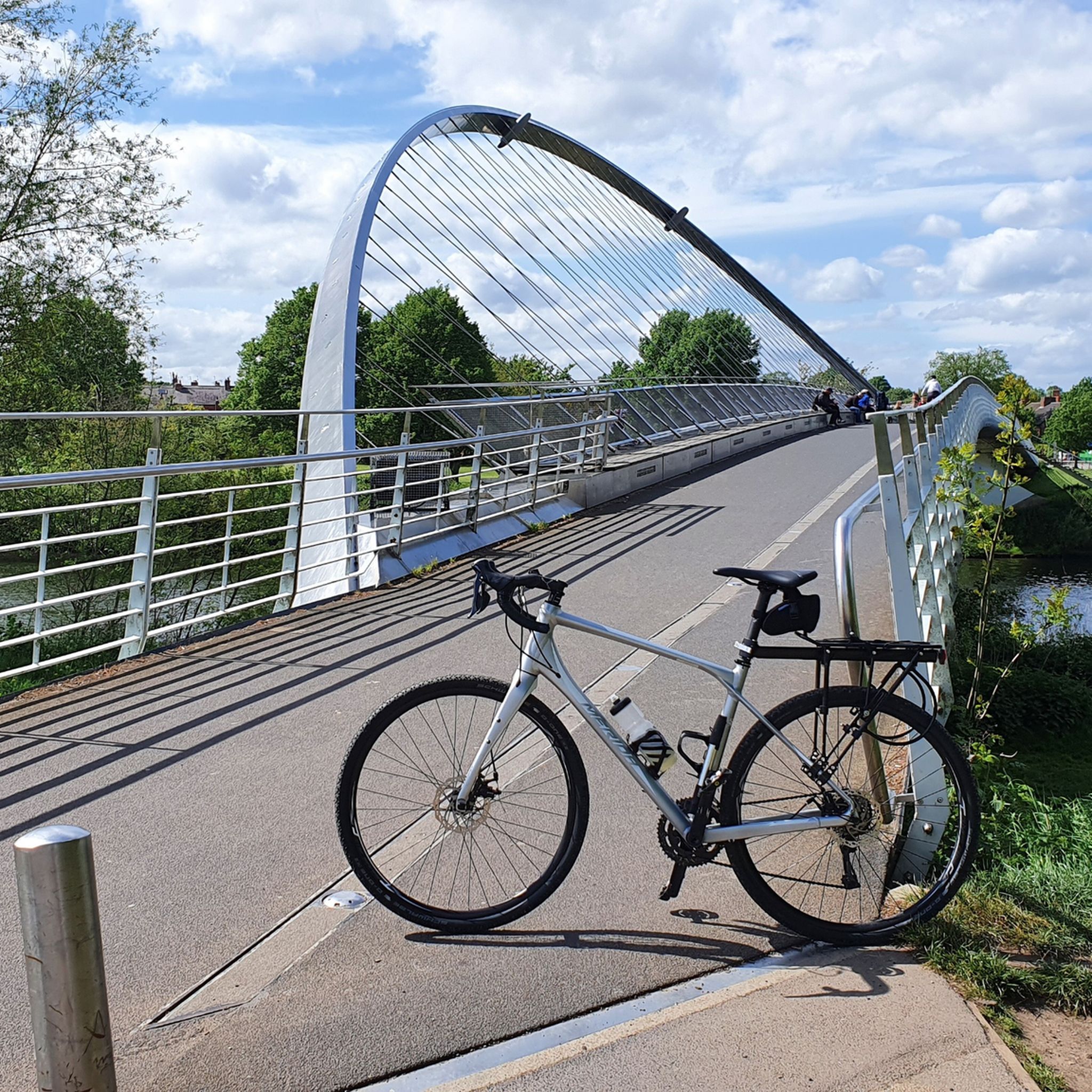
Cute sculpture atop the old railway bridge over the River Ouse. Information board with a potted history of the River Ouse.
3
0
Location is slightly out - the highlight is just over the bridge on the north side of York Road, however, just here you can also see a one third scale model replica of the Cassini-Huygens Space Probe, and a few metres south there is a little self-serve cafe kiosk with honesty box. Don't count on this though, it was empty and looked like it had been neglected for quite some time when I passed it.
2
0

Watch out for the Sun marker and then ride the trail towards Selby and spot all the planets along the way. Tried to educate you on how big/small they are and how far away from the sun. Interesting 👍
0
0
Frequently Asked Questions
How many hiking trails are available around Appleton Roebuck?
There are over 300 hiking routes around Appleton Roebuck. The majority, more than 200, are classified as easy, with another 100+ moderate options, making the area accessible for various activity levels.
Are there easy and family-friendly hiking options in Appleton Roebuck?
Yes, Appleton Roebuck is ideal for easy and family-friendly hikes. The terrain is generally gentle and low-lying, characterized by mostly flat paths through agricultural fields and tranquil river valleys. Many of the over 200 easy routes are suitable for families.
What kind of terrain can I expect on hikes around Appleton Roebuck?
The terrain around Appleton Roebuck is predominantly gentle and low-lying. You can expect to hike through agricultural fields, along tranquil river valleys, and occasionally through scattered woodlands. Trails often follow riverbanks or ancient routes, providing open views of the surrounding countryside with minimal elevation changes.
Are there any circular walks available near Appleton Roebuck?
Yes, many routes around Appleton Roebuck are circular. For example, the Hiking loop from Appleton Roebuck is a moderate 8-mile (13 km) trail that takes you through local fields and quiet country lanes, offering a great circular experience.
What are some interesting places to explore or landmarks to see while hiking?
While hiking, you can explore various historical sites and attractions nearby. Consider visiting Clifford's Tower or the Historic Centre of York for a deeper dive into the region's past. The area also features unique highlights like the York Solar System Greenway.
Are the hiking trails around Appleton Roebuck dog-friendly?
Many of the trails around Appleton Roebuck are suitable for dogs, especially those that follow public footpaths through fields and along riverbanks. However, always keep dogs under control, particularly near livestock, and be mindful of local signage regarding lead requirements.
What do other hikers say about the trails in Appleton Roebuck?
The hiking routes in Appleton Roebuck are highly rated by the komoot community, with an average score of 4.5 stars from over 400 reviews. Hikers often praise the peaceful countryside, the accessibility of the flat paths, and the charming village connections.
Where can I find parking for hikes near Appleton Roebuck?
Parking is generally available in or near the villages that serve as starting points for many routes, such as Appleton Roebuck itself or nearby Acaster Malbis and Copmanthorpe. Look for designated village car parks or consider roadside parking where permitted and safe.
Are there any pubs or cafes along the hiking routes?
Yes, several villages in the area, including Appleton Roebuck, offer pubs and cafes where you can stop for refreshments. Many routes are designed to pass through or near these villages, providing convenient breaks during your hike.
What is a good moderate hike to try in the area?
For a moderate challenge, consider the The Grange Coffee Shop – Bridle Path Along Roman Road loop from Copmanthorpe. This 7.2-mile (11.6 km) route offers a varied experience through the local landscape.
What is the best time of year to go hiking in Appleton Roebuck?
Appleton Roebuck's gentle terrain makes it suitable for hiking year-round. Spring and summer offer lush green landscapes and warmer weather, while autumn brings beautiful colours. Even in winter, the low-lying paths are generally accessible, though conditions can be muddy.
Most popular routes around Appleton Roebuck
Most popular attractions around Appleton Roebuck

Get inspired with the komoot mobile app


Explore more
Browse the best Hikes in other regions.
