The best walks and hikes around Lac de Bimont
4.5
(3028)
26,800
hikers
333
hikes
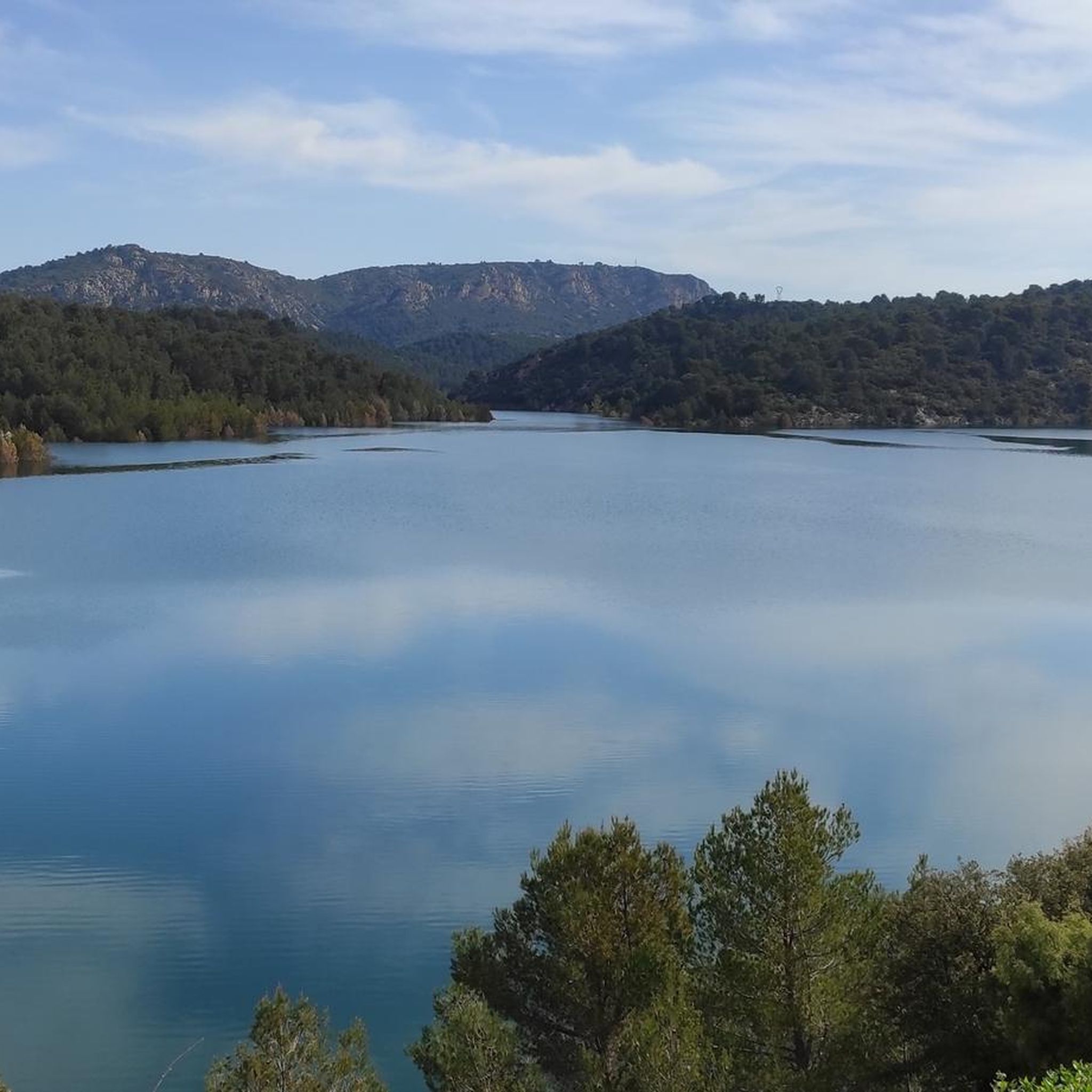
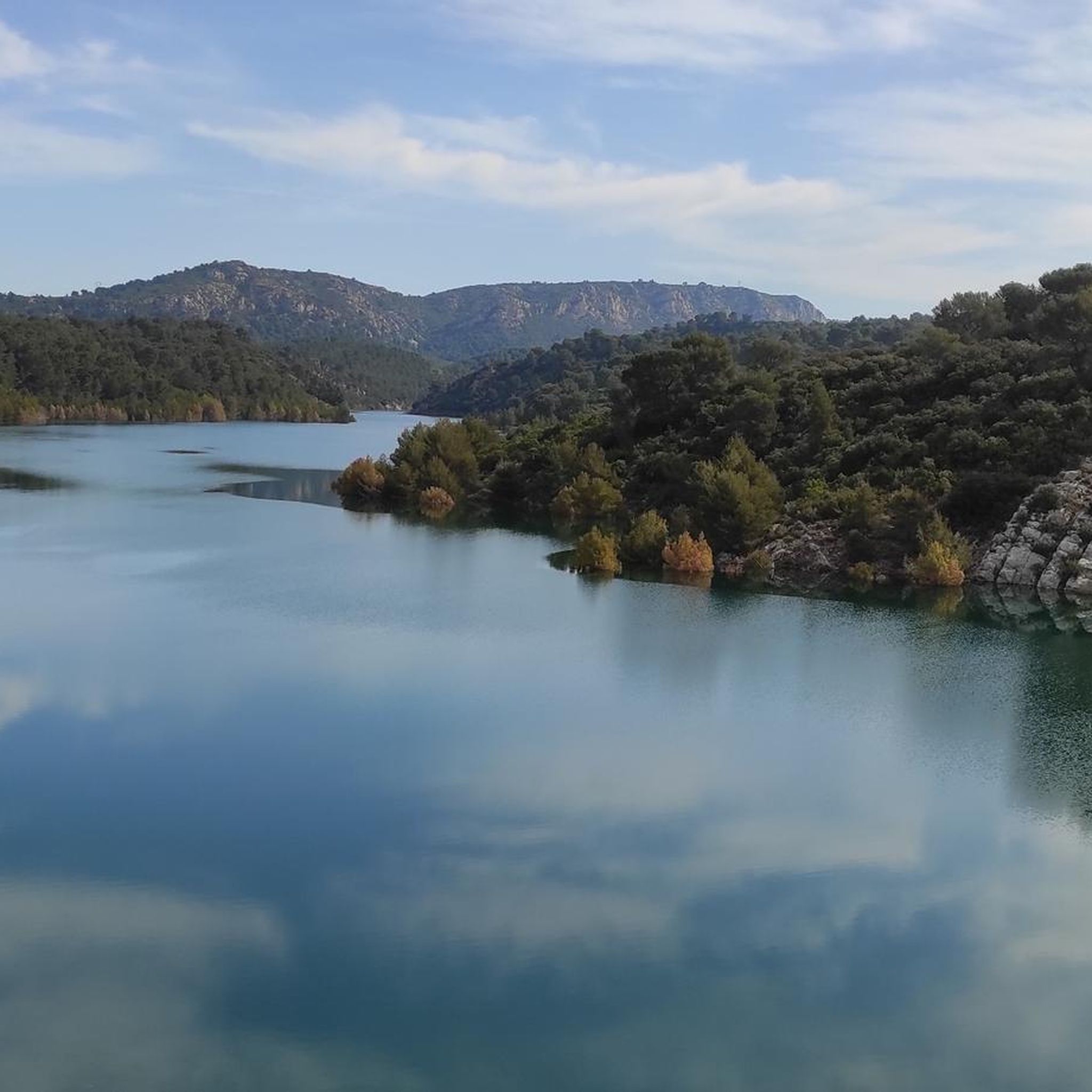
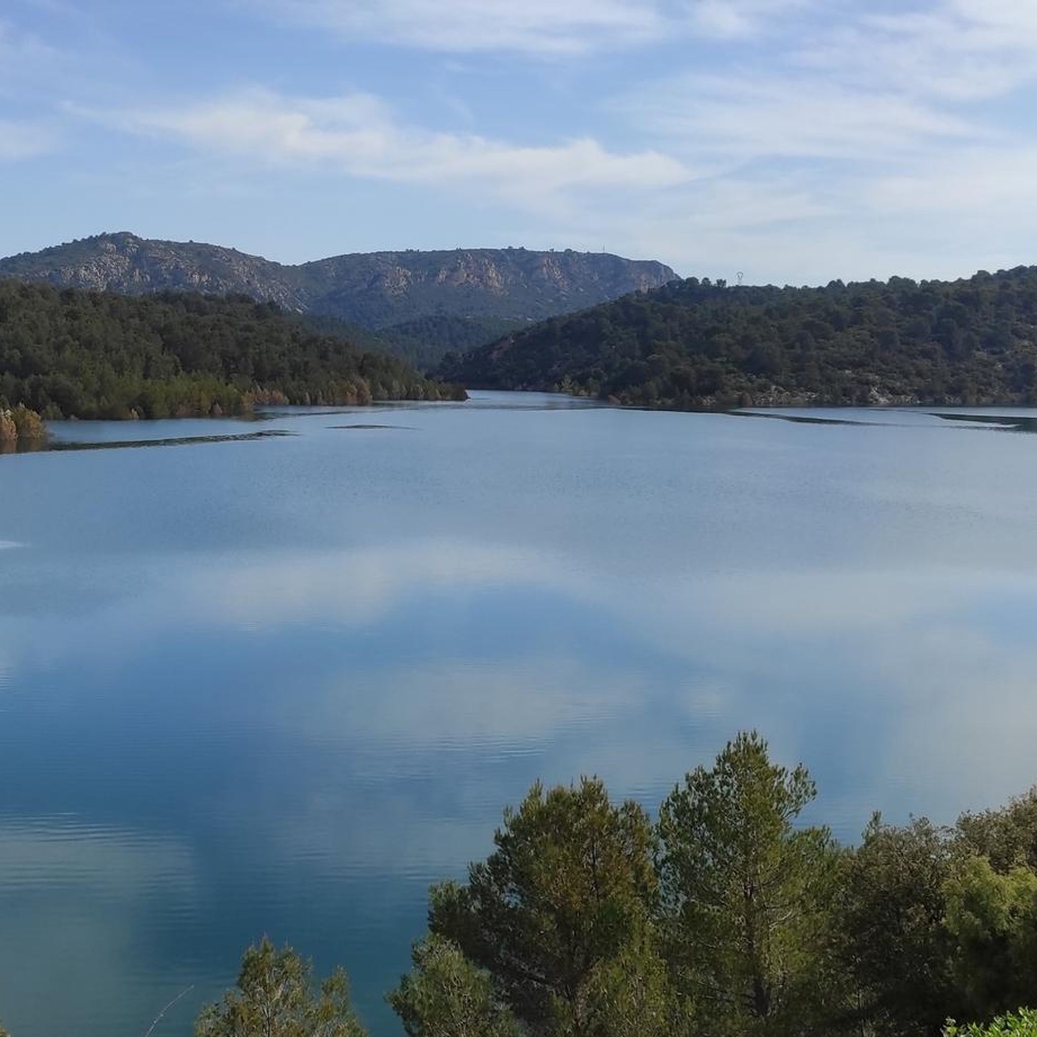
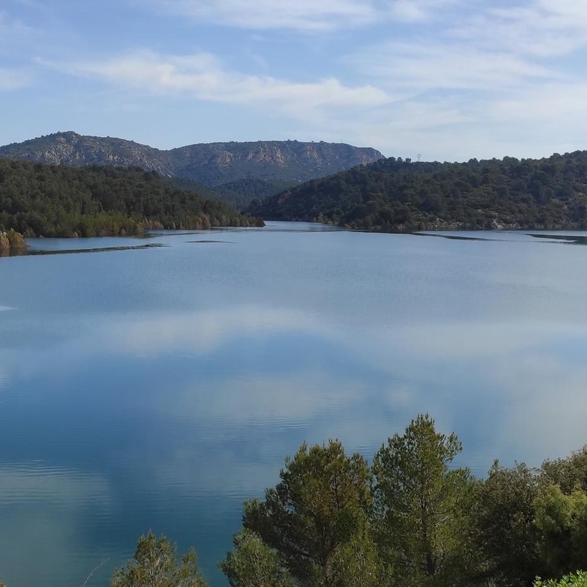
Hiking around Lac de Bimont offers trails surrounding the artificial lake, which is fed by the Verdon Canal and held by the Barrage de Bimont. The area features a mix of open paths with views of the water and surrounding hills, alongside sections that may pass through Mediterranean vegetation. Elevation changes are present on many routes, providing varied terrain for hikers.
Best hiking trails around Lac de Bimont
- The most popular hiking route is Amazing view – Lake Bimont loop from Saint-Marc-Jaumegarde, a 4.5 miles (7.3 km) trail that takes 2 hours 6 minutes to complete, offering expansive views of the lake.
- Another top favourite among local hikers is View of the Bimont Dam – Dam wall loop from Saint-Marc-Jaumegarde, a moderate 3.6 miles (5.9 km) path. This route provides perspectives of the Barrage de Bimont and its surroundings.
- Local hikers also love the Lake Bimont – Amazing view loop from Saint-Marc-Jaumegarde, a 2.7 miles (4.3 km) trail leading through varied terrain with lake views, often completed in about 1 hour 14 minutes.
- Hiking around Lac de Bimont is defined by lake shore paths, dam views, and surrounding hills. The network offers options for different ability levels, from easy family friendly hikes to more challenging routes.
- The routes in Lac de Bimont are highly rated by the komoot community with an average score of 4.6 stars from over 2600 reviews. More than 24000 hikers have used komoot to explore Lac de Bimont's varied terrain.
Last updated: October 12, 2026
4.7
(165)
861
hikers
7.29km
02:07
180m
180m
Moderate hike. Good fitness required. Easily-accessible paths. Suitable for all skill levels.
4.8
(16)
79
hikers
6.31km
01:52
180m
180m
Easy hike. Great for any fitness level. Easily-accessible paths. Suitable for all skill levels.

4.6
(19)
80
hikers
5.94km
01:55
240m
240m
Moderate hike. Great for any fitness level. Mostly accessible paths. Sure-footedness required.
4.3
(9)
96
hikers
4.27km
01:13
100m
100m
Easy hike. Great for any fitness level. Easily-accessible paths. Suitable for all skill levels.
4.8
(31)
141
hikers
12.6km
03:45
340m
340m
Hard hike. Good fitness required. Sure-footedness, sturdy shoes and alpine experience required.
Get access to more routes and recommendations from other explorers.
Already have an account?
Our route recommendations are based on thousands of hikes, rides, and runs completed by other people on komoot.
Start today with a free account
Your next adventure awaits.


Tips from the Community

Viewpoint. Must be seen once.
0
0
A dam with a lake. There is a path that's leads just at the top of the dam, with a water source on it, and a little café.
0
0


The dam of Lake Zola can be reached via beautiful trails. It was built between 1847 and 1854 and is one of the first arch dams in the world; according to Wikipedia, it may even be the very first. The lake served to supply Aix-en-Provence with drinking water, which was piped there via an aqueduct. A beautiful destination directly from Aix, or from Le Tholonet.
0
0


This spot is unique because it combines several types of environments, the edge of the Arc along a very bucolic path, a touch of urban planning, the crossing of the red earth, the magnificent climb to the dam in a very Provençal environment, the ridge after the dam and the descent into the woods until you reach the town and its cycle paths...
2
1
Frequently Asked Questions
How many hiking trails are available around Lac de Bimont?
There are over 300 hiking routes around Lac de Bimont, offering a wide variety of options for different skill levels and preferences. You'll find everything from easy strolls to more challenging treks.
Are there easy or beginner-friendly hiking routes at Lac de Bimont?
Yes, Lac de Bimont offers many easy routes suitable for beginners. For example, the Lake Bimont – Amazing view loop from Saint-Marc-Jaumegarde is an easy 2.7-mile (4.3 km) trail that takes about 1 hour 14 minutes, providing varied terrain with lake views. Another great option is the Dam wall – Lake Bimont loop from Saint-Marc-Jaumegarde, which is 3.9 miles (6.3 km) and also rated easy.
What is the best time of year to hike around Lac de Bimont?
The Mediterranean climate around Lac de Bimont makes hiking enjoyable for much of the year. Spring and autumn offer pleasant temperatures and vibrant scenery, while summer can be warm, so early morning or late afternoon hikes are recommended. Winter hiking is also possible, though some paths might be muddy after rain.
Are there any circular walks around Lac de Bimont?
Yes, many of the trails around Lac de Bimont are circular, allowing you to start and end at the same point. A popular choice is the Amazing view – Lake Bimont loop from Saint-Marc-Jaumegarde, a 4.5-mile (7.3 km) route that offers expansive views of the lake.
Are the hiking trails around Lac de Bimont suitable for families with children?
Absolutely. Lac de Bimont has numerous family-friendly options, particularly among its 118 easy routes. These trails often feature relatively flat sections and scenic views, perfect for a leisurely outing with children. Always check the specific route details for distance and elevation to ensure it matches your family's ability.
Can I bring my dog on the hiking trails at Lac de Bimont?
Generally, dogs are welcome on many trails around Lac de Bimont, but it's always best to keep them on a leash, especially in areas with wildlife or near other hikers. Please remember to clean up after your pet to help maintain the natural beauty of the area.
Are there challenging hikes available for experienced hikers?
Yes, for those seeking a greater challenge, Lac de Bimont offers 75 difficult routes. An example is the Croix de Provence – Sainte-Victoire Priory loop from Barrage de Bimont, a moderate to difficult 7.6-mile (12.2 km) trail with significant elevation gain, offering panoramic views of the Sainte-Victoire mountain.
What kind of wildlife can I expect to see while hiking around Lac de Bimont?
The area around Lac de Bimont is home to various Mediterranean flora and fauna. You might spot birds of prey soaring overhead, small mammals, and a diverse range of insects and reptiles. The vegetation includes pine forests and garrigue, providing habitats for different species.
Is there parking available near the trailheads at Lac de Bimont?
Yes, there are typically designated parking areas near popular access points and trailheads around Lac de Bimont, particularly close to the Barrage de Bimont and in villages like Saint-Marc-Jaumegarde. It's advisable to arrive early during peak seasons to secure a spot.
What do other hikers enjoy most about hiking in Lac de Bimont?
The komoot community highly rates the hiking experience around Lac de Bimont, with an average score of 4.6 stars from over 2600 reviews. Hikers frequently praise the expansive lake views, the varied terrain that includes both open paths and Mediterranean vegetation, and the sense of tranquility found on the trails.
Are there any cafes or places to eat near the hiking trails?
While the immediate vicinity of the lake and dam is primarily natural, you can find cafes and restaurants in nearby villages such as Saint-Marc-Jaumegarde. These offer opportunities to refuel before or after your hike.
How long do hikes around Lac de Bimont typically take?
Hike durations vary significantly based on the route's length and difficulty. Shorter, easy loops like the Lake Bimont – Amazing view loop from Saint-Marc-Jaumegarde can be completed in just over an hour, while longer, more challenging routes can take several hours, such as the Croix de Provence – Sainte-Victoire Priory loop from Barrage de Bimont which takes around 4 hours 53 minutes.
Most popular routes around Lac de Bimont

Get inspired with the komoot mobile app


Explore more
Browse the best Hikes in other regions.
