The best walks and hikes around Duncrun
4.6
(81)
498
hikers
22
hikes
Hiking around Duncrun offers access to the varied landscapes of the Binevenagh Area of Outstanding Natural Beauty. The region is characterized by its dramatic cliff lines, coastal paths, and forested hills. The network of trails provides routes across this terrain, with options for different fitness levels.
Best hiking trails around Duncrun
- The most popular hiking route is Binevenagh Hill and Lake loop — Binevenagh, a 3.4 mile (5.5 km) trail that takes about 1 hour 55 minutes to complete.…
Last updated: October 5, 2026
4.1
(17)
77
hikers
5.46km
01:54
170m
170m
Moderate hike. Great for any fitness level. Mostly accessible paths. Sure-footedness required.
4.8
(6)
31
hikers
15.5km
04:37
390m
390m
Moderate hike. Good fitness required. Mostly accessible paths. Sure-footedness required.

3.3
(4)
17
hikers
8.01km
02:39
260m
260m
Moderate hike. Good fitness required. Mostly accessible paths. Sure-footedness required.
4.0
(1)
5
hikers
4.82km
01:23
120m
120m
Easy hike. Great for any fitness level. Easily-accessible paths. Suitable for all skill levels.
17.6km
05:23
630m
630m
Hard hike. Very good fitness required. Easily-accessible paths. Suitable for all skill levels.
Get access to more routes and recommendations from other explorers.
Already have an account?
Our route recommendations are based on thousands of hikes, rides, and runs completed by other people on komoot.
Start today with a free account
Your next adventure awaits.

Tips from the Community

Glennagiveny Bay is a crescent shaped sandy beach on the northern coast of Magilligan Point.
0
0


Highly recommended 👌 I believe a location of a certain TV show may have been shot here.
0
0

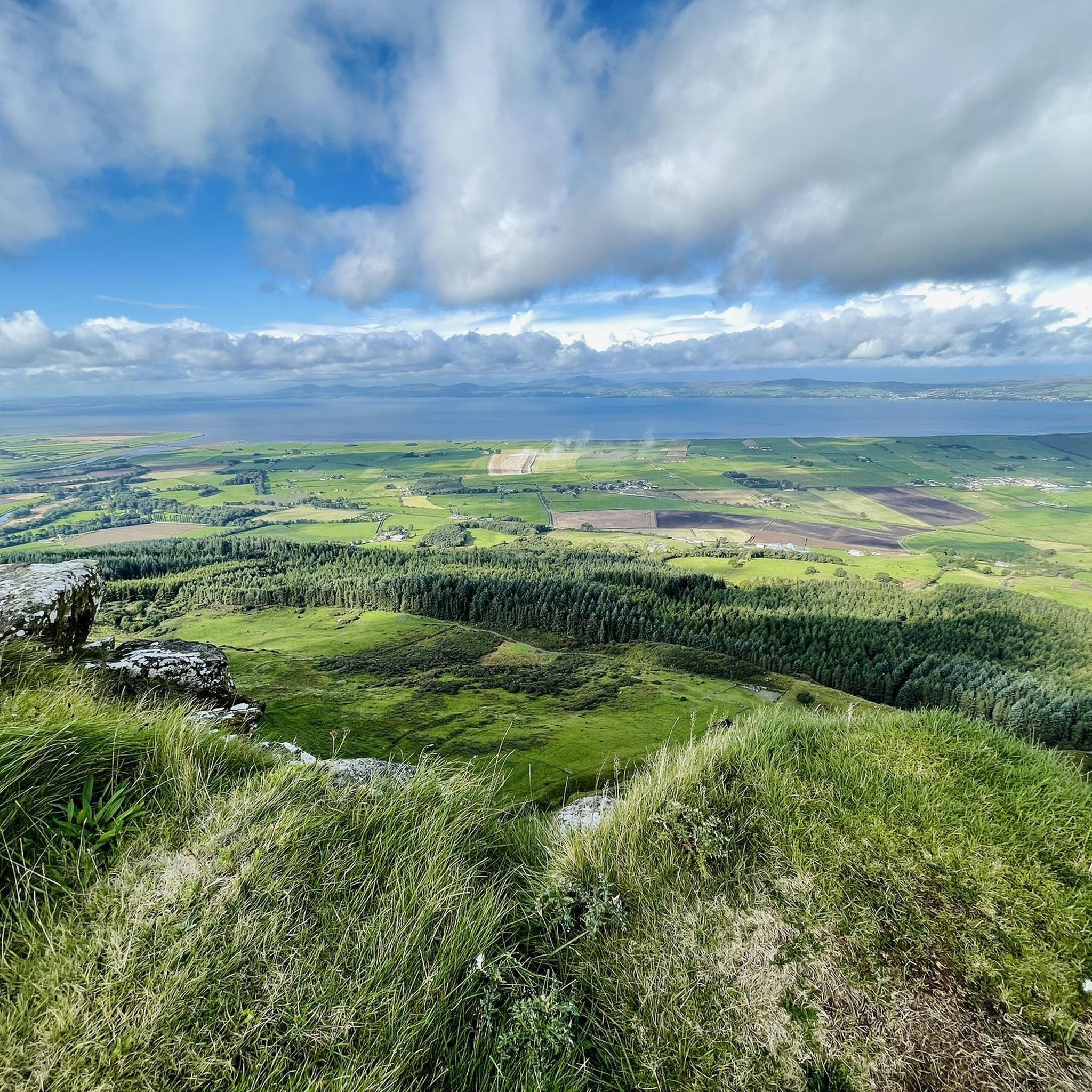
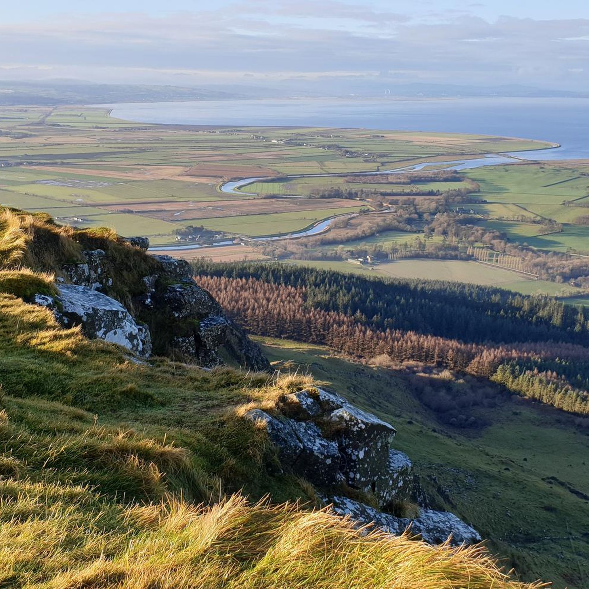
If you're lucky enough to reach this viewpoint on a clear day, you'll have stunning views of the Inishowen Peninsula, Lough Foyle stretching down to Londonderry, or even Scotland!
1
0
The solitary Bishops Road at its point near Eagle Hill, due to its altitude, offers a very beautiful view not only of the surroundings and the coast but also of the road itself as it winds through the countryside and descends towards the coast on the horizon.
1
0
This statue is located right next to the parking area and is easily accessible. The statue represents this sea god from Irish mythology overlooking the channel toward Greencastle, and from here, you can observe the beautiful countryside that surrounds you.
0
0
Gortmore is a fascinating place with an atmosphere all of its own. On clear days you can get stunning views. To the west is Lough Foyle stretching down to Londonderry and beyond; to the north is the Inishowen Peninsula and to the east you can see as far as Scotland.
0
0

This is a spectacular viewpoint looking across Lough Foyle to Binevenagh and Magilligan Point in County Derry. On a clear day you can see for miles into Northern Ireland and even Scotland.
0
0
Frequently Asked Questions
Are there many hiking trails to choose from around Duncrun?
Yes, there are over 20 hiking routes to explore in the Duncrun area. The trails range from easy strolls to more challenging moderate hikes, with no routes marked as difficult, making the region accessible for most fitness levels.
What do other hikers say about the trails in Duncrun?
The area is highly rated by the komoot community. Hikers often praise the dramatic cliff lines of the Binevenagh escarpment, the well-maintained woodland paths, and the stunning coastal views.
Can I bring my dog on hikes near Duncrun?
Many trails in the area are suitable for dogs, especially through woodlands like Downhill Forest. However, be aware of local restrictions. For example, on some routes to the Binevenagh peak, dogs may not be permitted on certain sections, particularly through farmland or sensitive habitats. Always check for signage at the trailhead.
Are there any family-friendly hikes in the area?
Absolutely. The region has several easy trails perfect for a family outing. A great option is the Eagle Hill loop — Binevenagh, a gentle 3.0 mi (4.8 km) walk through Downhill Forest that is manageable for all skill levels.
Where can I find the best viewpoints?
For panoramic views, the trails ascending Binevenagh are unmatched. The The Viewpoint of Binevenagh Hill loop — Binevenagh is a moderate 5.0 mi (8.0 km) hike that leads you to the summit plateau, offering expansive vistas over Lough Foyle and the surrounding coastline.
Are there any circular walks available?
Yes, many of the most popular routes are loops. For a moderate circular hike with great scenery, consider the View from Binevenagh Cliffs – View from Binevenagh Hill loop from Limavady. This 4.2 mi (6.8 km) trail provides a rewarding circuit with impressive cliffside views.
What are the hiking options around Mussenden Temple?
The grounds of Downhill Demesne, where Mussenden Temple is located, offer several accessible walking paths. You can enjoy gentle strolls around the historic ruins of Downhill House and the temple itself, all with a stunning coastal backdrop.
Can I find any waterfalls on the trails?
While the immediate Duncrun trails are more known for cliffs and coastline, the broader region features beautiful waterfalls. Nearby areas like Gortin Glen Forest Park have trails that follow babbling brooks and lead to cascades. The local Waterfall Caves are also a well-regarded scenic spot.
Is it possible to hike along the coast?
Yes, the area is part of the famous Causeway Coastal Route. You can find trails that follow the coastline, offering views of vast sandy beaches like Castlerock Beach and rugged headlands. The Lough Foyle Trail is a popular local option for a peaceful walk along the water.
How do I get to the trailheads? Is parking available?
Most trailheads, especially those around the Binevenagh and Downhill Forest areas, are best accessed by car. There are designated car parks available, such as at the Binevenagh Forest entrance. Arrive early on weekends as these spots can fill up quickly.
What should I pack for a hike in Duncrun?
Sturdy hiking boots are essential, as trails can be uneven and muddy. The weather can change quickly, so waterproof clothing is highly recommended, even on a clear day. Also, bring water and snacks, as there are few facilities once you are on the trails.
Most popular routes around Duncrun
Most popular attractions around Duncrun

Get inspired with the komoot mobile app


Explore more
Browse the best Hikes in other regions.
