Randwick And Westrip
Randwick And Westrip
The best running trails around Randwick And Westrip
4.6
(100)
9,267
runners
564
runs
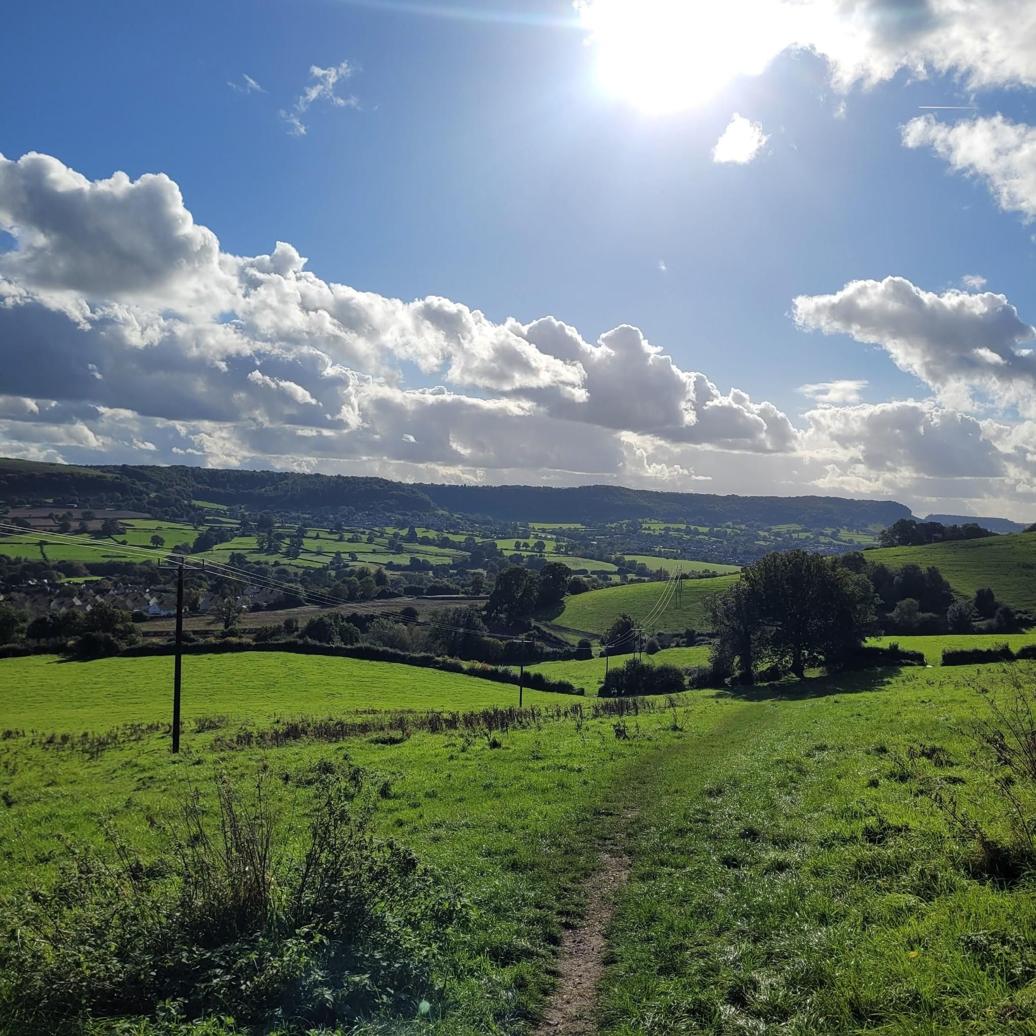
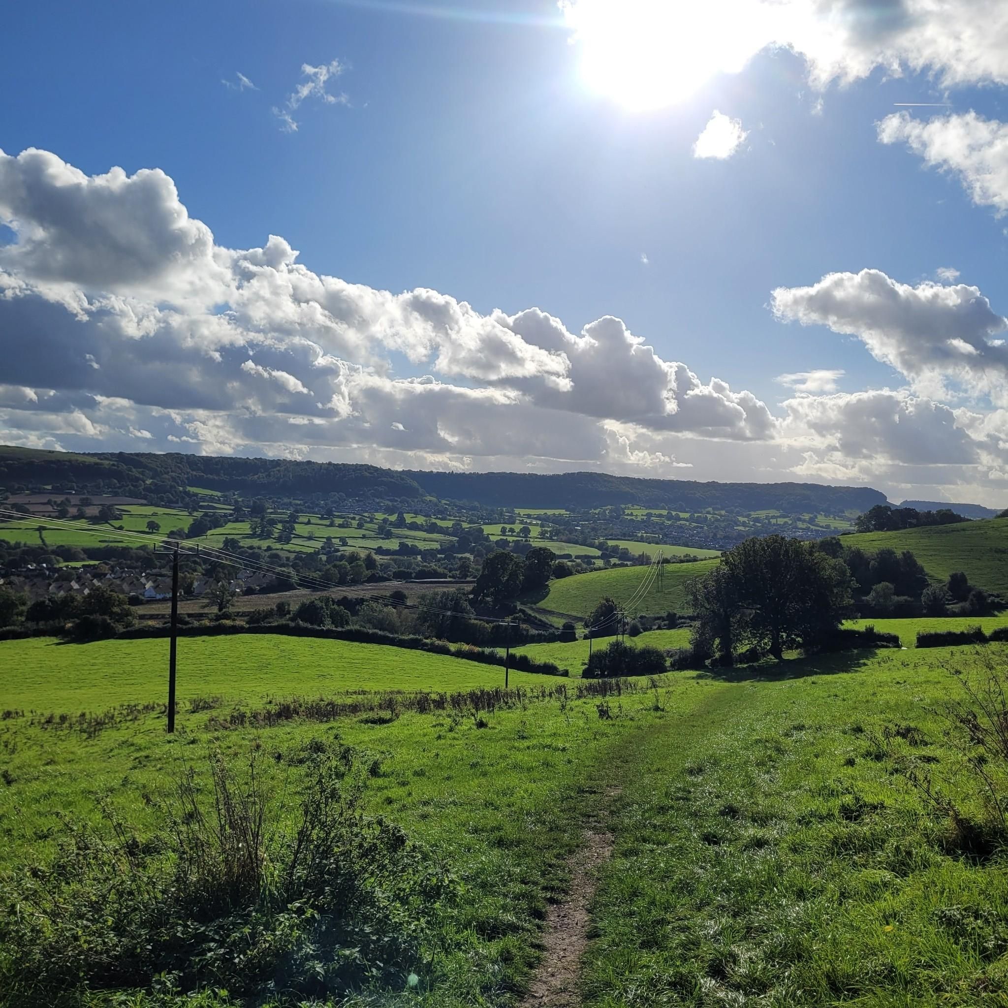
Jogging around Randwick And Westrip offers diverse and scenic landscapes within the Cotswolds Area of Outstanding Natural Beauty. The region features varied terrain, including expansive open fields, tranquil country lanes, and dense woodlands. Traditional Cotswold mixed beech woods and chalk grassland are present, providing a rich natural experience. Impressive viewpoints like Haresfield Beacon offer panoramic vistas, making it suitable for varied running routes.
Best jogging routes around Randwick And Westrip
- The most popular jogging route is View of the Cotswolds…
Last updated: October 9, 2026
148
runners
11.6km
01:25
260m
260m
Moderate run. Good fitness required. Mostly paved surfaces. Suitable for all skill levels.
95
runners
6.89km
00:43
20m
20m
Moderate run. Good fitness required. Mostly paved surfaces. Suitable for all skill levels.

50
runners
Hard run. Very good fitness required. Mostly paved surfaces. Suitable for all skill levels.
55
runners
Moderate run. Good fitness required. Mostly paved surfaces. Suitable for all skill levels.
46
runners
12.6km
01:34
290m
290m
Moderate run. Good fitness required. Mostly paved surfaces. Suitable for all skill levels.
Get access to more routes and recommendations from other explorers.
Already have an account?
Our route recommendations are based on thousands of hikes, rides, and runs completed by other people on komoot.
Start today with a free account
Your next adventure awaits.

Tips from the Community

A scenic walk along the canal, makes a change from all the ups and downs of the rest of the Cotswold Way!
0
0
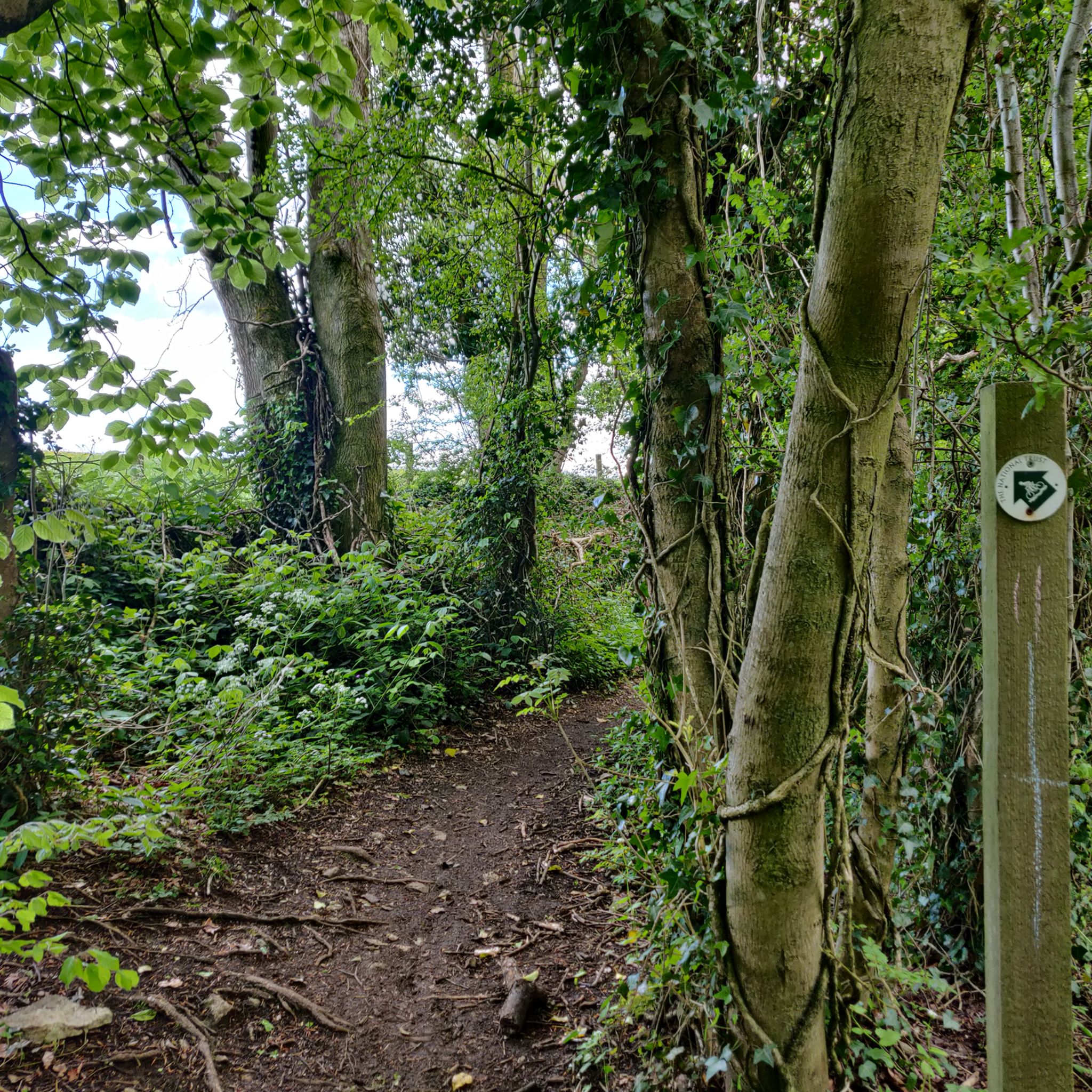
Part of the path that makes up the Cotswold Way through Standish Wood.
0
0
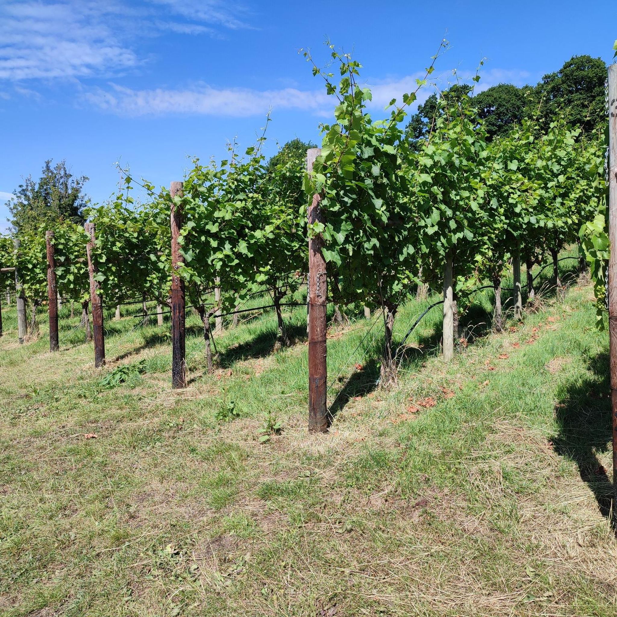
Fine vineyard on the south side of Doverow Hill, and the grapes seem to be doing very well this year!
0
0
A fine promontory on the south side of Haresfield Hill giving panoramic views south across Gloucestershire and the Severn Estuary.
0
0

Beautiful views over the Severn and lower parts of Gloucestershire, and of course Wales on the horizon. It is a fresh spot on windy days.
1
0


This scenic towpath along the Stroudwater Navigation is an excellent place for a stroll. It's long, flat, & leaves you feeling you're a million miles from a busy town.
1
0
Frequently Asked Questions
What kind of terrain can I expect on running routes in Randwick And Westrip?
The running routes in Randwick And Westrip offer a diverse and scenic landscape. You'll find a mix of expansive open fields, tranquil country lanes, and dense woodlands, including traditional Cotswold mixed beech woods. The area is part of the Cotswolds Area of Outstanding Natural Beauty, providing varied terrain from relatively flat paths to challenging uphill and downhill sections.
Are there easy running routes suitable for beginners in Randwick And Westrip?
Yes, there are options for runners of all abilities. While some routes feature challenging ascents, you can find easier paths. For example, the Stroudwater Navigation – Stroudwater Navigation loop from Stroud is a moderate 4.3-mile (6.9 km) path that follows the Stroudwater Navigation, offering a relatively flat and accessible running experience.
What natural features or viewpoints can I see while jogging in Randwick And Westrip?
The region is rich in natural beauty and offers impressive viewpoints. You can experience panoramic vistas from places like Haresfield Beacon, which looks out across the England/Wales border and towards the Brecon Beacons. Other notable natural features include Painswick Beacon and the varied flora and fauna found in the mixed woodland and chalk grassland areas.
Are there challenging running routes for experienced runners in the area?
Absolutely. For those seeking a more demanding run, routes like the Standish Wood – Haresfield Beacon loop from Cainscross offer a significant challenge. This 10.9-mile (17.5 km) trail leads through Standish Wood and past Haresfield Beacon, featuring tough uphill and fast downhill sections through woodlands, ideal for varied terrain training.
When is the best time of year to go running in Randwick And Westrip?
Randwick And Westrip offers beautiful scenery year-round. Spring and summer bring lush greenery and vibrant wildflowers, while autumn showcases stunning fall foliage in the beech woods. Winter can also be picturesque, though some trails might be muddier. The varied landscape ensures a rewarding experience in any season, depending on your preference for weather and trail conditions.
Are there family-friendly running routes in Randwick And Westrip?
While specific 'family-friendly' routes aren't explicitly detailed, the presence of easy hiking opportunities and accessible paths, such as those near Woodchester Valley Vineyard, suggests that many of the less challenging routes could be suitable for families. Look for routes with lower elevation gain and shorter distances for a more enjoyable family outing.
Are dogs allowed on the running trails in Randwick And Westrip?
Many trails in the Cotswolds, including those around Randwick And Westrip, are generally dog-friendly. However, it's always advisable to keep dogs under control, especially when passing through fields with livestock or nature reserves. Always check local signage for specific restrictions and ensure you clean up after your pet.
What do other runners enjoy most about jogging in Randwick And Westrip?
The running routes in Randwick And Westrip are highly rated by the komoot community, with an average score of 4.6 stars from over 80 reviews. Runners frequently praise the diverse and scenic landscapes, the peaceful environment away from heavy traffic, and the variety of terrain that caters to different fitness levels, from open fields to dense woodlands and challenging ascents.
Are there any circular running routes available?
Yes, many of the routes in Randwick And Westrip are designed as loops, offering convenient circular options. Examples include the popular View of the Cotswolds – Robber's Road loop from Cainscross and the Stroudwater Navigation – Stroudwater Navigation loop from Stroud, allowing you to start and finish in the same location.
How many running routes are available in the Randwick And Westrip area?
There are over 580 running routes available in the Randwick And Westrip area, catering to a wide range of preferences and fitness levels. This includes approximately 60 easy routes, over 400 moderate routes, and more than 100 difficult routes, ensuring plenty of options for exploration.
Can I find routes that are part of the Cotswold Way in this area?
Yes, many running routes in Randwick And Westrip incorporate sections of the renowned Cotswold Way. This long-distance trail is known for its scenic beauty and offers a fantastic opportunity to experience some of the best landscapes the Cotswolds have to offer while jogging.
Are there any routes that follow waterways or canals?
Yes, you can find routes that follow waterways. The Stroudwater Navigation – Stroudwater Navigation loop from Stroud is a great example, offering a relatively flat and accessible running experience alongside the canal.
Most popular routes around Randwick And Westrip
Most popular attractions around Randwick And Westrip

Get inspired with the komoot mobile app


Explore more
Browse the best Running Trails & Routes in other regions.
