The best running trails around Stoneleigh
4.3
(6)
649
runners
27
runs
Jogging routes around Stoneleigh offer a blend of natural landscapes and historical surroundings in Warwickshire, UK. The region is characterized by scenic rivers, nature reserves, and pathways that wind through varied terrain. Joggers can explore areas near the Leam Valley Local Nature Reserve, known for its wildlife and tranquil settings. The presence of historic sites nearby provides interesting landmarks that can be incorporated into longer running routes.
Best jogging routes around Stoneleigh
- The most popular jogging route is After Tea…
Last updated: June 30, 2026
2
runners
6.36km
00:42
60m
60m
Moderate run. Good fitness required. Mostly paved surfaces. Suitable for all skill levels.
4.3
(3)
62
runners
9.09km
00:57
60m
60m
Moderate run. Good fitness required. Mostly paved surfaces. Suitable for all skill levels.

Sign up for free
61
runners
Moderate run. Good fitness required. Mostly paved surfaces. Suitable for all skill levels.
107
runners
16.1km
01:44
100m
100m
Hard run. Very good fitness required. Mostly paved surfaces. Suitable for all skill levels.
52
runners
Moderate run. Good fitness required. Mostly paved surfaces. Suitable for all skill levels.
Get access to more routes and recommendations from other explorers.
Sign up for free
Already have an account?
Our route recommendations are based on thousands of hikes, rides, and runs completed by other people on komoot.
Start today with a free account
Your next adventure awaits.
Login or Signup

Tips from the Community

Its different and makes think why and what for.
0
0

Constructed during the late 15th century, this elongated and slender bridge consists of nine arches spanning the River Avon. Its purpose was to serve the community of Stoneleigh Abbey. Crafted from red sandstone ashlar, the bridge measures 10 feet in width and features plain parapets. While the river flows beneath the three arches at its southern end, the remaining arches are designed to manage floodwaters.
1
0
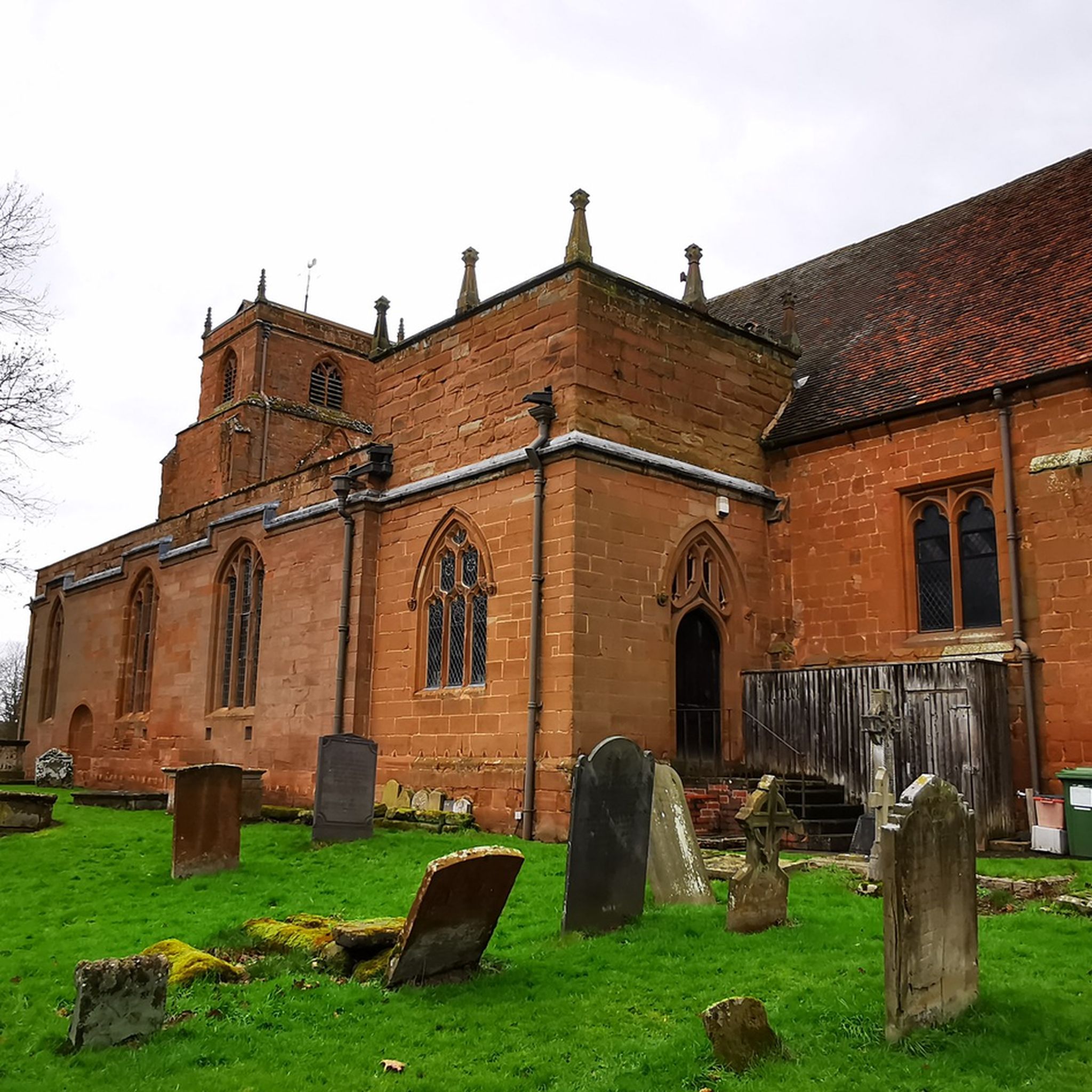
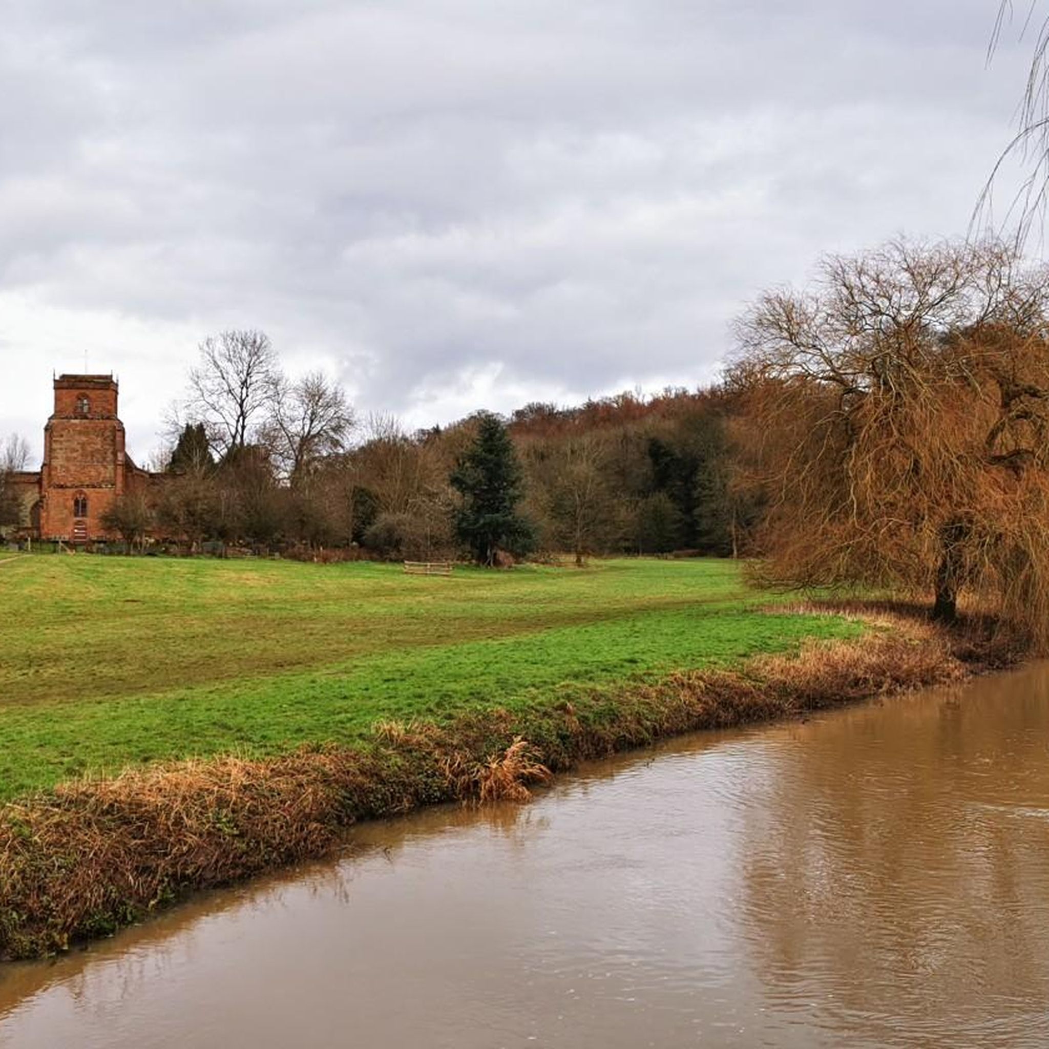
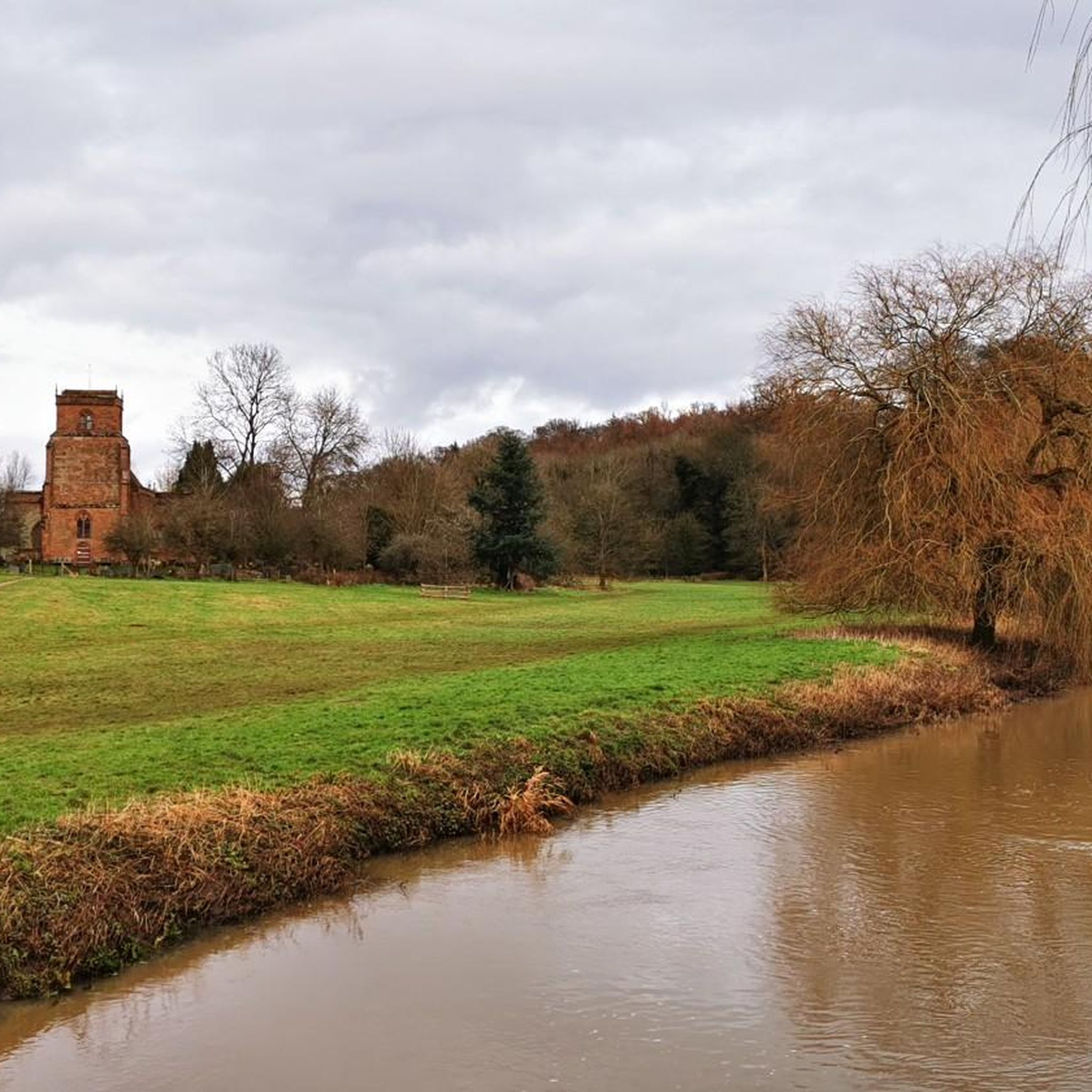
The Norman Church of St Mary the Virgin across Stoneleigh Meadows was created by the villagers into a Trust for the public in 1982. The Domesday Book of 1086 mentions two priests at Stoneleigh, but nothing about the church. Any building was probably of wood and rebuilt in red sandstone during the 12th century, representing over 800 years of births, marriages and deaths. Many of the old village names are on the headstones in the churchyard and have been researched by the Stoneleigh History Society.
1
0

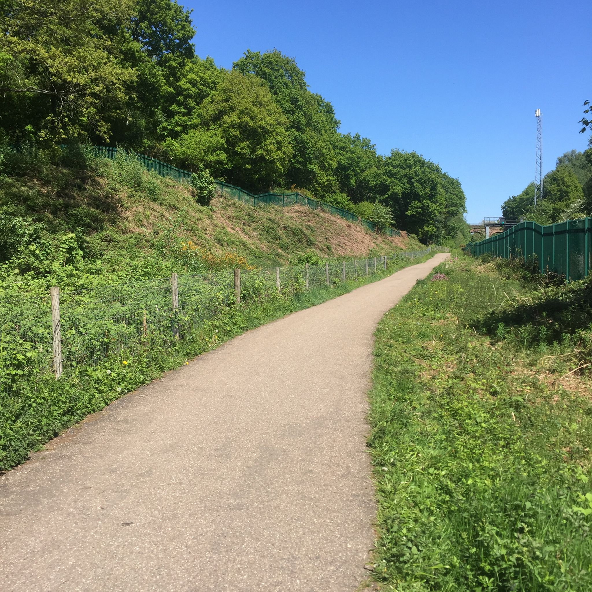
Kenilworth Greenway is a former railway line, now a 6.5km multi-user path, which runs between Kenilworth and Berkswell through scenic countryside. Some of the Greenway is due to be removed by HS2, but diversions are in place.
0
0

I just don't understand why 150m of hedgerows has been cut down it's not even close to the HS2 route. Thew cut it downed put up a metal fence the hedgerow was a natural fence...
0
1

The church was built in 1842. It is built from the local red stone and consists of a nave, chancel and a north porch with a brick bellcote over the west gable. It is one of the first archaeologically conscientious churches in England … an attempt at least at recreating the local village church … the attitude is unmistakably the Victorian as against the pre-Victorian. Lord Leigh of Stoneleigh, who was a scholarly poet and a member of Christ Church, Oxford, provided the site, the endowment and the stone from his nearby quarry. It was designed for 300 people, with two-thirds of the sittings being free and was completed by 1845, although a vestry was later added in 1876.
0
0
The Kenilworth to Berkswell Greenway is a linear Country Park set in the beautiful South Warwickshire countryside. The site forms a 6.5 kilometres section of former railway, with the entire park extending to some 16 hectares. History The railway branch line from Berkswell to Kenilworth Junction was opened in 1884. It effectively provided a short cut avoiding Coventry for freight trains heading south. Rumour has it that it was used in the war for the transport of munitions and the siding at Berkswell, left when the track was lifted in the 1960s, was used for ‘parking’ the Royal Train when the Queen visited the area. Later, even the siding was removed to make way for a station car park. Left to itself, the old railway became a wildlife corridor. Hawthorn, birch and other plants quickly took hold and softened the edges, animals and birds found cover for dens and nests. Warwickshire County Council took ownership of the route in the 1970′s but apart from work to clear a wider path, it was left to the walkers and the wildlife. After the turn of the Millennium, Warwickshire County Council worked in partnership with Sustrans to develop the route.
0
0
Frequently Asked Questions
How many running routes are available in the Stoneleigh area?
There are over 25 running routes around Stoneleigh, offering a variety of options for different fitness levels and preferences. These include 5 easy routes, 20 moderate routes, and 1 difficult route.
What kind of terrain can I expect on jogging trails in Stoneleigh?
Jogging routes in Stoneleigh feature a mix of natural landscapes, including river valleys, nature reserves, and pathways near historic sites. You'll find varied terrain suitable for different experiences, from relatively flat paths to routes with gentle elevation changes.
Are there any family-friendly running routes in Stoneleigh?
Yes, Stoneleigh offers several routes suitable for families. For a moderate option, consider the After Tea — A Coventry Way Circular Walk 06, which is 3.9 miles long and takes about 42 minutes. The region's natural settings and accessible paths make it enjoyable for all ages.
Can I bring my dog on the running trails in Stoneleigh?
Many of Stoneleigh's natural trails and public footpaths are dog-friendly, allowing you to enjoy your run with your canine companion. Always ensure your dog is under control, and check for any specific local regulations or signage regarding dogs in nature reserves or private land sections.
What interesting landmarks or natural features can I see while running in Stoneleigh?
Stoneleigh's routes often pass by significant landmarks and natural features. You might encounter historic sites like Kenilworth Castle or enjoy the wildlife in areas like the Leam Valley Local Nature Reserve. Other points of interest include Berkswell Well and Sand Martin Nesting Wall, Ryton Pools Country Park.
Are there any circular running routes in Stoneleigh?
Yes, Stoneleigh features several circular running routes. A popular choice is the After Tea — A Coventry Way Circular Walk 06, which is a moderate 3.9-mile loop. Another option is the Viewpoint Near Balsall Common – Old Railway Tunnel loop from University of Warwick, a 5.9-mile route featuring a viewpoint and an old railway tunnel.
Where can I find parking for Stoneleigh's running routes?
Many running routes in Stoneleigh, especially those starting from areas like the University of Warwick or near local villages, offer accessible parking. For example, routes like the University of Warwick – Cat 1 Sculpture loop typically have parking available at or near their starting points.
Are there pubs or cafes near the running trails in Stoneleigh?
Yes, after your run, you can find places to relax and refuel. The historic area of Stoneleigh, Warwickshire, has local pubs such as The Bear Inn, Berkswell, which can be incorporated into longer running routes or visited post-run.
What do other runners enjoy most about jogging in Stoneleigh?
The running routes in Stoneleigh are highly rated by the komoot community, with an average score of 4.5 stars. Runners often praise the blend of natural beauty, tranquil settings, and the opportunity to explore historic surroundings and diverse ecosystems.
What is a good moderate running route to try in Stoneleigh?
For a moderate run, consider the Kenilworth Greenway – Bat Roost loop from University of Warwick. This route is 7.9 miles long and offers a scenic experience, often completed in about 1 hour and 19 minutes.
Are there any routes that pass by churches or historical buildings?
Yes, the Public Footpath – St John's Church, Westwood loop from University of Warwick is a moderate 4.7-mile route that takes you past St John the Baptist Church, Berkswell, offering a glimpse into the region's history during your run.
What is the best time of year to go running in Stoneleigh?
Stoneleigh's natural landscapes are enjoyable throughout the year. Spring and autumn offer pleasant temperatures and beautiful scenery with changing foliage or blooming wildflowers. Summer is also great, especially for early morning or late afternoon runs, while winter runs can be invigorating, though paths might be muddier.
Most popular routes around Stoneleigh
Most popular attractions around Stoneleigh

Get inspired with the komoot mobile app


Explore more
Browse the best Running Trails & Routes in other regions.
