The best walks and hikes around Lindridge
4.5
(227)
1,578
hikers
103
hikes
Hiking around Lindridge offers a network of trails through varied landscapes, characterized by rolling hills, river valleys, and woodlands. The region provides accessible options for outdoor activities, connecting villages and natural features. Elevations are generally moderate, making many routes suitable for regular walking. The area's green spaces and established paths allow for exploration of the local countryside.
Best hiking trails around Lindridge
- The most popular hiking route is Flagstaff Woods Trig Pillar – View of Abberley Clock Tower loop from…
Last updated: October 9, 2026
4.3
(4)
8
hikers
Easy hike. Great for any fitness level. Easily-accessible paths. Suitable for all skill levels.
4.0
(3)
6
hikers
Moderate hike. Good fitness required. Easily-accessible paths. Suitable for all skill levels.

5.0
(2)
6
hikers
Easy hike. Great for any fitness level. Easily-accessible paths. Suitable for all skill levels.
3
hikers
7.10km
01:59
130m
130m
Easy hike. Great for any fitness level. Easily-accessible paths. Suitable for all skill levels.
4.3
(3)
10
hikers
14.3km
04:18
450m
450m
Moderate hike. Good fitness required. Easily-accessible paths. Suitable for all skill levels.
Get access to more routes and recommendations from other explorers.
Already have an account?
Our route recommendations are based on thousands of hikes, rides, and runs completed by other people on komoot.
Start today with a free account
Your next adventure awaits.

Tips from the Community

Doors open, with a visitor book to sign.
0
0

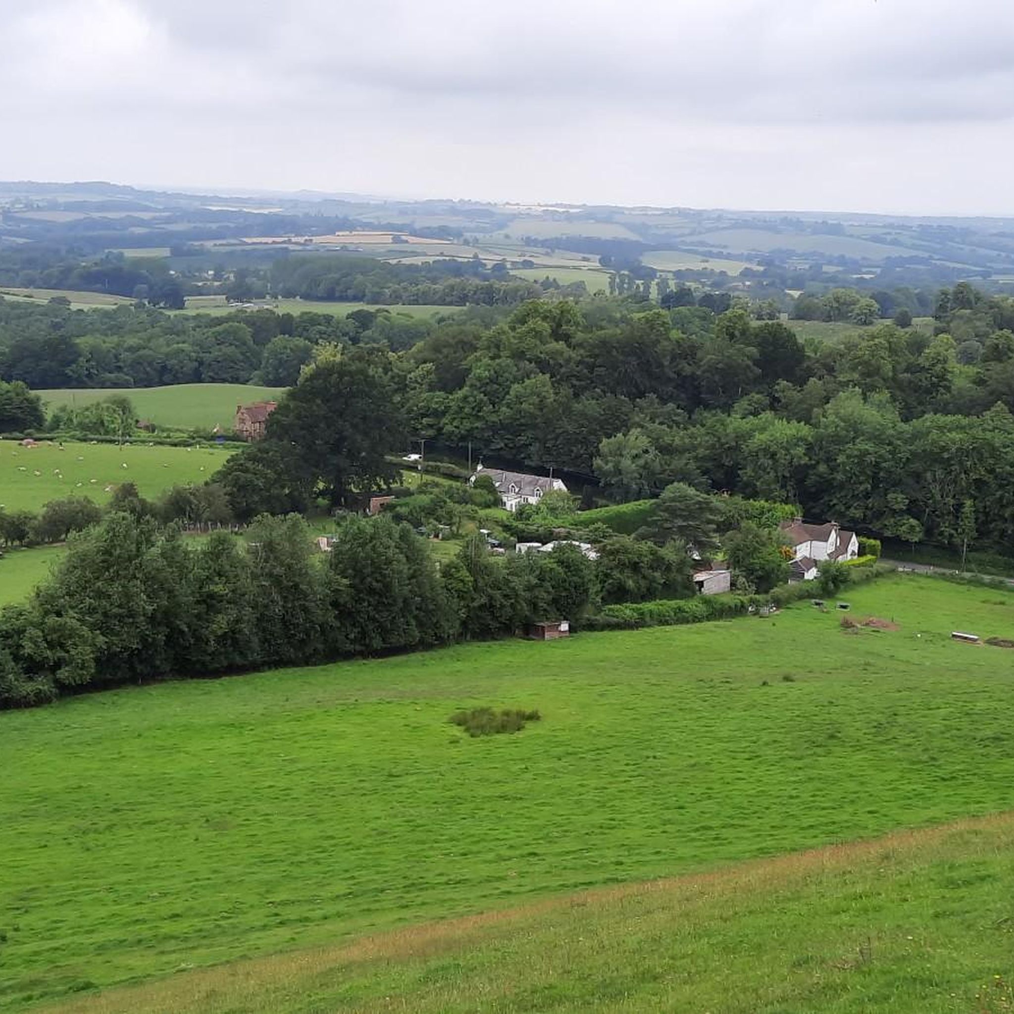
In decent weather the long gently sloping south side of Walsgrove Hill gives fine views north to the distant Titterstone Clee Hill.
0
0
It's a steep pull up Walsgrove Hill from the north, and in the winter it will be slippery and muddy due to the activities of the sheep that live in this field. However, it offers fine views across to the clocktower and beyond.
0
0
Abberley Hill trig point, there are not many trig points that are surrounded by large mature trees, it rather defeats the object of surveying!
0
0
The ridge of Abberley hill is a fine walk, and that is the reason it forms part of the Worcestershire Way, the Geopark Way and the Abberley Circular.
0
0
This is actually a view of Great Witley, Abberley is behind you at this viewpoint
0
0
The view from the top across to the clock tower of the school and to Woodbury Hill is a highlight of any walk on Abberley Hill.
0
0

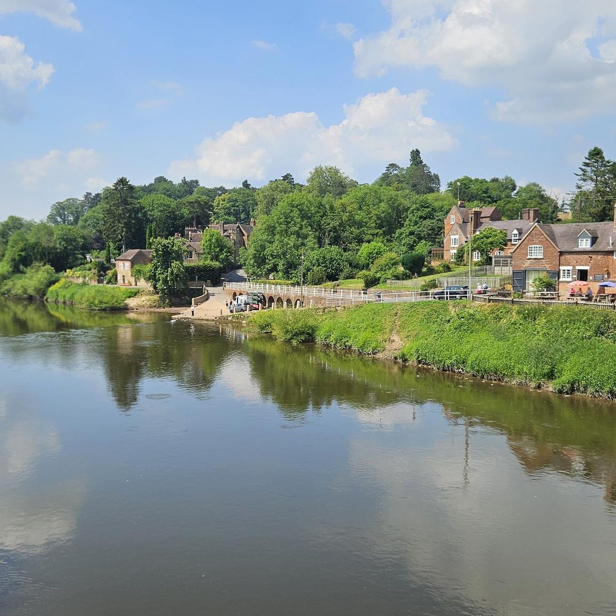
Quite a busy bridge on B-road to Tenbury. However, water in River Teme is brilliant as always, so may be worth stopping right before the bridge.
0
0
Frequently Asked Questions
How many hiking trails are there in Lindridge?
Lindridge offers a wide selection of hiking opportunities, with over 100 routes available. These trails traverse varied landscapes, including rolling hills, river valleys, and woodlands, providing accessible options for outdoor activities within the region.
What is the typical terrain like for hiking in Lindridge?
The terrain in Lindridge is characterized by rolling hills, river valleys, and established woodland paths. While it's an urban setting, the area features green spaces and trail connections, offering a mix of natural and developed paths. Elevations are generally moderate, making many routes suitable for regular walking.
Are there easy hiking options in Lindridge?
Yes, Lindridge provides numerous easy hiking options. Approximately 41 of the available routes are classified as easy, making them suitable for casual walkers or those looking for a less strenuous experience. These trails often feature moderate elevations and well-maintained paths.
Are there circular walks available in Lindridge?
Many of the hiking routes in Lindridge are designed as circular walks, allowing you to start and end at the same point. For example, the View of Woodbury Hill – View of Abberley Clock Tower loop from Abberley is a popular circular trail that offers scenic views.
What kind of natural features or landmarks can I expect to see on a hike in Lindridge?
While hiking in Lindridge, you can explore various natural features and landmarks. The area is known for its proximity to creeks, such as the North Fork Peachtree Creek, which contributes to the natural feel of the trails. You might also encounter historical sites like Knowles Mill or natural monuments such as Titterstone Clee Hill summit. The Wyre Forest Line Rail Trail also offers a unique path through the landscape.
Are the hiking trails in Lindridge suitable for families?
Yes, many trails in Lindridge are suitable for families. The region's moderate elevations and accessible paths, particularly within local green spaces like Armand Park and the Cheshire Farm Trail, offer convenient opportunities for daily outdoor activity. You can find a variety of easy and moderate routes that are enjoyable for all ages.
What do other hikers enjoy most about hiking in Lindridge?
The hiking experience in Lindridge is highly rated by the komoot community, with an average score of 4.6 stars from over 180 reviews. Hikers often praise the varied terrain, which includes rolling hills and river valleys, and the well-established woodland paths that connect different natural features and villages.
Are there any longer or more challenging hikes available in the Lindridge area?
While Lindridge primarily offers easy to moderate routes, there are a few more challenging options for experienced hikers. The region has 3 routes classified as difficult. For instance, the View of Teme Valley – Walsgrove Hill Summit View loop from Stanford with Orleton is a moderate 6.5-mile trail that provides a good workout through the Teme Valley.
Can I connect to larger trail systems from Lindridge?
Yes, Lindridge offers excellent connectivity to broader trail systems. The local Armand Park connects to the South Fork Trail System, and from the Cheshire Farm Trail, it's possible to link up with the Path 400 Trail. These connections significantly expand your options for longer walks, biking, and exploring more extensive routes beyond the immediate neighborhood.
What is the best time of year to go hiking in Lindridge?
Lindridge's urban green spaces and interconnected trail system make it suitable for outdoor activities year-round. The moderate elevations and varied landscapes can be enjoyed in most seasons, offering a convenient escape into nature for daily walks or longer excursions.
Are there any trails that offer elevated viewpoints in Lindridge?
Yes, several trails in Lindridge provide elevated viewpoints. For example, the Flagstaff Woods Trig Pillar – View of Abberley Clock Tower loop from Abberley features woodland sections and elevated viewpoints, offering panoramic vistas of the surrounding area. You can also find the Walsgrove Hill Summit View as a notable viewpoint.
Most popular attractions around Lindridge

Get inspired with the komoot mobile app


Explore more
Browse the best Hikes in other regions.
