The best walks and hikes around Santa Cruz Del Valle
4.7
(214)
1,319
hikers
87
hikes
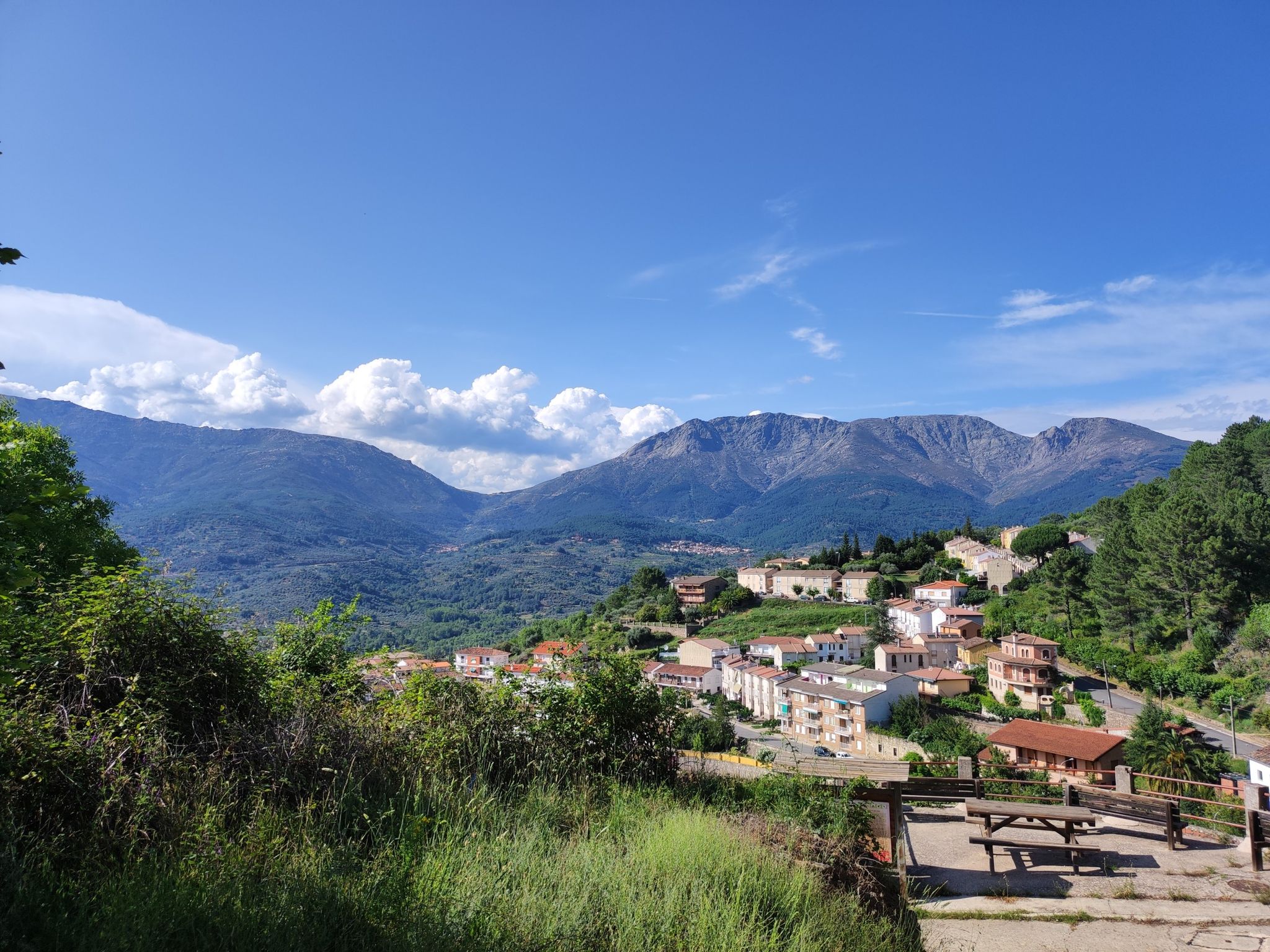
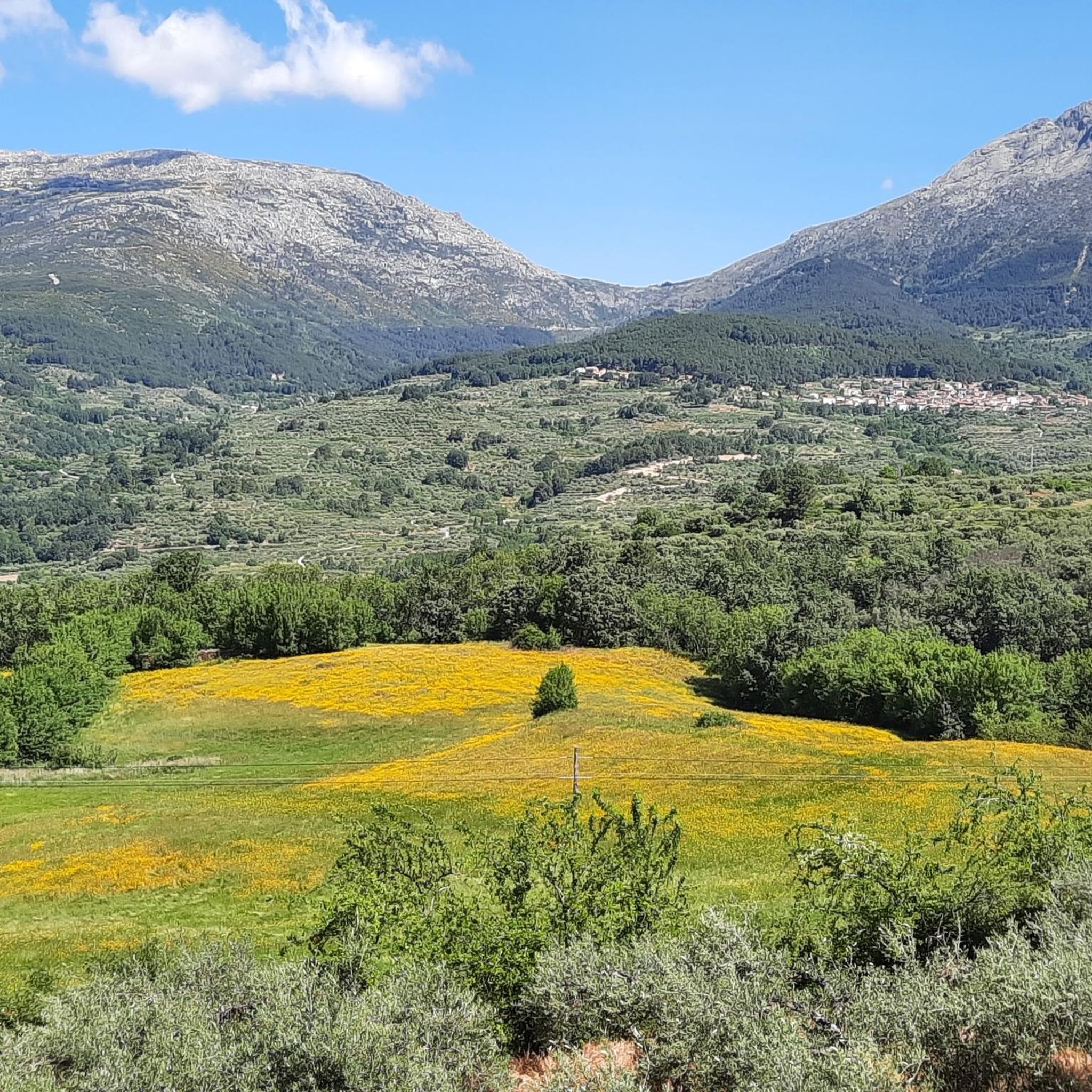
Hiking around Santa Cruz Del Valle offers diverse terrain, characterized by river valleys, forested slopes, and elevated viewpoints. The region features a network of trails that traverse varied landscapes, from the gentle paths along the Ramacastañas River to more challenging ascents towards panoramic vistas. This area provides opportunities for exploring the natural environment through its distinct geographical features.
Best hiking trails around Santa Cruz Del Valle
- The most popular hiking route is From Mombeltrán to San Esteban del Valle —…
Last updated: July 8, 2026
5.0
(2)
11
hikers
Moderate hike. Good fitness required. Mostly accessible paths. Sure-footedness required.
4.8
(17)
69
hikers
19.1km
05:37
530m
530m
Hard hike. Very good fitness required. Easily-accessible paths. Suitable for all skill levels.

Sign up for free
5.0
(2)
40
hikers
Moderate hike. Good fitness required. Easily-accessible paths. Suitable for all skill levels.
4.5
(2)
5
hikers
14.9km
04:21
420m
420m
Moderate hike. Good fitness required. Easily-accessible paths. Suitable for all skill levels.
3
hikers
6.53km
01:48
110m
100m
Easy hike. Great for any fitness level. Easily-accessible paths. Suitable for all skill levels.
Get access to more routes and recommendations from other explorers.
Sign up for free
Already have an account?
Our route recommendations are based on thousands of hikes, rides, and runs completed by other people on komoot.
Start today with a free account
Your next adventure awaits.
Login or Signup
Popular around Santa Cruz Del Valle


Other adventures around Santa Cruz Del Valle

Tips from the Community

Upon arriving by road, the first spectacular view of San Esteban del Valle that appears before the pedestrian's eyes. At this point is located the Casa Encantada, a marvel of the rural construction evolution of farmhouses.
0
0
Delicious coffee on the terrace of the Puente Seco bar, with views of Torozo, Serranillos and Puerto de Pedro Bernardo
0
0

Stone houses with balconies. One of the jewels of Gredos.
0
0

Mombeltrán Castle is situated in a beautiful spot in the Sierra de Gredos mountains, just south of the Puerto del Pico Pass (altitude 1352 m).
0
0

Natural swimming pool open from July to September
0
0

The Puerto del Pico with its viewing point is one of the classics of the Sierra de Gredos, used frequently in the routes of the Vuelta a España. The viewing point offers beautiful views of the Valle del Barranco or Valle de las Cinco Villas. You can also see the layout of the old Roman road that also went up this valley to access the upper part of the Iberian plateau. The road that goes up to the Puerto del Pico on its southern slope is in perfect condition as it is the national road N-502. It is a fast road so you have to be very careful with cars, especially on holidays and vacations.
1
0

Old Roman road with a breathtaking view of the valley
1
0
Frequently Asked Questions
How many hiking trails are available around Santa Cruz Del Valle?
There are nearly 90 hiking trails around Santa Cruz Del Valle, offering a wide range of options for different skill levels and preferences. The komoot community has rated these routes highly, with an average score of 4.6 stars.
Are there easy hiking trails suitable for beginners or families in Santa Cruz Del Valle?
Yes, Santa Cruz Del Valle offers over 20 easy hiking routes. A great option for a relaxed outing is the Lanzahíta – Lanzahíta loop from Lanzahíta, which is 4.0 miles (6.5 km) long and takes about 2 hours to complete.
Where can I find more challenging hikes around Santa Cruz Del Valle?
For those seeking a challenge, there are over 10 difficult routes available. One such demanding trail is the San Esteban del Valle – Cuevas del Valle loop from Mombeltrán, an 11.8 miles (19.1 km) path that connects two valleys and features sustained climbs.
Are there many circular hiking routes in the area?
Yes, many routes in Santa Cruz Del Valle are circular. For example, the popular From Mombeltrán to San Esteban del Valle — circular through the Valle del Río Ramacastañas is a moderate 6.8 miles (11.0 km) loop exploring the scenic Ramacastañas River valley.
What kind of natural features can I expect to see on hikes in Santa Cruz Del Valle?
Hiking around Santa Cruz Del Valle is characterized by diverse terrain including river valleys, forested slopes, and elevated viewpoints. You'll encounter varied landscapes, from gentle paths along the Ramacastañas River to more challenging ascents towards panoramic vistas.
Are there any notable viewpoints along the hiking trails?
Absolutely. The region is known for its panoramic viewpoints. A recommended route is the Puerto del Pico Viewpoint loop from Cuevas del Valle, which leads through elevated terrain to a significant viewpoint, offering expansive views of the surrounding landscape.
What are some interesting landmarks or attractions near the hiking routes?
Near the hiking routes, you can explore several mountain passes such as Puerto de Pedro Bernardo and Centenera Pass. There are also various huts and shelters like the Collado de la Casa y Fuente Shelter, which can be points of interest during your hike.
What do other hikers enjoy the most about hiking in Santa Cruz Del Valle?
The area is highly rated by the komoot community, with an average score of 4.6 stars from over 190 reviews. Hikers often praise the region's diverse terrain, from river valleys to panoramic viewpoints, and the variety of routes suitable for all levels.
Are there any routes that connect different valleys?
Yes, some routes are designed to traverse multiple valleys, offering varied scenery and terrain. The San Esteban del Valle – Cuevas del Valle loop from Cuevas del Valle is a moderate 9.3 miles (14.9 km) route that connects these two valleys.
What is the typical duration for hikes in Santa Cruz Del Valle?
Hike durations vary significantly. Easy routes like the Lanzahíta loop can take around 2 hours, while moderate trails such as the Ramacastañas River valley circular route typically take about 3.5 hours. More difficult routes, like the San Esteban del Valle – Cuevas del Valle loop, can extend to 5.5 hours or more.
Is there parking available at trailheads?
While specific parking details for every trailhead are not listed, many popular hiking areas in rural regions like Santa Cruz Del Valle typically have designated parking spots near trail starts, especially for well-known routes. It's advisable to check route descriptions on komoot for specific parking information before you go.
Most popular routes around Santa Cruz Del Valle
Most popular attractions around Santa Cruz Del Valle

Get inspired with the komoot mobile app


Explore more
Browse the best Hikes in other regions.
