The best road cycling routes around Peñalsordo
33
riders
8
rides
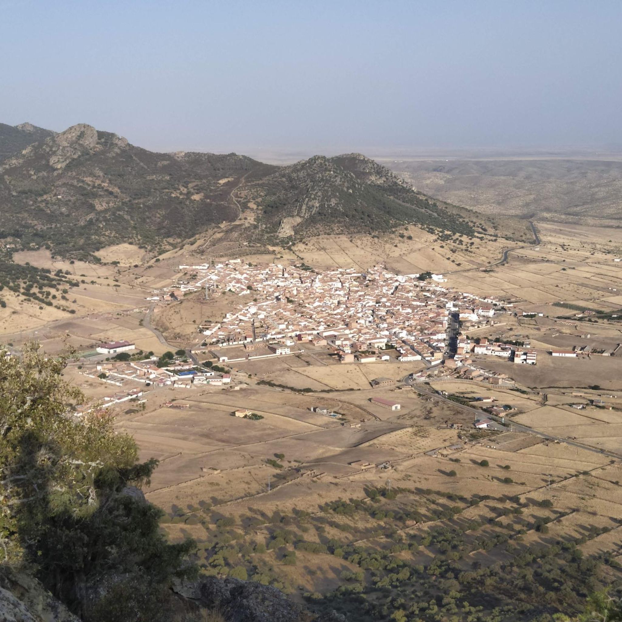
Road cycling routes around Peñalsordo traverse a diverse landscape characterized by the expansive La Serena Reservoir and surrounding sierras. The region features varied topography, including plains, hills, and mountainous areas, with elevations reaching up to 938 meters. Notable natural features include the conical Cerro Masatrigo and the series of small mountain ranges such as Sierra del Palenque and Sierra del Torozo. These elements provide a range of gradients and distances for road cyclists.
Best road cycling routes around Peñalsordo
- The…
Last updated: July 10, 2026
6
riders
80.9km
04:01
1,090m
1,090m
This difficult 50.3-mile road cycling route near Chillón explores historic castles, mining landscapes, and offers panoramic views.
96.7km
04:23
1,060m
1,060m
Hard road ride. Very good fitness required. Some segments of this route may be unpaved and difficult to ride.

Sign up for free
9
riders
75.0km
03:39
990m
990m
Hard road ride. Very good fitness required. Mostly well-paved surfaces and easy to ride.
9
riders
81.9km
04:03
1,170m
1,170m
Hard road ride. Very good fitness required. Some segments of this route may be unpaved and difficult to ride.
3
riders
71.5km
03:19
780m
790m
Moderate road ride. Good fitness required. Some segments of this route may be unpaved and difficult to ride.
Get access to more routes and recommendations from other explorers.
Sign up for free
Already have an account?
Our route recommendations are based on thousands of hikes, rides, and runs completed by other people on komoot.
Start today with a free account
Your next adventure awaits.
Login or Signup
Popular around Peñalsordo

Tips from the Community

The Plaza de Toros de Almadén, also known as Plaza Nueva, is a historical monument located in Almadén (Ciudad Real, Spain) and is famous worldwide for its characteristic and unique hexagonal floor plan. Built between 1752 and 1752 for the famous mercury mines in the area
0
0
The Almadén Mining Park (Ciudad Real, Spain) is the largest mercury deposit in the world, declared a [UNESCO](0.5.4, 0.5.5) World Heritage Site. It offers an underground journey into mining history, starting from Roman times up to 2003, the year the activity closed.
1
0

A hexagonal shape, unique in the world. A complex of 24 two-story houses surrounds the bullring, forming a single block. Built between 1752 and 1765 at the initiative of Superintendent Francisco Javier de Villegas. Purpose: to provide employment for miners during forced work stoppages and to raise funds for the Royal Miners' Hospital of San Rafael through bullfights and the rental of houses. First bullfights: October 1752, with 21 bulls fought. Declared a Site of Cultural Interest in 1979 and a World Heritage Site by UNESCO in 2012 as part of the "Mercury Heritage: Almadén and Idrija."
9
0
It is a mountain pass that connects areas of the Sierra de los Villares and Mirabueno. It is part of old livestock routes such as the Cañada Real Segoviana, historically used for transhumance. Landscapes: Sierras de Mirabueno and Los Villares, with forests and landscapes such as Tabla Corta (Boquerón Park) on the Guadalemar River. Ideal for hiking, cycling, and nature photography.
11
0
Cerro Masatrigo is a hill located in the municipality of Esparragosa de Lares. This hill is known for its almost perfect conical shape, which has earned it the nickname "the magic mountain." It rises 501 meters above sea level and 161 meters above the surrounding terrain. After the construction of the La Serena Dam, Cerro Masatrigo became a peninsula surrounded by the waters of the reservoir.
1
0
Cerro Masatrigo is a hill located in the municipality of Esparragosa de Lares. This hill is known for its almost perfect conical shape, which has earned it the nickname "the magic mountain." It rises 501 meters above sea level and 161 meters above the surrounding terrain. After the construction of the La Serena Dam, Cerro Masatrigo became a peninsula surrounded by the waters of the reservoir.
6
0

Zarza-Capilla is a small town in the La Serena valley. One of the most interesting monuments in the town is the 16th century Church of Saint Bartholomew.
1
1

Castle that is located right at the top of the town of Almadén and that is also called the Ermita Virgen del Castillo. The mountain has the same name as the castle with spectacular views of the area and the town.
0
0
Frequently Asked Questions
How many road cycling routes are available around Peñalsordo?
There are 8 road cycling routes available around Peñalsordo, offering a variety of experiences for cyclists. These routes showcase the region's diverse landscapes, from reservoir views to challenging mountain passes.
What kind of terrain can I expect when road cycling in Peñalsordo?
Road cycling in Peñalsordo features a diverse topography, including plains, rolling hills, and mountainous areas. You'll encounter routes around the expansive La Serena Reservoir, as well as through the surrounding sierras like Sierra del Palenque and Sierra del Torozo, which offer varied gradients and scenic views.
Are there routes suitable for different difficulty levels?
Yes, while many routes in Peñalsordo are considered difficult, there is at least one moderate route available. For example, the Garbayuela – View of Cerro Masatrigo loop from Sancti-Spíritus is a moderate option, offering a less strenuous ride while still providing beautiful scenery.
What natural features can I see along road cycling routes in Peñalsordo?
You can expect to see prominent natural features such as the vast La Serena Reservoir and the distinctive, conical Cerro Masatrigo. The routes also traverse areas with Mediterranean scrub, oaks, juniper, and pine forests within the surrounding sierras, offering impressive backdrops.
Are there any historical landmarks or points of interest to visit while cycling?
Absolutely. Many routes pass by significant landmarks. For instance, the Cabeza de Buey – Capilla and its Castle loop from Cabeza Del Buey leads you through the area around Capilla and its historic Castillo de Capilla. The Almadén Mercury and Castles Route also explores historical castles in the broader regional landscape.
Where can I find scenic viewpoints on road cycling routes?
Several routes offer stunning panoramic views. The road traversing the La Serena Reservoir, skirting Cerro Masatrigo, provides picturesque vistas of the water and the unique mountain. Additionally, the View from Peñón del Pez, near Capilla, is a rewarding destination for panoramic views.
What are the elevation challenges like on road cycling routes in Peñalsordo?
The region's topography includes significant elevation changes, with some routes featuring climbs of over 1,000 meters. For example, the View of Cerro Masatrigo – Capilla and its Castle loop from Puebla de Alcocer includes over 1,140 meters of elevation gain, providing challenging ascents for experienced cyclists.
Are there any circular road cycling routes in the area?
Yes, many of the routes around Peñalsordo are circular, allowing you to start and end in the same location. Examples include the Villages of La Serena: Peñalsordo and Capilla — circular from Cabeza Del Buey and the Garbayuela – View of Cerro Masatrigo loop from Sancti-Spíritus.
What is the best time to cycle in Peñalsordo?
The region's climate, typical of Extremadura, generally offers pleasant conditions for cycling outside of the peak summer months when temperatures can be very high. Spring and autumn are often ideal, providing milder weather to enjoy the diverse landscapes and challenging routes.
Is parking available for cyclists in Peñalsordo?
While specific cycling parking facilities are not detailed, the Peñalsordo Beach area on the La Serena reservoir offers a recreational zone with parking, which could serve as a convenient starting or ending point for your ride. For other routes, it's advisable to check local parking options in the starting towns.
Can I find accommodation or places to eat suitable for cyclists?
Peñalsordo and nearby villages offer local amenities including cafes, bars, and accommodation options. While not specifically tailored for cyclists, these establishments provide opportunities for rest and refueling. The Peñalsordo Beach also has a cafe-bar and picnic area.
What do other road cyclists enjoy most about cycling in Peñalsordo?
Road cyclists using komoot often praise the region for its varied terrain, which includes both challenging climbs and scenic routes around the vast La Serena Reservoir. The presence of unique natural features like Cerro Masatrigo and historical sites such as Castillo de Capilla also contribute to a rewarding cycling experience.
Most popular routes around Peñalsordo
Most popular attractions around Peñalsordo

Get inspired with the komoot mobile app


Explore more
Browse the best Road cycling routes in other regions.
