The best road cycling routes around San García De Ingelmos
67
riders
9
rides
Road cycling routes around San García De Ingelmos are situated at an altitude of 1066 meters above sea level, within a transitional zone between the Sierra de Ávila and La Moraña. The landscape features open fields, primarily cultivated with cereal, and is traversed by the Almar and Navazamplón rivers. This rural setting offers quiet roads and varied terrain, with the nearby Sierra de Ávila providing mountainous landscapes and granite peaks for more challenging rides. The region's natural environment is conducive…
Last updated: July 11, 2026
8
riders
118km
05:40
1,490m
1,490m
Hard road ride. Very good fitness required. Mostly well-paved surfaces and easy to ride.
14
riders
70.4km
03:05
670m
670m
Moderate road ride. Good fitness required. Mostly well-paved surfaces and easy to ride.

Sign up for free
13
riders
85.7km
03:53
950m
950m
Hard road ride. Very good fitness required. Mostly well-paved surfaces and easy to ride.
6
riders
61.2km
03:07
1,040m
1,040m
Hard road ride. Very good fitness required. Mostly well-paved surfaces and easy to ride.
6
riders
42.3km
02:03
620m
620m
Moderate road ride. Good fitness required. Mostly well-paved surfaces and easy to ride.
Get access to more routes and recommendations from other explorers.
Sign up for free
Already have an account?
Our route recommendations are based on thousands of hikes, rides, and runs completed by other people on komoot.
Start today with a free account
Your next adventure awaits.
Login or Signup
Popular around San García De Ingelmos


Tips from the Community

The Church of San Miguel in Peñaranda de Bracamonte is a beautiful classicist-style temple, built in quarry stone. Although its interior was severely damaged in 1971, its imposing exterior façade remains a testament to its history. After the fire of 1971, only the main altar chapel was saved, where the main altarpiece was located, a baroque masterpiece made by Sebastián Ducete and Esteban de Rueda. The chapel of San Antonio is also preserved, and in it you can see the Cristo de la Cama, an object of great local devotion. The stone baptismal font is original and was remodeled under the direction of Fernando Pulín, who received the National Restoration Award for his work. If you ever visit Peñaranda de Bracamonte, be sure to admire this architectural gem. 🌟🏰
2
0

This church was dedicated to the Archangel Michael "San MIGUEL". The name (coming from the Hebrew language) means "Who is like God?". He is often depicted - in paintings or as a statue - with a flaming sword, and occasionally a lance. Michael / Miguel is - along with Raphael, Gabriel and Uriel - one of the four archangels who (according to human understanding) occupy the highest rank in the heavenly hierarchy of angelic beings. Their common feast day in the saints' calendar is September 29th.
1
0

Small town that is located at the foot of the northern side of the Sierra de Ávila and that the center is governed by the parish church of San Juan Bautista. It is worth taking a stroll through its streets.
1
0
Possibly built from the chapel of the deserted area of San Juan de Robledo and which is located right next to the road. Beautiful building!
0
1

The history of this town is linked to the fact that it is the head of a region, Tierra de Peñaranda, also known as Campo de Peñaranda. Its churches and streets are very beautiful!
0
0
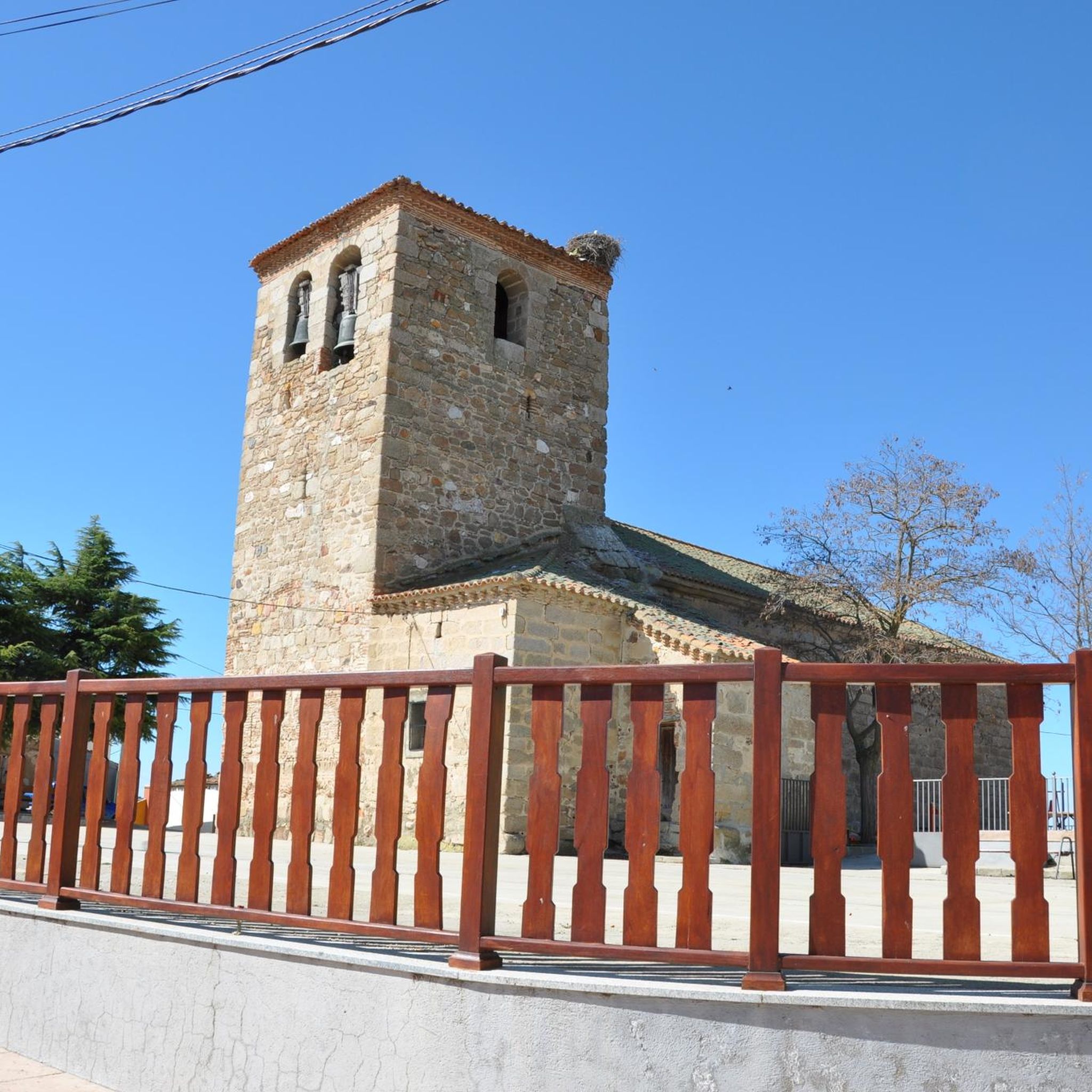
Beautiful church located in the town of Mancera de Arriba. This one, made of stone from the area, has flagged the core since a long time ago.
0
0
The relief of the municipality is formed by two mountainous areas separated by the Amblés valley, through which the Adaja river runs, which is born in the territory. The northern area is called Sierra de Villanueva, a branch of the Sierra de Ávila.
0
0
Frequently Asked Questions
How many road cycling routes are available around San García De Ingelmos?
There are 7 road cycling routes documented on komoot around San García De Ingelmos. These routes offer a variety of experiences, from moderate loops through agricultural land to more challenging rides with significant elevation gain into the Sierra de Ávila.
What kind of terrain can I expect on road cycling routes in this region?
The region around San García De Ingelmos offers varied terrain. You'll find open fields, primarily cultivated with cereal, and rural roads that are generally quiet. As you venture towards the Sierra de Ávila, the landscape transitions to mountainous areas with granite peaks, providing more challenging ascents and descents.
Are there any challenging road bike climbs in the San García De Ingelmos area?
Yes, the proximity to the Sierra de Ávila means there are routes with significant ascents. For example, the route Ascents to the Sierra de Ávila and Villanueva — circular from Peñaranda de Bracamonte is a difficult 73.1-mile (117.6 km) trail featuring substantial climbs. Another challenging option is the Fuente del Oro – Las Fuentes Pass loop from Peñaranda de Bracamonte, which includes demanding climbs and scenic views.
Are there any moderate or beginner-friendly road cycling routes?
While many routes offer challenges, there are also moderate options suitable for less experienced riders or those seeking a more relaxed pace. The Fuente del Oro – Mancera de Arriba loop from Cabezas del Villar is a moderate 43.7-mile (70.4 km) trail that takes you through open fields and rolling terrain. Another moderate choice is the San Juan del Olmo – Las Fuentes Pass loop from Gallegos de Sobrinos.
What is the best time of year for road cycling in San García De Ingelmos?
Given its altitude of 1066 meters, the region experiences distinct seasons. Spring and autumn generally offer the most pleasant temperatures for road cycling, with comfortable weather and beautiful landscapes. Summers can be warm, while winters may bring colder temperatures and potentially adverse conditions, especially in higher elevations.
Are there any circular road cycling routes available?
Yes, many of the routes around San García De Ingelmos are designed as loops, allowing you to start and end in the same location. Examples include the challenging Ascents to the Sierra de Ávila and Villanueva — circular from Peñaranda de Bracamonte and the moderate Fuente del Oro – Mancera de Arriba loop from Cabezas del Villar.
What are the typical distances and elevation gains for routes in this area?
Route distances vary significantly, from around 42 km (26 miles) to over 117 km (73 miles). Elevation gains can range from approximately 600 meters (2,000 feet) on moderate routes to nearly 1,500 meters (5,000 feet) on more difficult trails that venture into the Sierra de Ávila.
What can I see or explore along the road cycling routes?
The routes offer a chance to experience the tranquil rural character of the region. You'll cycle through open fields, alongside the Almar and Navazamplón rivers, and enjoy views of the Sierra de Ávila's granite peaks. The village of San García de Ingelmos itself features the traditional Church of San Fabián and San Sebastián, built with granite sillar and housing a wooden Mudejar coffered ceiling.
Is San García De Ingelmos a good destination for quiet road cycling?
Yes, the region is known for its serene, rural backdrop and low traffic volume on its roads, which is a desirable characteristic for road cycling. Its appeal lies in its quiet, rural character and proximity to natural areas within the wider province of Ávila.
Are there any routes that pass through the Las Fuentes Pass?
Yes, the Las Fuentes Pass is a feature on several routes. You can explore it on the difficult San Juan del Olmo – Las Fuentes Pass loop from Muñico, or the moderate San Juan del Olmo – Las Fuentes Pass loop from Gallegos de Sobrinos.
Most popular routes around San García De Ingelmos

Get inspired with the komoot mobile app


Explore more
Browse the best Road cycling routes in other regions.
