The best cycling routes around Talarrubias
5.0
(1)
63
riders
12
rides
Touring cycling around Talarrubias offers diverse landscapes, characterized by extensive dehesas and oak forests. The region features significant bodies of water, including the Embalse de La Serena and the Pantano de Orellana, which provide scenic routes. Its rugged terrain, part of the Villuercas-Ibores-Jara Geopark, presents an Appalachian geological landscape with varied elevations. These natural features create a range of touring cycling routes suitable for different preferences.
Best touring cycling routes around Talarrubias
- The most popular touring cycling route is Guadiana…
Last updated: June 23, 2026
5
riders
43.5km
02:46
350m
350m
Moderate bike ride. Good fitness required. Mostly paved surfaces. Suitable for all skill levels.
Hard bike ride. Very good fitness required. Mostly paved surfaces. Suitable for all skill levels.

Sign up for free
60.7km
04:31
840m
840m
Hard bike ride. Very good fitness required. Some segments of this route may be unpaved and difficult to ride.
15
riders
20.2km
01:35
170m
170m
Moderate bike ride. Good fitness required. Mostly paved surfaces. Suitable for all skill levels.
8
riders
65.7km
04:38
1,310m
1,310m
Hard bike ride. Very good fitness required. Mostly paved surfaces. Suitable for all skill levels.
Get access to more routes and recommendations from other explorers.
Sign up for free
Already have an account?
Our route recommendations are based on thousands of hikes, rides, and runs completed by other people on komoot.
Start today with a free account
Your next adventure awaits.
Login or Signup
Tips from the Community

This Almohad-era castle, now devoid of walls and decoration, is built on an octagonal plan atop a high crag south of the town, on a summit difficult to access. It lacks a keep, towers, and external defenses, perhaps due to its reconstruction during the Christian era, which only preserved the wall, omitting any other defensive elements beyond the rugged terrain on which it stands.
2
0
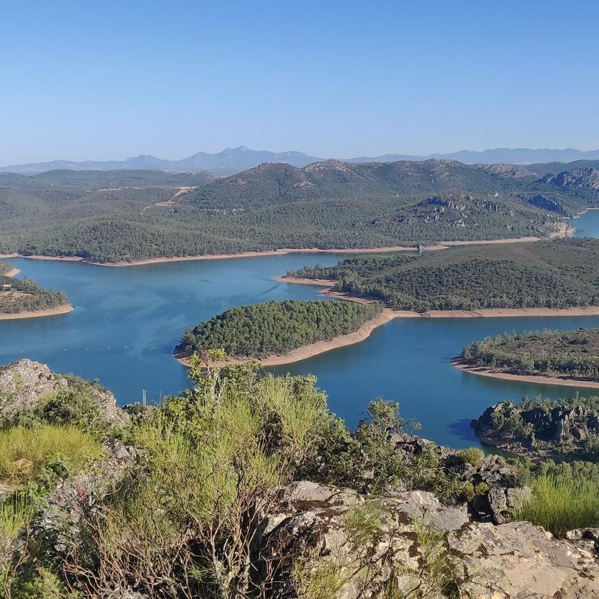
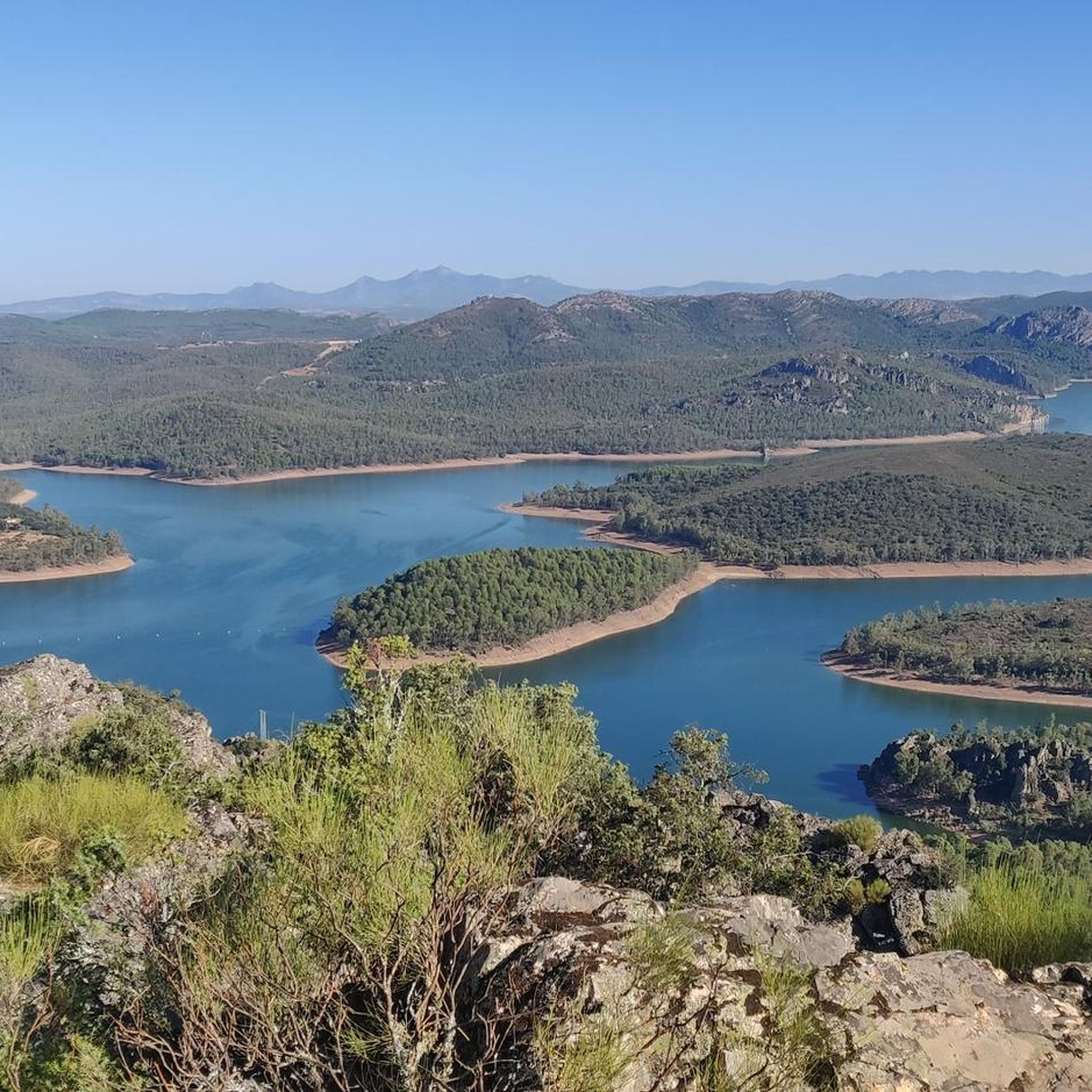
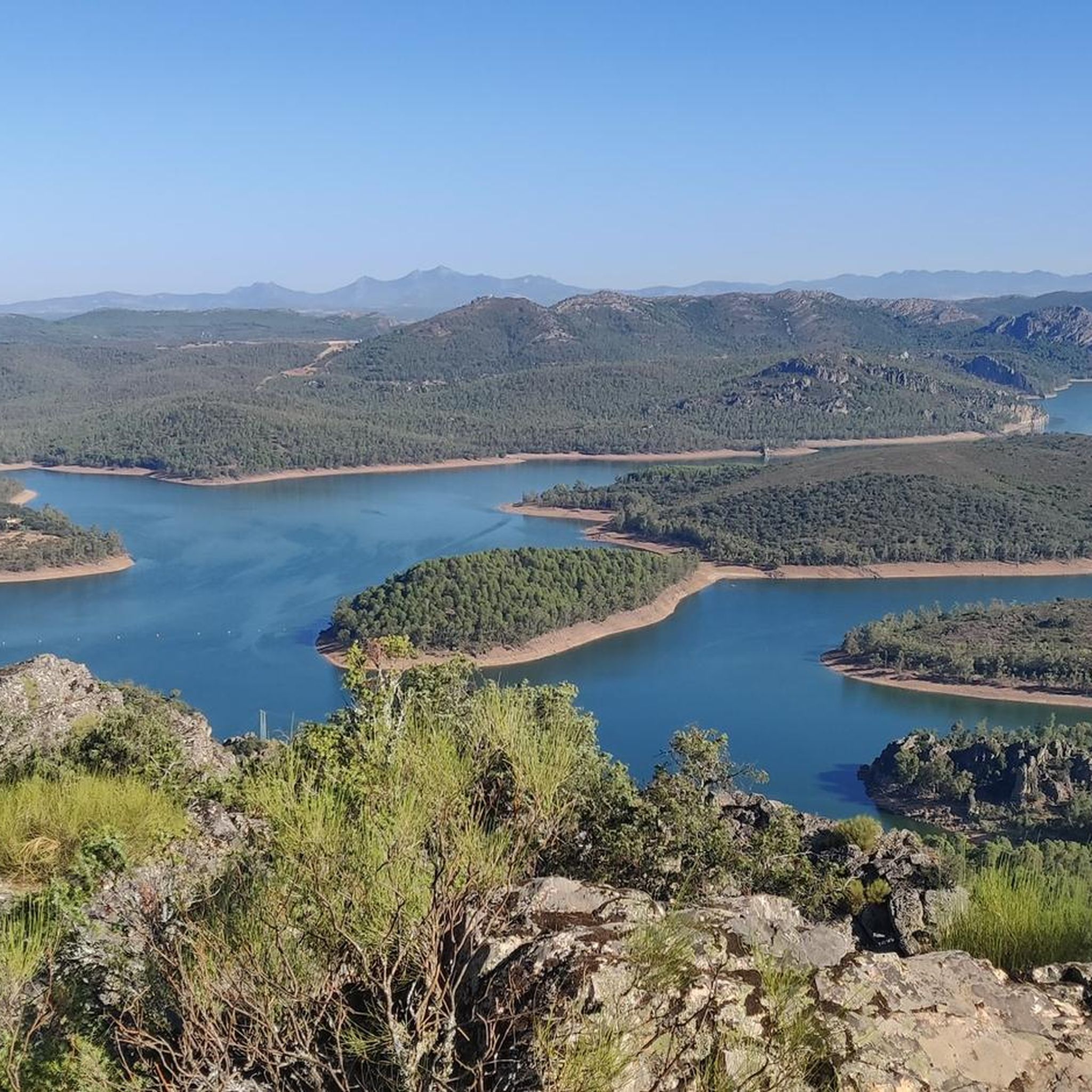
The García de Sola Reservoir, also known as Puerto Peña, is located on the Guadiana River, in the La Siberia Extremeña region (Badajoz). It was built in 1962 as part of the Badajoz Plan and has a capacity of 554 hm³. It is an emblematic site for its natural, scenic, and recreational value.
5
0
The Guadiana Riverside Trail in Siberia Extremadura is not an official name, but it refers to routes that run alongside the Guadiana River and its reservoirs in the La Siberia region (Badajoz), declared a Biosphere Reserve by UNESCO in 2019. This area combines landscapes of pastureland, mountains and large bodies of water (Cíjara, García de Sola and Orellana reservoirs), ideal for hiking, cycling and wildlife watching.
5
0
Playa de los Calicantos, located in Casas de Don Pedro (Badajoz), is an inland beach at the tail end of the Orellana Reservoir, within the La Siberia Extremeña region. It's an ideal place to enjoy the summer surrounded by nature, with excellent services and a peaceful setting.
10
0
Cerro Masatrigo is a hill located in the municipality of Esparragosa de Lares. This hill is known for its almost perfect conical shape, which has earned it the nickname "the magic mountain." It rises 501 meters above sea level and 161 meters above the surrounding terrain. After the construction of the La Serena Dam, Cerro Masatrigo became a peninsula surrounded by the waters of the reservoir.
6
0
The La Serena Dam, located in the province of Badajoz (Extremadura), is one of the most impressive hydraulic infrastructures in Europe. Location: Zújar River, in the region of La Serena It is part of the La Siberia Biosphere Reserve. It houses inland islands such as Cerro Masatrigo, considered a "magic mountain" for its perfect conical shape. A SPA (Special Protection Area for Birds), ideal for watching aquatic birds and birds of prey.
6
0
The Herrera del Duque Castle, located in the province of Badajoz (Extremadura), is an impressive 15th-century fortress that dominates the landscape of the La Siberia region from the top of the Sierra Chamorro. It is said that wailing sounds can be heard at night from the "Tower of Sighs," and there are legends about a hidden treasure protected by a curse.
6
0

This spectacular reservoir was built during the 1960s. The reflection of the sunsets in the water and the surrounding landscape make it a must-see if you're exploring the Guadiana Nature Trail.
0
1
Frequently Asked Questions
How many touring cycling routes are available around Talarrubias?
There are over 15 touring cycling routes around Talarrubias, offering a variety of experiences for different skill levels. These routes explore the diverse landscapes of the region, from extensive dehesas to significant reservoirs.
What kind of landscapes will I encounter on touring cycling routes near Talarrubias?
Touring cycling routes near Talarrubias feature diverse landscapes, including extensive dehesas and oak forests. You'll also find significant bodies of water like the Embalse de La Serena and the Pantano de Orellana. The region's rugged terrain is part of the Villuercas-Ibores-Jara Geopark, characterized by an 'Appalachian geological landscape' with varied elevations, offering stunning panoramic views.
Are there any historical sites or landmarks to see along the touring cycling routes?
Yes, several routes combine natural beauty with historical interest. For instance, the Embalse de la Serena and Castillo de Puebla de Alcocer — circular from la Puebla de Alcocer route passes by the impressive Castle of Puebla de Alcocer. Another option is the Garcia de Sola Reservoir and Herrera del Duque Castle Loop, which takes you past the Herrera del Duque Castle. You can also find the Church of San Pedro Apóstol in Casas de Don Pedro nearby.
What are the difficulty levels of touring cycling routes in Talarrubias?
The touring cycling routes around Talarrubias cater to various fitness levels. You'll find a mix of moderate and difficult routes. There are 6 moderate routes, typically featuring rolling terrain, and 9 difficult routes, which often include more significant ascents and descents, especially within the rugged Geopark areas.
Are there routes that feature the large reservoirs in the region?
Absolutely. The region is known for its emblematic reservoirs. You can explore the Guadiana Natural Trail: Orellana Reservoir Loop, offering views of the Orellana Reservoir. Another popular choice is the Embalse de la Serena and Castillo de Puebla de Alcocer — circular from la Puebla de Alcocer, which provides stunning vistas of the Embalse de La Serena. The Garcia de Sola Reservoir and Herrera del Duque Castle Loop also highlights reservoir landscapes. Other notable reservoirs include Cancho del Fresno Reservoir and Garcia de Sola Reservoir.
What do other touring cyclists say about the routes in Talarrubias?
The touring cycling routes in Talarrubias are highly rated by the komoot community, with an average score of 4.0 stars from over 2 reviews. More than 80 touring cyclists have used komoot to explore the varied terrain, often praising the scenic beauty of the reservoirs and the tranquility of the natural environment.
Can I find circular touring cycling routes in the area?
Yes, many of the touring cycling routes around Talarrubias are designed as loops, allowing you to start and finish at the same point. Examples include the popular Guadiana Natural Trail: Orellana Reservoir Loop, the challenging Embalse de la Serena and Castillo de Puebla de Alcocer — circular from la Puebla de Alcocer, and the scenic Garcia de Sola Reservoir and Herrera del Duque Castle Loop.
What is the best time of year for touring cycling in Talarrubias?
The region of Extremadura, where Talarrubias is located, generally offers pleasant cycling conditions during spring (March to May) and autumn (September to November). These seasons provide milder temperatures, making longer rides more comfortable and allowing you to fully enjoy the natural beauty without the intense heat of summer.
Are there any specific natural attractions or viewpoints worth visiting?
Beyond the reservoirs, the region boasts several natural highlights. Cerro Masatrigo, a 'natural paradise' close to Talarrubias, offers impressive panoramic views of the Siberia and Serena regions. The Villuercas-Ibores-Jara Geopark, with its unique 'Appalachian geological landscape,' provides stunning scenery and geological formations. You can also find the tranquil Canal de las Dehesas – Guadiana Natural Trail.
How long do the touring cycling routes typically take to complete?
The duration of touring cycling routes around Talarrubias varies depending on the distance and difficulty. For example, the Guadiana Natural Trail: Orellana Reservoir Loop (43.5 km) typically takes about 2 hours 46 minutes. Longer, more challenging routes like the Embalse de la Serena and Castillo de Puebla de Alcocer — circular from la Puebla de Alcocer (73.1 km) can take around 5 hours, while the Garcia de Sola Reservoir and Herrera del Duque Castle Loop (60.7 km) is often completed in about 4 hours 30 minutes.
Are there any family-friendly touring cycling routes in Talarrubias?
While many routes in Talarrubias are moderate to difficult due to the rugged terrain, some sections of the natural trails around the reservoirs might be suitable for families looking for a more relaxed ride. It's advisable to check the specific route details and elevation profiles to ensure they match your family's cycling abilities.
Can I bring my dog on touring cycling routes in Talarrubias?
Many natural areas and trails in Spain are generally dog-friendly, especially if your dog is well-behaved and kept on a leash. However, specific regulations can vary, particularly in protected areas or private lands. It's always best to check local signage or contact the regional tourism office for the most current information regarding pets on specific routes.
Are there options for parking near the touring cycling routes?
Access points for touring cycling routes often have designated parking areas, especially near popular trailheads or towns. For routes starting from specific villages or attractions, you can usually find public parking. It's recommended to check the starting point of your chosen route on komoot for details on available parking facilities.
Is public transport available to access touring cycling routes in Talarrubias?
Public transport options in rural Extremadura can be limited. While there might be bus services connecting Talarrubias to larger towns, direct access to specific trailheads via public transport might be challenging. For flexibility, bringing your own vehicle or arranging local transport is often the most convenient way to reach the starting points of touring cycling routes.
Most popular attractions around Talarrubias

Get inspired with the komoot mobile app


Explore more
Browse the best Cycling routes in other regions.
