The best cycling routes around San Andrés Del Rey
5.0
(1)
11
riders
2
rides
Touring cycling around San Andrés Del Rey offers routes through varied landscapes in the province of Guadalajara, Spain. The area is situated at an altitude of over a thousand meters, featuring a narrow valley with Monte Iruela and diverse forests of junipers, holm oaks, and oaks. Terrain includes both paved and unpaved surfaces, with significant elevation changes suitable for different fitness levels. Prominent natural features include the Entrepeñas Reservoir and open landscapes with traditional villages.
Best touring cycling routes around…
Last updated: July 2, 2026
5.0
(1)
7
riders
47.0km
03:24
860m
860m
Hard bike ride. Very good fitness required. Mostly paved surfaces. Suitable for all skill levels.
2
riders
20.4km
01:24
360m
370m
Moderate bike ride. Good fitness required. Mostly paved surfaces. Suitable for all skill levels.

Sign up for free
2
riders
33.0km
02:39
540m
550m
Hard bike ride. Very good fitness required. You may need to push your bike for some segments of this route.
Our route recommendations are based on thousands of hikes, rides, and runs completed by other people on komoot.
Start today with a free account
Your next adventure awaits.
Login or Signup
Popular around San Andrés Del Rey
Tips from the Community

Alocén is a pretty town with cobbled streets and beautiful traditional architecture located next to the Entrepeñas reservoir.
2
0
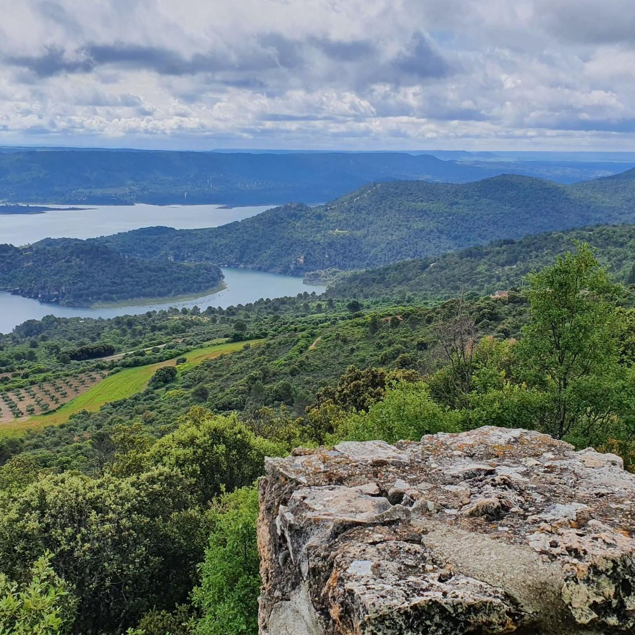
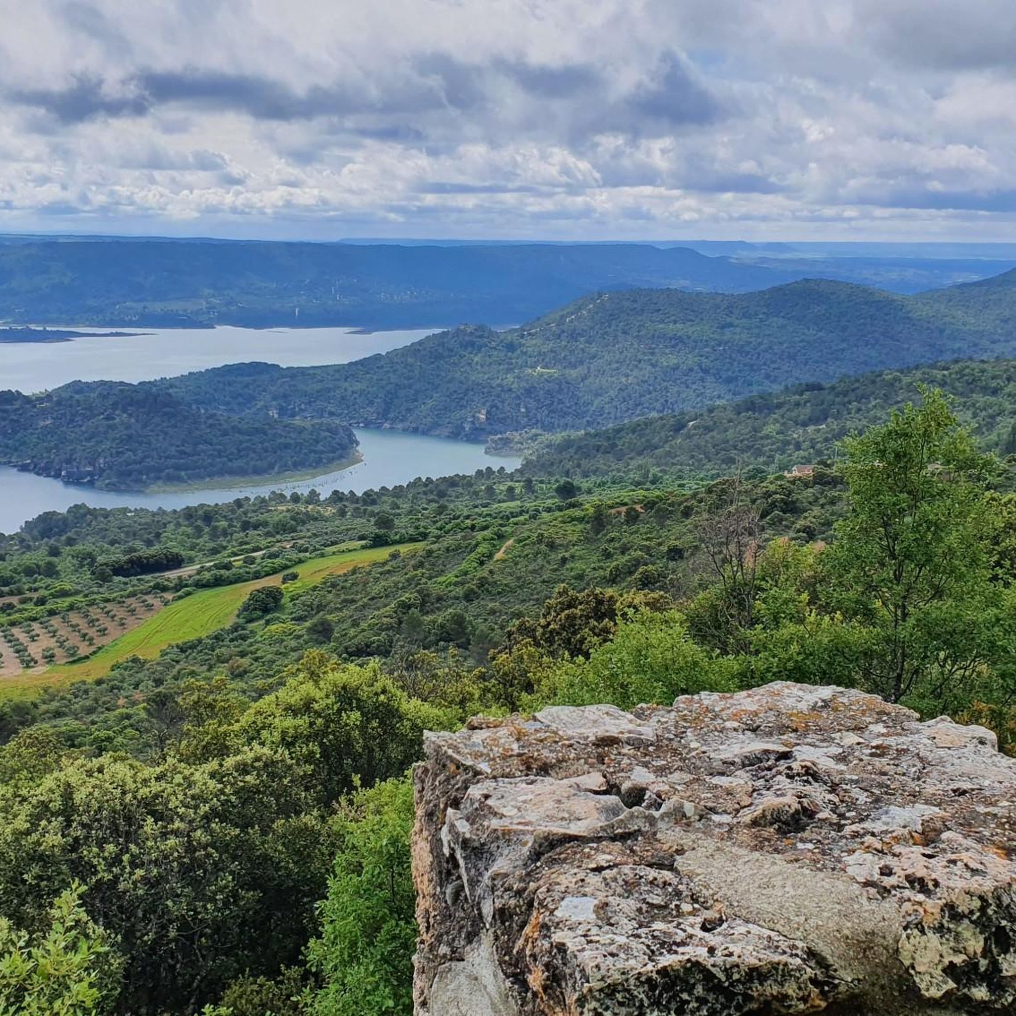
The Alcoén viewpoint, located a short distance from the town center of the town of the same name, offers beautiful views of the Entrepeñas reservoir and the surrounding green mountains.
2
0

Great walk through the incredibly diverse landscape created around the Entrepeñas Reservoir located near the city of Sacedón.
1
0
Auñón is a small town next to the N-320 national road. The tower of the great Church of San Juan Bautista rises up and can be seen from miles away.
1
0
Budia is a cute little town nestled in the plains of the Alcarria and the Tagus valley. The town became famous in the book "Journey to the Alcarria" by Camilo José Cela.
1
0

It is a natural spectacle. You can really enjoy views and tranquility typical of that area of Guadalajara. You can see the Entrepeñas Reservoir perfectly!
0
0

The next section to the streets of Berninches can be done directly along the road or take a detour that leaves the fertile plain to the left and reaches the town along an agricultural track. The track of the route indicates the dirt road to a bridge over the Arles stream and goes up the steep alleys of the town. The streets are staggered on the slope of Mount Las Matas and show a striking medieval distribution. The Plaza Mayor is large and welcoming, surprising such a wide space in a narrow and steep street, on one side is the impressive Church of the Asunción, from the 16th century, a beautiful fountain with two spouts, the pediment and in the center an elm which has replaced a previous one who died of graphiosis. The route leaves the town along the road and turns off along a rural road that passes through the striking Torreón de Berninches, a curious geodesic vertex placed on the pingorota of a formidable stone tower between cereal fields.
0
0
The path crosses the Tagus River over the Pareja bridge and takes the Alocén detour along a panoramic road between mountains of oaks, Pyrenean oaks and pine forests. The first kilometers to the town are a comfortable and quiet climb of about seven kilometers and with hardly any traffic. The route continues along the same road and immediately begins a fantastic descent through the pine forests of Monte de la Veguilla to the tunnels of the Entrepeñas dam. Among the trees appear the calcareous cliffs of the island of Pico de Monte Abajo and at the end the steep islet of Boca del Infierno, a symbolic stamp in the landscapes of the Alcarreño swamp. On the south side of the dam, after passing through the tunnel, there are the viewpoints of the Romanesque Bridge and Castillejo, impressive, you have to stop, lean out and contemplate the great calcareous canyon of the Tagus River in this environment, thinking about the aspect that should have before the construction of the Entrepeñas reservoir in 1956.
0
0
Frequently Asked Questions
What kind of terrain can I expect on touring cycling routes around San Andrés Del Rey?
The region around San Andrés Del Rey, situated at over a thousand meters altitude, features varied terrain. You'll encounter mountainous and valley landscapes, with both paved and unpaved surfaces. Routes often include significant elevation changes, traversing diverse forests of junipers, holm oaks, and oaks, as well as open landscapes.
Are there routes suitable for different fitness levels?
Yes, the touring cycling routes in San Andrés Del Rey cater to various fitness levels. While some routes are quite challenging with significant elevation changes, others are more moderate. For example, the Alocén – Mirador de Alocén loop from Alocén is considered moderate, while the Entrepeñas Reservoir Dam – View of Alocén loop from Durón is more difficult.
What natural features or landmarks can I see along the touring cycling routes?
Cycling routes often offer views of the prominent Entrepeñas Reservoir and its viaduct. You'll also pass through diverse forests and open landscapes. Some routes may lead you near traditional villages like Berninches, or offer scenic viewpoints such as Mirador de Alocén. The Arroyo de San Andrés is another natural feature in the area.
Are there any circular touring cycling routes in the area?
Yes, several touring cycling routes around San Andrés Del Rey are designed as loops. Examples include the Entrepeñas Reservoir Dam – View of Alocén loop from Durón, the Alocén – Mirador de Alocén loop from Alocén, and the Berninches – Mirador de Alocén loop from Auñón, providing convenient starting and ending points.
What is the best season for touring cycling in San Andrés Del Rey?
The region's elevated position and varied landscapes make it suitable for cycling during many seasons. However, spring and autumn generally offer the most pleasant weather conditions for touring cycling, with milder temperatures and beautiful scenery. Summers can be warm, and winters can be cold, so checking the forecast is always recommended.
What are the typical distances of touring cycling routes in this region?
The touring cycling routes around San Andrés Del Rey vary in length. You can find routes like the Alocén – Mirador de Alocén loop from Alocén which is about 12.7 miles (20.4 km), up to longer options such as the Entrepeñas Reservoir Dam – View of Alocén loop from Durón at 29.2 miles (47.0 km).
Is the area suitable for family-friendly touring cycling?
While the region features significant elevation changes, some routes are more moderate and could be suitable for families with older children or those accustomed to cycling. The tranquil environment and low-traffic secondary roads contribute to a peaceful experience. Always check the specific route's difficulty and elevation profile to ensure it matches your family's capabilities.
What do other touring cyclists say about the routes in San Andrés Del Rey?
The touring cycling routes in San Andrés Del Rey are highly rated by the komoot community, with an average score of 5.0 stars. Cyclists often appreciate the varied terrain, the scenic views of the Entrepeñas Reservoir, and the peaceful atmosphere of the region's roads and natural landscapes.
Are there any traditional villages to explore along the cycling routes?
Yes, touring cycling routes in the area often connect charming traditional villages. For instance, the Berninches – Mirador de Alocén loop from Auñón passes near Berninches, a settlement that offers a glimpse into local culture and history amidst your ride.
Are there specific viewpoints or scenic spots recommended for cyclists?
Many routes offer panoramic views, particularly those that incorporate the Entrepeñas Reservoir. The Mirador de Alocén, featured in routes like the Alocén – Mirador de Alocén loop from Alocén, is a notable viewpoint providing expansive vistas of the surrounding landscape.
Is parking available near the touring cycling routes?
While specific parking areas are not detailed for every route, the traditional villages and starting points of many loops, such as Durón, Alocén, or Auñón, typically offer parking options suitable for accessing the cycling trails. The region's low-traffic nature generally makes finding parking less challenging than in more urban areas.
Most popular routes around San Andrés Del Rey
Most popular attractions around San Andrés Del Rey

Get inspired with the komoot mobile app


Explore more
Browse the best Cycling routes in other regions.
