The best road cycling routes around Arroyo Del Ojanco
90
riders
15
rides
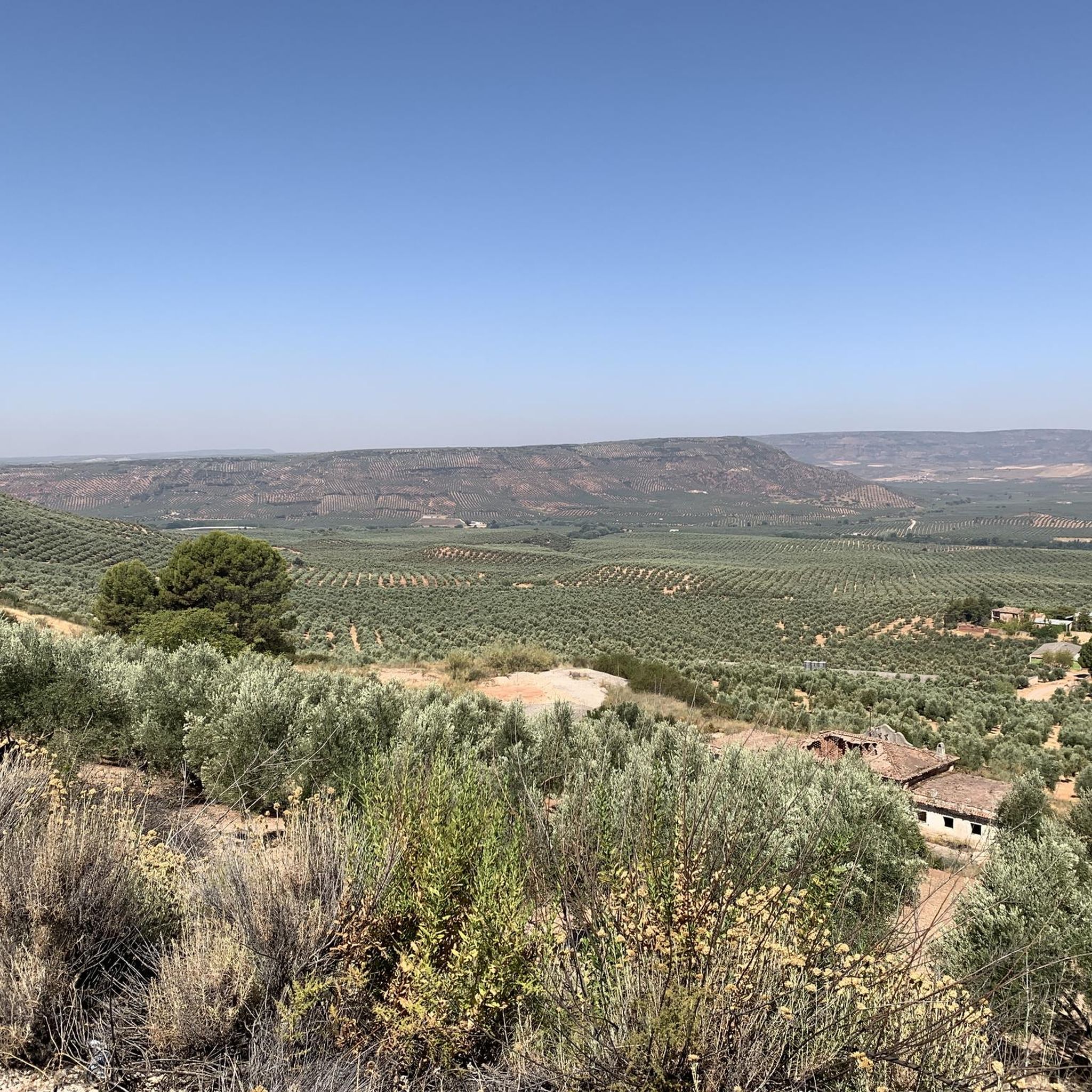
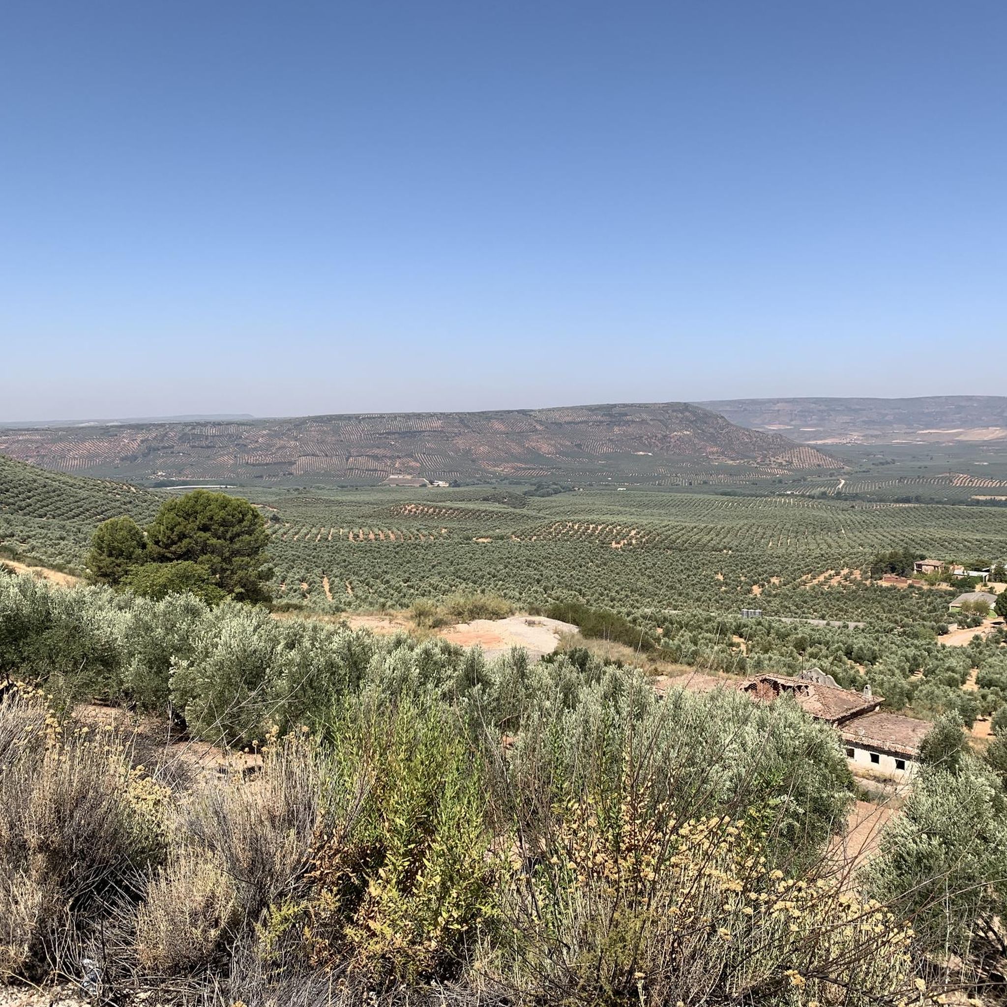
Road cycling routes around Arroyo Del Ojanco traverse a landscape characterized by extensive olive groves and mountainous terrain, situated at the foothills of the Sierra de Segura. This region is part of the Sierra de Cazorla, Segura y Las Villas Natural Park, offering varied topography for cyclists. The area features roads winding through karstic formations, forests, and along the Guadalmena and Guadalimar rivers.
Best road cycling routes around Arroyo Del Ojanco
- The most popular road cycling route is Puente de Génave – return via Sierra de Segura, a 39.4 miles (63.4 km) trail that takes 2 hours 48 minutes to complete. This route offers moderate difficulty through the Sierra de Segura's varied landscape.
- Another top favourite among local road cyclists is Roadbike loop from Estación de Beas de Segura, a moderate 39.6 miles (63.8 km) path. It provides access to the diverse natural features of the surrounding parkland.
- Local road cyclists also love the Beas de Segura – Beas de Segura - La Teja loop from Beas de Segura, a 31.9 miles (51.4 km) trail leading through olive groves and scenic roads, often completed in about 2 hours 28 minutes.
- Road cycling around Arroyo Del Ojanco is defined by extensive olive groves, mountainous terrain, and river valleys. The network offers options for both moderate and difficult ability levels.
- The guide includes highly-rated routes that showcase the best of the region's landscape. More than 80 road cyclists have used komoot to explore Arroyo Del Ojanco's varied terrain.
Last updated: July 10, 2026
16
riders
63.4km
02:48
640m
640m
Moderate road ride. Good fitness required. Some segments of this route may be unpaved and difficult to ride.
10
riders
63.8km
03:19
740m
740m
Moderate road ride. Good fitness required. Some segments of this route may be unpaved and difficult to ride.

Sign up for free
8
riders
51.4km
02:28
680m
680m
Moderate road ride. Good fitness required. Mostly well-paved surfaces and easy to ride.
8
riders
55.5km
02:31
610m
610m
Moderate road ride. Good fitness required. Mostly well-paved surfaces and easy to ride.
6
riders
96.8km
05:12
1,450m
1,450m
Hard road ride. Very good fitness required. Some segments of this route may be unpaved and difficult to ride.
Get access to more routes and recommendations from other explorers.
Sign up for free
Already have an account?
Our route recommendations are based on thousands of hikes, rides, and runs completed by other people on komoot.
Start today with a free account
Your next adventure awaits.
Login or Signup
Popular around Arroyo Del Ojanco
Tips from the Community

Beautiful and elevated road that allows you to see the set of landscapes that lie at the foot of the valleys. The road winds from one side to the other!
0
0

It is a beautiful municipality on the banks of the Guadalimar river. It is located at the foot of the Sierra del Segura and is a strategic point for adventurers who want to explore it, both on foot and by bicycle.
1
0
This charming town belongs to the Sierra del Segura region. It is surrounded by hills full of olive groves. Many consider this town the door to the mountains, since it is the starting point of several hiking trails.
0
0

Siles is an Andalusian border town on the edge of the Los Calares del Mundo and La Sima natural park. Perfect place to start your adventure.
2
0

easy route ... well paved road and no traffic
0
0
It is a very pretty town that is located on the Muela de Chiclana, a mountain of 865 meters. From the top of the viewpoint you can see the provinces of Jaén, Ciudad Real, Albacete and Granada. It is worth a stop and discover its caves and passageways, as well as its rich history.
0
0
Small typical mountain village located in the Sierra de Segura. The town square has a tall clock tower, surrounded by whitewashed buildings and narrow winding streets typical of the area.
1
0
Small town located on the A-6301 road that crosses the town between Sierra Morena and Sierra de Segura. The area is the largest protected natural space in Spain.
1
0
Frequently Asked Questions
What kind of terrain and difficulty can I expect on road cycling routes around Arroyo Del Ojanco?
Road cycling routes around Arroyo Del Ojanco offer a varied topography, ranging from extensive olive groves to mountainous terrain at the foothills of the Sierra de Segura. You'll find options for both moderate and difficult ability levels, with significant elevation gains in the mountain passes. The region's karstic nature and river valleys also contribute to diverse landscapes.
Are there road cycling routes suitable for different skill levels in Arroyo Del Ojanco?
Yes, the area caters to various skill levels. While there are no easy routes listed, you can find 9 moderate routes and 6 difficult routes. For example, the Puente de Génave – return via Sierra de Segura is a popular moderate option, while the La Puerta de Segura – Beas de Segura loop from Estación de Beas de Segura presents a more challenging ride.
What natural features and landmarks can I discover while road cycling near Arroyo Del Ojanco?
The region is rich in natural beauty and interesting landmarks. You can cycle through vast olive groves, characteristic of Jaén province, and explore the mountainous landscapes of the Sierra de Segura, part of the Sierra de Cazorla, Segura y Las Villas Natural Park. Notable points of interest include the village of La Puerta de Segura, the scenic Forest track through wild scenery, and the historic Puente Mocho. You might also encounter the Guadalmena and Guadalimar rivers, and enjoy panoramic views like the View of the wide valley.
When is the best time of year to go road cycling around Arroyo Del Ojanco?
Given its location in Andalusia, the spring and autumn months generally offer the most pleasant conditions for road cycling, with milder temperatures. Summers can be very hot, especially when cycling through exposed olive groves. Winter can be cooler, but often still suitable for cycling, particularly in the lower elevations.
Are there any circular road cycling routes available from Arroyo Del Ojanco?
Yes, many of the road cycling routes in the area are designed as loops. For instance, the Roadbike loop from Estación de Beas de Segura and the Beas de Segura – Beas de Segura - La Teja loop from Beas de Segura are popular circular options that allow you to experience the diverse scenery without retracing your path.
What are some of the longer road cycling routes in the Arroyo Del Ojanco area?
For cyclists looking for longer rides, routes like the La Puerta de Segura – Beas de Segura loop from Estación de Beas de Segura cover nearly 100 km (97.3 km) and involve significant elevation gain, making for a substantial day out on the bike.
Are there any specific routes that highlight the famous olive groves of Jaén province?
Many routes in the region will naturally take you through the extensive 'sea of olive trees' that characterize Jaén province. The Beas de Segura – Beas de Segura - La Teja loop from Beas de Segura is one such route that leads through these scenic olive groves, offering picturesque views of the agricultural landscape.
What is the community's general impression of road cycling in Arroyo Del Ojanco?
Over 80 road cyclists have used komoot to explore Arroyo Del Ojanco's varied terrain. The community appreciates the diverse landscape, which includes extensive olive groves, challenging mountainous sections, and scenic river valleys, providing a rewarding experience for those seeking both moderate and difficult rides.
Are there any permits required for road cycling in the Sierra de Cazorla, Segura y Las Villas Natural Park?
Generally, road cycling on public roads within the Sierra de Cazorla, Segura y Las Villas Natural Park does not require special permits. However, if you plan to venture onto specific trails or protected areas off the main roads, it's advisable to check with local park authorities for any specific regulations or permits that might apply.
What are the typical durations for road cycling routes around Arroyo Del Ojanco?
The durations vary depending on the route's length and difficulty. For example, a moderate route like Puente de Génave – return via Sierra de Segura typically takes around 2 hours 48 minutes, while a slightly longer moderate option such as Roadbike loop from Estación de Beas de Segura might take closer to 3 hours 19 minutes. More difficult and longer routes will naturally require more time.
Can I find routes that connect Arroyo Del Ojanco to other towns or points of interest?
Yes, many routes serve as connectors to nearby towns and regions within the broader Sierra de Segura. For instance, the La Puerta de Segura – Benatae Clock Tower loop from Puente de Génave allows you to explore beyond Arroyo Del Ojanco, linking different settlements and landmarks within the area.
Most popular routes around Arroyo Del Ojanco
Most popular attractions around Arroyo Del Ojanco

Get inspired with the komoot mobile app


Explore more
Browse the best Road cycling routes in other regions.
