The best road cycling routes around Pliego
4.9
(11)
747
riders
55
rides
Road cycling routes around Pliego traverse a landscape characterized by the foothills of the Sierra Espuña and Sierra de la Pila mountain ranges, offering varied terrain. The region features a mix of agricultural areas, reservoirs, and historical sites. Road cyclists can expect routes that navigate through valleys and ascend into higher elevations, providing diverse riding conditions.
Best road cycling routes around Pliego
- The most popular road cycling route is Puente de Alambre – Acequia de la Andelma loop from Mula, a 50.7 miles (81.6 km) trail that takes 3 hours 45 minutes to complete. This challenging route traverses varied landscapes including a bridge and an ancient irrigation channel.
- Another top favourite among local road cyclists is Avenida de las Fuerzas Armadas – View of Sierra Espuña loop from Mula, a moderate 47.9 miles (77.1 km) path. This route offers views of the Sierra Espuña mountain range.
- Local road cyclists also love the Argos Reservoir – Castillo de Don Fabio loop from Mula, a 56.7 miles (91.2 km) trail leading through areas around Argos Reservoir and past Castillo de Don Fabio, often completed in about 4 hours 12 minutes.
- Road cycling around Pliego is defined by mountainous terrain, reservoirs, and historical landmarks. The network offers options for easy, moderate, and difficult routes, catering to various ability levels.
- The routes in Pliego are highly rated by the komoot community with an average score of 4.9 stars from 9 reviews. More than 700 road cyclists have used komoot to explore Pliego's varied terrain.
Last updated: July 5, 2026
54
riders
81.6km
03:46
980m
980m
Hard road ride. Very good fitness required. Mostly well-paved surfaces and easy to ride.
5.0
(1)
45
riders
77.1km
04:15
890m
890m
Moderate road ride. Good fitness required. Mostly well-paved surfaces and easy to ride.

Sign up for free
5.0
(1)
38
riders
92.0km
04:15
1,050m
1,050m
Hard road ride. Very good fitness required. Some segments of this route may be unpaved and difficult to ride.
36
riders
101km
04:53
1,400m
1,400m
Hard road ride. Very good fitness required. Mostly well-paved surfaces and easy to ride.
30
riders
Moderate road ride. Good fitness required. Some segments of this route may be unpaved and difficult to ride.
Get access to more routes and recommendations from other explorers.
Sign up for free
Already have an account?
Our route recommendations are based on thousands of hikes, rides, and runs completed by other people on komoot.
Start today with a free account
Your next adventure awaits.
Login or Signup

Other adventures around Pliego

Tips from the Community

A curious suspension bridge that crosses the Segura River as it passes through Cieza.
0
0


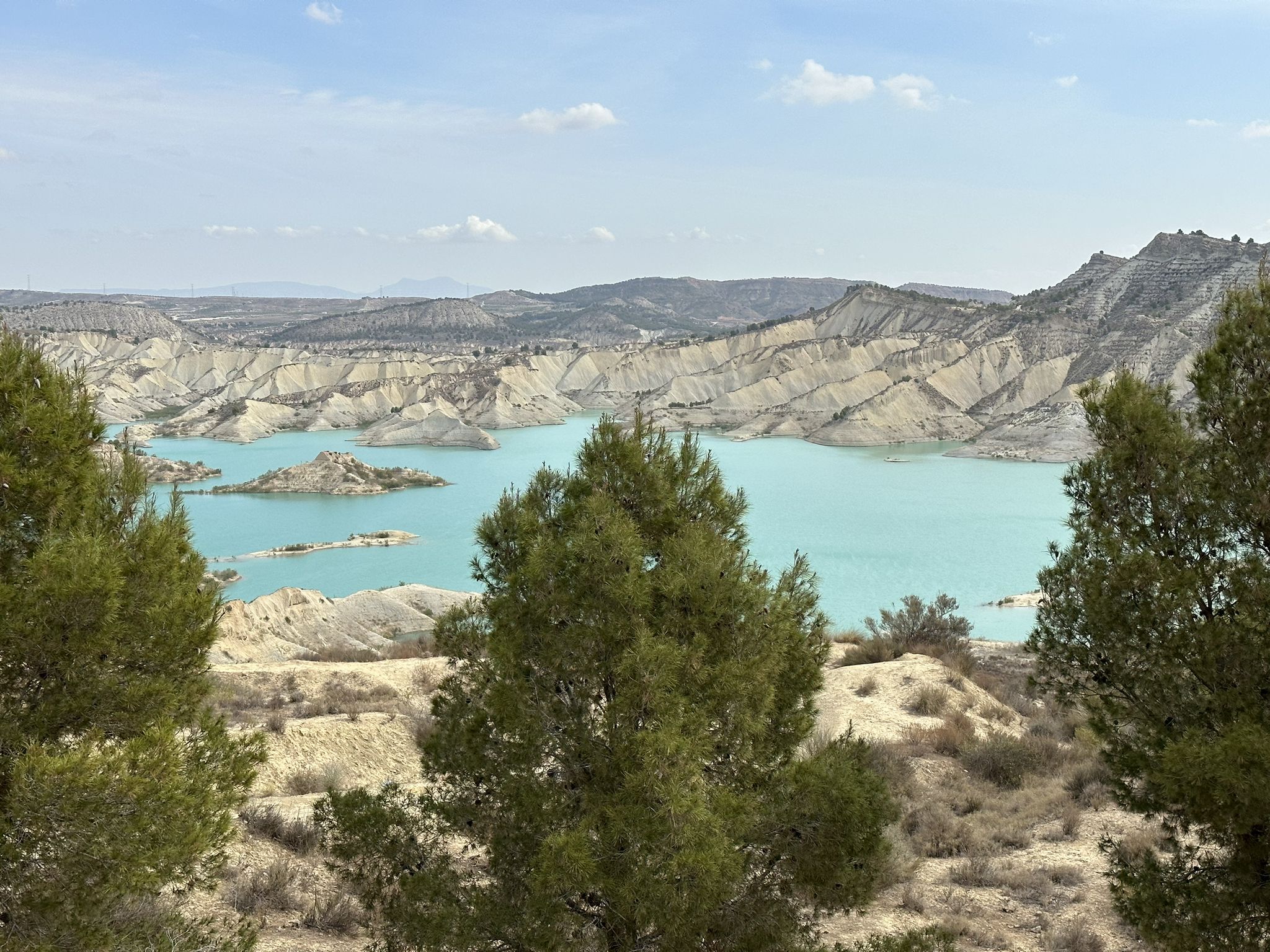
If you select this highlight for a bike route, Komoot will take you down a road with no access allowed, However, there is a track to the right that gives a good view of the reservoir. For the bike route there is another Highlight that takes you down a proper signposted road to the Dam. Both are extremely quiet and worth a look.
0
0

The first waterwheel in this place dates back to the 15th century and was made of wood. The current waterwheel, made of metal, was installed in 1956 and is 11 metres in diameter. The waterwheel is used to raise water from the Acequia Mayor Alquibla to the Acequia del Turbedal, allowing the irrigation of the lands in the upper area of Alcantarilla. The museum, opened in 1967, shows the ethnology of the Huerta de Murcia and is focused on various axes such as agriculture, anthropology and water culture.
4
0
If you decide to explore this route, you will be surrounded by nature and breathtaking views. Enjoy your hike! 🏞️🚶♂️🥾🚵🌞
4
0

In the north mostly new asphalt (but not everywhere), very wavy. Relatively little traffic despite the tourists. Very nice view of the great landscape. In the north of this section it is worth planning to go west, as it goes directly through the Sierra Espuña :)
1
0
Very good asphalt, almost no traffic and a great landscape. Great route that you should plan for. It's just a little wavy and the waste of putting up all the signs twice instead of continuing to use the old poles is annoying. In the north you can continue west to go around the Espuna, in the south of this section you can go further west to go through the Espuña over the mountain or further south to go around the Espuna via Alhama de Murcia.
0
0

This route is fantastic to do by bicycle.
0
1
Frequently Asked Questions
How many road cycling routes are available around Pliego?
There are over 50 road cycling routes available around Pliego, offering a wide range of options for different skill levels. The komoot community has explored these routes over 700 times.
What kind of terrain can I expect on road cycling routes near Pliego?
Road cycling routes around Pliego offer varied terrain, traversing the foothills of the Sierra Espuña and Sierra de la Pila mountain ranges. You can expect a mix of agricultural areas, reservoirs, and historical sites, with routes navigating through valleys and ascending into higher elevations.
Are there road cycling routes suitable for beginners in Pliego?
Yes, Pliego offers some easy road cycling routes suitable for beginners. While the majority are moderate to difficult, there is at least one easy route to get started. These routes typically feature less elevation gain and shorter distances.
What are some challenging road cycling routes for experienced riders in Pliego?
For experienced riders seeking a challenge, Pliego has 16 difficult routes. One such route is the View of the Sierra de la Pila – El Cajal Track loop from Mula, which covers over 100 km and features significant elevation gain, offering demanding climbs and rewarding descents.
Are there any circular road cycling routes in Pliego?
Many of the road cycling routes around Pliego are designed as loops, allowing you to start and finish at the same point. For example, the Avifauna Motu del Río – Alcantarilla Water Wheel loop from Mula is a moderate circular route that takes you through diverse landscapes.
What scenic viewpoints can I find on road cycling routes around Pliego?
Many routes offer stunning views, particularly of the Sierra Espuña and Sierra de la Pila mountain ranges. You might also encounter scenic spots like the Morrón de Alhama Summit or the Morra de las Moscas, providing panoramic vistas of the region.
Are there historical landmarks to see while road cycling near Pliego?
Yes, the region around Pliego is rich in history. Routes often pass by historical sites such as the Old Baños de Mula Railway Station or areas around Castillo de Don Fabio. You can also find structures like the Mula River Viaduct.
What is the best time of year for road cycling in Pliego?
The best time for road cycling in Pliego is typically during the spring (March to May) and autumn (September to November) months. During these periods, the weather is generally mild and pleasant, avoiding the intense heat of summer and the cooler, sometimes wetter, conditions of winter.
Where can I find parking for road cycling routes in Pliego?
While specific parking areas are not detailed for each route, Pliego and nearby towns like Mula, which serve as common starting points, generally offer public parking options. It's advisable to check local parking availability in the town centers before your ride.
What do other road cyclists say about the routes in Pliego?
The road cycling routes in Pliego are highly rated by the komoot community, with an average score of 4.9 out of 5 stars from 9 reviews. Cyclists often praise the varied terrain, scenic views, and the network's ability to cater to different ability levels.
Are there road cycling routes that pass by cafes or places to refuel?
Many routes in Pliego pass through or near small towns and agricultural areas where you can find local cafes or shops to refuel. Planning your route to include stops in villages along the way is a good strategy to ensure you have access to refreshments.
Are there less crowded road cycling options around Pliego?
To find less crowded routes, consider exploring some of the moderate or difficult trails that venture further into the natural landscapes away from main roads. Riding during off-peak hours or weekdays can also help you enjoy a more solitary experience on any route.
Most popular attractions around Pliego

Get inspired with the komoot mobile app


Explore more
Browse the best Road cycling routes in other regions.
