The best walks and hikes around Aldeanueva De Guadalajara
4.7
(67)
381
hikers
24
hikes
Hiking around Aldeanueva De Guadalajara offers diverse natural landscapes, situated at an altitude of 948 meters. The region is characterized by the River Matayeguas Valley, which has carved sandy valleys, and a varied topography including high plains with hills, productive river plains, and mountain slopes. Native forests of Portuguese oak and kermes oak, alongside reforested pine areas, provide varied environments for exploration. Pico del Águila offers panoramic views of the surrounding area.
Best hiking trails around Aldeanueva De Guadalajara
- The…
Last updated: July 11, 2026
4.4
(5)
83
hikers
10.1km
02:54
240m
240m
Hike the moderate Peña Hueva Ascent Trail, a 6.3-mile route offering panoramic views of La Mancha and Sierra de Madrid from its flat summit.
4.0
(4)
21
hikers
9.80km
02:53
270m
270m
Hike the Pico del Águila circular route, a moderate 6.1-mile trail offering panoramic views of Guadalajara and beyond.

Sign up for free
5.0
(1)
26
hikers
5.76km
01:47
210m
210m
Easy hike. Great for any fitness level. Easily-accessible paths. Suitable for all skill levels.
11
hikers
10.6km
03:08
290m
290m
Moderate hike. Good fitness required. Easily-accessible paths. Suitable for all skill levels.
5.0
(1)
7
hikers
13.9km
04:28
560m
560m
Moderate hike. Good fitness required. Easily-accessible paths. Suitable for all skill levels.
Get access to more routes and recommendations from other explorers.
Sign up for free
Already have an account?
Our route recommendations are based on thousands of hikes, rides, and runs completed by other people on komoot.
Start today with a free account
Your next adventure awaits.
Login or Signup

Tips from the Community

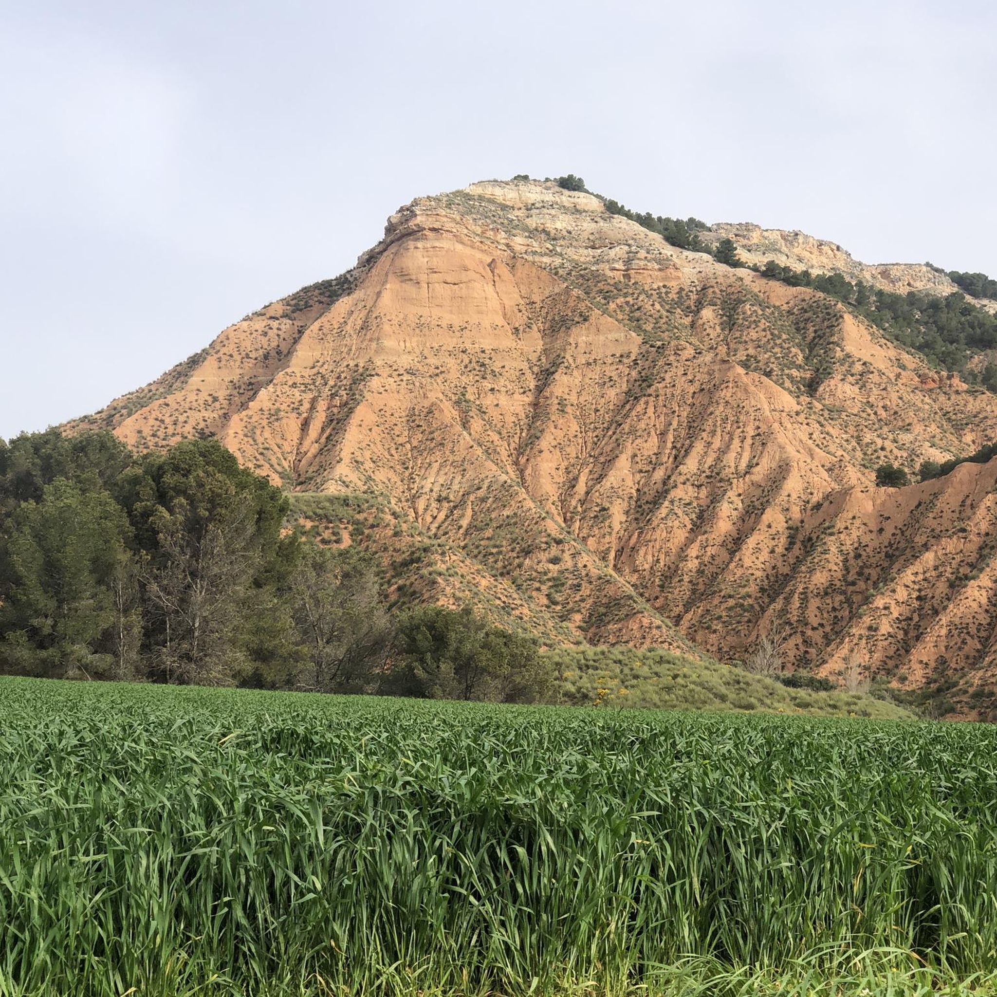
If you go in summer or when it's hot, go up the shady side, it's all covered with pine trees.
0
1

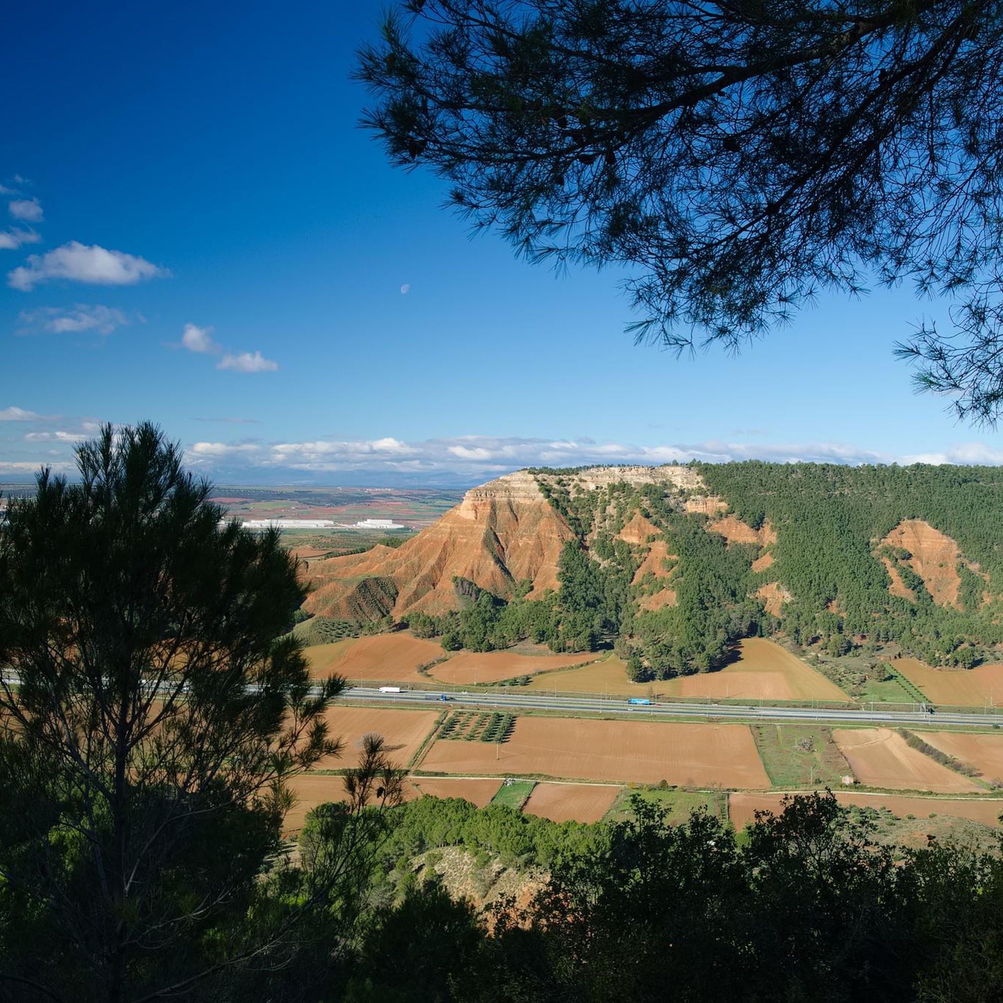
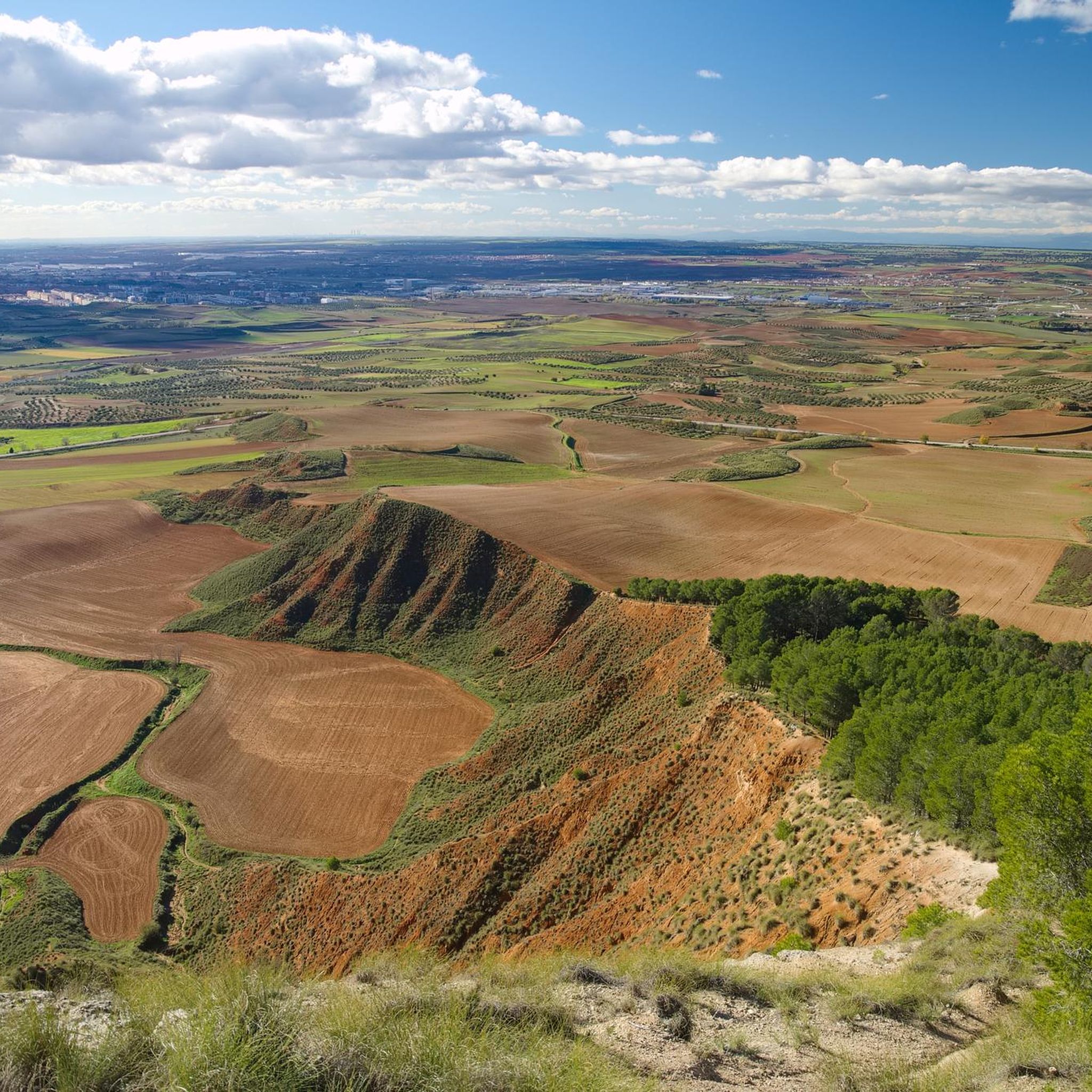
An extraordinary viewpoint of Guadalajara and in the distance of Madrid. Also from the neighboring Peña Hueva, Iriepal and the Torija Valley with the A2 Highway
2
0
Whenever you arrive at this Mirador or Balcony of La Peña Hueva, it is convenient to sit on one of its rocks, without danger of falling into the abyss, and admire the nearby landscape, Iriepal, Guadalajara, Pico del Águila, etc., and in the distance, Madrid, Long Rope, etc. Restful rest admiring the beauty of the landscape and the people who walk there.
1
0

The Pico del Águila ("Eagle's Peak") is an approximately 970 m high mountain on the northern edge of the La Alcarria plateau in the Spanish province of Guadalajara. The mountain is about 20 km north-east of the provincial capital of Guadalajara, which is about 700 m high. The mountain breaks off to the north through a striking, approx. 200 m high steep slope that can be seen from afar. To the east and west it slopes more gently and wooded into the valley of Valdenoches, which has been a suburb of Guadalajara since 1969. [wp:de]
1
0

Unique viewpoint in Peña Hueva, a recreational space for walks and public use for many citizens of the city of Guadalajara.
2
0
The viewpoint located in Peña Hueva is a recreational space for walks and public use for many citizens of the city of Guadalajara. It offers very beautiful views of Alcarria.
2
0
Frequently Asked Questions
How many hiking trails are available around Aldeanueva De Guadalajara?
There are over 25 hiking trails around Aldeanueva De Guadalajara, offering a variety of experiences. These include 11 easy routes, 13 moderate trails, and 3 more challenging options, ensuring something for every skill level.
What do other hikers say about the trails in Aldeanueva De Guadalajara?
The hiking trails in Aldeanueva De Guadalajara are highly rated by the komoot community, with an average score of 4.7 stars from over 70 reviews. Hikers often praise the diverse landscapes, from river valleys to oak forests, and the rewarding viewpoints like Pico del Águila.
What kind of terrain can I expect on hikes near Aldeanueva De Guadalajara?
The terrain around Aldeanueva De Guadalajara is quite varied. You'll find sandy river plains along the Matayeguas River, high plains with rolling hills, and mountain slopes. Many routes pass through regenerated native forests of Portuguese and kermes oak, offering shaded paths and diverse natural beauty.
When is the best time of year to go hiking in Aldeanueva De Guadalajara?
Aldeanueva De Guadalajara offers unique hiking experiences throughout the year. Spring and autumn provide pleasant temperatures and vibrant scenery. During winter, the landscape can be transformed by snowfall, offering picturesque white vistas for those seeking a different kind of outdoor adventure.
Are there easy hiking trails suitable for beginners in Aldeanueva De Guadalajara?
Yes, there are several easy routes perfect for beginners or those looking for a relaxed stroll. An excellent option is the Viewpoint of Peña Hueva loop from Restaurante Las Galeras, which is 3.6 miles (5.8 km) long and takes about 1 hour 46 minutes to complete, leading through local landscapes to a scenic viewpoint.
Can I find challenging hikes in the Aldeanueva De Guadalajara area?
While most trails are easy to moderate, some routes offer more challenge. The region's varied topography, including mountain slopes and ascents to viewpoints like Pico del Águila, provides opportunities for more strenuous hikes. There are 3 difficult routes available for experienced hikers.
Are there any circular hiking routes around Aldeanueva De Guadalajara?
Yes, many routes in the area are circular, allowing you to start and end at the same point. For example, the Pico del Águila loop from Restaurante Las Galeras is a moderate 9.4 km (5.8 miles) trail that takes you to the extraordinary viewpoint of Pico del Águila and back.
Are the hiking trails around Aldeanueva De Guadalajara suitable for families with children?
Many of the 11 easy routes are suitable for families. The diverse landscapes, including riverbanks and forests, offer engaging environments for children to explore. Look for shorter, flatter loops for the best family experience.
Can I bring my dog on the hiking trails in Aldeanueva De Guadalajara?
Generally, dogs are welcome on hiking trails in the Aldeanueva De Guadalajara area. It's always recommended to keep your dog on a leash, especially in areas with wildlife or near livestock, and to follow local regulations regarding pet waste.
What natural features or viewpoints can I expect to see on the trails?
You can expect to see the scenic River Matayeguas Valley, regenerated Portuguese and kermes oak forests, and reforested pine areas. A prominent natural feature is Pico del Águila, which offers extraordinary panoramic views of Guadalajara and, on clear days, even Madrid in the distance.
Are there any historical landmarks or attractions near the hiking routes?
While hiking, you can explore charming villages and historical sites. Nearby attractions include the impressive Palace of the Infantado and the Co-Cathedral of Santa María de la Fuente la Mayor, both in Guadalajara. The village of Centenera is also a notable settlement in the vicinity.
Where can I park when hiking in Aldeanueva De Guadalajara?
Aldeanueva De Guadalajara is a small village, and parking is generally available within the village itself or at designated starting points for popular trails. For routes like the Viewpoint of Peña Hueva loop, you might find parking near local establishments like Restaurante Las Galeras.
Is public transport available to reach the hiking trailheads?
Aldeanueva De Guadalajara is located just 10 km from the city of Guadalajara, which is well-connected by public transport. While direct public transport to every trailhead might be limited, local bus services from Guadalajara to Aldeanueva De Guadalajara are available, making it accessible for day trips. It's advisable to check local bus schedules in advance.
Are there places to eat or stay near the hiking trails in Aldeanueva De Guadalajara?
Aldeanueva De Guadalajara, being a 'beautiful village,' offers some local amenities. You can find places to eat, such as Restaurante Las Galeras, which is a common starting point for several hikes. For accommodation, options may be available within the village or in the nearby city of Guadalajara.
Most popular routes around Aldeanueva De Guadalajara
Most popular attractions around Aldeanueva De Guadalajara

Get inspired with the komoot mobile app


Explore more
Browse the best Hikes in other regions.
