The best road cycling routes around El Robledo
45
riders
8
rides
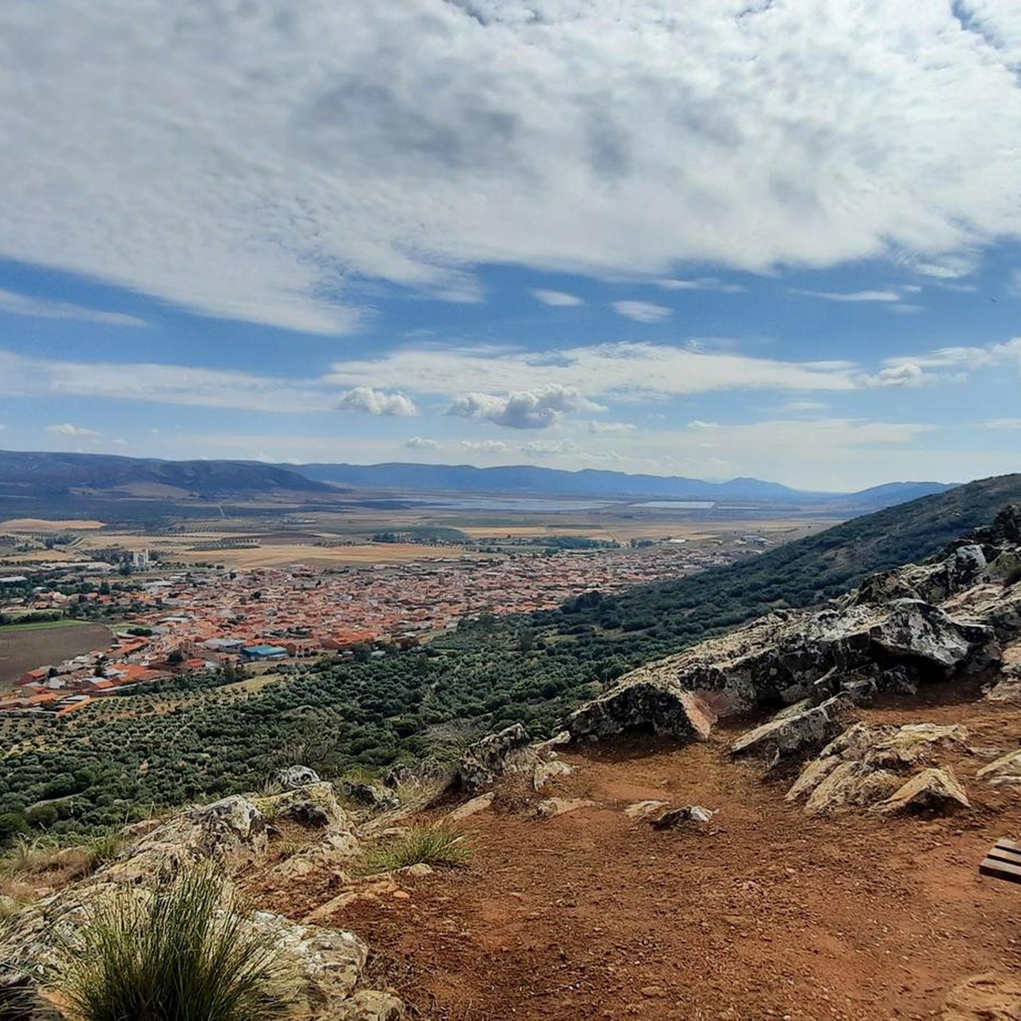
Road cycling routes around El Robledo, located in Ciudad Real, Spain, traverse a landscape characterized by green hills, dense forests, and river plains. The region is situated on the Raña de Matagrande plain, where the Alcobilla and Bullaque rivers converge, offering varied terrain for cyclists. Elevations reach up to 646 meters above sea level, with the majestic Navalaencina mountain range visible to the southwest. The area borders the Cabañeros National Park, known for its Mediterranean forest, providing a diverse backdrop…
Last updated: July 1, 2026
9
riders
Hard road ride. Very good fitness required. Mostly well-paved surfaces and easy to ride.
9
riders
122km
05:04
850m
850m
This difficult 75.5-mile road cycling route circles Embalse Torre de Abraham through Parque Nacional de Cabañeros, offering rich wildlife.

Sign up for free
9
riders
Moderate road ride. Good fitness required. Mostly well-paved surfaces and easy to ride.
5
riders
Hard road ride. Very good fitness required. Mostly well-paved surfaces and easy to ride.
3
riders
111km
05:00
890m
890m
This moderate 68.8-mile (110.6 km) road cycling loop through Cabañeros National Park offers beautiful scenery and 2904 feet (885 metres) of
Get access to more routes and recommendations from other explorers.
Sign up for free
Already have an account?
Our route recommendations are based on thousands of hikes, rides, and runs completed by other people on komoot.
Start today with a free account
Your next adventure awaits.
Login or Signup
Popular around El Robledo

Tips from the Community

It is considered a natural and tourist gem in Castilla-La Mancha. It stands out for its spectacular landscape, tranquility, and biodiversity. Ideal for photography, hiking, fishing, and water sports. Visitors appreciate the accessible riverside path, the panoramic viewpoint, and its proximity to the Torre de Abraham Visitor Center, which offers information about the flora, fauna, and history of the park.
7
0
The Casa Palillos Visitor Center is located in Cabañeros National Park, in Alcoba (Ciudad Real). What will you find? Permanent exhibition on the park's fauna, flora, and culture. Audiovisual room with projections about Cabañeros. Botanical and ethnographic viewpoints and trails. Picnic area and parking. Accessible for people with reduced mobility.
24
0

Good reservoir, many fishing ducks with entrances for boats, canoes...
3
0
The Valbuena Bridge is a historic stone bridge located near Corral de Calatrava, in the province of Ciudad Real, Spain. This bridge, along with the nearby Geldres and Valbuena mills, dates back to Roman times. The area is rich in history, with important Roman artifacts found nearby, such as the Carcalia tombstone and a Roman altar, both displayed in the Provincial Museum of Ciudad Real.
16
0

One of my favorite roads, but bring enough food and water for 30km completely alone.
1
0
El Robledo is located in a privileged natural environment in the valley where the Alcobilla river meets the Bullaque, in the Matagrande raña and between the Toledana and Piedralá rivers, in the vicinity of the Cabañeros National Park. The Cabañeros National Park is one of the most valuable protected corners of the Montes de Toledo, a refuge for large birds of prey, black storks, eagles, vultures and many other endangered species. Its landscape is made up of extensive pastures or meadows with rich seasonal pastures, the mountains and massifs provide shelter to a wide variety of birds and mammals. Its magnificent natural environment invites you to carry out all types of activities related to nature.
15
0

Visitor center where they explain the Cabañeros National Park and all its species of fauna and flora while being preserved. From the road you can see the center and if you want, enter it!
1
0
In this center it is possible to enjoy a complete exhibition on the natural and cultural values of the park, which includes an audiovisual area with projections about Cabañeros, and a quality recording that shows an Iberian imperial eagle nest in the Park.
25
0
Frequently Asked Questions
What kind of terrain can I expect on road cycling routes around El Robledo?
The road cycling routes around El Robledo, located in Ciudad Real, Spain, feature diverse terrain. You'll encounter lush green hills, dense forests, and river plains, particularly around the Bullaque River. Many routes are on paved surfaces, making them ideal for road cycling, with elevations reaching up to 646 meters above sea level and views of the majestic Navalaencina mountain range.
Are there road cycling routes suitable for beginners or those looking for an easier ride?
Yes, El Robledo offers routes for various fitness levels. While many routes are moderate to difficult, there is at least one easy road cycling route available. For a less strenuous option, consider routes that avoid significant elevation gains, focusing on the flatter river plains.
Can I find challenging road cycling routes with significant elevation in El Robledo?
Absolutely. El Robledo is known for its challenging road cycling routes. For instance, the route By the Pozuelos de Calatrava and the Tabla de la Yedra — circular by Piedrabuena features the highest elevation gain in the area, offering a demanding ride through varied landscapes.
Are there any circular road cycling routes around El Robledo?
Yes, many of the road cycling routes in the El Robledo area are circular, allowing you to start and end in the same location. Examples include the extensive From Horcajo de los Montes through the Cabañeros National Park — circular route around the Torre de Abraham Reservoir and the moderate Circular by Piedrabuena and the Tabla de la Yedra (Río Bullaque) — from Porzuna.
What natural attractions or landmarks can I see while road cycling in El Robledo?
Road cycling routes often pass through or near the Cabañeros National Park, known for its well-preserved Mediterranean forest. You can also explore areas around the Bullaque River and the Torre de Abraham Reservoir. Notable highlights in the vicinity include the Colada de Navalrincón Trail and the charming settlement of Alcoba de los Montes.
How long do road cycling routes typically take to complete in this region?
The duration of road cycling routes varies significantly based on distance and difficulty. For example, a longer, difficult route like From Horcajo de los Montes through the Cabañeros National Park — circular route around the Torre de Abraham Reservoir, which is over 120 km, can take around 5 hours. Shorter, moderate routes, such as the Circular by Piedrabuena and the Tabla de la Yedra (Río Bullaque) — from Porzuna (52.8 km), can be completed in about 2 hours and 12 minutes.
Is El Robledo a good destination for road cyclists who enjoy scenic views?
Yes, El Robledo offers beautiful scenery for road cyclists. The region is characterized by green hills, dense forests, and river plains, with routes often providing panoramic views of the surrounding natural landscape, including the Navalaencina mountain range and areas within the Cabañeros National Park.
What is the best time of year for road cycling in El Robledo?
While specific seasonal data isn't provided, the region's climate suggests that spring and autumn would likely offer the most pleasant conditions for road cycling, with milder temperatures and vibrant natural scenery. Summers can be hot, and winters might be cooler, so checking local weather forecasts is always recommended.
Are there any cultural or historical points of interest near the cycling routes?
Beyond the natural beauty, you can find cultural points of interest. For example, the Parish Church of Porzuna is a notable religious building in a nearby settlement. Exploring the villages like El Robledo itself or Alcoba de los Montes can offer a glimpse into local life and architecture.
Are there options for parking or public transport access to the road cycling routes?
While specific parking or public transport details for each route are not provided, El Robledo and surrounding towns like Porzuna and Piedrabuena typically offer parking facilities. For public transport, regional bus services might connect larger towns, but direct access to trailheads often requires personal vehicle transport.
What other outdoor activities are available in the El Robledo area besides road cycling?
The El Robledo region is a hub for various outdoor activities. Beyond road cycling, you can enjoy hiking, horse riding, paintball, canyoning, and climbing. The Sierra de Alcaraz Natural Park, with its trails and waterfalls, is a prime location for exploring the area's biodiversity.
Most popular routes around El Robledo
Most popular attractions around El Robledo

Get inspired with the komoot mobile app


Explore more
Browse the best Road cycling routes in other regions.
