The best road cycling routes around La Bodera
3.0
(2)
161
riders
7
rides
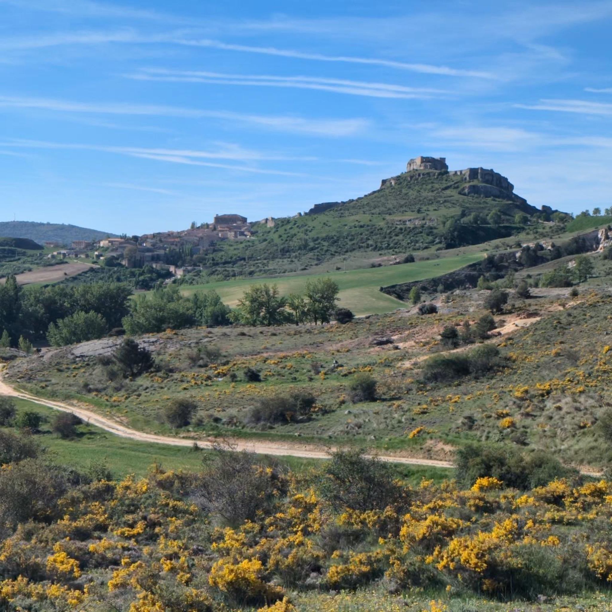
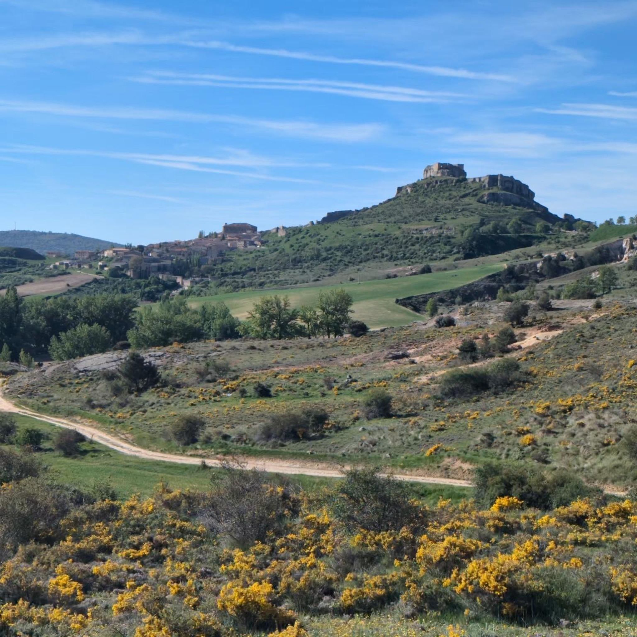
Road cycling around La Bodera, a municipality in Guadalajara, Spain, offers diverse routes through a distinctive landscape. The region is characterized by a rugged natural environment, featuring the imposing Peña de la Bodera, the Cañamares River, and the valleys of Lanzarero and Palomar. Cyclists encounter varied terrain, from well-paved roads to some unpaved segments on longer routes, with robust oaks and holm oaks defining the vegetation. The area's "sterile and broken" geological landscape provides a dramatic backdrop for road cycling.
Best road cycling routes around La Bodera
- The most popular road cycling route is From Atienza to Marquezado de Berlanga — circular via the Castillo de Atienza, a 49.7 miles (80.0 km) trail that takes 3 hours 46 minutes to complete. This route offers over 1,000 meters of elevation gain and incorporates historical sights like the Castle of Atienza.
- Another top favourite among local road cyclists is Sierra de Pela y Sierra de Bulejo - Archaeological Site of Tiermes — circular from Atienza, a difficult 62.2 miles (100.1 km) path. This challenging route features over 1,300 meters of elevation gain, traversing the Sierra de Pela and Sierra de Bulejo.
- Local road cyclists also love the View of Atienza Castle loop from Pálmaces de Jadraque, a 35.9 miles (57.8 km) trail leading through a rugged natural environment with views of Atienza Castle, often completed in about 2 hours 32 minutes.
- Road cycling around La Bodera is defined by dramatic natural features like the Peña de la Bodera, the Cañamares River, and the historical Castle of Atienza. The network offers options for varying fitness levels, from moderate rides to more challenging routes exceeding 100 km.
- The routes in La Bodera are highly rated by the komoot community with an average score of 5.0 stars from 1 review. More than 150 road cyclists have used komoot to explore La Bodera's varied terrain.
Last updated: July 11, 2026
6
riders
80.0km
03:47
1,010m
1,010m
Hard road ride. Very good fitness required. Some segments of this route may be unpaved and difficult to ride.
6
riders
Hard road ride. Very good fitness required. Some segments of this route may be unpaved and difficult to ride.

Sign up for free
5.0
(1)
54
riders
Moderate road ride. Good fitness required. Some segments of this route may be unpaved and difficult to ride.
22
riders
117km
05:29
1,480m
1,480m
Hard road ride. Very good fitness required. Some segments of this route may be unpaved and difficult to ride.
16
riders
65.2km
02:58
740m
740m
Moderate road ride. Good fitness required. Mostly well-paved surfaces and easy to ride.
Get access to more routes and recommendations from other explorers.
Sign up for free
Already have an account?
Our route recommendations are based on thousands of hikes, rides, and runs completed by other people on komoot.
Start today with a free account
Your next adventure awaits.
Login or Signup


Tips from the Community

What to see 🧭 “El País de la Plata” Interpretation Center Interactive museum about local mining, open Saturdays and Sundays from 12:00 to 14:00. General admission approx. €2, free for residents and children under 14. ⛪ Santa Cecilia Parish Church 19th-century building constructed during the mining boom, with a single nave and a simple transept. 🏗️ Mining and Industrial Heritage More than 200 shafts/mines, such as Santa Catalina, Santa Teresa, Mala Noche, Fuerza, etc. Remains of ore-washing facilities like San Carlos, ruined industrial sites, and power plants.
4
0
A village in the Sierra Norte of Guadalajara, at an altitude of approximately 1,084 meters. Its origins are medieval, possibly predating the Bronze Age. The name derives from the Arabic Hisn al-Ancina (“castle of the holm oak”). In 1844, the discovery of silver triggered a “silver rush,” transforming Hiendelaencina into a major 19th-century mining district, with up to 200 mines and a population that reached 5,000. A parish church dedicated to Saint Cecilia was built between 1848 and 1851, financed with funds from the mining town.
4
0

At the bar, very nice, they have an affordable daily menu
0
0

Nice area for hiking and mountain biking trails
0
0
Ideal places for mountain biking and hiking routes
0
0
Border between the two Castillas Soria and Guadalajara, and some beautiful views
0
0
Fountain, shops and at least a couple of bars make Romnillos a good stop on the Camino del Cid
0
0
Frequently Asked Questions
What types of road cycling routes can I find around La Bodera?
La Bodera offers a variety of road cycling routes, ranging from moderate rides to challenging routes exceeding 100 km with over 1,000 meters of elevation gain. The terrain is diverse, featuring well-paved roads and some unpaved segments on longer routes, all set against a rugged natural environment with robust oaks and holm oaks.
Are there any circular road cycling routes in the La Bodera area?
Yes, many routes around La Bodera are circular. For example, you can explore From Atienza to Marquezado de Berlanga — circular via the Castillo de Atienza, which is 80 km long and includes historical sights. Another option is the challenging Sierra de Pela y Sierra de Bulejo - Archaeological Site of Tiermes — circular from Atienza, a 100 km path with significant elevation.
What are the difficulty levels of road cycling routes near La Bodera?
The routes around La Bodera cater to various fitness levels. You'll find moderate routes, such as the View of Atienza Castle loop from Pálmaces de Jadraque (57.8 km), and more difficult options like the Castle of Atienza – Sigüenza Castle loop from Cerro Grande, which is over 116 km with nearly 1,500 meters of elevation gain.
What natural features or landmarks can I see while road cycling in La Bodera?
Road cycling routes in La Bodera offer views of dramatic natural features like the imposing Peña de la Bodera and the Cañamares River. You can also pass by historical landmarks such as the Castle of Atienza and the Pálmaces Reservoir. The region's landscape is characterized by robust oaks, kermes oaks, and holm oaks.
Are there any routes that pass by reservoirs or lakes?
Yes, some routes offer scenic views of local reservoirs. The Views of the Pálmaces Reservoir – Huérmeces del Cerro loop from Pálmaces de Jadraque is a moderate 64 km route that provides beautiful vistas of the Pálmaces Reservoir. You might also encounter the Cañamares River Reservoir and the El Atance Reservoir in the wider area.
What is the best time of year for road cycling in La Bodera?
The region's aromatic low-lying vegetation is especially vibrant in spring, making it a picturesque time for cycling. While specific seasonal recommendations aren't provided, spring and autumn generally offer pleasant temperatures for road cycling in this part of Spain, avoiding the intense heat of summer.
What do other road cyclists say about the routes in La Bodera?
The road cycling routes in La Bodera are highly rated by the komoot community, with an average score of 5.0 stars. Over 150 road cyclists have used komoot to explore the varied terrain, often praising the dramatic natural features and the historical sights along the way.
Are there any historical sites or villages to explore along the cycling routes?
Absolutely. Many routes incorporate historical elements. The From Atienza to Marquezado de Berlanga — circular via the Castillo de Atienza route, for instance, includes the Castle of Atienza. The village of La Bodera itself showcases traditional slate architecture and has a rich silver mining heritage, with traces like the 'Camino de la Mina' still visible.
Are the road cycling routes around La Bodera suitable for families or beginners?
While there are moderate routes available, such as the View of Atienza Castle loop from Pálmaces de Jadraque (57.8 km with 565m elevation), many routes involve significant distances and elevation gains, making them more suitable for cyclists with some experience. The terrain can also include unpaved segments on longer routes, which might be challenging for beginners or young families.
Where can I find parking or starting points for road cycling routes in La Bodera?
Many routes are described as starting from nearby towns like Atienza or Pálmaces de Jadraque, which are common access points for the region's cycling network. These villages typically offer parking facilities. For example, the route From Atienza to Marquezado de Berlanga starts from Atienza.
What is the average length and elevation gain for road cycling routes in this area?
Routes vary significantly. Moderate rides can be around 57.8 km with approximately 570m of elevation gain, while more challenging routes can exceed 100 km with over 1,000m of elevation. The longest route mentioned, Castle of Atienza – Sigüenza Castle loop from Cerro Grande, is 116.7 km with nearly 1,480m of climbing.
Most popular routes around La Bodera
Most popular attractions around La Bodera

Get inspired with the komoot mobile app


Explore more
Browse the best Road cycling routes in other regions.
