The best walks and hikes around Rickelsbüller Koog
4.4
(404)
1,637
hikers
81
hikes
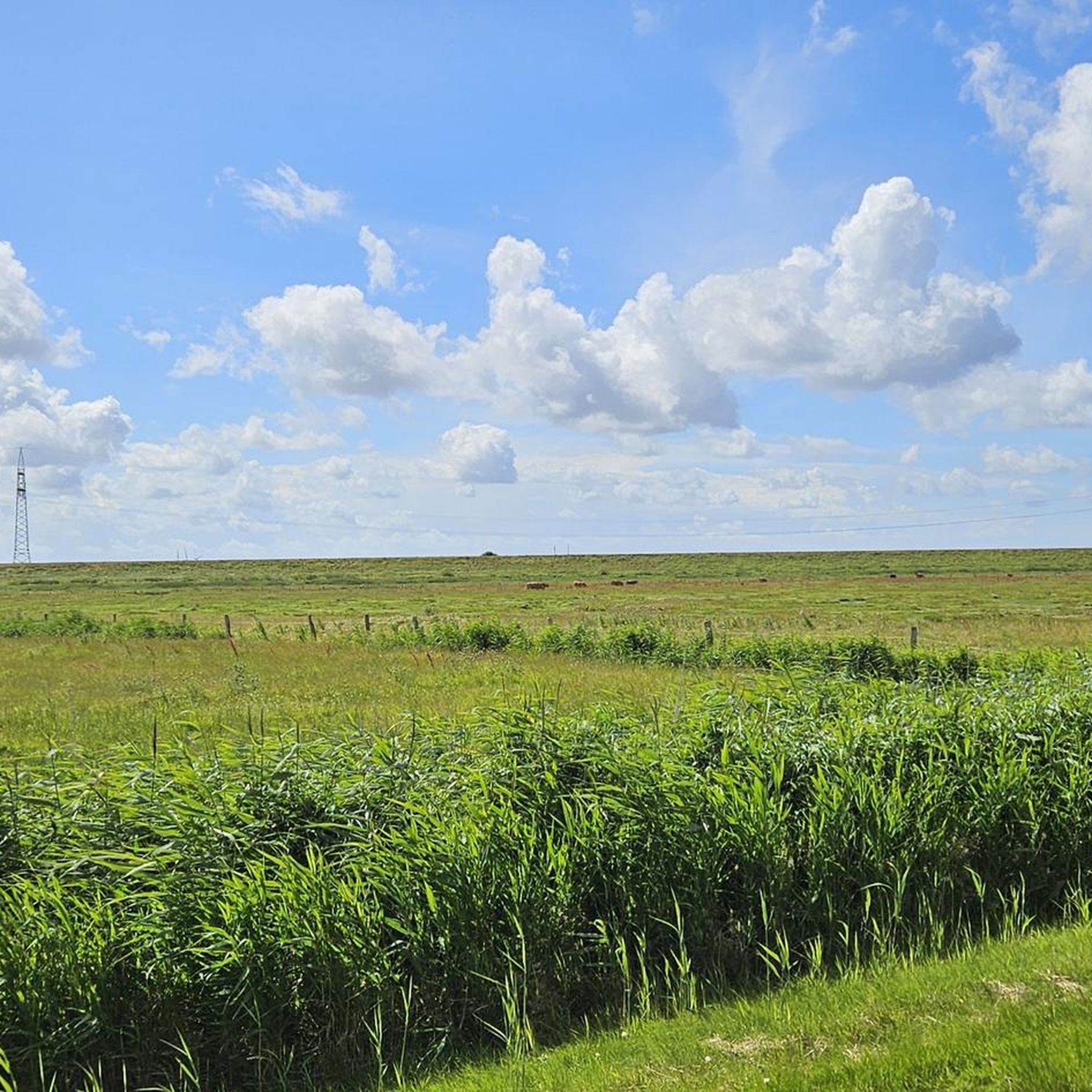
Hiking around Rickelsbüller Koog offers trails through a flat, reclaimed landscape in North Frisia, characterized by its proximity to the North Sea and open marshlands. The region features minimal elevation changes, making it accessible for various activity levels. Trails often provide views of the surrounding polders and coastal areas.
Best hiking trails around Rickelsbüller Koog
- The most popular hiking route is Sylt Railway View loop from Café Zollhaus, a 9.3 miles (15.0 km) trail that takes 3 hours 45…
Last updated: June 24, 2026
4.3
(31)
74
hikers
15.0km
03:45
10m
10m
Moderate hike. Good fitness required. Easily-accessible paths. Suitable for all skill levels.
4.4
(28)
62
hikers
14.3km
03:36
10m
10m
Moderate hike. Good fitness required. Easily-accessible paths. Suitable for all skill levels.

Sign up for free
4.2
(13)
82
hikers
5.06km
01:16
0m
0m
Easy hike. Great for any fitness level. Easily-accessible paths. Suitable for all skill levels.
4.6
(5)
22
hikers
Moderate hike. Good fitness required. Easily-accessible paths. Suitable for all skill levels.
4.5
(2)
8
hikers
5.98km
01:30
0m
0m
Easy hike. Great for any fitness level. Easily-accessible paths. Suitable for all skill levels.
Get access to more routes and recommendations from other explorers.
Sign up for free
Already have an account?
Our route recommendations are based on thousands of hikes, rides, and runs completed by other people on komoot.
Start today with a free account
Your next adventure awaits.
Login or Signup
Tips from the Community

Access to the dam is strictly forbidden and will be prosecuted criminally as a serious interference with rail traffic. The route is partially monitored by thermal imaging cameras.
0
0

Northernmost point of mainland Germany It's not spectacular, but if you're cycling the North Sea Cycle Route, it's a must-see. Seeing this spot is a must 😉. There's a shelter in the parking lot for shelter in case of rain. There's also information about the dike construction and the Wadden Sea.
2
0

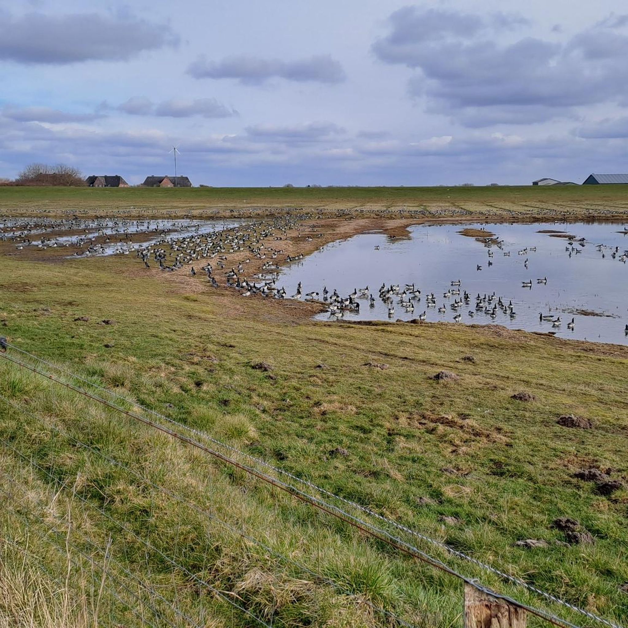
The Rickelsbüller Koog is a nature reserve covering approximately 534 hectares in the North Frisian district – the northwesternmost point of mainland Germany lies there, directly on the border dam near Rodenäs-Markhäuser. Since its embankment in 1981 and official designation as a protected area in 1982, it offers a mosaic of wet meadows, reed beds, and inland waters that developed from the former mudflats and salt marshes. For birdwatchers, the Koog is a true paradise: it is one of the most important resting and breeding areas along the Schleswig-Holstein North Sea coast. Species such as pink-footed goose, barnacle goose, redshank, black-tailed godwit, dunlin, knot, and many more rest and breed here in large numbers. Particularly impressive are the now regular sightings of white-tailed eagles – a testament to the ecological importance of the area. The landscape is crisscrossed by easily accessible dikes and observation points, including an observation hut. Ideal for nature lovers: binoculars are a must to experience the vibrant birdlife in action. The circular trail – for example, part of the "WWF Tour – Boundless Birdlife" – runs approximately 13 km through the area, offering extensive experiences of the open landscape and the opportunity to experience the northernmost point of the mainland. The Koog is accessible via Rodenäs: By bike or car, you can reach a free parking area directly next to the dike via the border road. From there, paths lead into the protected area – the clear landscape, the rich birdlife, and the peacefully flowing border make the destination a special natural location.
2
0
The northernmost point of the German mainland is located in the Rickelsbüller Koog, near Rodenäs in the district of Nordfriesland, Schleswig-Holstein. It marks Germany's outermost land border on the North Sea. Access is via the Norddeich–Sieltoft border crossing, which also serves as a reference point for this extreme point. This is not the absolute northernmost point in Germany—that position is occupied by the Ellenbogen peninsula on Sylt, a peninsula north of List that belongs to the island.
2
0

the landscape with the various flying animals
2
0
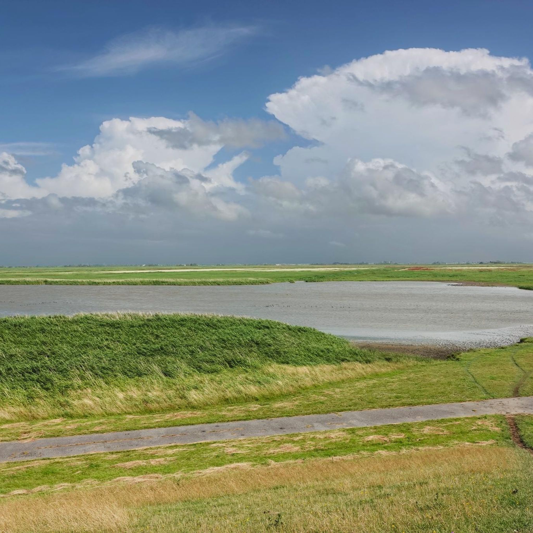
Looking over the dike, you can see the Hindenburg Dam to the left and, from time to time, a train passing by. Ahead, the east coast of Sylt with its lighthouse and cliffs. In front, the Wadden Sea is a magnificent sight.
3
0

Nice place on the dike for sunset fans.
0
0
This is a real bird paradise....
1
0
Frequently Asked Questions
How many hiking trails are available in Rickelsbüller Koog?
There are over 80 hiking routes in Rickelsbüller Koog, offering a variety of options for different preferences. The majority of these trails are rated as easy or moderate, making the area accessible for many hikers.
Are there easy hiking trails suitable for beginners in Rickelsbüller Koog?
Yes, Rickelsbüller Koog is known for its flat terrain, making it ideal for beginners and those seeking less strenuous walks. An excellent easy option is the Rickelsbüller Koog loop from Norddeich, which is about 5.1 km long and takes just over an hour to complete.
What are some longer hiking routes in Rickelsbüller Koog?
For those looking for a longer experience, the Sylt Railway View loop from Café Zollhaus covers 15.0 km, typically taking around 3 hours 45 minutes. Another substantial option is the Sylt Railway View loop from Rickelsbüller Koog, which is 14.3 km long.
Are there any circular walks in Rickelsbüller Koog?
Yes, many of the trails in Rickelsbüller Koog are designed as circular routes, allowing you to start and end at the same point. Examples include the Rickelsbüller Koog – View of the North Sea Marshes loop from Rickelsbüller Koog and the Hindenburgdamm – Continue loop from Nordhörn.
What kind of views can I expect on the hiking trails?
The trails in Rickelsbüller Koog offer expansive views across the flat, reclaimed polder landscape, often with glimpses of the North Sea and the unique marshland environment. You'll experience open vistas characteristic of North Frisia.
What interesting landmarks or attractions can I see along the trails?
Hikers can explore several points of interest. You might encounter the Northernmost point of the German mainland, or get a View of the Hindenburgdamm. The area also features the Wild Boar Fence at the German-Danish Border, which is part of the Nationalpark Vadehavet.
Is Rickelsbüller Koog suitable for family hikes?
Absolutely. Given the predominantly flat and easy terrain, Rickelsbüller Koog is very suitable for families with children. The shorter, easy routes provide a great opportunity for a pleasant outdoor experience without significant challenges.
Are dogs allowed on the hiking trails in Rickelsbüller Koog?
Yes, dogs are generally welcome on the hiking trails in Rickelsbüller Koog. However, as it is a natural area, especially near the Wadden Sea National Park, it's important to keep dogs on a leash to protect local wildlife and livestock. Always clean up after your pet.
What is the best time of year to hike in Rickelsbüller Koog?
The best time to hike in Rickelsbüller Koog is typically from spring through autumn (April to October). During these months, the weather is generally milder and more pleasant for outdoor activities. The open landscape means you should be prepared for wind, regardless of the season.
Are there facilities like cafes or restaurants near the hiking routes?
While Rickelsbüller Koog itself is a natural area, you can find cafes and restaurants in nearby towns such as Niebüll or Süderlügum. Some routes, like the Sylt Railway View loop from Café Zollhaus, even start or pass by establishments where you can get refreshments.
What do other hikers enjoy most about hiking in Rickelsbüller Koog?
The area is highly rated by the komoot community, with an average score of 4.4 stars from over 360 reviews. Reviewers often praise the peaceful, open landscape, the unique coastal views, and the accessibility of the flat trails, making it a great place for relaxed walks and nature observation.
Is public transport available to reach the hiking trails?
Public transport options to Rickelsbüller Koog are limited. It is generally recommended to travel by car to access the trailheads. However, you can check local bus schedules for connections to nearby towns like Niebüll, from which you might be able to reach some starting points by a longer walk or taxi.
Where can I find parking for the hiking trails?
Parking is typically available at various starting points for the trails, often in designated areas near small villages or specific landmarks. For example, routes starting from Norddeich or Rickelsbüller Koog usually have parking facilities nearby.
Most popular routes around Rickelsbüller Koog
Most popular attractions around Rickelsbüller Koog

Get inspired with the komoot mobile app


Explore more
Browse the best Hikes in other regions.
