The 9 Most Amazing Peaks around Sant Julià De Cerdanyola
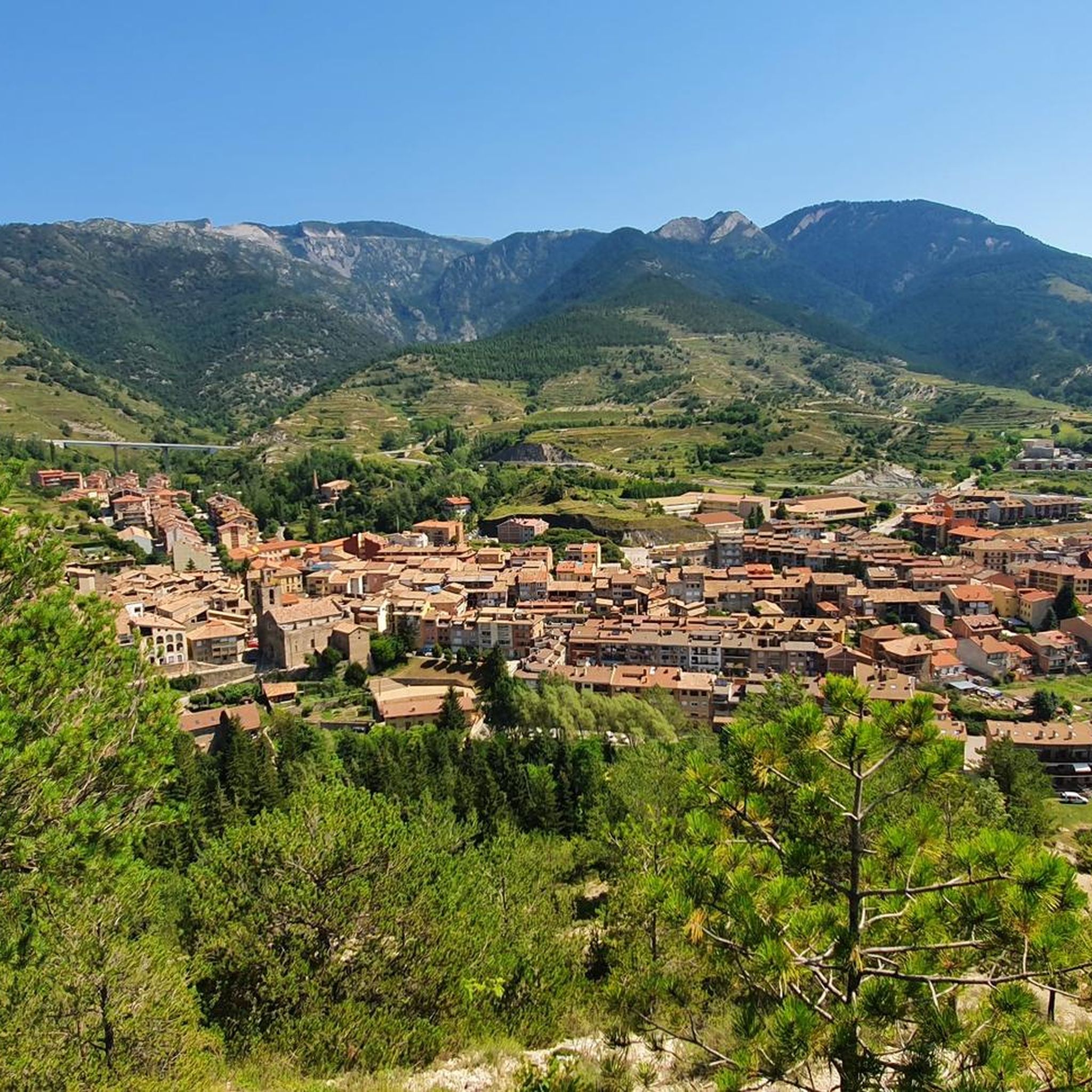
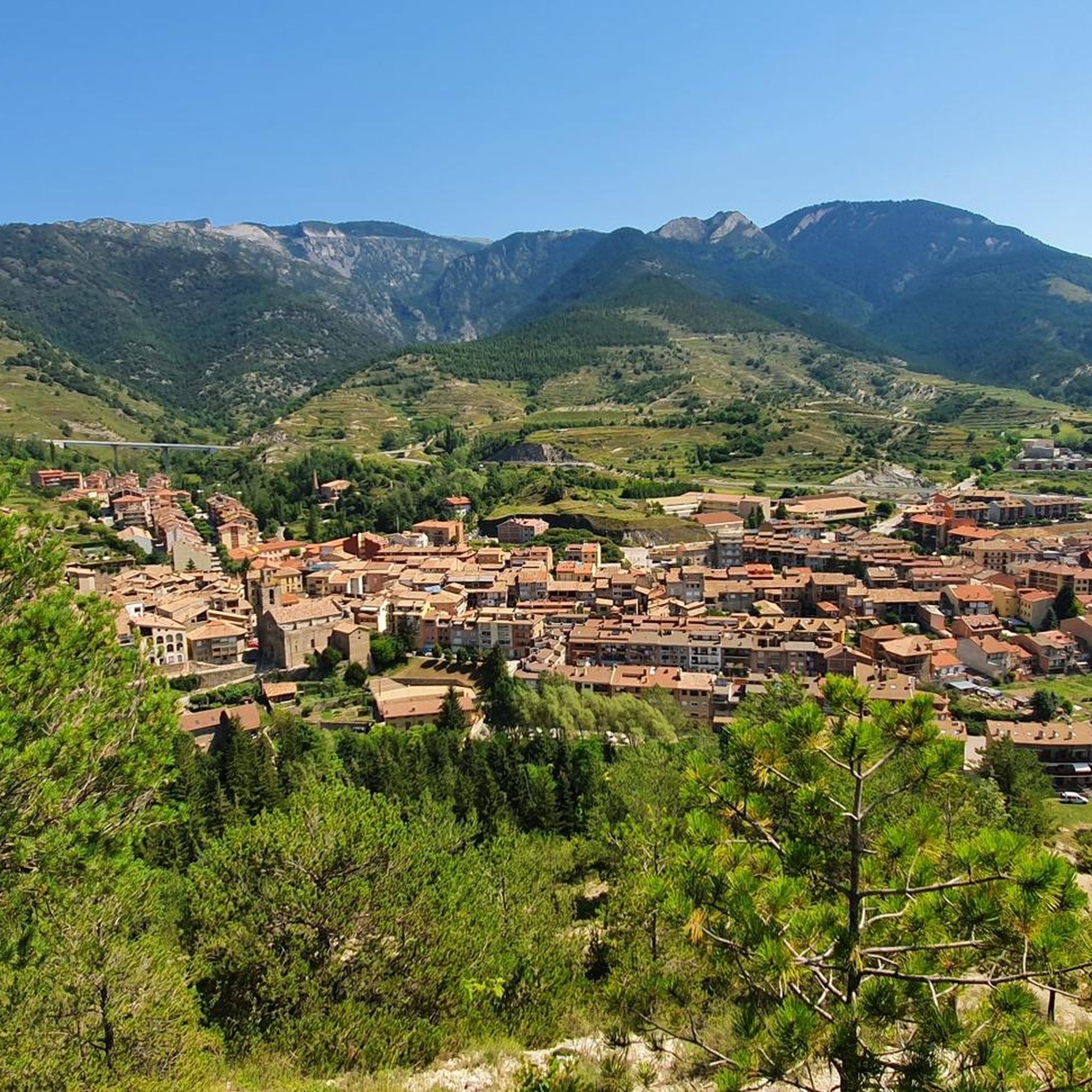
Best mountain peaks around Sant Julià De Cerdanyola are found within the Berguedà district, nestled in the western sector of the Catllaràs mountain range in Catalonia, Spain. This area provides diverse mountain experiences, characterized by forest paths and higher ridges. The region offers opportunities for hiking and exploring natural landscapes.
Best mountain peaks around Sant Julià De Cerdanyola
- The most popular mountain peaks is Penyes Altes del Moixeró, a summit reaching 2,276 meters in altitude. This peak offers extensive…
Last updated: October 10, 2026
Coll de Merolla
Highlight • Mountain Pass
Good food and a fantastic morning in the foothills of the Pyrenees
Translated by Google •
Tip by

Penyes Altes del Moixeró
Highlight • Summit
Translated by Google •
Tip by

Sign up now to discover places like this
Get recommendations on the best single tracks, peaks, & plenty of other exciting outdoor places.
Niu de l'Àliga Refuge
Highlight • Mountain Hut
It is one of the eight shelters that make up the Cavalls del Vent …
Translated by Google •
Tip by

Collada de Sobirana
Highlight • Mountain Pass
Translated by Google •
Tip by

Sant Romà de la Clusa Hermitage
Highlight • Religious Site
Translated by Google •
Tip by

Sign up for free to discover even more peaks around Sant Julià De Cerdanyola.
Already have an account?
Start today with a free account
Your next adventure awaits.
Popular around Sant Julià De Cerdanyola

Tips from the Community

views of Tossa d'Alp, Pedraforca, Cadi and Serra Ensija
0
0

The Niu de l'Àliga Refuge is located at an altitude of 2,500 meters at the top of Tosa d'Alp, in the municipality of Bagà. This refuge is an iconic building at the highest point of the La Molina ski resort and offers spectacular views of the Cerdanya valley, Ripollès, and Berguedà. It is a privileged spot to enjoy sunsets and moonlit nights. The refuge has capacity for 27 people and offers services such as a cable car, blankets, showers, mobile charging, Wi-Fi, a bar, and a restaurant.
5
0

There are a couple of rope climbs just before the summit, but they are not difficult at all. My 20kg dog climbed them up and down without any problems.
0
0

Magnificent church of Sant Romà de la Clusa in an unbeatable setting, with spectacular views of the Serra del Catllaràs. It belongs to the municipality of Castell de l'Areny, and to get there you can go from the track that leaves the town of Vilada, it's about 10km uphill with some quite demanding sections. The path that follows, cut in the rock, hangs over deep precipices cut by the Clusa stream. Next door is the manor house of the same name. The Mirador is also located a few meters below. Also highly recommended.
0
0

The Collada Sobirana is a classic of the Berguedà, whether from Guardiola de Berguedà or from the Pobla de Lillet, it is a pleasant and tough port at the same time. The first is longer and harder, with more exposure to wind and sun. The second is shorter and draws its curves in a very leafy forest that can protect you on very hot days.
0
0

It is a very steep and fun climb on both sides. The road is very winding, with continuous curves and countercurves, some of these counterbanks. The asphalt is rough and there is no shoulder, although it is true that traffic is very scarce. The eastern slope, which starts from Campdevánol and passes through Gombrèn, is approximately 14 km and in no case does the slope exceed 5%. It is a sunny climb, very favorable for the colder months. In summer it is usually very hot. The western slope, which starts from Guardiola de Berguedà, is a little longer and presents a first section to La Pobla de Lillet characterized by long straights. It has some sections at 6-7% and the last 3 km are the hardest.
0
0
The Coll de Merolla is the crossing point between the Pobla de Lillet and Campdevànol, that is to say between the upper Berguedà and the Ripollès. The two slopes are gentle, and halfway, near Gombrèn, there is the link with the Carretera de Montgrony, to continue climbing up to Castellar de N'Hug. At the top is the Merolla refuge, site of the legendary full moon brevet dinner.
0
0

The Coll de Merolla refuge is located at 1090 meters above sea level, next to the road that connects Pobla de Lillet and Gombrèn. It consists of a kitchen and dining room and four rooms with bunk beds and capacity for 23 people. There is also a community kitchen and bar and restaurant service.
0
0
Frequently Asked Questions
What are some prominent mountain peaks and passes to explore near Sant Julià de Cerdanyola?
The region offers several notable points. You can visit Penyes Altes del Moixeró, a summit at 2,276 meters with extensive 360º panoramic views. Another key location is Coll de Merolla, a mountain pass dividing the Berguedà and Ripollès regions, where you'll find a refuge. Additionally, the Collada de Sobirana offers a challenging climb through forests with rewarding viewpoints.
Are there any high-altitude refuges or huts in the area?
Yes, the Niu de l'Àliga Refuge is a high mountain hut located at 2,510 meters at the top of Tosa d'Alp. It provides services such as a bar, restaurant, and accommodation, along with spectacular views of the Cerdanya valley, Ripollès, and Berguedà. It's also part of the Cavalls del Vent route.
What kind of views can I expect from the mountain peaks around Sant Julià de Cerdanyola?
From peaks like Penyes Altes del Moixeró, you can expect extensive 360º panoramic views across the Cerdanya and Berguedà districts. The Roc de la Clusa, though not listed as a highlight, also offers panoramic views from its highest point, including the Moixeró massif, Pedraforca, and the cliffs of Vallcebre.
What is the best time of year to go hiking in the Catllaràs Mountain Range?
The area around Sant Julià de Cerdanyola, within the Catllaràs mountain range, is generally best for hiking during the warmer months, from spring through autumn. This period offers pleasant temperatures and clear trails, allowing for optimal enjoyment of the forest paths and higher ridges. Winter hiking is possible but may require specialized gear due to snow and colder conditions, especially at higher elevations.
Are there any historical or cultural sites among the mountain peaks?
Yes, you can visit the Sant Romà de la Clusa Hermitage. This religious building is also a historical site and offers a refuge, set in an unbeatable location with spectacular views of the Serra del Catllaràs.
What are the typical difficulty levels for hiking trails in this region?
The trails around Sant Julià de Cerdanyola offer a range of difficulty levels. While some routes, like those to Roc de la Clusa, can be long with significant elevation gain and some exposed sections, others are more moderate. Highlights like Coll de Merolla and Niu de l'Àliga Refuge are generally considered intermediate, while Penyes Altes del Moixeró and Collada de Sobirana involve more challenging sections.
What kind of natural environment can I expect to see on these mountain trails?
The trails traverse varied terrain, including dense forests of Scots pine and oak. You'll also encounter ancient cultivation areas marked by dry stone walls. The Catllaràs mountain range is characterized by beautiful forest paths and higher ridges, providing a tranquil setting to enjoy nature.
Are there opportunities for other outdoor activities besides hiking near these peaks?
Absolutely. The region around Sant Julià de Cerdanyola is excellent for various outdoor sports. You can find numerous MTB trails, road cycling routes, and touring bicycle routes, catering to different preferences and skill levels.
What do visitors particularly enjoy about the mountain peaks around Sant Julià de Cerdanyola?
Visitors appreciate the extensive panoramic views, especially from summits like Penyes Altes del Moixeró. The presence of well-equipped refuges, such as Niu de l'Àliga Refuge, which offer food, accommodation, and stunning vistas, is also highly valued. The overall tranquility and diverse natural landscapes for outdoor activities are frequently highlighted.
Are there any circular walks that include mountain peaks in the area?
Yes, the Roc de la Clusa, a prominent point in the local landscape, is a key highlight of the 'Olla de Sant Julià de Cerdanyola' circular route. This trail allows you to experience varied terrain and panoramic views as part of a loop.
What facilities are available at mountain passes or refuges?
At passes like Coll de Merolla, you'll find a refuge offering a place to stop and rest. The Niu de l'Àliga Refuge is particularly well-equipped, providing a bar, restaurant, accommodation, blankets, showers, mobile charging, and Wi-Fi, making it a comfortable stop for hikers and skiers alike.
Is the area suitable for family-friendly mountain walks?
While some trails involve significant elevation gain and exposed sections, the region also offers beautiful forest paths that can be suitable for families. It's advisable to check specific route details for length and elevation to ensure they match your family's capabilities. The general character of the Catllaràs mountain range provides an excellent setting for enjoying nature with varying levels of intensity.
Most popular routes around Sant Julià De Cerdanyola
Most popular attractions around Sant Julià De Cerdanyola

Get inspired with the komoot mobile app


Explore more
See even more amazing summits around Sant Julià De Cerdanyola with these guides:
