The best road cycling routes around Isona I Conca Dellà
4.6
(14)
1,613
riders
50
rides
Road cycling routes around Isona i Conca Dellà traverse the diverse terrain of the Catalan Pre-Pyrenees, situated within the Tremp basin. The region is characterized by varied elevations, including mountain ranges like Sant Quiri and Serra Mitjana, and features well-paved roads suitable for cycling. Cyclists encounter challenging climbs, such as the Coll de Comiols, and scenic descents through valleys. The landscape is further defined by rivers like the Noguera Pallaresa and reservoirs such as Sant Antoni, offering a blend of…
Last updated: July 12, 2026
27
riders
113km
06:02
2,130m
2,130m
Hard road ride. Very good fitness required. Mostly well-paved surfaces and easy to ride.
82
riders
Moderate road ride. Good fitness required. Some segments of this route may be unpaved and difficult to ride.

Sign up for free
76
riders
45.5km
02:14
510m
510m
Moderate road ride. Good fitness required. Some segments of this route may be unpaved and difficult to ride.
4.5
(2)
62
riders
83.4km
04:40
1,770m
1,770m
Hard road ride. Very good fitness required. Mostly well-paved surfaces and easy to ride.
55
riders
66.3km
03:23
1,050m
1,050m
Hard road ride. Very good fitness required. Mostly well-paved surfaces and easy to ride.
Get access to more routes and recommendations from other explorers.
Sign up for free
Already have an account?
Our route recommendations are based on thousands of hikes, rides, and runs completed by other people on komoot.
Start today with a free account
Your next adventure awaits.
Login or Signup
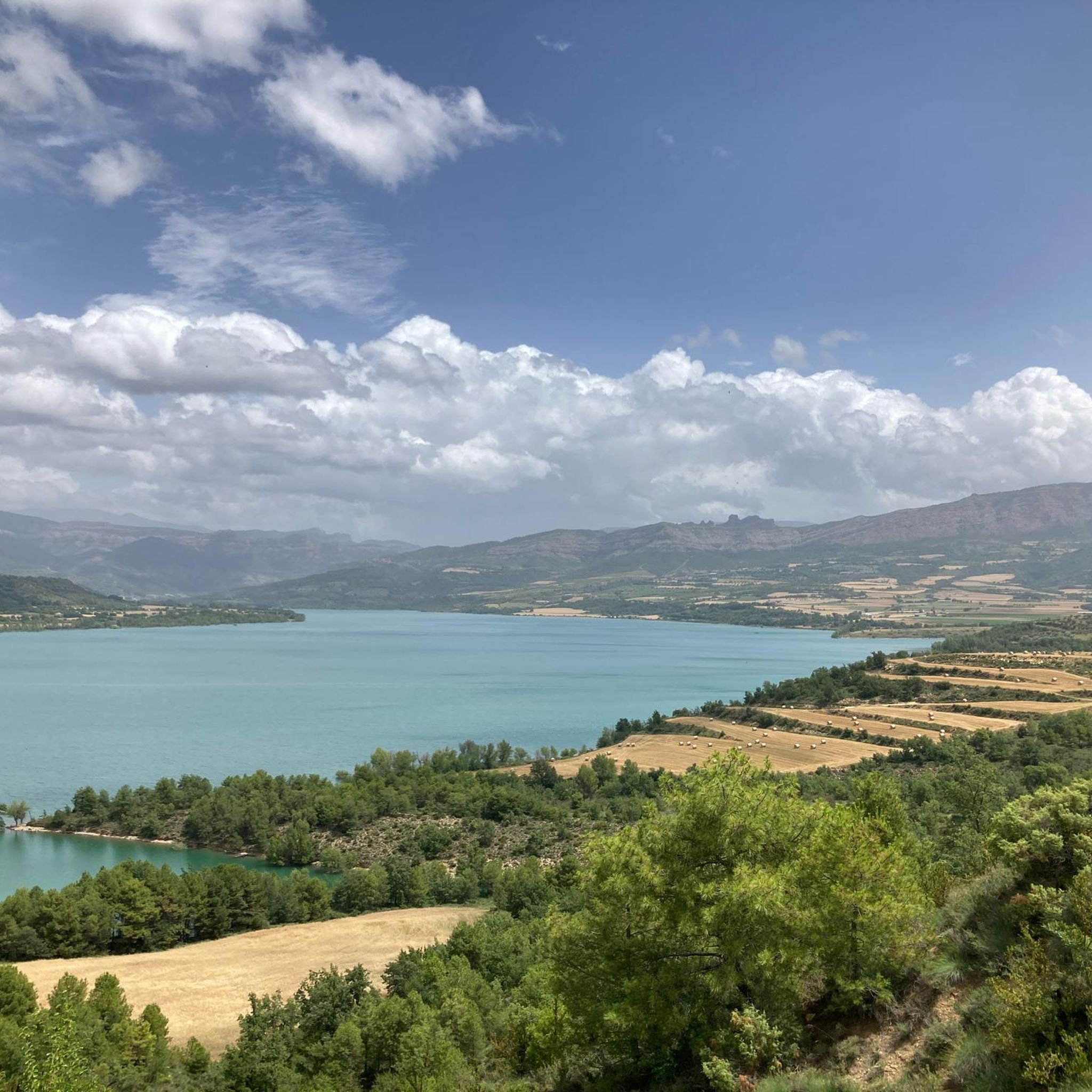
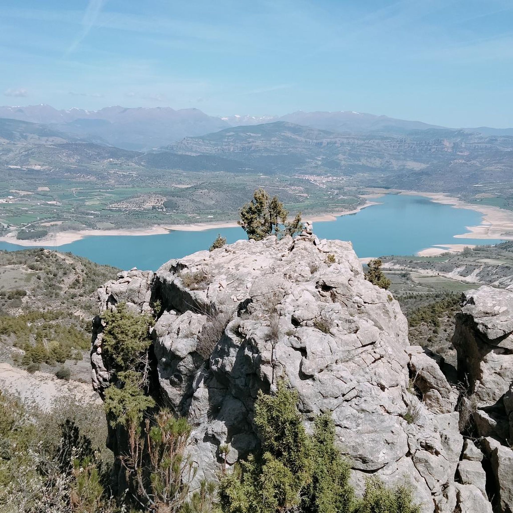

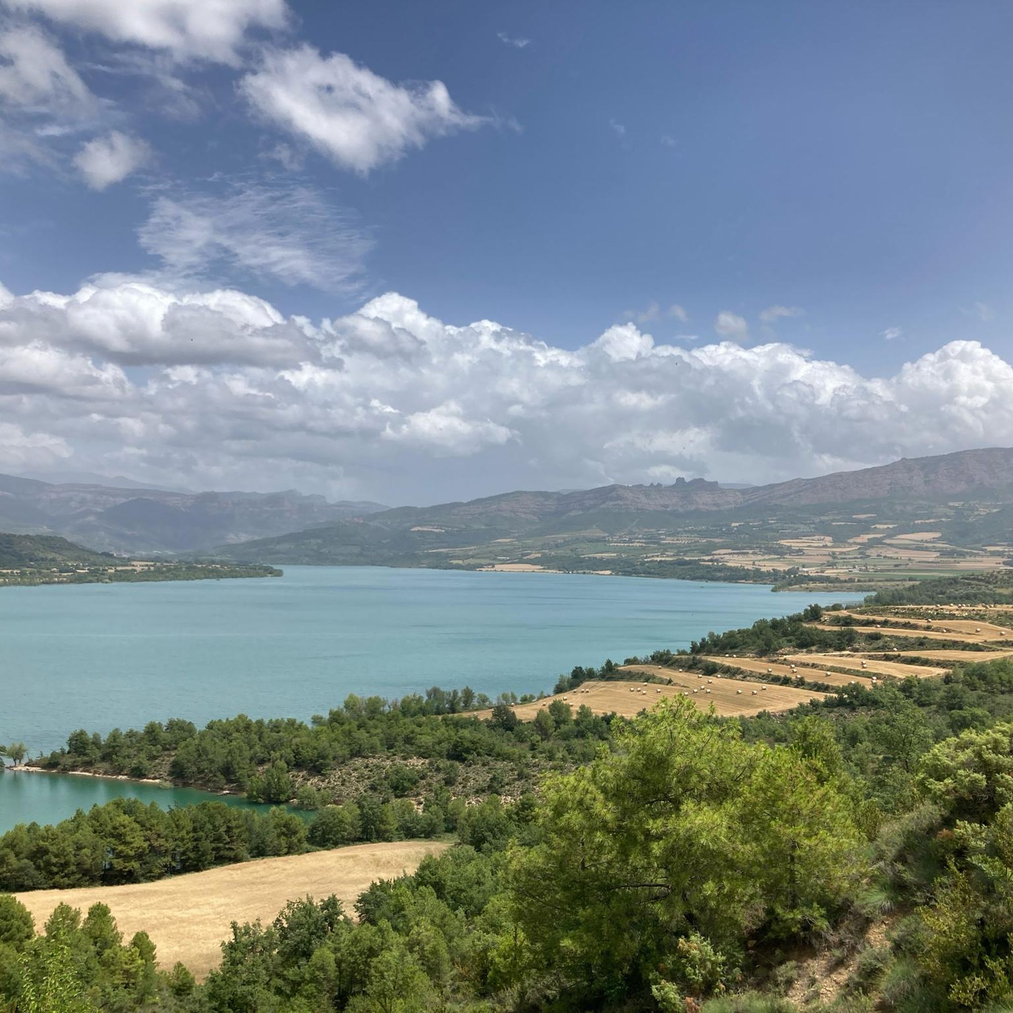
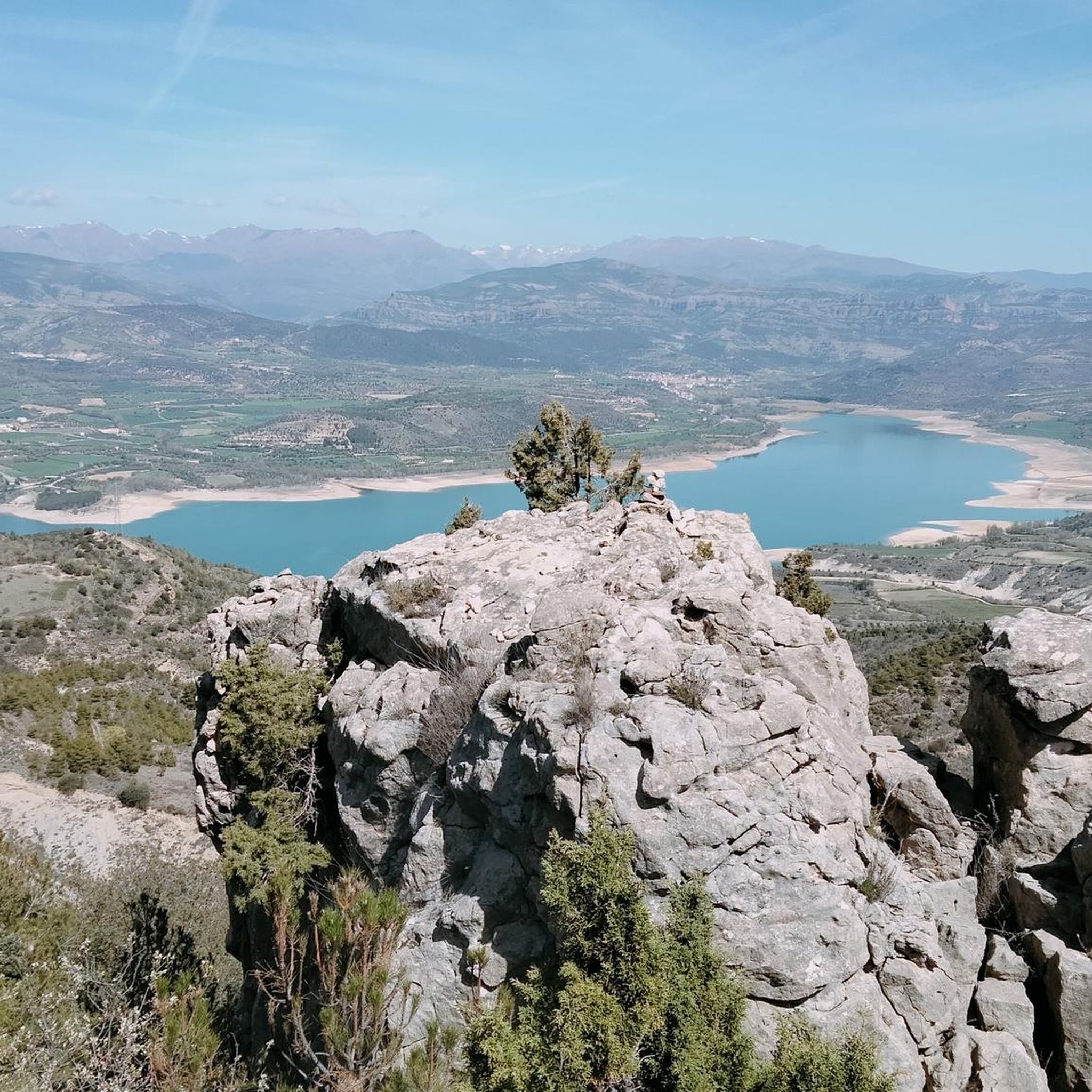
Tips from the Community

Important explanation of geology
0
0

Good alternative to not driving on the national road. The landscape is beautiful and the road, despite being secondary, is in good condition.
0
0

Next to the Coll d'Ares, it is the most iconic port in the Montsec mountain range and the Lleida Pre-Pyrenees. The views from above, either towards the Pyrenees and the Isona and Tremp valley, as well as the Plana de Lleida, are magnificent. It is a port with 4 aspects, each one different: - The southern slope, which begins in Artesa de Segre, is almost 24 km long and runs along a road with a lot of traffic, very wide and with long straights. After passing the town of Folquer, you face the hardest section of the climb, now with continuous curves and horseshoes, although with a road that is still very wide. The best are the views of the Lleida plain. It is not a side that I like since it is very stinky. - The southeast slope, the one that begins in Pons, is longer than the previous one, with 29 km. It has 2 rest sections, with some descent, and the road is narrow and twisty. There are good views along the climb. This slope joins the southern slope that comes from Artesa de Segre at the height of Folquer, where the hardest 7 km remain until reaching the top of the pass. - The main northern slope begins in Tremp and is 28.2 km. It is similar to the Artesa de Segre slope, with a similar gradient and a wide, busy road with a progressive slope, although it is true that there are no kilometers that reach 7%. I don't like. - The northwest slope, which also begins in Tremp, takes the old road that goes up through the town of Sant Salvador de Toló. It is a climb without traffic, on an irregular asphalt road, one of the old ones, which is grippy and difficult to roll, but in good condition. If you plan to go up to Comiols on the northern slope, you have to do it here and forget about the slope that runs along the main road.
0
0

Sant Esteve de la Sarga is a beautiful 11th century Romanesque church located in the town of the same name.
1
0

Small town located below the Coll de Comiols and at the foot of the Roc de Benavent, a stone structure that can be reached on foot from the town itself.
0
0
It is located on top of a small hill in the middle of the Jussana plain, or lower, of the Conca de Tremp, just over a kilometer from Gavet, which is south of Fontsagrada and practically at the same height.
0
0
Vilamitjana, sometimes called Vilamitjana de la Conca, is an old municipality of Pallars Jussà added in 1972 to the municipal area of Tremp.
0
0
The Gavet Canal is a canal that runs parallel to the Noguera Pallaresa River and crosses the whole of the Conca de Tremp to this area.
0
0
Frequently Asked Questions
How many road cycling routes are available in Isona i Conca Dellà?
There are over 45 road cycling routes in Isona i Conca Dellà, offering a wide range of options for different skill levels and preferences.
What kind of terrain and elevation can I expect on road cycling routes in Isona i Conca Dellà?
The region, nestled in the Catalan Pre-Pyrenees, offers diverse terrain with varied elevations. You can expect well-paved roads, challenging climbs like the Coll de Comiols, and scenic descents through valleys. The landscape features mountain ranges, river valleys, and reservoirs, providing a dynamic cycling experience.
Are there challenging road cycling routes for experienced cyclists?
Yes, Isona i Conca Dellà offers 26 difficult road cycling routes. For instance, the Escales and Sant Antoni Reservoirs Loop is a demanding 70.1-mile route with over 2,100 meters of elevation gain. Another challenging option is the Coll de Montllobar (1080 m) loop from Estació de Tremp, which covers 81.8 km with significant climbing.
Are there easier road cycling options for beginners or those seeking a more relaxed ride?
Yes, the region also provides moderate routes suitable for less experienced cyclists or those looking for a gentler ride. There are 22 moderate routes available. A good example is the View of Pantà de Terradets – Terradets Reservoir loop from Isona i Conca Dellà, a 31.1-mile path circling the reservoir with scenic views.
What natural features and viewpoints can I discover while road cycling in the region?
Road cycling routes often pass by stunning natural features. You can encounter the Noguera Pallaresa river, the Sant Antoni reservoir, and the picturesque Font de la O. The Basturs Lagoons are another notable natural monument. Many routes offer expansive views, such as those from the Viewpoint near the lakes or the View of the Sant Antoni Reservoir and Dam.
Are there any historical or cultural attractions to visit along the road cycling routes?
Absolutely. The region is rich in history. You can explore the remains of the Roman city of Aeso, including a preserved wall and defense tower. Medieval fortifications like the magnificent Llordà Castle and the Romanesque church of Santa Maria de Covet are also prominent. The Salàs de Pallars Historic Village is another interesting stop.
Can I find routes that are circular or loop back to the starting point?
Yes, many road cycling routes in Isona i Conca Dellà are designed as loops, allowing you to start and finish in the same location. Examples include the Escales and Sant Antoni Reservoirs Loop and the Coll de Comiols – Benavent de la Conca loop from Estació de Tremp.
What is the best season for road cycling in Isona i Conca Dellà?
The Catalan Pre-Pyrenees generally offer pleasant cycling conditions during spring and autumn, with milder temperatures and beautiful scenery. Summer can be warm, especially in the valleys, while winter may bring colder temperatures and potential snow at higher elevations like the Coll de Comiols.
What do other road cyclists enjoy the most about road cycling in Isona i Conca Dellà?
The area is highly rated by the komoot community, with an average score of 4.6 stars from over 10 reviews. Cyclists often praise the diverse terrain, the blend of challenging climbs and scenic descents, and the stunning views of the Pyrenees, reservoirs, and historical sites. The well-paved roads and varied options for different ability levels are also frequently highlighted.
Are there any paleontological sites or unique geological features to see?
Yes, the region is famous for its unique geological heritage. You can visit the Cretaceous Park, a significant paleontological site featuring over 2,000 dinosaur footprints and ancient dinosaur egg deposits, offering a fascinating glimpse into prehistory.
Are there any mountain passes that are popular among road cyclists in the area?
Yes, the region is known for its challenging mountain passes. The Coll de Comiols, reaching over 1,100 meters, is a prominent feature offering panoramic views. Another notable pass is the Coll de Bóixols.
What are some of the longer road cycling routes available?
For those seeking longer distances, the Escales and Sant Antoni Reservoirs Loop is a substantial 70.1-mile (112.7 km) route. Another long option is the Coll de Montllobar (1080 m) loop from Estació de Tremp, covering 81.8 km.
Most popular routes around Isona I Conca Dellà
Most popular attractions around Isona I Conca Dellà

Get inspired with the komoot mobile app


Explore more
Browse the best Road cycling routes in other regions.
