The best road cycling routes around Navarredondilla
4.5
(4)
1,292
riders
46
rides
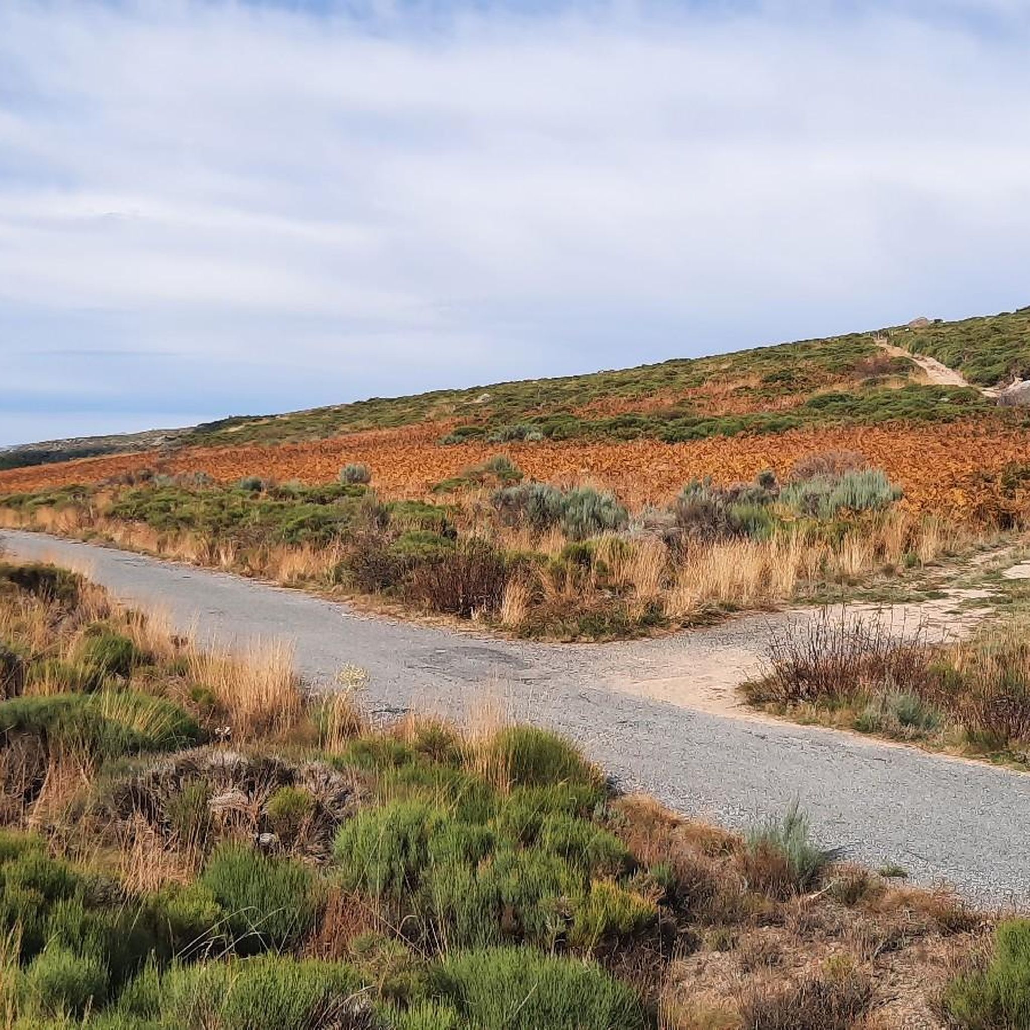
Road cycling routes around Navarredondilla are situated within the mountainous Sierra de Gredos range, offering diverse and challenging landscapes. The region features demanding climbs, scenic descents, and varied terrains, including dehesa landscapes and river valleys. Cyclists can expect routes traversing parts of the Sistema Central mountain range, characterized by hills and open woodlands. This area provides a range of road cycling experiences for different skill levels.
Best road cycling routes around Navarredondilla
- The most popular road cycling route is Burguillo Reservoir Loop via El Barraco and Navalmoral, a 29.2 miles (46.9 km) trail that takes 2 hours 12 minutes to complete. This moderate route offers views of the Burguillo Reservoir.
- Another top favourite among local road cyclists is Burguillo Reservoir – Puerto de Mijares loop from Parking del mirador estelar de Navaluenga, a difficult 77.8 miles (125.2 km) path. This route features significant elevation gain through mountainous terrain.
- Local road cyclists also love the Puerto de Pedro Bernardo – Puerto de Mijares loop from Navalmoral de la Sierra, a 94.8 miles (152.6 km) trail leading through mountain passes, often completed in about 8 hours 29 minutes.
- Road cycling around Navarredondilla is defined by mountainous terrain, dehesa landscapes, and river valleys. The network offers options for moderate to difficult ability levels.
- The routes in Navarredondilla are highly rated by the komoot community with an average score of 4.0 stars from 2 reviews. More than 1200 road cyclists have used komoot to explore Navarredondilla's varied terrain.
Last updated: July 2, 2026
39
riders
46.9km
02:12
610m
610m
Moderate road ride. Good fitness required. Mostly well-paved surfaces and easy to ride.
94
riders
154km
08:32
3,320m
3,320m
Hard road ride. Very good fitness required. Mostly well-paved surfaces and easy to ride.

Sign up for free
44
riders
61.6km
03:41
1,600m
1,600m
Hard road ride. Very good fitness required. Mostly well-paved surfaces and easy to ride.
35
riders
44.1km
02:11
570m
570m
Moderate road ride. Good fitness required. Mostly well-paved surfaces and easy to ride.
31
riders
56.9km
03:05
1,150m
1,150m
Hard road ride. Very good fitness required. Mostly well-paved surfaces and easy to ride.
Get access to more routes and recommendations from other explorers.
Sign up for free
Already have an account?
Our route recommendations are based on thousands of hikes, rides, and runs completed by other people on komoot.
Start today with a free account
Your next adventure awaits.
Login or Signup



Tips from the Community

Very good, comfortable and affordable hotel.
0
0

The Serranillos Pass is one of the most iconic mountain passes in the Sierra de Gredos, famous for its beauty and for being a historic stage in the Vuelta a España (Hinault's legendary stage in 1983). Views of the Cinco Villas Valley and the Gredos peaks. Spectacular scenery throughout the climb. Signage with gradient and remaining distance information. Ideal for linking up with Puerto del Pico, Pedro Bernardo, and Mijares for an epic stage.
1
0
The Mijares Pass is one of the great mountain passes in the Sierra de Gredos, highly prized by cyclists for its length, elevation gain, and scenic beauty. Maximum gradient: 11% (on short ramps before Mijares). There are several steep sections in the villages and near the Horcajo area, as well as another one 2 km from the summit.
1
0
The Pedro Bernardo Pass is one of the classic climbs in the Sierra de Gredos mountains, highly prized by cyclists and a regular feature of races like the Vuelta a España. First section: Up to the village (Pedro Bernardo), with gradients of 5-6%, a road in good condition, and spectacular views of the Tiétar Valley. Urban section: In the village, the gradient eases, even offering some flatter sections. Second section: After the village, the asphalt becomes rougher, and the toughest kilometer (7-8%) appears, followed by a "balcony" section with incredible views and a sustained 5% gradient to the summit.
1
0

You cool down very quickly up here, especially when it's windy.
7
0

Highest point 1580 on this route, there is a large parking lot to enjoy the view.
16
0

A legendary mountain pass in the Vuelta a España and in the Gredos mountain range, along with Serranillos, Peña Negra, Pedro Bernardo, and Puerto del Pico. It's a namesake of Serranillos, as it connects the same valleys, running parallel. Like Serranillo, it's a pass with a gentle, continuous gradient and uneven, bumpy asphalt, which is typical of this area. A pass of thermal contrasts: in winter, you're freezing cold, and in summer, you can die of heat.
0
0
The Puerto de Pedro Bernardo is the younger brother of the Puerto de Serranillos. Almost every time this port has been climbed in a professional race it is linked to the Puerto de Serranillos, only the second being considered a port. However, the Puerto de Pedro Bernardo is in itself a hill where you can go from the valley where the CL-501 road runs (where the town with the same name is located) to the valley of the Puerto de Pico, where Esteban del Valle and Mombeltrán are located. The chain with Serranillos is the most typical, as I said previously, although it is also worth chaining it with the Puerto de la Centenera or the Puerto del Pico. The road is rough, with hardly any shoulder and very little traffic. It is a very pleasant port to climb... as long as the heat is not suffocating.
2
0
Frequently Asked Questions
How many road cycling routes are available around Navarredondilla?
There are over 40 road cycling routes around Navarredondilla, offering a wide range of experiences. These routes are primarily categorized as moderate to difficult, catering to cyclists looking for a challenge.
What kind of terrain can I expect on road cycling routes in Navarredondilla?
The terrain around Navarredondilla is diverse, situated within the mountainous Sierra de Gredos range. You can expect demanding climbs, scenic descents, and varied landscapes including dehesa (wooded pastures) and river valleys. Routes often traverse parts of the Sistema Central mountain range, featuring rolling hills and open woodlands.
Are there road cycling routes suitable for beginners or those looking for easier rides?
While the region is known for its challenging terrain, there are 13 moderate routes available. These routes offer a less strenuous option compared to the more difficult climbs, but still provide an engaging experience through the varied landscapes of the Sierra de Gredos.
What are some challenging or long-distance road cycling routes in the area?
For experienced cyclists seeking a challenge, there are 31 difficult routes. Notable long-distance options include the Burguillo Reservoir – Puerto de Mijares loop from Parking del mirador estelar de Navaluenga, which spans 125.2 km with significant elevation, and the even longer Puerto de Pedro Bernardo – Puerto de Mijares loop from Navalmoral de la Sierra, covering 152.6 km through mountain passes.
Can I find circular road cycling routes around Navarredondilla?
Yes, many of the road cycling routes in the Navarredondilla area are designed as loops, allowing you to start and finish at the same point. Examples include the popular Burguillo Reservoir Loop via El Barraco and Navalmoral and the more challenging Puerto de Navalmoral – Paramera Pass loop from Parking del mirador estelar de Navaluenga.
What natural features or landmarks can I see along the road cycling routes?
Road cycling routes in Navarredondilla offer stunning views and pass by several notable features. You can encounter mountain passes like Puerto de Mijares and Puerto de Navalmoral, and enjoy views of rugged peaks within the Sierra de Gredos Regional Park. Some routes may also pass through charming villages or near historical elements like the Puente Viejo de Navaluenga.
Is Navarredondilla a good destination for family-friendly road cycling?
Navarredondilla's road cycling routes are predominantly moderate to difficult, with significant elevation changes, making them less ideal for young children or families seeking very easy, flat rides. While there are moderate options, families with younger or less experienced cyclists might find the terrain challenging.
What is the best time of year for road cycling in Navarredondilla?
The mountainous Sierra de Gredos region generally offers pleasant cycling conditions outside of the peak summer heat and winter cold. Spring and autumn are often considered the best times, with milder temperatures and beautiful scenery. Cyclists should be prepared for varied weather due to the mountainous environment.
Are there options for parking near the road cycling trailheads?
Yes, many road cycling routes in the Navarredondilla area, particularly those starting from larger towns or popular viewpoints, offer designated parking. For example, some routes begin from locations like 'Parking del mirador estelar de Navaluenga', indicating available parking facilities.
What do other cyclists say about road cycling in Navarredondilla?
The road cycling routes around Navarredondilla are highly rated by the komoot community, with an average score of 4.0 stars. Cyclists often praise the challenging climbs, the stunning natural beauty of the Sierra de Gredos, and the well-maintained secondary roads that make for an enjoyable riding experience.
Are there any routes that offer particularly scenic viewpoints?
Many routes in the region provide breathtaking views of the Sierra de Gredos. The Serranillos Pass – Puerto del Pico Viewpoint loop from Parking del mirador estelar de Navaluenga, for instance, specifically highlights a viewpoint, suggesting exceptional scenic opportunities along its course.
Can I find road cycling routes that pass through traditional villages?
Yes, the region's cycling routes often traverse picturesque mountain villages. While specific village names are not always highlighted in route titles, the broader Ávila area, including routes around Navarredondilla, is known for incorporating charming settlements like Villanueva de Ávila, offering a glimpse into local culture and architecture.
Most popular attractions around Navarredondilla

Get inspired with the komoot mobile app


Explore more
Browse the best Road cycling routes in other regions.
