The best walks and hikes around Narros De Matalayegua
4.5
(9)
102
hikers
7
hikes
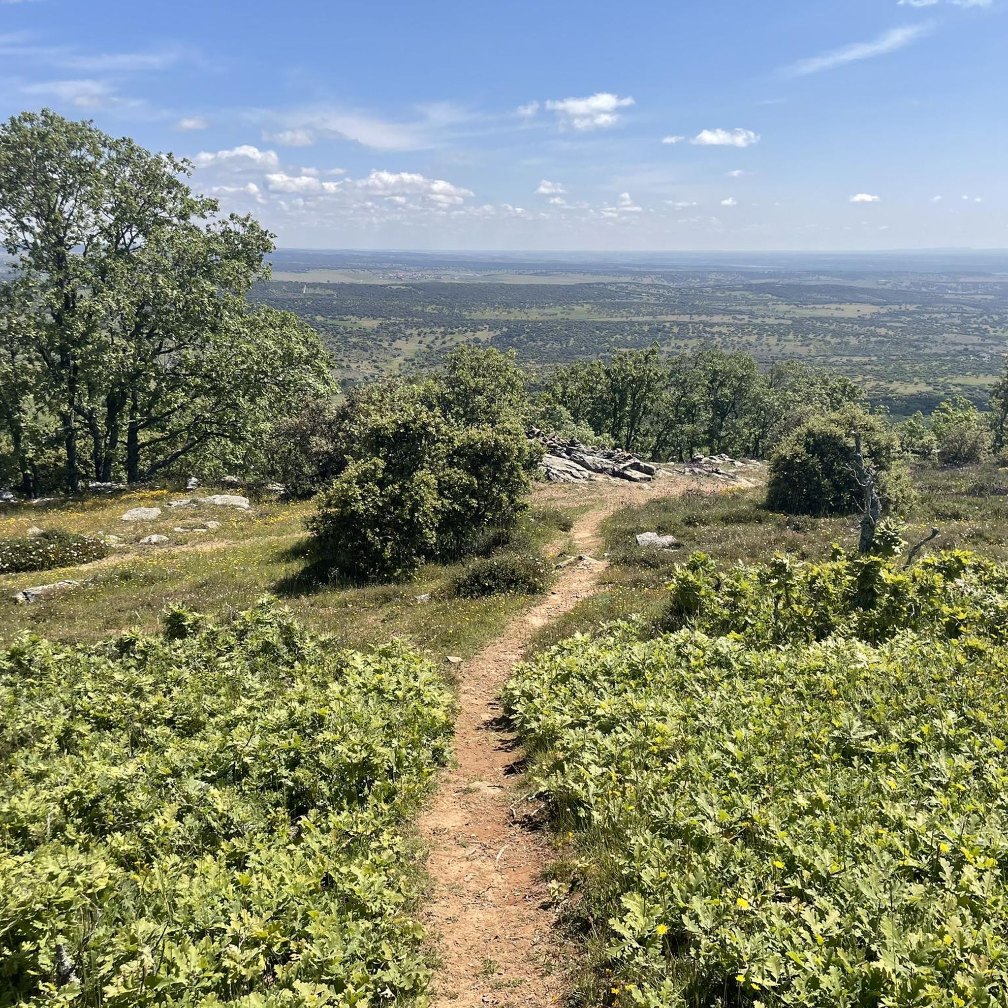
Hiking around Narros De Matalayegua offers access to diverse landscapes, including the Sierra de Francia Natural Park and the Arribes del Duero Natural Park. The region features hidden valleys, dramatic river canyons carved by the Duero River, and extensive oak and chestnut forests. Hikers can explore a variety of terrains, from gentle paths to more challenging ascents, often encountering impressive rock formations and water features.
Best hiking trails around Narros De Matalayegua
- The most popular hiking route is Sendero de…
Last updated: June 28, 2026
25
hikers
Moderate hike. Good fitness required. Easily-accessible paths. Suitable for all skill levels.
1
hikers
4.06km
01:07
70m
70m
Easy hike. Great for any fitness level. Easily-accessible paths. Suitable for all skill levels.

Sign up for free
25
hikers
7.59km
02:11
190m
190m
Moderate hike. Good fitness required. Easily-accessible paths. Suitable for all skill levels.
4.5
(6)
30
hikers
18.9km
05:28
500m
500m
Hard hike. Very good fitness required. Easily-accessible paths. Suitable for all skill levels.
4.0
(2)
8
hikers
13.0km
03:36
240m
240m
Moderate hike. Good fitness required. Easily-accessible paths. Suitable for all skill levels.
Get access to more routes and recommendations from other explorers.
Sign up for free
Already have an account?
Our route recommendations are based on thousands of hikes, rides, and runs completed by other people on komoot.
Start today with a free account
Your next adventure awaits.
Login or Signup
Popular around Narros De Matalayegua

Tips from the Community

Located between the municipalities of Navarredonda de la Rinconada and Escurial de la Sierra, in the Sierra de Francia-Quilamas region. A protected natural area within the Natura 2000 network, with oak and chestnut forests and wildlife such as the golden eagle and griffon vulture.
5
0

The castle ruins are of great historical and tourist interest in the Peña de Santa Cruz area and also offer beautiful views. The origin of it is unknown for sure, but it is considered to be from pre-Roman times, and which later formed part of a larger group to defend the lands at the beginning of the 10th century and which was rebuilt in this century by King Ramiro II of León .
1
0
The top of Pico Cervero is located at 1,522 meters above sea level within the wonderful Natural Space of Las Quilamas. The ascent is demanding and depending on where you climb it from, it may have some technical sectors. From Linares de Riofrío you can follow the path through the Honfrías forest, a wonderful and picturesque place.
1
1
The castle ruins are of great historical and tourist interest in the Peña de Santa Cruz area and also offer beautiful views. The origin of it is unknown for sure, but it is considered to be from pre-Roman times, and which later formed part of a larger group to defend the lands at the beginning of the 10th century and which was rebuilt in this century by King Ramiro II of León .
3
0

La Morana or Quintos fountain, belonging to the La Honfría forest. According to posters in the area up to this source "the Fifth of the town went up to wash at the beginning of December".
1
0
The most recommended times for this route are May, well into spring and autumn. The landscapes of the area with the trees covered with leaves are highly recommended, especially the forest of La Honfría.
1
0

Magical place, excellent 360º views (if it is not cloudy). It is worth the ascent both by mountain bike, gravel or walking.
1
0

El Cervero is the highest peak in the Sierra de las Quilamas, with an altitude of 1465 meters
1
0
Frequently Asked Questions
How many hiking trails are available around Narros de Matalayegua?
There are over 7 hiking routes documented on komoot around Narros de Matalayegua, offering a range of experiences from easy strolls to more challenging mountain ascents. These trails explore diverse landscapes, including hidden valleys, river canyons, and ancient oak and chestnut forests.
Are there any circular hiking routes near Narros de Matalayegua?
Yes, the region offers several circular routes perfect for a varied day out. A popular option is the Sendero de las Honfrías - circular from Linares de Riofrío, which winds through the Espacio Natural de las Quilamas. For an easier option, consider the Castillo de Santa Cruz – circular from Navagallega, offering views of the local landscape and historical points of interest.
What kind of natural features can I expect to see on hikes in this area?
Hiking around Narros de Matalayegua provides access to the diverse landscapes of the Sierra de Francia Natural Park and the Arribes del Duero Natural Park. You can expect to encounter hidden valleys, dramatic river canyons carved by the Duero River, extensive oak and chestnut forests, and impressive rock formations. The region is also known for its rich biodiversity, including various birds of prey.
Are there any challenging hikes for experienced trekkers?
Yes, for those seeking a more demanding adventure, the area offers routes with significant elevation gain. The Cervero Peak – Pico Cervero (1465 m) loop from Linares de Riofrío is a difficult 18.9 km trail leading through mountainous terrain, often completed in about 5 hours 28 minutes, offering rewarding views from the summit.
What are some notable landmarks or attractions to look out for during a hike?
The region is rich in natural and historical points of interest. You can find the impressive Cervero Peak, which offers panoramic views. The Santa Cruz de Navagallega Castle is another historical landmark. In the wider region, the Arribes del Duero Natural Park features dramatic river canyons and the spectacular Pozo de los Humos waterfall, especially striking in winter or spring.
What do other hikers say about the trails around Narros de Matalayegua?
The routes in Narros de Matalayegua are highly rated by the komoot community, with an average score of 4.5 stars from 9 reviews. Hikers often praise the varied terrain, from gentle paths through forests to more challenging ascents, and the opportunity to explore the natural beauty of the Sierra de Francia and Arribes del Duero Natural Parks.
Are there any art-themed hiking trails in the nearby Sierra de Francia Natural Park?
Yes, the Sierra de Francia Natural Park is home to several 'Nature Art Paths' (Caminos de Arte en la Naturaleza). These circular routes blend active tourism with artistic expression, featuring discreet sculptures and Land Art installations integrated into the natural scenery. Examples include the Camino del Agua, Camino de las Raíces, and Asentadero-Bosque de los Espejos.
When is the best time of year to go hiking in Narros de Matalayegua?
The region offers pleasant hiking conditions for much of the year. Spring and autumn are particularly ideal, with milder temperatures and vibrant natural colors. Spring brings lush greenery and strong water flow for features like the Pozo de los Humos waterfall, while autumn showcases the rich hues of the oak and chestnut forests. Summer can be warm, so early morning or late afternoon hikes are recommended.
Are there any easy hiking options suitable for beginners or a relaxed walk?
Certainly. For an easy and enjoyable walk, consider the Castillo de Santa Cruz – circular from Navagallega. This 4.1 km path is rated easy and provides pleasant views of the local landscape without significant elevation changes, making it perfect for a leisurely outing.
Can I find routes that pass through traditional villages or cultural sites?
Many trails in the Sierra de Francia region, such as the Camino de las Raíces starting in La Alberca, wind through woodlands and pass by historical and cultural sites. These routes often connect traditional villages, allowing hikers to experience the local heritage and charming rural accommodations alongside the natural beauty.
What are the typical durations for hikes in the Narros de Matalayegua area?
Hiking durations vary depending on the route's length and difficulty. You can find shorter walks like the Castillo de Santa Cruz – circular from Navagallega, which takes about 1 hour 7 minutes. Moderate trails, such as the Sendero de las Honfrías, typically last around 2 hours. Longer, more difficult routes, like the Cervero Peak loop, can take over 5 hours.
Most popular routes around Narros De Matalayegua
Most popular attractions around Narros De Matalayegua

Get inspired with the komoot mobile app


Explore more
Browse the best Hikes in other regions.
