The best mountain hikes around Benifato
4.3
(9)
37
hikers
4
hikes
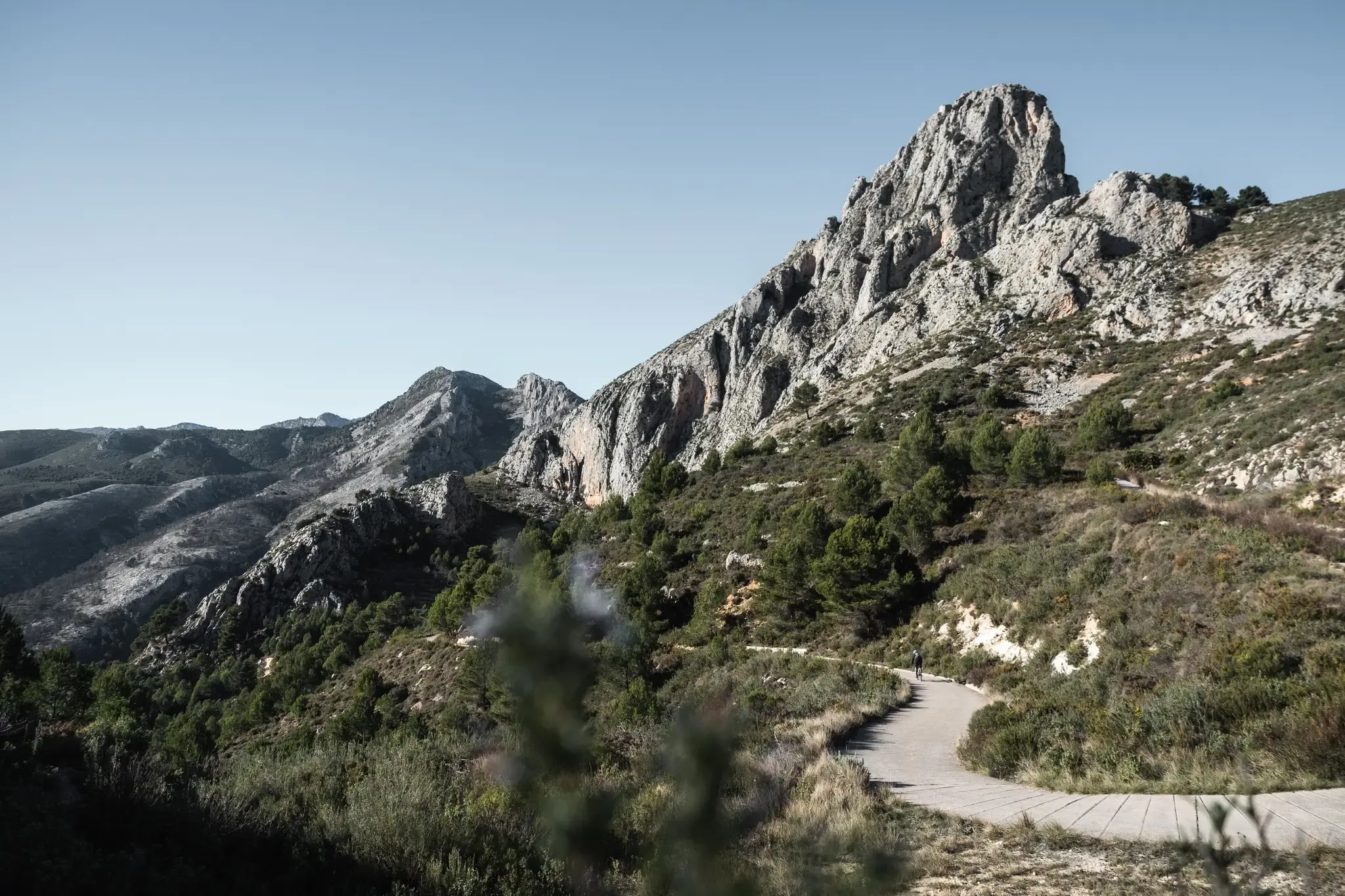
Mountaineering routes Benifato are characterized by the rugged terrain of the Sierra Aitana range, offering diverse challenges and scenic beauty. The region features prominent limestone masses, including Puig Campana, the second-highest peak in Alicante province, which rises to 1408 meters. Valleys with olive and almond trees provide a contrast to the higher mountain slopes, creating varied landscapes for exploration.
Best mountaineering routes around Benifato
- The most popular mountaineering route is El Puigcampana – el Collado del Pouet loop from Finestrat…
Last updated: June 24, 2026
4.2
(5)
21
hikers
13.2km
06:24
1,100m
1,100m
Hard mountaineering route. Very good fitness required. Sure-footedness, sturdy shoes and alpine experience required.
8
hikers
11.4km
05:01
650m
650m
Hard mountaineering route. Very good fitness required. Mostly accessible paths. Sure-footedness required.

Sign up for free
4.5
(4)
4
hikers
9.50km
02:39
180m
180m
Moderate mountaineering route. Good fitness required. Easily-accessible paths. Suitable for all skill levels.
4
hikers
14.1km
05:35
750m
750m
Hard mountaineering route. Very good fitness required. Sure-footedness, sturdy shoes and alpine experience required.
Our route recommendations are based on thousands of hikes, rides, and runs completed by other people on komoot.
Start today with a free account
Your next adventure awaits.
Login or Signup

Other adventures around Benifato

Tips from the Community

Wear a windbreaker in September-October
1
0

€3.50 admission to the walkway. 2 glass bottomed viewing points. Well worth a visit
1
0

Just a few meters before the footbridge of the Relleu Dam stands this old house, of which logically only its four walls remain today, which is attractive to people who set out to visit this strange place. It seems that many years ago, in this house the guard of the dam lived or at least took refuge.
2
0

Alpine experience is REALLY necessary. Very rough/rocky paths, lots of climbing on the slope. The descent is particularly difficult and most hikers there had their shoe soles come apart (or fall off completely). So all the requirements stated on the sign should be observed!
1
1

Best time to visit this place is Winter.. in any case not late afternoon….🤣🤣👍✊️
2
2
Short movies about our hike up to PUIG CAMPANA summit are available at my YouTUBE channel under the following links: - https://www.youtube.com/watch?v=VD7IpzFm20U (video - short version) - https://www.youtube.com/watch?v=jOkfaILxdwo (Full version) Enjoy
1
1
This is a most easiest section of the hike. Use hike time for mental preparation the final stage! Good Luck and Enjoy!
1
0
Hiking up to the summit of PUIG CAMPANA mountains is not easy task and required a good fitness conditions. But as a reward one get an unique option to enjoy great view of Marina Alta/Bajo area (make sure you select good sunny day for your hike ). A proper hiking equipment (especially shoes) is important point. Since your hike could exceed nine hours, do not forget to take enough water (especially by nice sunny day). GOOD LUCK and ENJOY your hike in one of most exiting area in Costa Blanca!
4
0
Frequently Asked Questions
What kind of mountaineering routes can I expect around Benifato?
The Benifato area, nestled within the Sierra Aitana range, offers a variety of mountaineering routes characterized by rugged terrain and stunning limestone peaks. You'll find options ranging from moderate ascents to challenging high-altitude routes, often featuring panoramic views of the surrounding mountains and valleys dotted with olive and almond trees. The area is particularly known for prominent features like Puig Campana, the second-highest peak in Alicante province.
Are there any moderate mountaineering routes suitable for those looking for a less strenuous challenge?
Yes, there are several moderate mountaineering routes available. For instance, the Penya Alta – Alt de Tagarina loop from Serra d'Aitana is a moderate 8.9 km trail that takes about 3 hours 22 minutes, leading through the heart of the Sierra Aitana range. Another moderate option is the Reservoir viewpoint – Caminito de Relleu loop from Relleu, which is 9.5 km long and typically completed in about 2 hours 38 minutes.
What are some of the more challenging mountaineering routes in the Benifato region?
For those seeking a significant challenge, Benifato offers several difficult routes. The El Puigcampana – el Collado del Pouet loop from Finestrat is a demanding 11.3 km trail, taking nearly 6 hours to complete, offering expansive views from the slopes of Puig Campana. Another difficult option is the Tossal d'Avellà – el Puigcampana loop from Finestrat, a 16.2 km path that navigates mountainous terrain with sustained ascents.
Are there any circular mountaineering routes around Benifato?
Yes, many of the mountaineering routes in the Benifato area are designed as loops, allowing you to start and end at the same point. Examples include the challenging El Puigcampana – el Collado del Pouet loop from Finestrat and the moderate Penya Alta – Alt de Tagarina loop from Serra d'Aitana. These circular paths provide varied scenery without retracing your steps.
What natural landmarks or features can I expect to see along the mountaineering routes?
The region is rich in natural beauty. You can encounter prominent peaks like Puig Campana and Cima del Cocoll, offering breathtaking panoramic views. The trails often pass through picturesque valleys with olive and almond trees, and you might discover natural springs such as the 'Partagas Fountain' and 'El Moli fountain'. The area also features impressive mountain passes like Port de Tudons, known for its stunning vistas.
Are there any historical sites or attractions near the mountaineering trails?
Absolutely. The Benifato area is close to several historical attractions. You can visit El Castell de Guadalest and the Guadalest Reservoir, a stunning cliffside castle and village. Another notable site is Polop Castle and San Gregorio Hermitage. These provide interesting diversions and cultural insights alongside your mountaineering adventures.
What do other mountaineers enjoy most about the routes in Benifato?
The mountaineering routes around Benifato are highly rated by the komoot community, with an average score of 4.7 stars from over 10 reviews. Mountaineers often praise the diverse challenges, from moderate ascents to difficult high-altitude routes, and the stunning natural scenery, including the rugged Sierra Aitana range and the striking Puig Campana.
Is there public transport available to reach the trailheads around Benifato?
While Benifato is a small village, public transport options directly to specific trailheads might be limited. It's advisable to check local bus schedules for connections to Benifato or nearby towns like Finestrat, from where many routes, such as those around Puig Campana, often start. For ultimate flexibility, especially for reaching more remote starting points, a car is generally recommended.
Where can I find parking for mountaineering routes in the Benifato area?
Parking availability varies by trailhead. For routes starting from larger towns like Finestrat or near popular attractions, you can often find designated parking areas. For example, routes around Puig Campana often have parking facilities in Finestrat. For more remote starting points, roadside parking might be an option, but always ensure you park legally and considerately, especially in residential or protected areas.
Are there any family-friendly mountaineering options or easier trails for beginners?
While many routes are classified as moderate to difficult, the region does offer some less strenuous options that could be suitable for families or beginners looking for an introduction to mountaineering. The Reservoir viewpoint – Caminito de Relleu loop from Relleu is a moderate 9.5 km route that might be a good starting point. Always check the specific route details for elevation gain and terrain to ensure it matches your group's ability.
What is the best time of year to go mountaineering in Benifato?
The Benifato region is suitable for outdoor activities year-round. However, spring (March to May) and autumn (September to November) are often considered ideal due to milder temperatures and beautiful natural scenery, such as almond trees in bloom. Summer can be very hot, especially at lower altitudes, so early morning starts are recommended. Winter offers cooler temperatures but some higher routes might encounter colder conditions.
Are there any waterfalls or natural pools to visit near the mountaineering routes?
Yes, approximately 12.5 km from Benifato, you'll find Les Fonts d'Algar, a significant natural attraction known for its stunning waterfalls and natural pools. While not directly on the mountaineering routes, it's a highly recommended natural reserve for a refreshing visit after a challenging hike.
Can I bring my dog on the mountaineering trails around Benifato?
Many outdoor trails in Spain are dog-friendly, but regulations can vary. It's generally advisable to keep dogs on a leash, especially in protected natural areas or where livestock might be present. Always ensure your dog is well-behaved and that you carry waste bags. Check for specific signage at trailheads regarding dog access, particularly in national parks or reserves.
Most popular attractions around Benifato

Get inspired with the komoot mobile app


Explore more
Browse the best Mountain Hikes & Routes in other regions.
