The best running trails around Villares De Jadraque
97
runners
9
runs
Jogging around Villares De Jadraque offers an opportunity to explore the natural landscapes of the Sierra del Alto Rey in Guadalajara, Spain. The region is characterized by mountainous terrain, lush river valleys, and extensive oak forests, providing varied running environments. Waterways like the Bornova River and numerous arroyos create serene paths, while the presence of "black architecture" adds a unique cultural element to the routes. The area's well-preserved environment ensures tranquil and diverse jogging experiences.
Best jogging routes around Villares…
Last updated: August 21, 2026
1
runners
9.59km
01:11
150m
150m
Jog this 6.0-mile (9.6 km) moderate trail from Prádena de Atienza to a viewpoint overlooking the Cueva del Oso, gaining 478 feet.
27
runners
21.9km
03:22
1,020m
1,020m
Hard run. Very good fitness required. Sure-footedness, sturdy shoes and alpine experience required.

Sign up for free
10
runners
8.75km
01:07
210m
210m
Moderate run. Good fitness required. Mostly paved surfaces. Suitable for all skill levels.
11
runners
17.0km
02:23
550m
550m
Hard run. Very good fitness required. Sure-footedness, sturdy shoes and alpine experience required.
6
runners
11.5km
01:54
570m
570m
Hard run. Very good fitness required. Sure-footedness, sturdy shoes and alpine experience required.
Get access to more routes and recommendations from other explorers.
Sign up for free
Already have an account?
Our route recommendations are based on thousands of hikes, rides, and runs completed by other people on komoot.
Start today with a free account
Your next adventure awaits.
Login or Signup

Tips from the Community

A beautiful village in northern Guadalajara, near Alto Rey, with a Romanesque church, fountain, old oven, etc. It's a very welcoming place, with a terrace in the Plaza.
0
0

What to see 🧭 “El País de la Plata” Interpretation Center Interactive museum about local mining, open Saturdays and Sundays from 12:00 to 14:00. General admission approx. €2, free for residents and children under 14. ⛪ Santa Cecilia Parish Church 19th-century building constructed during the mining boom, with a single nave and a simple transept. 🏗️ Mining and Industrial Heritage More than 200 shafts/mines, such as Santa Catalina, Santa Teresa, Mala Noche, Fuerza, etc. Remains of ore-washing facilities like San Carlos, ruined industrial sites, and power plants.
4
0
A village in the Sierra Norte of Guadalajara, at an altitude of approximately 1,084 meters. Its origins are medieval, possibly predating the Bronze Age. The name derives from the Arabic Hisn al-Ancina (“castle of the holm oak”). In 1844, the discovery of silver triggered a “silver rush,” transforming Hiendelaencina into a major 19th-century mining district, with up to 200 mines and a population that reached 5,000. A parish church dedicated to Saint Cecilia was built between 1848 and 1851, financed with funds from the mining town.
4
0
Nature in Vena. Extraordinary landscape in everything around. Possibility of taking various routes, circular or online, with different origins and destinations.
1
0
It is a very interesting town, with a large number of silver mines in its surroundings. In the La Plata museum everything related to the exploitation of these mines is explained. Very close is the Bornova River, whose canyon can be visited in some sections, with a beautiful landscape. There are also good bar and restaurant services.
2
0

Incredibly beautiful remote village that rose to prominence thanks to the silver mines.
1
0

Beautiful mountain village and starting point of the Camino Viejo del Alto Rey.
1
0
One of the starting points of the Alto Rey mountain trail, the small rural town of Prádena de Atienza is a unique place to visit. I love the small local stone houses, typical of the mountain villages in this area.
1
0
Frequently Asked Questions
How many running routes are available in Villares de Jadraque?
There are 6 diverse running routes around Villares de Jadraque, offering a range of experiences from moderate loops to more challenging mountain ascents. These routes allow you to explore the natural landscapes of the Sierra del Alto Rey.
What is the best time of year for trail running in Villares de Jadraque?
The mild weather during spring and autumn makes these seasons ideal for trail running in Villares de Jadraque. The temperatures are pleasant, and the natural scenery, including the oak forests and riverside paths, is particularly beautiful.
What kind of terrain can I expect on the running trails around Villares de Jadraque?
You can expect a varied terrain, including paths through lush river valleys alongside the Bornova River, extensive oak forests providing shaded sections, and the foothills of the Sierra del Alto Rey, which offer mountainous landscapes and varying elevations. Some routes may also feature tracks and small road sections.
Are there any easy jogging routes in Villares de Jadraque for beginners?
While the area is known for its moderate to difficult trails, there are no routes specifically classified as 'easy' in our current selection. However, some moderate routes, like the GR 167: Prádena de Atienza to Cueva del Oso Trail, offer a balanced challenge that might be suitable for runners looking to progress beyond beginner level.
What are some longer, more challenging running routes in the area?
For experienced runners seeking a challenge, the Alto Rey Peak (1,858 m) – Prádena de Atienza loop from Prádena de Atienza is a demanding 23.6 km (14.7 miles) trail leading through the Sierra del Alto Rey. Another difficult option is the Prádena de Atienza – Sierra de Alto Rey loop from Prádena de Atienza, which covers approximately 23.9 km (14.9 miles) with significant elevation changes.
Are there any circular running routes in Villares de Jadraque?
Yes, several routes in the area are circular, allowing you to start and finish in the same location. An example is the Hiendelaencina Silver Mines – Hiendelaencina loop from Hiendelaencina, a moderate 10.5 km (6.5 miles) path that explores the historical silver mining area.
What natural features or landmarks can I see while running in Villares de Jadraque?
The routes offer views of the Sierra del Alto Rey and pass through extensive oak forests. You can also explore the historical Hiendelaencina Silver Mines. Notable natural attractions nearby include the Cañamares River Reservoir and the Alcorlo Reservoir, which provide serene waterscapes.
Are the running trails in Villares de Jadraque suitable for families?
The region's tranquil landscapes and diverse natural features can be enjoyable for families. While there are no 'easy' routes specifically listed, families with some running experience might enjoy the moderate trails, especially those along the Bornova River or through shaded oak forests, which offer a peaceful environment. Always check the route difficulty and length to match your family's fitness level.
Can I bring my dog on the running routes in Villares de Jadraque?
Villares de Jadraque's natural setting, with its extensive woodlands and riverside paths, is generally welcoming for dogs. The area's untouched nature and tranquil environment make it a great place to run with your canine companion. However, always ensure your dog is under control, respect local wildlife, and check for any specific local regulations regarding pets on trails.
What makes the running experience in Villares de Jadraque unique?
The unique combination of the Sierra del Alto Rey's mountainous terrain, the serene paths along the Bornova River, and the presence of traditional 'black architecture' villages sets Villares de Jadraque apart. The area's minimal human impact ensures a quiet, well-preserved environment, offering a truly tranquil and immersive outdoor experience.
Are there any viewpoints or scenic spots along the running routes?
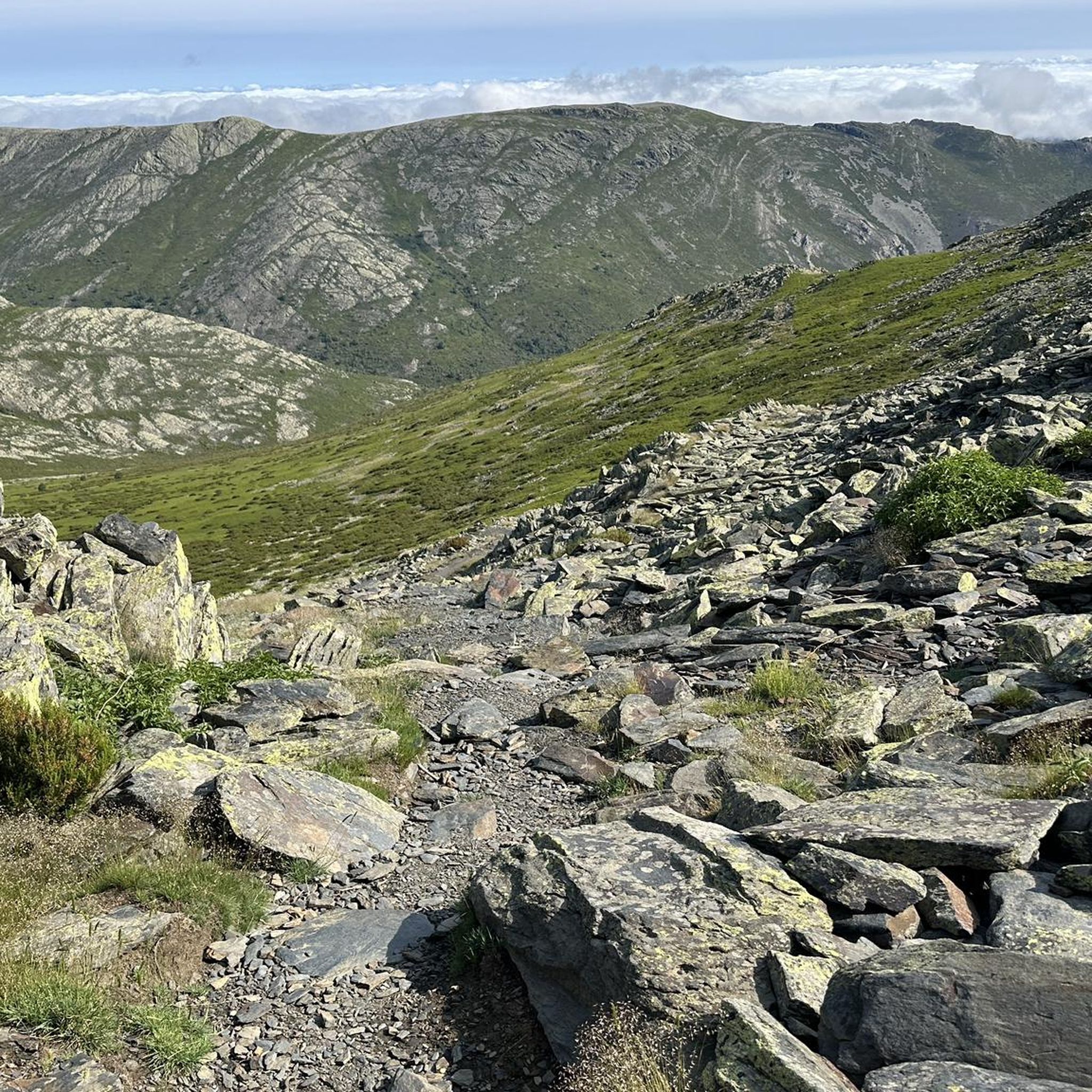
Many routes offer picturesque mountain views of the Sierra del Alto Rey. The Alto Rey Peak (1,858 m) itself is a significant viewpoint, and trails leading towards it provide expansive panoramic vistas of the surrounding natural landscape, including the Barranco del Val ravine.
What is the average length of a running route in this region?
The running routes in Villares de Jadraque vary significantly in length. You can find moderate trails around 9.6 km (6 miles), such as the GR 167: Prádena de Atienza to Cueva del Oso Trail, up to more challenging routes exceeding 23 km (14 miles), like the Alto Rey Peak (1,858 m) – Prádena de Atienza loop from Prádena de Atienza.
Most popular routes around Villares De Jadraque
Most popular attractions around Villares De Jadraque

Get inspired with the komoot mobile app


Explore more
Browse the best Running Trails & Routes in other regions.
