The best road cycling routes around Urkiola
4.5
(210)
14,831
riders
160
rides
Road cycling around Urkiola offers routes through a landscape characterized by dramatic limestone formations, deep valleys, and extensive forests. The region features challenging ascents, notably the Urkiola Pass, which is a regular feature in professional races. Cyclists can navigate well-maintained roads that wind through varied terrain, providing both endurance tests and scenic experiences. This area provides a diverse environment for road cyclists seeking routes with significant elevation changes and panoramic views.
Best road cycling routes around Urkiola
- The most popular…
Last updated: June 28, 2026
4.0
(1)
128
riders
41.6km
02:05
490m
490m
Moderate road ride. Good fitness required. Mostly well-paved surfaces and easy to ride.
52
riders
23.4km
01:06
230m
230m
Easy road ride. Great for any fitness level. Mostly well-paved surfaces and easy to ride.

Sign up for free
4.7
(11)
422
riders
39.3km
01:49
330m
340m
Moderate road ride. Good fitness required. Some segments of this route may be unpaved and difficult to ride.
5.0
(4)
337
riders
Moderate road ride. Good fitness required. Mostly well-paved surfaces and easy to ride.
225
riders
Moderate road ride. Good fitness required. Mostly well-paved surfaces and easy to ride.
Get access to more routes and recommendations from other explorers.
Sign up for free
Already have an account?
Our route recommendations are based on thousands of hikes, rides, and runs completed by other people on komoot.
Start today with a free account
Your next adventure awaits.
Login or Signup
Popular around Urkiola
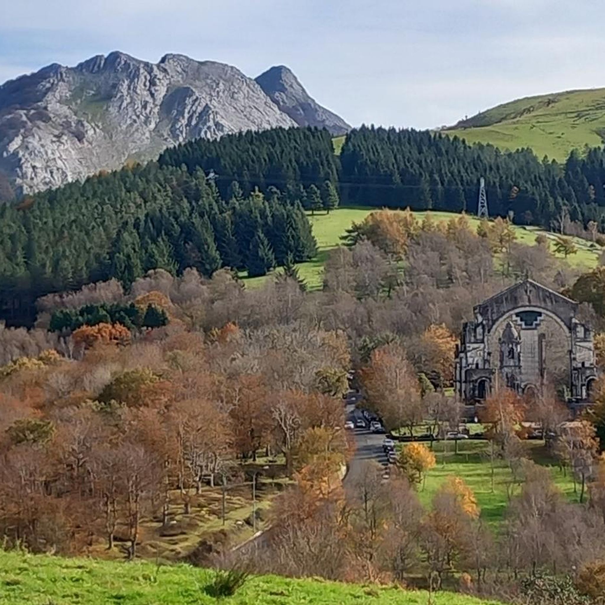
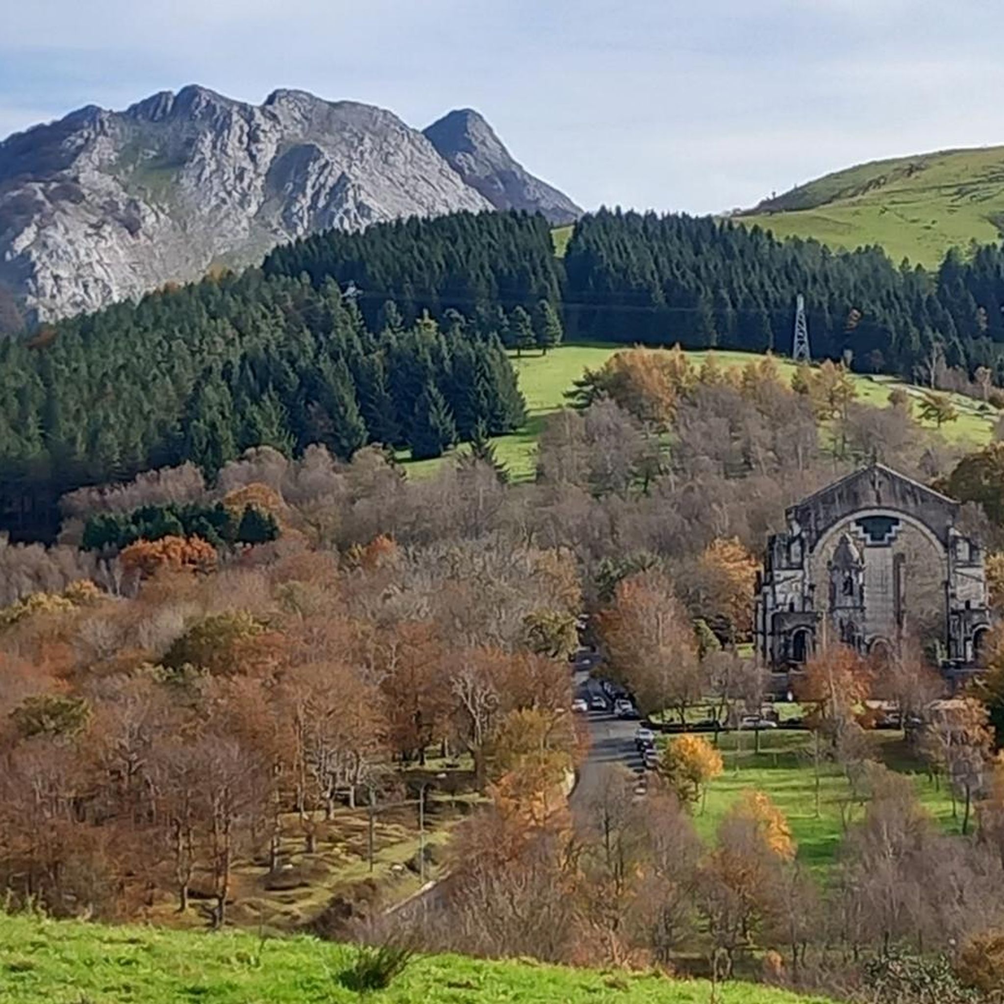




Tips from the Community

Located in the center of San Miguel, on the outskirts of Amorebieta, the hermitage of San Miguel de Dudea. It should be noted that one of the entrances is decorated with diamond points.
0
0
In the province of Biscay, the municipality of Amorebieta-Etxano is crossed by the Ibaizábal River. Among its historic buildings stands out the beautiful church of Santa María de la Asunción, located along the river course.
0
0


Montecalvo is located at an altitude of 381 meters, offering impressive views of the sea and Urdaibai on one side and Duranguesado on the other. The Muniketa road was the main communication route south through Durango until 1848, when the Autzagane road was improved.
1
0

The current official name of the municipality is Arrasate/Mondragón. This double denomination is an old dispute where it was decided that the nucleus should be called both Arrasate and Mondragón, one in Spanish and the other in Basque.
0
0

From the top of Muniketa or Montecalvo, there are exceptional views and you can see the sea and Urdaibai on one side, as well as the Duranguesado on the other. Muniketa is a dispersed neighborhood with several typical hamlets and until 1848 it was the main route of communication to the south through Durango. That year the Autzagane road was improved. In Muniketa is the Astei agrotourism, a rehabilitated farmhouse with restaurant service from where we can perfectly see a slope of Mount Oiz and Goraño. From Artatza, the ascent is a 3.7-kilometre climb with 261 meters of positive elevation gain, 12 beautiful horseshoe curves and a very regular slope of around 7%. From Muxika, the ascent is 9 kilometers and a total of 382 meters of positive slope. More info at: https://www.muxikakoudala.eus/es-ES/informacion-cultural/Barrios/Paginas/Muniketa.aspx
0
0

good place for a pintxo or sweet coffee
0
0

Dima is the perfect place to make a stop and recharge your batteries with a delicious pintxo and coffee, or simply enjoy the beautiful views and the local atmosphere.
0
0
Frequently Asked Questions
How many road cycling routes are available around Urkiola?
There are over 120 road cycling routes around Urkiola, offering a wide range of experiences. You'll find 20 easy routes, 57 moderate routes, and 52 difficult routes, catering to various skill levels and preferences.
What kind of terrain can I expect when road cycling in Urkiola?
Urkiola is characterized by dramatic limestone formations, deep valleys, and extensive forests. Cyclists can expect challenging ascents, notably the legendary Urkiola Pass, which is a regular feature in professional races. The routes wind through varied landscapes, from wooded trails to mountain tracks, with generally well-maintained road surfaces.
Are there any easy or beginner-friendly road cycling routes in Urkiola?
Yes, Urkiola offers 20 easy road cycling routes suitable for beginners or those looking for a less strenuous ride. These routes still allow you to experience the region's natural beauty without the demanding gradients of the more challenging climbs.
What are some notable landmarks or viewpoints along the road cycling routes?
Many routes offer stunning views and pass by significant landmarks. You can enjoy panoramic vistas from the Urkiolaguirre Summit or the Saibi Summit Cross. The Urkiola Sanctuary is a significant cultural landmark, and the Anboto (1,331 m) mountain, central to Basque mythology, is often visible from various points, such as on the route View of Anboto from Atxondo – Climb from Elorrio loop from Durango.
What is the best time of year for road cycling in Urkiola?
The best time for road cycling in Urkiola is generally during the spring and autumn months when the weather is milder and the landscapes are vibrant. While the roads are generally well-maintained, it's always advisable to check the local weather forecast, especially for mountain passes, as conditions can change rapidly.
Are there any loop routes for road cycling in Urkiola?
Yes, many road cycling routes in Urkiola are designed as loops, allowing you to start and finish at the same point. An example is the Dima Village and Scenic Views – Feed Zone Bilbao Bilbao loop from Dima, which offers scenic landscapes and a moderate challenge.
What do other road cyclists enjoy most about road cycling in Urkiola?
The road cycling routes in Urkiola are highly rated by the komoot community, with an average score of 4.4 stars from over 90 reviews. Cyclists frequently praise the challenging ascents, the dramatic limestone formations, and the stunning panoramic views from the summits and passes. The varied terrain and well-maintained roads also contribute to a highly enjoyable experience.
Can I find less crowded road cycling routes in Urkiola?
While the main Urkiola Pass can experience significant traffic, particularly on weekdays, the region offers numerous routes that wind through dense forests and less frequented mountain tracks. Exploring some of the moderate or difficult routes further from the main pass can often lead to a more tranquil cycling experience.
Where can I park my car when going road cycling in Urkiola?
Parking is generally available at key access points to the Urkiola Natural Park, such as near the Urkiola Sanctuary or in the villages surrounding the park. It's recommended to check specific starting points of routes for designated parking areas to ensure convenience and safety.
Are there any cafes or places to stop for refreshments along the routes?
Yes, you can find cafes and establishments in the villages and towns surrounding the Urkiola Natural Park, as well as near popular spots like the Urkiola Pass. These provide opportunities for refreshments and breaks during your ride.
What is the elevation gain like on road cycling routes in Urkiola?
Road cycling in Urkiola is known for its significant elevation changes. Routes can feature substantial climbs, such as the Urkiola Pass. For example, the route Dima Village and Scenic Views – Alto de Dima loop from Durango includes an elevation gain of over 860 meters, providing a challenging workout for experienced cyclists.
Are there any routes that feature the Urkiola Pass?
Absolutely. The Urkiola Pass is a central feature of road cycling in the region, famed for its demanding gradients. Many routes incorporate this iconic climb, offering a significant test of endurance and rewarding panoramic views from the summit. While not explicitly named in the provided routes, many local loops will naturally include or pass near this legendary ascent.
Most popular routes around Urkiola
Most popular attractions around Urkiola

Get inspired with the komoot mobile app


Explore more
Browse the best Road cycling routes in other regions.
