The best cycling routes around Zalamea La Real
4.2
(15)
361
riders
70
rides
Touring cycling routes around Zalamea La Real traverse a landscape characterized by the unique "lunar landscape" of the Riotinto Mining Park and the striking reddish waters of the Río Tinto. The region features diverse natural elements, including extensive pine and eucalyptus forests, as well as preserved oak and cork oak groves. Its undulating topography combines elements of the Andévalo, Sierra, and mining regions, offering varied terrain for cyclists. The area is situated at the confluence of the Río Tinto and…
Last updated: October 13, 2026
5.0
(1)
16
riders
Hard bike ride. Very good fitness required. Mostly paved surfaces. Suitable for all skill levels.
6
riders
17.6km
01:17
220m
220m
Moderate bike ride. Good fitness required. Mostly paved surfaces. Suitable for all skill levels.

5
riders
52.6km
03:50
1,130m
1,130m
Hard bike ride. Very good fitness required. Mostly paved surfaces. Suitable for all skill levels.
5.0
(1)
6
riders
24.3km
01:58
310m
310m
Moderate bike ride. Good fitness required. Mostly paved surfaces. Suitable for all skill levels.
5.0
(2)
6
riders
11.8km
01:08
110m
110m
Easy bike ride. Great for any fitness level. Mostly paved surfaces. Suitable for all skill levels.
Get access to more routes and recommendations from other explorers.
Already have an account?
Our route recommendations are based on thousands of hikes, rides, and runs completed by other people on komoot.
Start today with a free account
Your next adventure awaits.
Tips from the Community

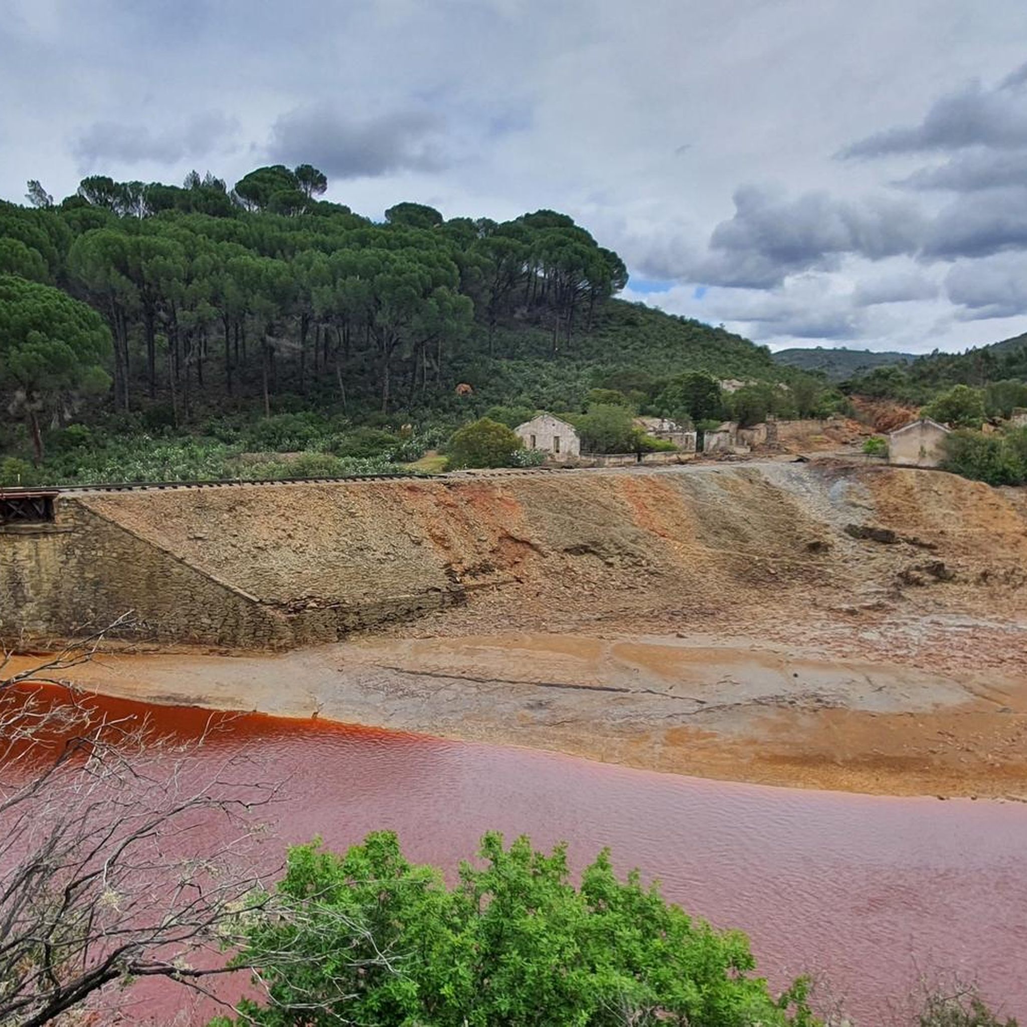
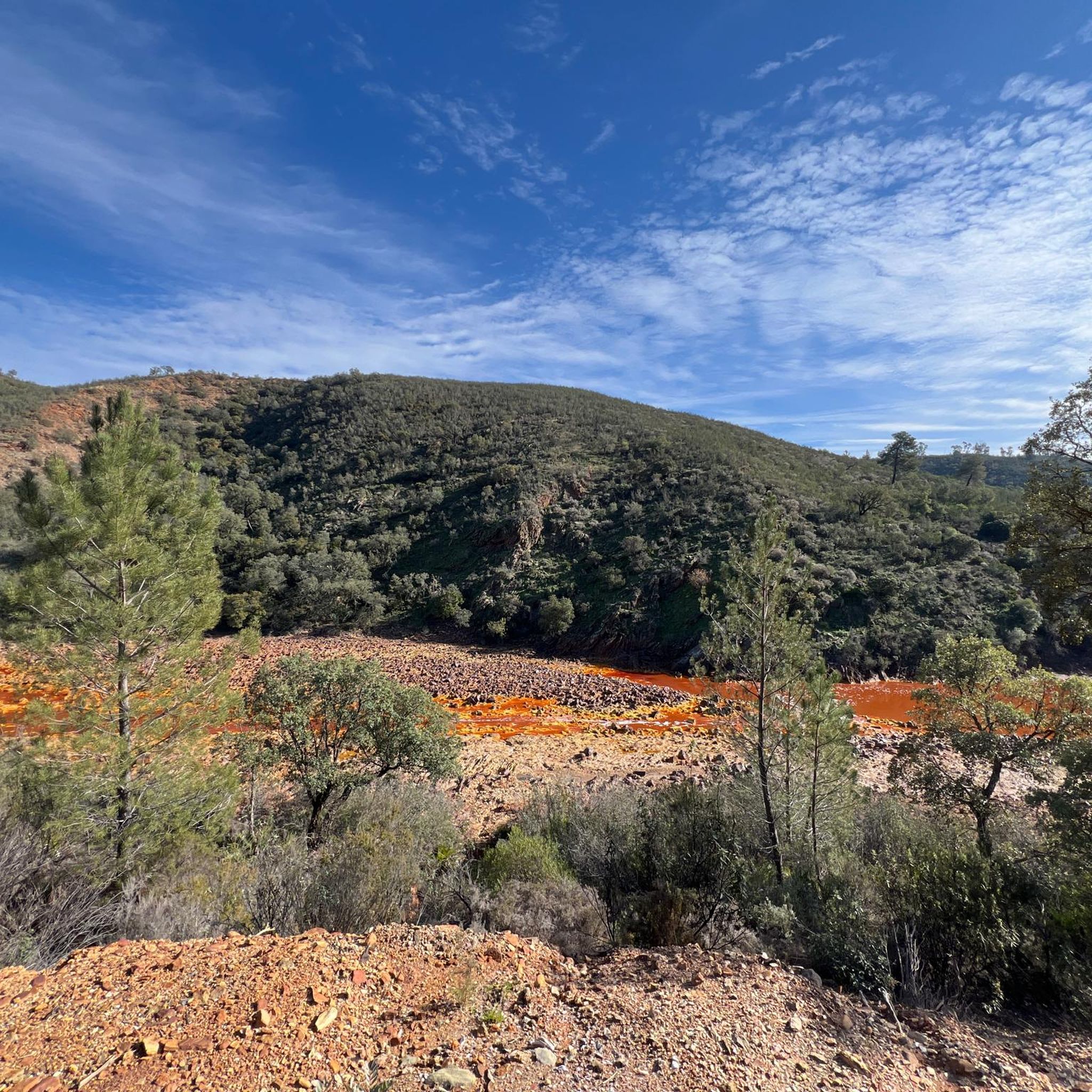
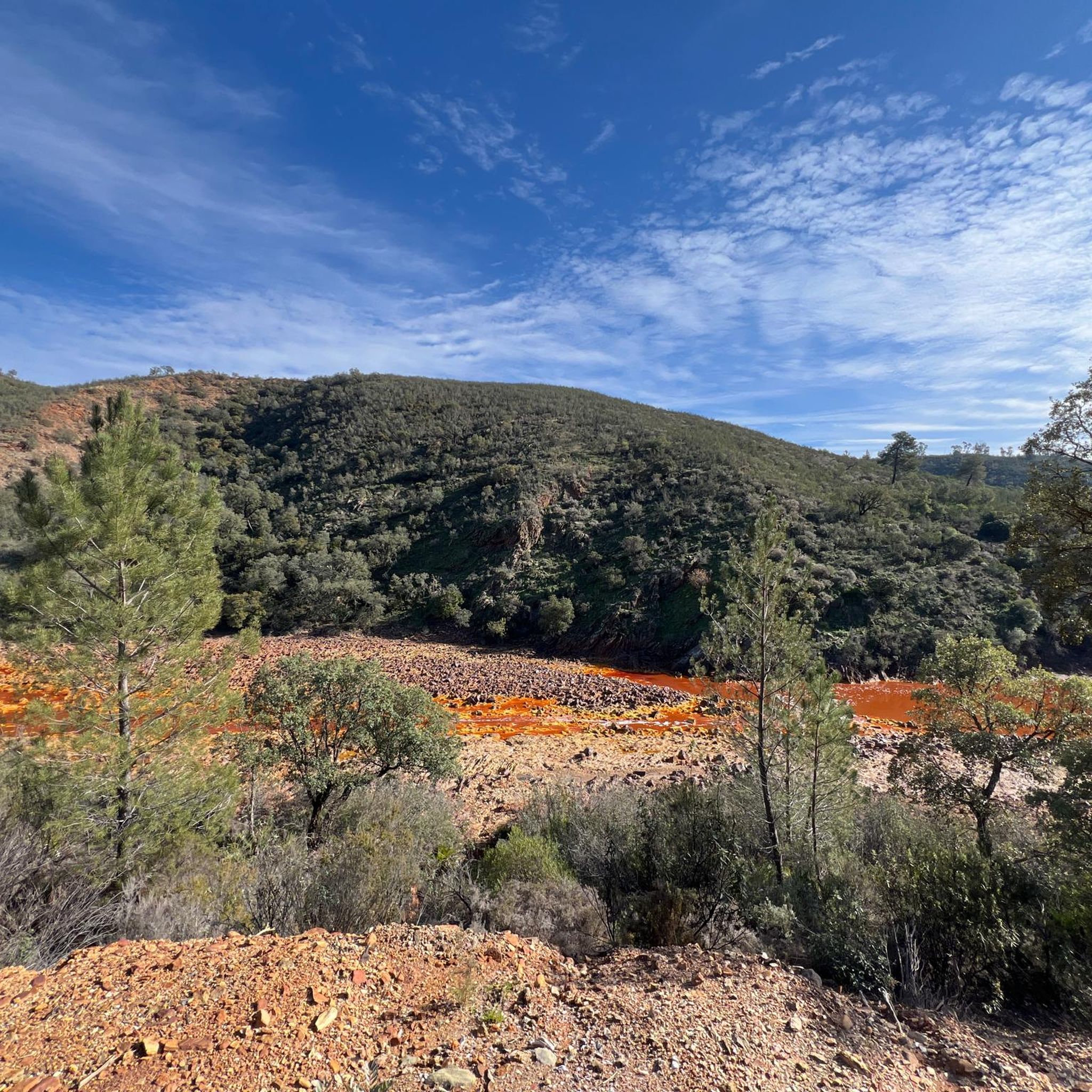
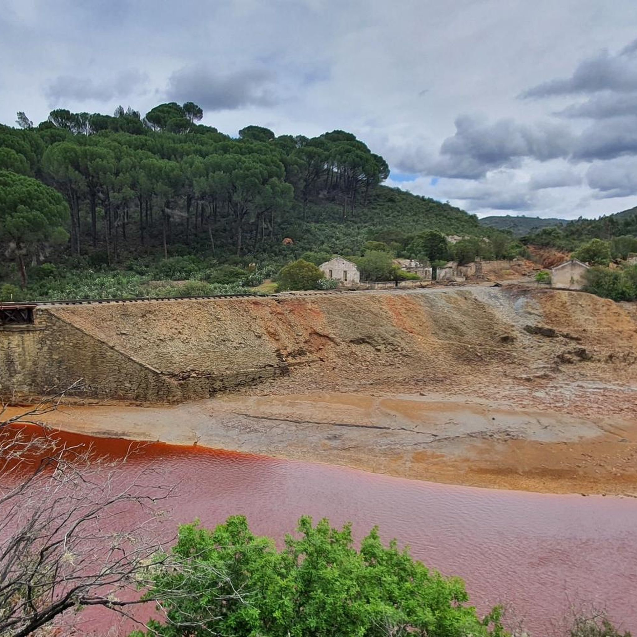
The Tinto River is famous for its intense red-colored waters and extreme acidity, caused by the oxidation of iron and sulfide minerals. It is so peculiar that NASA and other space agencies study it as a terrestrial analogue of Mars, as its extreme conditions host microorganisms capable of surviving in very hostile environments. Furthermore, the area has been mined for over 5000 years by Phoenicians, Romans, and other civilizations.
0
0

The source of the Tinto River is located in the municipality of Nerva, in the province of Huelva, Andalusia, and is one of the most unique landscapes in Europe due to its reddish color and its scientific and geological value.
1
0

Via Verde is in catastrophic condition. Simply don't use it.
0
0

Locomotive No. 201. Popularly called “Gilda”. It was a steam locomotive from the Riotinto mines, where it was used for almost three decades. In 1876, she traveled on the 83 km of tracks from the Riotinto mine to the port of Huelva to transport the mineral.
0
0

Impressive images from the river.
2
0

Cerro Colorao Mine Viewpoint, a viewpoint located above the road with privileged views of this large open pit mine. The landscape is impressive and seeing the trucks that look like toys, you can feel truly small in front of this work. It is the only mine currently active. The site has shade and has an explanatory sign.
1
0

Obligatory stopping point if you take the road. There are incredible views even of the Rio Tinto mining railway.
0
0

Religious sanctuary of the town of Berrocal. Said congregation was divided into two buildings that represented two sides, the one above and the one below. That is why we still find the Hermitage of the Brotherhood of the Santa Cruz de Abajo and the one above.
1
1
Frequently Asked Questions
What kind of terrain can I expect on touring cycling routes in Zalamea La Real?
The touring cycling routes around Zalamea La Real offer a diverse and undulating topography, combining elements of the Andévalo, Sierra, and mining regions. You'll encounter a mix of paved and unpaved surfaces, including gravel and tracks, catering to various cycling preferences and skill levels. The landscape features extensive pine and eucalyptus forests, preserved oak and cork oak groves, and the distinctive 'lunar landscape' of the Riotinto Mining Park.
How many touring cycling routes are available around Zalamea La Real?
There are over 60 touring cycling routes available around Zalamea La Real. These routes vary in difficulty, with options ranging from easy rides to more challenging excursions, ensuring there's something for every cyclist.
Are there touring cycling routes suitable for beginners or families in Zalamea La Real?
Yes, Zalamea La Real offers some touring cycling routes suitable for beginners and families. While many routes are moderate to difficult, there are at least 2 easy routes available. These easier options provide a great way to experience the region's beauty without requiring advanced fitness levels.
What natural features or landmarks can I see while cycling around Zalamea La Real?
While cycling around Zalamea La Real, you can encounter several significant natural features and historical landmarks. Notable sights include the striking reddish waters of the Source of the Río Tinto, the impressive open-pit Corta Atalaya Mine, and the ancient Dolmens of El Pozuelo. You might also pass by the Peña del Hierro and a historic Roman bridge over the Odiel River.
Can I explore the Riotinto Mining Park by touring bike?
Absolutely. The Riotinto Mining Park is a central feature of the region, and several touring cycling routes allow you to explore its unique 'lunar landscape.' For example, the Riotinto Mining Basin Loop is a challenging route that traverses this distinctive area, offering a unique cycling experience.
Are there any circular touring cycling routes in the area?
Yes, many touring cycling routes around Zalamea La Real are designed as circular loops, making them convenient for day trips. A popular option is the Embalse de Gossán y Minas de Riotinto — circular desde Nerva, which takes you through the Riotinto mines and past the Embalse de Gossán.
What is the best time of year for touring cycling in Zalamea La Real?
Zalamea La Real is generally suitable for outdoor activities, including touring cycling, for much of the year. Spring and autumn typically offer the most pleasant temperatures for cycling. Summers can be quite hot, especially in July and August, while winters are generally mild, making it possible to cycle year-round, though some days might be cooler or wetter.
What do other touring cyclists enjoy the most about touring cycling in Zalamea La Real?
The touring cycling routes around Zalamea La Real are highly rated by the komoot community, with an average score of 3.4 stars from over 10 reviews. Cyclists often praise the unique landscapes, particularly the distinctive mining areas and the striking Río Tinto, as well as the diverse natural elements like the pine and eucalyptus forests.
Are there options for parking near the touring cycling routes in Zalamea La Real?
While specific parking facilities for each route are not detailed, Zalamea La Real and nearby towns like Nerva, which serve as starting points for many routes, typically offer public parking options. It's advisable to check local parking availability in the town centers or designated areas before starting your ride.
Is public transport available to Zalamea La Real for cyclists with bikes?
Public transport options to Zalamea La Real, particularly buses, may have varying policies regarding carrying bicycles. It's recommended to check directly with the local bus operators for their specific bicycle policies and any restrictions or additional fees that may apply before planning your journey.
Are there any permits required for touring cycling in the Huelva province?
Generally, no specific permits are required for touring cycling on public roads and established trails in the Huelva province. However, if you plan to cycle through private land or protected natural areas, it's always best to verify if any special permissions or regulations apply. For most touring routes, you can enjoy the ride freely.
Can I find longer touring cycling routes that connect to other towns?
Yes, the region offers longer touring cycling routes that connect Zalamea La Real to other towns. For instance, the Nerva, Campofrío, and La Granada de Río-Tinto Loop is a challenging route that extends through multiple municipalities, providing a more extensive exploration of the area.
What is the elevation gain like on touring cycling routes in Zalamea La Real?
The touring cycling routes around Zalamea La Real feature an undulating topography, meaning you can expect significant elevation changes. Many routes, particularly the more challenging ones, involve considerable climbs and descents. For example, the Minas y Nacimiento del Río Tinto — circular desde Nerva route includes over 600 meters of elevation gain.
Most popular attractions around Zalamea La Real

Get inspired with the komoot mobile app


Explore more
Browse the best Cycling routes in other regions.
