Reserva Natural del Valle de Iruelas
Reserva Natural del Valle de Iruelas
The best road cycling routes around Reserva Natural del Valle de Iruelas
4.6
(12)
2,661
riders
132
rides
Road cycling around Reserva Natural del Valle de Iruelas offers varied terrain within the Sierra de Gredos, featuring significant altitudinal changes. The landscape ranges from the 730-meter elevation at the Burguillo Reservoir to mountainous areas reaching up to 1,950 meters. Cyclists encounter granitoid rocks, lush forests of black pine and oak, and mountain streams like the Iruelas. This diverse topography provides both challenging climbs and scenic descents for road cyclists.
Best road cycling routes around Reserva Natural del Valle de…
Last updated: September 3, 2026
17
riders
Moderate road ride. Good fitness required. Mostly well-paved surfaces and easy to ride.
61
riders
71.8km
03:19
880m
880m
Moderate road ride. Good fitness required. Mostly well-paved surfaces and easy to ride.

Sign up for free
39
riders
74.8km
03:42
1,170m
1,170m
Hard road ride. Very good fitness required. Mostly well-paved surfaces and easy to ride.
36
riders
71.5km
03:42
1,240m
1,240m
Hard road ride. Very good fitness required. Mostly well-paved surfaces and easy to ride.
7
riders
77.3km
03:47
1,120m
1,120m
Hard road ride. Very good fitness required. Mostly well-paved surfaces and easy to ride.
Get access to more routes and recommendations from other explorers.
Sign up for free
Already have an account?
Our route recommendations are based on thousands of hikes, rides, and runs completed by other people on komoot.
Start today with a free account
Your next adventure awaits.
Login or Signup
Popular around Reserva Natural del Valle de Iruelas

Tips from the Community

Los Toros de Guisando are a set of zoomorphic sculptures of Vettonian origin, carved in granite between the 4th and 2nd centuries BC. They probably represent bulls or verracos and were linked to rituals for the protection of livestock and the delimitation of territory.
0
0

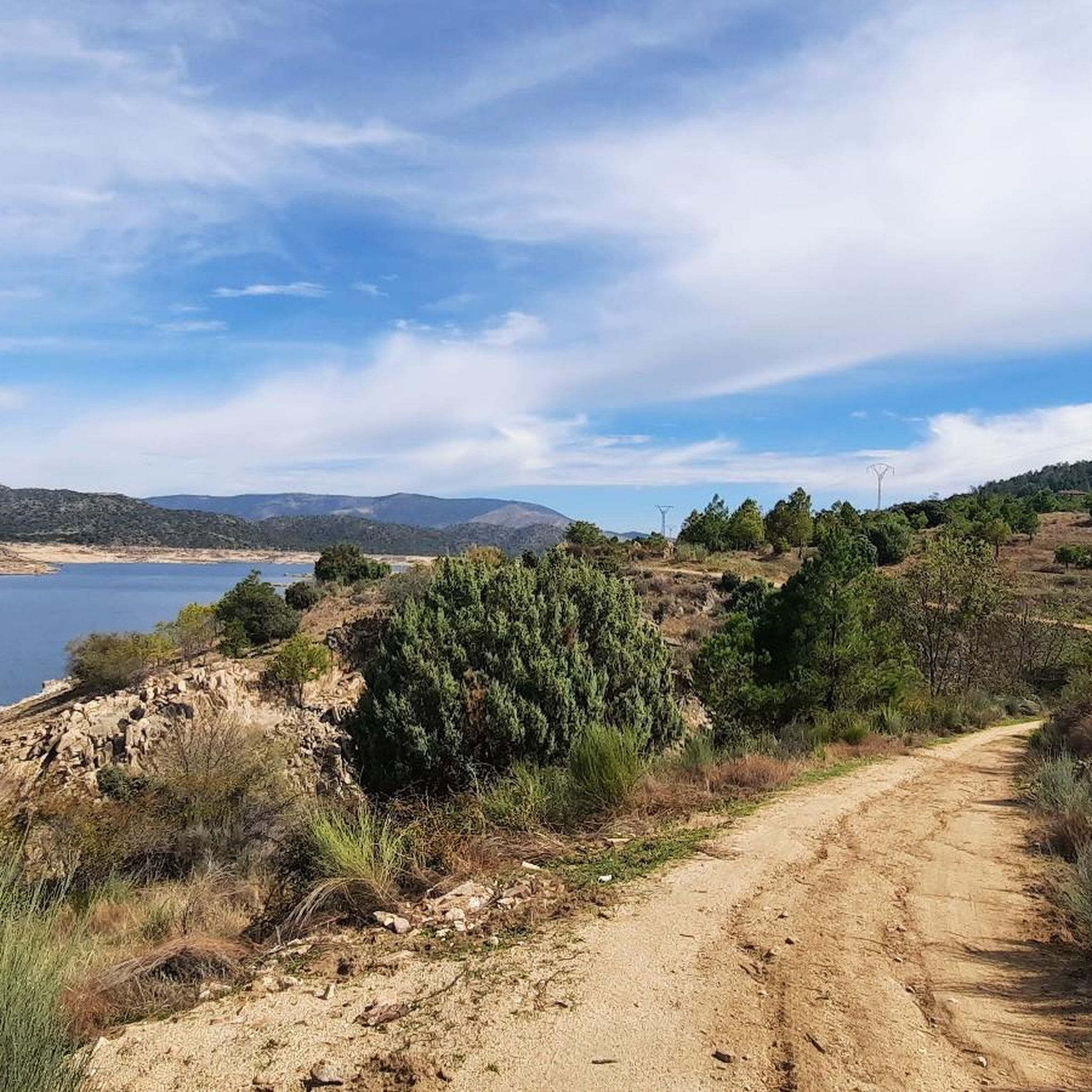
Beautiful road alongside the reservoir, very quiet. It has no paved exit.
0
0

The cycle trip continues along the lane of the Jacobean route until it connects with the Cebreros highway. The route continues along the side of the road, passing through the popular port of Arrebatacapas and another descent to Cebreros, a mountain town with a wine-growing tradition that would be a good place to finish the second stage when organized as a three-day trip. The Camino de Levante descends from the port along a mountain path that is quite technical and difficult by bicycle, suitable for trail experts and everyone can choose. The path begins next to the port sign and ends where the road enters the urban complex. The track goes down the road, crosses the town and continues the descent along the old Camino Real de Toledo, used by the funeral procession of Isabel la Católica when they carried her remains from Medina del Campo to Granada. At the Cebreros exit there are remains of the old medieval road and on the Alberche River there are the monumental bridges of Valsordo and Santa Yusta, used since Roman times, although they have undergone several reconstructions throughout history. The climb coincides with the last arrows of the Camino de Levante and deviates through the Puente Nuevo urbanization towards San Martín de Valdeiglesias, following the markings of the GR-10 long-distance path, with several hard ramps on the Camino de la Aliseda.
0
0

The arrangement of the sculptures is interesting: they are side by side, forming a line in a north-south direction and all of them facing west, to the hill of Cerro de Guisando, from which they receive their name. The Tórtolas stream, which is located behind it, marks the natural border between the communities of Castilla y León and Madrid.
13
0

It is a very beautiful route leaving from the campsite passing through green roads until you reach the castle
0
0

It is a place where you can admire stone carvings that are more than 2,000 years old that were recovered and taken there so that they can be contemplated by visitors who wish to do so. You have to pay a small entrance fee of €2 to ensure the conservation and maintenance of the sculptures, but it is definitely worth it. These are 4 bulls carved in stone from the 3rd century BC. next to an old inn or inn called "Juradera" in which the pact was signed between Enrique IV and his sister Isabel.
21
0

The Guisando Bulls are an outstanding example of Vetona sculpture, a pre-Roman art, found in the municipality of El Tiemblo, in the province of Ávila. These are four large granite statues that represent bulls. These sculptures date from the 6th or 3rd century BC. and they are considered one of the most outstanding examples of Veton sculpture, associated with Celtic culture. Although their exact meaning is unclear, it is believed that the Guisando Bulls could have a symbolic or religious purpose related to fertility and the protection of livestock. There has also been speculation about its possible connection with ritual ceremonies.
12
0

Cadalso de los Vidrios acquired fame in the 16th and 17th centuries thanks to the fact that its glass factory supplied the royal pharmacy of the monastery of San Lorenzo de El Escorial. In the municipality there are important historical buildings, such as the Renaissance palace of Villena. This town is located at the top of the hillside, which allows you to contemplate the Alberche valley majestically.
1
0
Frequently Asked Questions
How many road cycling routes are available in Reserva Natural del Valle de Iruelas?
The Reserva Natural del Valle de Iruelas offers a wide selection of road cycling routes, with over 100 options to explore. These routes cater to various skill levels, from moderate to difficult, ensuring there's a suitable challenge for most cyclists.
What kind of terrain and elevation can I expect on road cycling routes in the Valle de Iruelas?
Road cycling in the Valle de Iruelas features diverse terrain with significant altitudinal changes. You can expect routes ranging from the 730-meter elevation around the Burguillo Reservoir to mountainous areas reaching up to 1,950 meters. This variation provides both challenging climbs and scenic descents, often characterized by granitoid rocks and lush forests.
Are there any circular road cycling routes in the Reserva Natural del Valle de Iruelas?
Yes, many of the road cycling routes in the Reserva Natural del Valle de Iruelas are designed as loops, offering convenient circular journeys. For example, the popular El Burguillo Reservoir – Burguillo Reservoir loop from La Chorreta is a 44.6-mile route that circles the reservoir, providing a complete experience without retracing your path.
What are some notable landmarks or viewpoints I can see while road cycling in the region?
The region is rich in natural beauty and offers several rewarding viewpoints. You can cycle past the expansive Burguillo Reservoir, or climb to the Puerto de Casillas, which provides spectacular panoramic views of the entire valley. Another route, Views of Hoyo de Pinares – Viewpoint of the city of Madrid loop from El Tiemblo, offers varied terrain and significant elevation changes, leading to impressive vistas.
What is the best time of year for road cycling in Reserva Natural del Valle de Iruelas?
The diverse topography of the Valle de Iruelas makes it suitable for road cycling across multiple seasons. Spring and autumn generally offer pleasant temperatures and vibrant landscapes. While specific weather patterns vary, the region's varied altitudes mean conditions can change, so checking local forecasts is always recommended.
Are there any family-friendly road cycling options in the Valle de Iruelas?
While many routes in the Valle de Iruelas involve significant elevation changes, there are some easier options available. The region has 5 easy road cycling routes, which might be more suitable for families or those looking for a less strenuous ride. These routes often stick to flatter sections, such as those closer to the Burguillo Reservoir.
Where can I find parking for road cycling routes in the Reserva Natural del Valle de Iruelas?
Specific parking areas for cyclists are often available near popular starting points for routes. For instance, routes like the El Burguillo Reservoir – Burguillo Reservoir loop from La Chorreta or those starting from El Tiemblo, such as El Burguillo Reservoir – Burguillo Reservoir loop from El Tiemblo, typically have designated parking facilities nearby. It's advisable to check the route details on komoot for specific trailhead information.
What do other road cyclists enjoy most about cycling in Reserva Natural del Valle de Iruelas?
The area is highly rated by the komoot community, with an average score of 4.4 stars from over 10 reviews. Cyclists often praise the varied terrain, which offers both challenging climbs and rewarding descents, as well as the stunning natural beauty, including the Burguillo Reservoir and the lush forests. The sense of accomplishment from tackling routes with significant elevation gain is also frequently highlighted.
Are there any natural monuments or unique natural features to explore near the cycling routes?
Absolutely. The reserve is home to several unique natural features. You can visit the famous El Abuelo Chestnut Tree (Castañar de El Tiemblo) or The Grand Chestnut of El Tiemblo, both ancient and impressive trees. The region is also known for its diverse forests, including centenary black pine and juniper, and is a Special Protection Area for birds, notably hosting a large colony of black vultures.
Can I find accommodation or places to eat near the road cycling routes?
Yes, the region offers options for accommodation and dining. The former village of Las Cruceras, located on the banks of the Burguillo Reservoir, has been rehabilitated for rural tourism. Additionally, towns like El Tiemblo, Casillas, and Navaluenga, which serve as starting points or pass-throughs for many routes, typically have cafes, pubs, and restaurants where cyclists can refuel and rest.
What are the most challenging road cycling routes in the Valle de Iruelas?
For experienced cyclists seeking a challenge, the Valle de Iruelas offers several difficult routes with substantial elevation gains. An example is the Hinojosa de San Vicente – Casillas loop from Casillas, a 50.5-mile path that includes nearly 4,920 feet (1,500 meters) of climbing, providing panoramic views as a reward for the effort.
Is public transport an option for reaching the Reserva Natural del Valle de Iruelas with a bike?
While specific public transport options for bikes can be limited, some regional bus services might allow bikes, often requiring prior arrangement or specific times. It's best to check with local transport providers for their current policies regarding bicycle carriage to towns like El Tiemblo or Casillas, which are common access points to the reserve.
Most popular routes around Reserva Natural del Valle de Iruelas
Most popular attractions around Reserva Natural del Valle de Iruelas

Get inspired with the komoot mobile app


Explore more
Browse the best Road cycling routes in other regions.
