The best cycling routes around Parc del Castell de Montesquiu
4.4
(66)
2,149
riders
153
rides
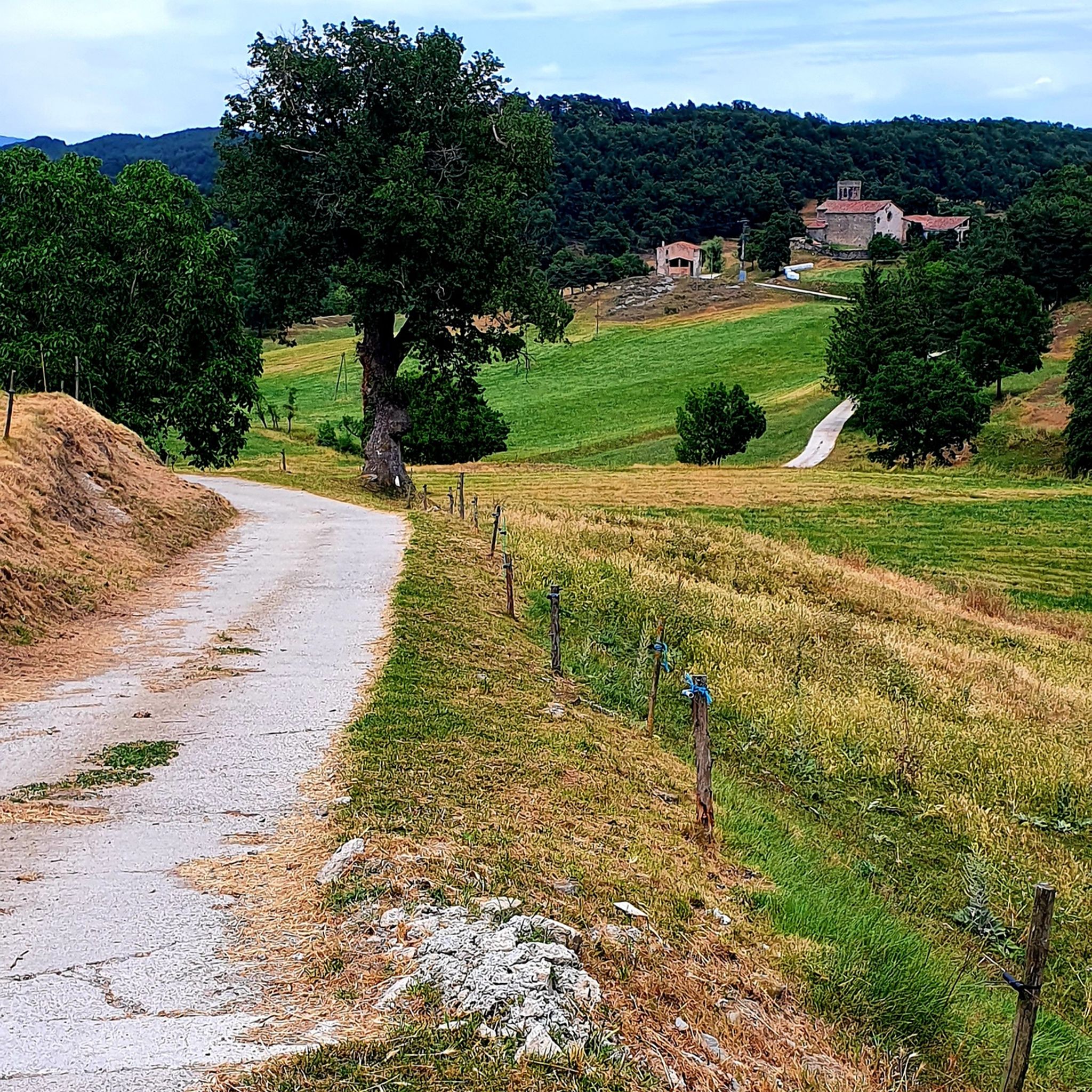
Touring cycling around Parc del Castell de Montesquiu offers diverse landscapes in the eastern Pre-Pyrenean region of Catalonia, Spain. The park features a mix of east-west mountain ranges, including the Bufadors Range, with elevations between 580 and 850 meters. The Ter River longitudinally divides the park, creating riparian environments alongside dense forests of oaks, Scots pines, and beech trees, as well as open meadows. This varied topography provides a range of routes for touring cyclists.
Best touring cycling routes around…
Last updated: July 12, 2026
5.0
(2)
17
riders
43.7km
03:20
770m
770m
Hard bike ride. Very good fitness required. Mostly paved surfaces. Suitable for all skill levels.
14
riders
Hard bike ride. Very good fitness required. Mostly paved surfaces. Suitable for all skill levels.

Sign up for free
14
riders
Hard bike ride. Very good fitness required. Mostly paved surfaces. Suitable for all skill levels.
11
riders
Hard bike ride. Very good fitness required. Mostly paved surfaces. Suitable for all skill levels.
5.0
(1)
9
riders
28.6km
02:15
570m
570m
Hard bike ride. Very good fitness required. Mostly paved surfaces. Suitable for all skill levels.
Get access to more routes and recommendations from other explorers.
Sign up for free
Already have an account?
Our route recommendations are based on thousands of hikes, rides, and runs completed by other people on komoot.
Start today with a free account
Your next adventure awaits.
Login or Signup
Popular around Parc del Castell de Montesquiu

Other adventures around Parc del Castell de Montesquiu

Tips from the Community

Sanctuary of the Munts, viewpoint of Osona and Lluçanés, spectacular views.
0
0

Good asphalt and good climbs
0
0
Impressive views, very quiet place with little traffic 100% recommended
0
0


The center of Santa Eulàlia de Puig-Oriol belongs to the municipality of Lluçà and is located on the ridge that separates the valley of the Gavarresa river from the valley of the Lluçanès river. The town grew from the first constructions in the 18th century, due to the importance of the transhumance route that connected Sant Feliu Sasserra with Alpens. In many of its houses built between the 18th and 19th centuries you can still read the inscriptions and dates engraved in the stone. At the northern end of the town there is a small parish church in the popular baroque style.
0
0

A nice graf and several mosaics in this former industrial area...
0
0
It was a beautiful building from the facade...
0
0

A few months ago I covered the route from the R 3 train station, from Farga de Bebié to Montesquiu Castle and back to Sant Quirze de Besora Pueblo de la Ratafía: It is approximately 5 km. It is worth it, it is a very beautiful route.
2
0
Frequently Asked Questions
How many touring cycling routes are available in Parc del Castell de Montesquiu?
There are over 160 touring cycling routes in Parc del Castell de Montesquiu. This includes a diverse selection, with 4 easy routes, 49 moderate routes, and 109 difficult routes, catering to various skill levels and preferences.
What kind of terrain can I expect on touring cycling routes in the park?
The terrain in Parc del Castell de Montesquiu is quite varied. You'll encounter east-west mountain ranges like the Bufadors and Serrat de la Rovira, with elevations typically between 580 and 850 meters. The Ter River valley offers flatter sections, while other routes traverse dense forests of oaks, Scots pines, and beech trees, as well as open meadows and cultivated fields. This mix provides both challenging ascents and scenic, gentler rides.
Are there any family-friendly touring cycling routes in Parc del Castell de Montesquiu?
Yes, the park offers a few easier routes that are suitable for families. While many routes are rated as moderate or difficult, there are 4 routes specifically categorized as easy. These typically feature less elevation gain and shorter distances, making them more accessible for a family outing. Look for routes with lower difficulty ratings on komoot to find the most suitable options.
What historical landmarks or natural features can I see along the cycling routes?
The park is rich in both historical and natural attractions. You can cycle past the historic Montesquiu Castle, which dates back to the 10th century, and its attractive gardens. Other points of interest include the chapel of Sant Moí and the Codines bridge, a small single-arch bridge over the Sora stream. For natural beauty, routes often feature panoramic viewpoints like Montesquiu Viewpoint and La Rovira Viewpoint, offering stunning vistas of the Ter River, forests, and the surrounding village.
What do other touring cyclists enjoy most about cycling in Parc del Castell de Montesquiu?
The area is highly rated by the komoot community, with an average score of 4.3 stars from over 80 reviews. Touring cyclists often praise the diverse landscapes, which include river valleys, mountain ranges, and dense forests. The variety of routes, from challenging climbs to more relaxed rides, is also frequently highlighted, along with the opportunity to explore historical landmarks like Montesquiu Castle.
Are there any circular touring cycling routes in the park?
Yes, many of the touring cycling routes in Parc del Castell de Montesquiu are designed as loops, allowing you to start and end at the same point. For example, the Sant Miquel de Gallifa – Camí dels Munts loop from Sant Quirze de Besora is a popular option. Another great choice is the Santa Maria de Besora Village loop from Sant Quirze de Besora, offering scenic views and passing through village areas.
What is the best time of year to go touring cycling in Parc del Castell de Montesquiu?
The region experiences a benign climate with abundant rainfall and moderate temperatures, making it suitable for cycling for much of the year. Spring and autumn are generally ideal, offering pleasant temperatures and vibrant natural scenery. Summer can be warm, especially in the middle of the day, so early morning or late afternoon rides are recommended. Winter cycling is also possible, though some higher elevation routes might be cooler.
Are dogs allowed on the touring cycling trails in Parc del Castell de Montesquiu?
While the park is a natural space, specific rules regarding dogs on cycling trails can vary. Generally, dogs are permitted in natural parks but often need to be kept on a leash, especially in areas with wildlife or near cultivated fields. It's always best to check local signage or the park's official guidelines upon arrival to ensure compliance and a pleasant experience for everyone.
Where can I park my car when visiting Parc del Castell de Montesquiu for cycling?
Parking facilities are typically available near main access points to the park, especially around popular starting points for routes or near the Montesquiu Castle itself. Many routes, such as the Montesquiu Castle – Sant Agustí Pass loop from Sant Quirze de Besora, often start from villages like Sant Quirze de Besora, where public parking options can be found. It's advisable to check specific route details for recommended parking locations.
Are there any long-distance touring cycling routes that pass through or near the park?
Yes, some routes extend beyond the immediate park boundaries, offering longer distances for touring cyclists. For instance, the Plaça de Sant Pere, Berga – La Baells Reservoir loop from Sant Quirze de Besora is a challenging 96.9 km route that takes you through diverse landscapes, including the La Baells Reservoir, providing a significant long-distance cycling experience.
What are the official cycling rules or restrictions within Parc del Castell de Montesquiu?
The park generally encourages cycling on roads, forest trails, or paths wider than three meters. However, there might be temporary or permanent restrictions in certain sensitive areas to protect wildlife or natural habitats. It's important to respect all signage and local regulations within the protected natural space. Always stay on marked trails and avoid disturbing the environment.
Are there options for advanced touring cyclists seeking a challenge?
Absolutely. The park features a significant number of difficult routes, with 109 routes falling into this category. These routes often involve substantial elevation gain and longer distances, providing a robust challenge for experienced touring cyclists. An example is the Font del Padró – Camí dels Munts loop from Sant Quirze de Besora, which covers over 50 km with considerable climbing.
Most popular routes around Parc del Castell de Montesquiu

Get inspired with the komoot mobile app


Explore more
Browse the best Cycling routes in other regions.
