The best walks and hikes around Villaespasa
4.3
(21)
202
hikers
22
hikes
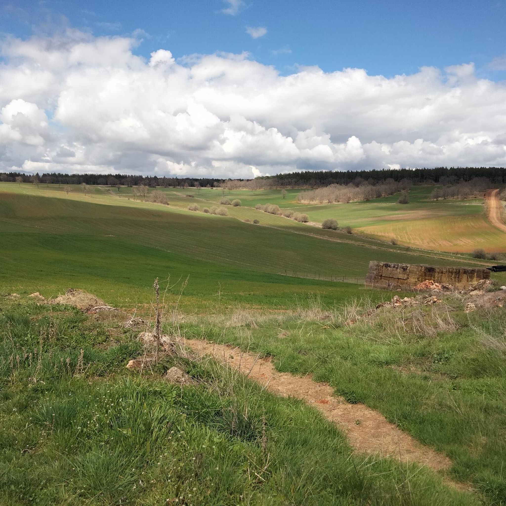
Hiking trails around Villaespasa are situated within the Sierra de la Demanda mountain range in Spain's Castilla y León region. The landscape features a varied terrain of hills, small rivers, and streams. This area offers a blend of natural environments and historical sites, providing diverse options for outdoor activities.
Best hiking trails around Villaespasa
- The most popular hiking route is Pico Mencilla by Pineda de la Sierra — circular through the Sierra de Mancilla, a 9.2 miles (14.8 km)…
Last updated: October 15, 2026
5.0
(1)
24
hikers
Hard hike. Very good fitness required. Mostly accessible paths. Sure-footedness required.
3.0
(1)
8
hikers
17.7km
04:55
330m
330m
Hike 11.0 miles (17.7 km) to explore the Peñalara massif and the ancient Dolmen of Cubillejo de Lara from Quintanilla de las Viñas.

1
hikers
11.9km
03:37
400m
400m
Hike the moderate 7.4-mile Bosque de Enraizados loop on Cerro San Cristóbal, exploring native forest restoration and panoramic views.
4.0
(1)
2
hikers
20.0km
05:42
450m
450m
Hard hike. Very good fitness required. Mostly accessible paths. Sure-footedness required.
16.5km
04:29
240m
230m
Moderate hike. Good fitness required. Mostly accessible paths. Sure-footedness required.
Get access to more routes and recommendations from other explorers.
Already have an account?
Our route recommendations are based on thousands of hikes, rides, and runs completed by other people on komoot.
Start today with a free account
Your next adventure awaits.



Tips from the Community

This humble rural church stands out for housing an authentic artistic gem inside: an exceptional Romanesque baptismal font from the 12th century.
0
0
The summit of Peñalara in Burgos (also known as Peña Lara or Sierra de Lara) rises to 1,296 meters in altitude in the heart of the Sierra de la Demanda region, overlooking the historic valley of Tierra de Lara.
0
0
Peñalara is a rocky mountain range and an impressive natural viewpoint of 1,296 meters in altitude, located in the Sierra de Lara (Lara region / Sierra de la Demanda). The hike is worth it to enjoy the views from its summit.
0
0
El Mencilla is the highest summit of the Mencilla mountain range, which in turn is part of the Sierra de la Demanda within the Iberian system. With an altitude of 1932 meters above sea level and a prominence of 532 meters, it gives its name to the homonymous mountain range. It is located in the Sierra de la Demanda natural space and the municipal terms of Pineda de la Sierra and Tinieblas de la Sierra converge here, part of the Sierra de la Demanda region, in the province of Burgos.
0
0

Crossing of the hill path with the path down to Tinieblas de la Sierra.
1
1
The Cubillejo/Mazariegos dolmen is considered the prototype of the megalithic passage tomb and preserves, on one of the large stone blocks that form its structure, a series of interesting rock carvings.
0
0

a highly recommended area for hiking.
0
0
a highly recommended area for hiking.
0
0
Frequently Asked Questions
How many hiking trails are available around Villaespasa?
There are over 15 hiking routes around Villaespasa, offering a variety of experiences within the Sierra de la Demanda. These include easy strolls, moderate loops, and more challenging ascents.
Are there any easy hiking trails suitable for beginners in Villaespasa?
Yes, Villaespasa offers 3 easy hiking trails, perfect for those new to hiking or looking for a relaxed walk. These routes typically feature gentler terrain and shorter distances, allowing you to enjoy the natural beauty without significant effort.
What kind of landscapes can I expect to see on hikes around Villaespasa?
Hiking around Villaespasa immerses you in the diverse landscapes of the Sierra de la Demanda. You'll encounter a varied terrain of rolling hills, small rivers (riachuelos), and streams (arroyos). Routes often traverse woodlands, open countryside, and offer panoramic views of the Arlanza Valley.
Are there any circular hiking routes near Villaespasa?
Yes, many of the trails around Villaespasa are circular, allowing you to start and end at the same point. For example, the challenging route to the Mirador de las Peñas del Tuero offers stunning panoramic views of the Arlanza Valley and is a popular circular option.
What historical or cultural sites can I explore while hiking in the area?
The region around Villaespasa blends natural beauty with historical intrigue. You can visit ancient sites like the 5,000-year-old Dolmen of Cubillejo de Lara, which is passed by the Quintanilla de las Viñas, Peñalara, and Cubillejo Dolmen Loop. Other notable landmarks include the 17th-century Ermita de Valpeñoso and the 15th-century Iglesia de Santa Eulalia.
Are there any hikes that offer great viewpoints?
Absolutely. The Mirador de las Peñas del Tuero is a prominent natural viewpoint offering panoramic vistas of the entire Arlanza Valley. It's also known as a spot where griffon vultures perch, adding to the experience.
What do other hikers say about the trails in Villaespasa?
The trails in Villaespasa are highly regarded by the komoot community, with an average rating of 4.4 stars. Hikers often praise the varied terrain, the blend of natural and historical sights, and the rewarding views from peaks like Pico Mencilla.
Can I find trails that lead to mountain peaks around Villaespasa?
Yes, the Sierra de la Demanda offers several peaks to conquer. While the challenging Pico Mencilla is a prominent option, you can also find routes leading to other summits such as Castillejo and CabezaPlantizo, offering rewarding climbs and views.
Are there any trails that pass by castles or ancient ruins?
Yes, you can explore historical ruins on your hikes. The Climb to Castillo Infantes de Lara is a moderate circular route that takes you to the remains of the Castillo Infantes de Lara, offering a glimpse into the region's past.
What is the best time of year to go hiking in Villaespasa?
The best time to hike in Villaespasa, located in Castilla y León, is typically during the spring (April to June) and autumn (September to October). During these seasons, the weather is generally mild and pleasant, with comfortable temperatures for outdoor activities and vibrant natural colors. Summers can be hot, and winters may bring colder temperatures and occasional snow in higher elevations.
Are there any trails suitable for wildlife observation?
The natural environment of the Sierra de la Demanda provides opportunities for wildlife observation. The area around the Peñas del Tuero Viewpoint is particularly known for griffon vulture perches, making it an excellent spot for birdwatching.
Most popular attractions around Villaespasa

Get inspired with the komoot mobile app


Explore more
Browse the best Hikes in other regions.
