The best road cycling routes around Mengamuñoz
4.0
(2)
185
riders
5
rides
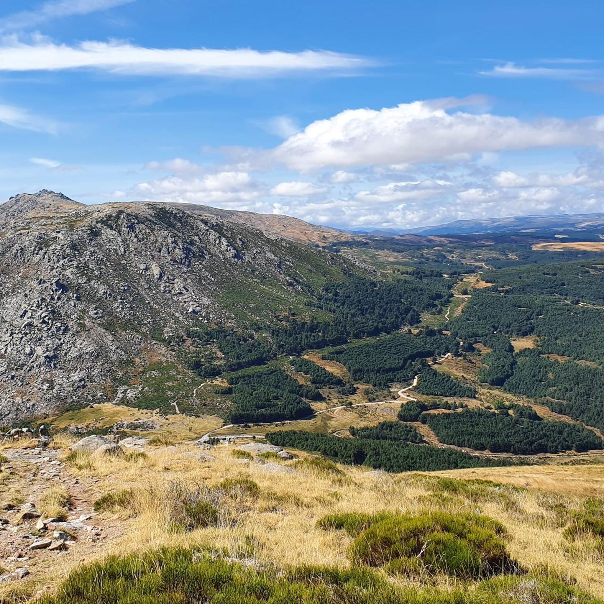
Road cycling around Mengamuñoz is characterized by its location within the Sierra de Gredos mountain range, offering a diverse and challenging terrain for cyclists. The region features well-maintained secondary and tertiary roads that wind through mountainous backdrops. Cyclists encounter significant elevation changes, including demanding climbs and rewarding descents, making it suitable for experienced riders. The landscape is defined by dramatic mountain scenery, valleys, and diverse ecosystems.
Best road cycling routes around Mengamuñoz
- The most popular road cycling route is Puerto…
Last updated: July 14, 2026
3.0
(1)
91
riders
115km
06:19
2,390m
2,390m
Hard road ride. Very good fitness required. Mostly well-paved surfaces and easy to ride.
11
riders
89.9km
04:42
1,450m
1,450m
Hard road ride. Very good fitness required. Mostly well-paved surfaces and easy to ride.

Sign up for free
11
riders
93.6km
04:50
1,580m
1,580m
Hard road ride. Very good fitness required. Some segments of this route may be unpaved and difficult to ride.
5
riders
126km
06:31
2,090m
2,080m
Hard road ride. Very good fitness required. Mostly well-paved surfaces and easy to ride.
3
riders
46.8km
02:17
610m
610m
Moderate road ride. Good fitness required. Mostly well-paved surfaces and easy to ride.
Our route recommendations are based on thousands of hikes, rides, and runs completed by other people on komoot.
Start today with a free account
Your next adventure awaits.
Login or Signup
Popular around Mengamuñoz


Tips from the Community

The Parador de Gredos, located in Navarredonda de Gredos (Ávila), is a historic and emblematic landmark in the Sierra de Gredos mountains, surrounded by pine forests and spectacular landscapes. Inauguration: October 9, 1928, by King Alfonso XIII. First Parador in Spain: It marked the beginning of the national network of Paradores, designed to promote tourism in natural settings and unique buildings. Architecture: Built with stone and slate, inspired by Castilian aesthetics, with rustic and welcoming interiors.
1
0

The views and panoramas of the Gredos Mountains from this point are incredible. The location is near the town of Hoyos del Espino.
0
0

A beautiful panoramic view of the Gredos mountain range from its northern slope, very close to the first Parador de Turimo in the history of Spain.
0
0


Beautiful views, on a good day you can see people taking off on paragliders.
0
0
A magnificent mountain pass to climb by bike with magnificent views from either side.
0
0
It's a tourist attraction with historical significance. This early 20th-century building was the first tourist inn in Spain. It opened in 1928. Later, it was also used as a meeting place by the proponents of the Spanish Constitution. You can stop for lunch at its terrace café in summer. The views of the pine forests and the Gredos mountain range are enchanting.
0
0
It is one of the most inhospitable ports in the Sierra de Gredos and has a lot of charm, not so much from a purely cycling point of view, but from a landscape point of view. If you are looking for a route through the northern area of Gredos, you have to go through this beautiful port.
0
0
Frequently Asked Questions
What kind of terrain can I expect when road cycling around Mengamuñoz?
Road cycling around Mengamuñoz, situated within the Sierra de Gredos mountain range, offers a diverse and challenging terrain. You'll encounter well-maintained secondary and tertiary roads winding through dramatic mountainous backdrops, featuring significant elevation changes with both demanding climbs and rewarding descents. The region is known for its rugged, high-mountain environment.
Are there any challenging climbs for experienced road cyclists in the area?
Yes, the Sierra de Gredos is renowned for its demanding climbs. Routes frequently feature high mountain passes like Peña Negra Pass and Chía Pass. For example, the Peña Negra Pass – Chía Pass (1,663 m) loop from Hoyocasero includes continuous ascents and descents, covering over 2,300 meters of elevation gain. Another challenging option is the Puerto de Villatoro – Peña Negra Pass loop from Mengamuñoz, which features over 2,000 meters of elevation gain.
What are some notable landmarks or points of interest I might see along the cycling routes?
As you cycle, you'll pass through picturesque mountain villages and enjoy stunning natural scenery. Notable landmarks and points of interest in the broader Gredos region include the historic Villatoro and Cepeda la Mora. You might also spot the Rollo de Muñotello, a historic monument, or enjoy views of the Serrota summit.
What is the best time of year for road cycling in Mengamuñoz?
The region is particularly vibrant in June when the native *piorno* (mountain broom) blankets the hillsides with bright yellow flowers, creating a spectacular natural display. While specific climate data isn't provided, the mountainous nature suggests spring and autumn offer pleasant temperatures, while summer can be warm, and winter may bring challenging conditions at higher elevations.
Are there any circular road cycling routes available?
Yes, many of the routes around Mengamuñoz are designed as loops, allowing you to start and finish in the same location. Examples include the Peña Negra Pass – Chía Pass (1,663 m) loop from Hoyocasero and the Puerto de Menga – Muñogalindo loop from La Torre.
What do other road cyclists enjoy most about cycling in Mengamuñoz?
The area is highly rated by the komoot community, with an average score of 4.0 stars. Cyclists often praise the challenging mountain passes, the stunning natural vistas of the Sierra de Gredos, and the opportunity to experience rural Spain through its charming villages.
Are there any moderate road cycling routes for those looking for a less intense ride?
While the region is primarily known for its difficult routes, there are some moderate options available. For instance, the Puerto de Menga – Muñogalindo loop from La Torre is a moderate 46.8 km (29.1 miles) trail that leads through varied rural landscapes and can be completed in about 2 hours 17 minutes.
Is there public transport available to Mengamuñoz that can accommodate bicycles?
Information regarding specific public transport options (bus or train) that accommodate bicycles directly to Mengamuñoz is not readily available. It's advisable to check local transport provider websites for the most current information on bicycle policies and routes if you plan to use public transport.
Where can I find parking for road cycling routes in Mengamuñoz?
While specific parking locations for each trailhead are not detailed, many routes, being loops, often start and end in villages or designated areas where parking might be available. For example, routes starting from Mengamuñoz or La Torre would likely have parking options within or near those settlements. It's recommended to check local signage upon arrival.
Are there any specific permits required for cycling in the Sierra de Gredos Regional Park?
There is no information indicating that specific cycling permits are required for general road cycling within the Sierra de Gredos Regional Park. However, it's always good practice to respect local regulations and protected area guidelines, especially when venturing off main roads or into sensitive natural zones.
Can I find places to eat or stay in the villages along the cycling routes?
Yes, cycling routes often pass through picturesque mountain villages like Burgohondo and Navatalgordo, where cyclists can stop for lunch and experience local culture. The region also features the historic Parador de Gredos, which is a notable landmark and offers accommodation. Many rural houses and small hotels can be found in the area for overnight stays.
What are the typical distances and elevation gains for road cycling routes in this area?
Routes vary significantly, but many are designed for experienced cyclists. Distances can range from moderate 46 km (29 miles) loops with around 600 meters of elevation gain, such as the Puerto de Menga – Muñogalindo loop from La Torre, to challenging long-distance rides like the Peña Negra Pass – Chía Pass (1,663 m) loop from Hoyocasero, which covers over 115 km (71 miles) with more than 2,300 meters of elevation gain.
Most popular routes around Mengamuñoz
Most popular attractions around Mengamuñoz

Get inspired with the komoot mobile app


Explore more
Browse the best Road cycling routes in other regions.
