The best MTB trails around Villargordo Del Cabriel
4.7
(16)
89
riders
21
rides
Mountain biking around Villargordo Del Cabriel offers diverse and rugged terrain within the western part of the Valencia Region. The area is characterized by the Hoces del Cabriel Natural Park, where the Cabriel River carves dramatic gorges, valleys, and ravines. This landscape includes riverside forests, Mediterranean woodlands, and features like the Moluengo peak and the Contreras Reservoir, providing varied conditions for mountain bike trails.
Best mountain bike trails around Villargordo Del Cabriel
- The most popular mountain bike trail is Hoces…
Last updated: October 10, 2026
5.0
(1)
4
riders
56.9km
05:20
1,020m
1,020m
Hard mountain bike ride. Very good fitness required. Advanced riding skills necessary.
5
riders
Hard mountain bike ride. Very good fitness required. Suitable for all skill levels.

5.0
(1)
6
riders
Hard mountain bike ride. Very good fitness required. Suitable for all skill levels.
5.0
(2)
8
riders
28.8km
02:02
550m
550m
Moderate mountain bike ride. Good fitness required. Suitable for all skill levels.
2
riders
Moderate mountain bike ride. Good fitness required. Suitable for all skill levels.
Get access to more routes and recommendations from other explorers.
Already have an account?
Our route recommendations are based on thousands of hikes, rides, and runs completed by other people on komoot.
Start today with a free account
Your next adventure awaits.
Popular around Villargordo Del Cabriel



Tips from the Community

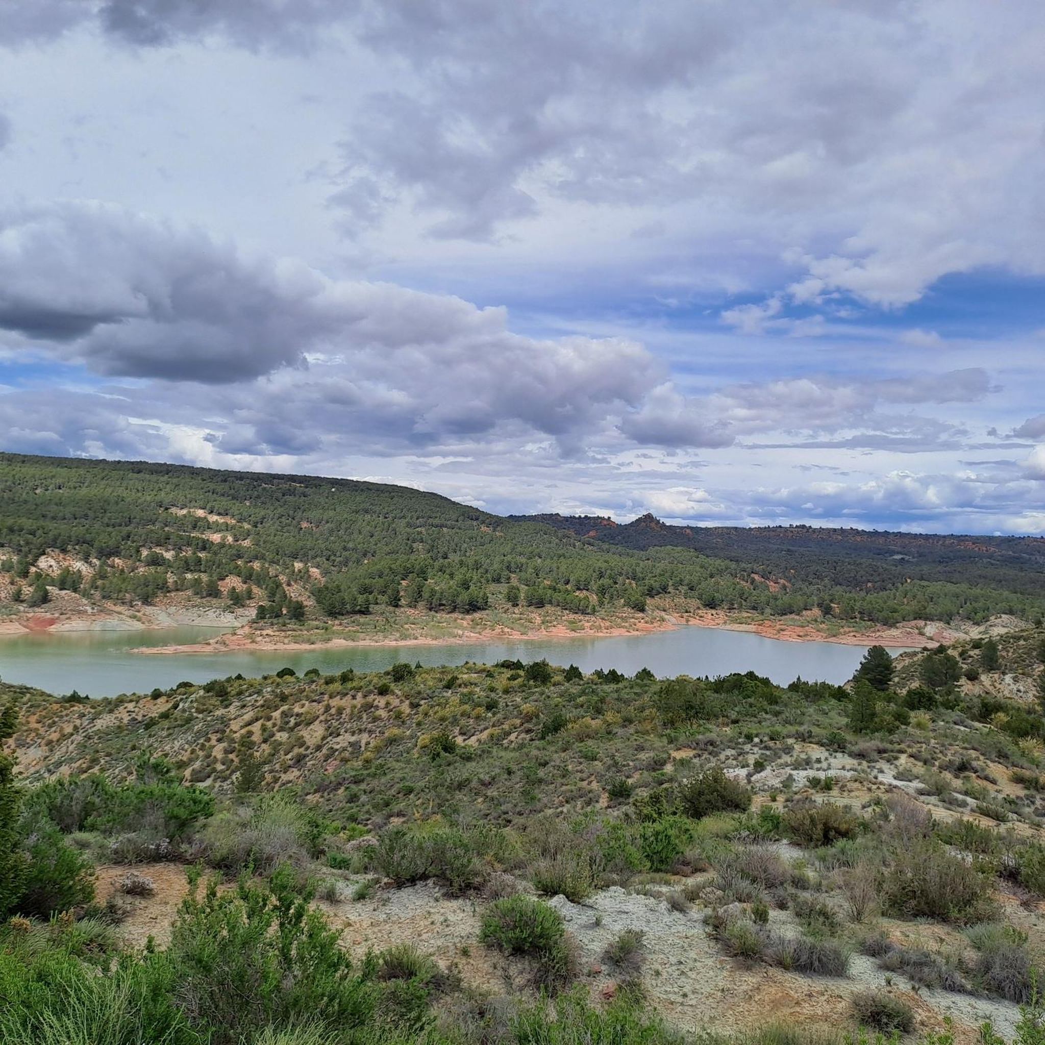
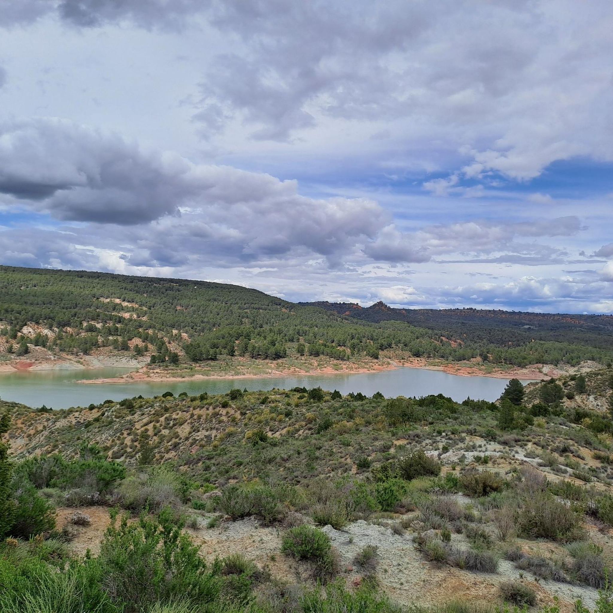
Path from the campsite leads directly to the reservoir with beautiful views.
0
0

The path leads across private land. Passage is not possible.
0
0
Beautiful viewpoint of the dam, the river and the factory.
12
0
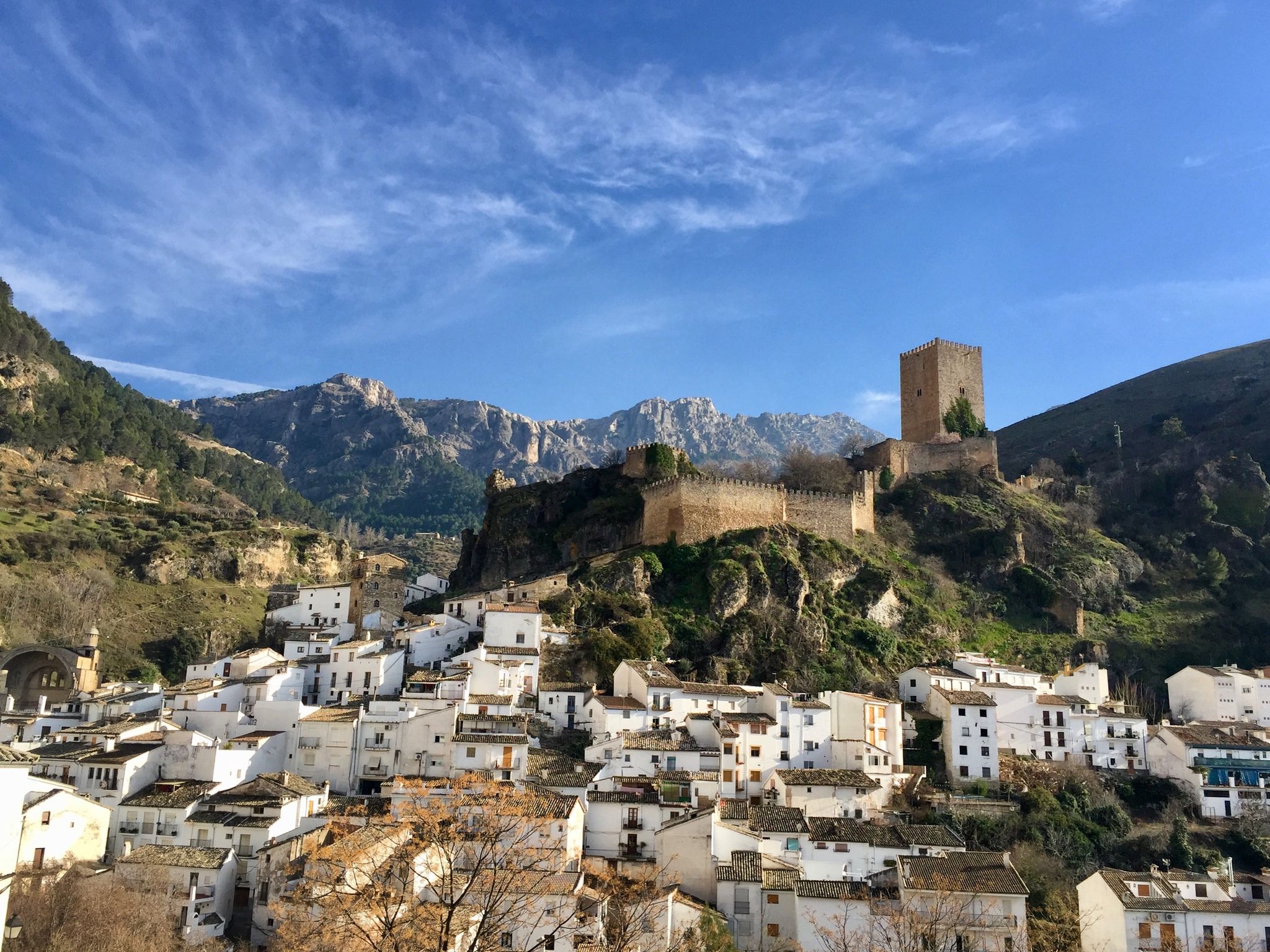
Square remarkable tower.
13
0
The Contreras dam (Embalse de Contreras) is a 129-meter-high arch dam built in 1972. Located on the border of the provinces of Cuenca (Castilla-La Mancha) and Valencia, the dam spans the Cabriel and Guadazaón rivers. The reservoir serves mainly for water supply, flood protection, and irrigation.
12
1
7 bow bridge, so beautiful
12
0
Some houses are still inhabited!!
0
0
The Contreras reservoir is located between the municipalities of Villargordo del Cabriel in the province of Valencia and La Pesquera, Mira, Enguídanos and Minglanilla in the province of Cuenca, Spain. It was built in 1972. Slightly downstream from the dam is the Contreras bridge, built between 1845 and 1851.
10
0
Frequently Asked Questions
What is the general difficulty level of mountain bike trails in Villargordo Del Cabriel?
The mountain bike trails around Villargordo Del Cabriel offer a range of challenges. Out of 20 available routes, 12 are rated as moderate and 8 are considered difficult. This means you'll find options for experienced riders seeking technical descents and demanding climbs, as well as routes suitable for those with a good level of fitness looking for a rewarding ride through diverse terrain.
Are there circular mountain bike routes in Villargordo Del Cabriel?
Yes, many of the mountain bike routes in Villargordo Del Cabriel are circular, allowing you to start and finish at the same point. For example, the challenging Hoces del Cabriel Cuchillares and Moluengo Loop and the moderate Enguídanos and Contreras Reservoir Loop from La Pesquera are both popular circular options.
What natural landmarks or viewpoints can I expect to see while mountain biking in the area?
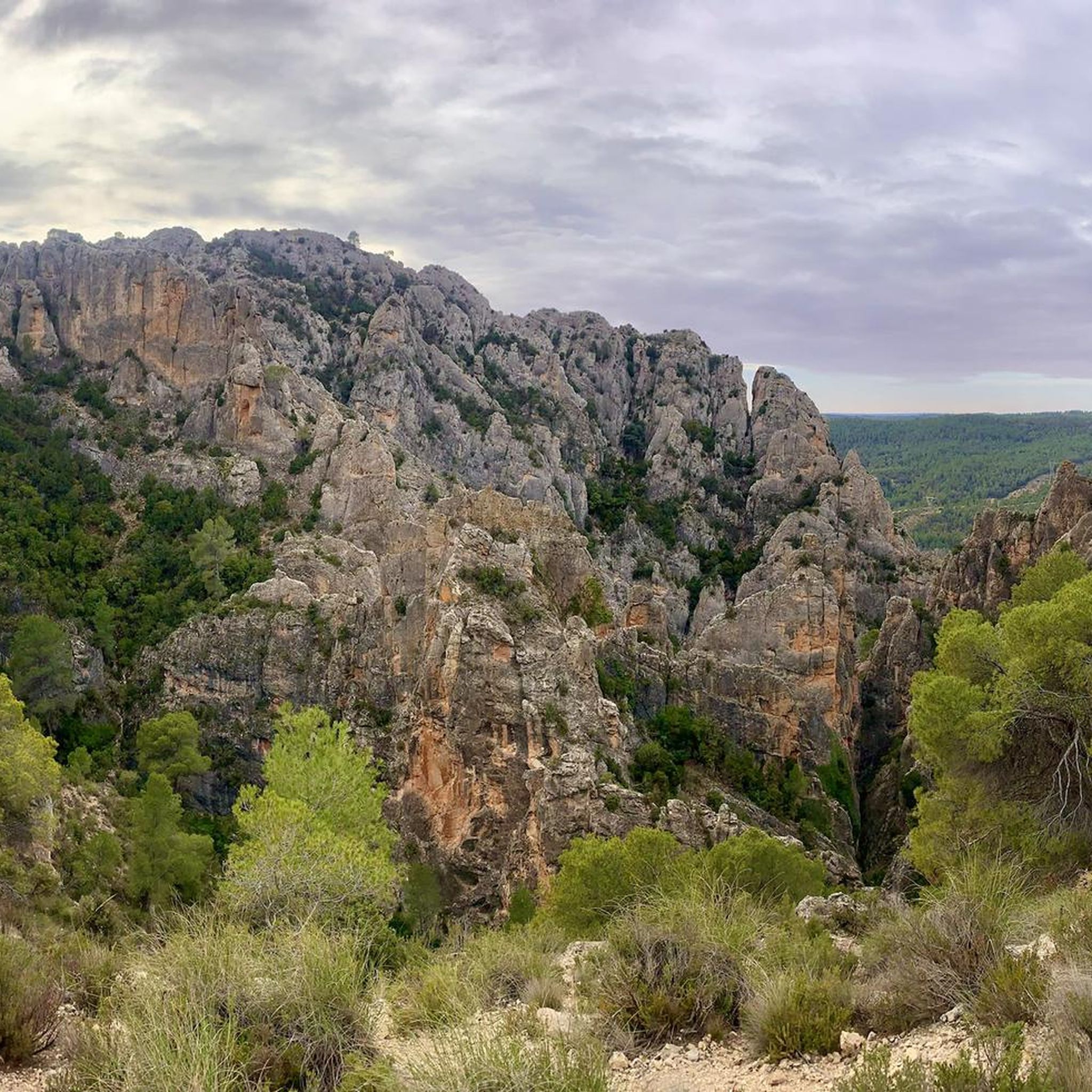
The region is rich in natural beauty, particularly within the Hoces del Cabriel Natural Park. You can expect to encounter dramatic gorges carved by the Cabriel River, and enjoy stunning vistas from various viewpoints. Notable spots include the Peña Azul Viewpoint, the Hoz del Rabo de la Sartén Viewpoint, and the Cabriel Valley Viewpoint. The serene Contreras Reservoir is also a prominent feature along many routes.
What is the best time of year for mountain biking in Villargordo Del Cabriel?
Villargordo Del Cabriel benefits from a climate with a predominance of sunny days, making it suitable for mountain biking for much of the year. Spring and autumn generally offer the most pleasant temperatures for riding, avoiding the peak heat of summer while still enjoying good weather. Winter can also be a good option, especially on sunnier days, though some higher elevation trails might be cooler.
Are there any historical sites or points of interest along the mountain bike trails?
Yes, the area around Villargordo Del Cabriel has historical significance. You might encounter sites like the Peñas Blancas Path Trench and the Contreras Trench, which offer glimpses into the region's past. The town itself also has historical elements, including traditional architecture and hints of its Arabic heritage.
How long do mountain bike trails typically take to complete in Villargordo Del Cabriel?
The duration of mountain bike trails in Villargordo Del Cabriel varies depending on their length and difficulty. For instance, the challenging Hoces del Cabriel Cuchillares and Moluengo Loop, at 35.4 miles (56.9 km), typically takes around 5 hours 20 minutes. A slightly shorter difficult route, the Villargordo del Cabriel – Cabriel Valley Viewpoint loop (27.2 miles / 43.7 km), can be completed in about 3 hours 20 minutes.
What do other mountain bikers enjoy most about the trails in Villargordo Del Cabriel?
The mountain bike trails in Villargordo Del Cabriel are highly rated by the komoot community, with an average score of 4.8 stars from over 9 reviews. Reviewers often praise the diverse and rugged terrain, the stunning gorges, and the breathtaking views, particularly within the Hoces del Cabriel Natural Park. The variety of trails catering to different skill levels is also frequently highlighted.
Are there any trails that offer technical sections for advanced riders?
Yes, the diverse terrain around Villargordo Del Cabriel includes options for advanced riders. Some routes feature challenging technical sections, offering an exhilarating experience. The difficult-rated trails, such as the Peña Azul Viewpoint – El Moluengo loop from Venta del Moro, are known to provide more demanding riding experiences.
Can I find trails that pass by water features like rivers or reservoirs?
Absolutely. The Cabriel River is a central feature of the region, and many trails wind alongside it or offer views of its dramatic gorges. The Enguídanos and Contreras Reservoir Loop from La Pesquera, for example, provides spectacular views of the Embalse de Contreras. The Cabriel River is also recognized as one of Europe's cleanest, adding to the scenic appeal.
What kind of natural environment will I experience on the mountain bike trails?
You'll experience a rich tapestry of natural environments. The trails traverse the Hoces del Cabriel Natural Park, featuring riverside forests with poplars, willows, and tamarix, as well as Mediterranean species like pine, holm oak, and juniper in the forested areas. The landscape is characterized by dramatic gorges, valleys, and ravines carved by the Cabriel River, offering a truly immersive natural experience.
Are there any long-distance mountain bike routes available?
Yes, there are several longer routes for those seeking an extended ride. The Hoces del Cabriel Cuchillares and Moluengo Loop is a substantial 35.4-mile (56.9 km) trail, and the Peña Azul Viewpoint – La Higuera - Cabriel River loop covers 33.5 miles (53.9 km), both offering significant distances and elevation changes.
Most popular attractions around Villargordo Del Cabriel

Get inspired with the komoot mobile app


Explore more
Browse the best MTB trails in other regions.
