The best road cycling routes around Vallejera De Riofrío
4.9
(9)
2,734
riders
101
rides
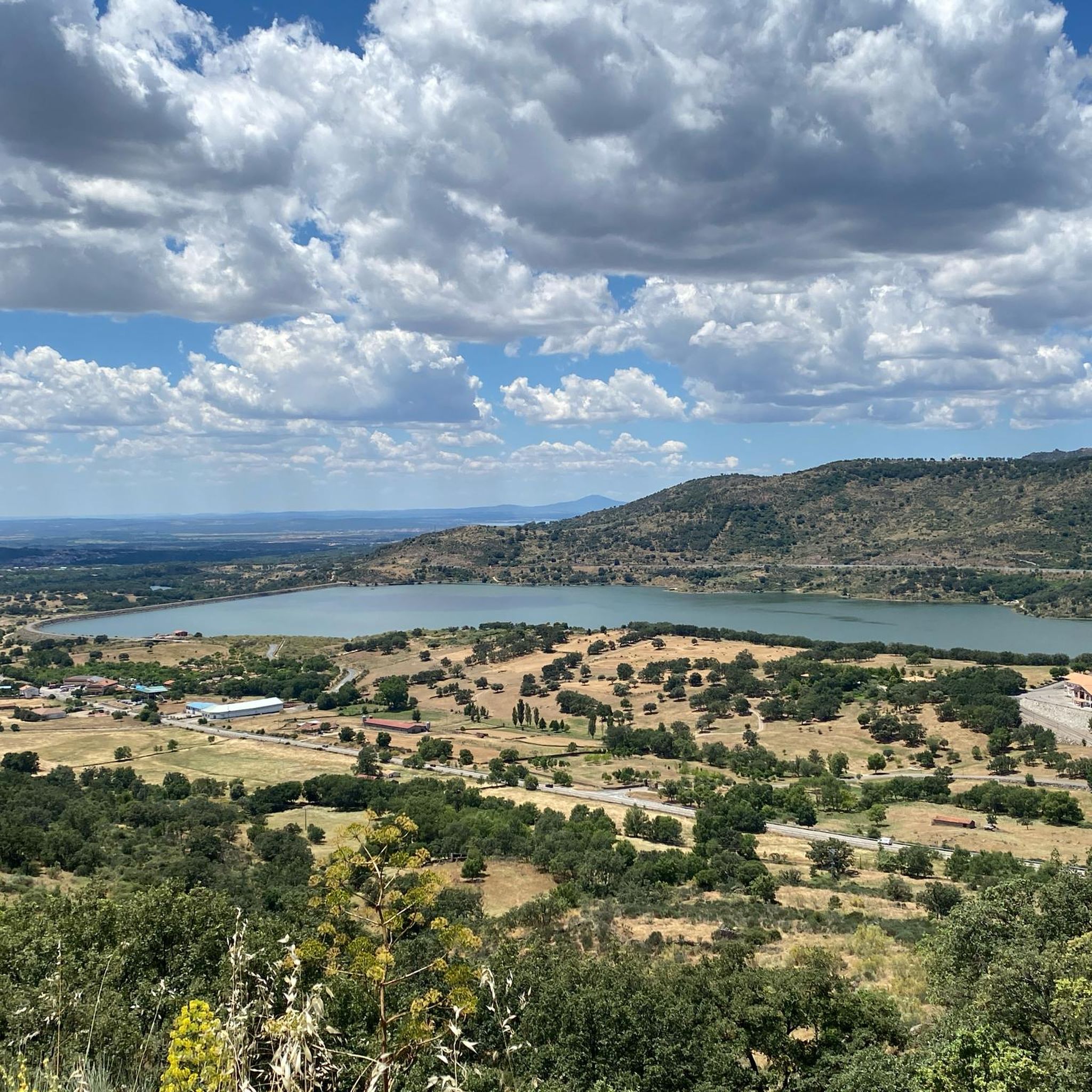
Road cycling around Vallejera De Riofrío is characterized by its elevated location within the Sierra de Béjar, offering mountainous landscapes and varied terrain. The region features significant ascents and descents, including Monte de Cabeza Gorda, which reaches 1,523 meters. Deciduous forests with oak, pine, and chestnut trees cover much of the landscape, providing a backdrop for routes that often include panoramic views of the Sierra. This area provides challenging road cycling routes for those seeking climbs.
Best road cycling routes…
Last updated: October 14, 2026
9
riders
72.9km
04:21
1,640m
1,640m
Hard road ride. Very good fitness required. Mostly well-paved surfaces and easy to ride.
231
riders
145km
08:02
2,820m
2,820m
Hard road ride. Very good fitness required. Mostly well-paved surfaces and easy to ride.

226
riders
70.7km
03:59
1,460m
1,460m
Hard road ride. Very good fitness required. Mostly well-paved surfaces and easy to ride.
87
riders
116km
06:12
1,960m
1,960m
Hard road ride. Very good fitness required. Mostly well-paved surfaces and easy to ride.
5.0
(2)
86
riders
36.9km
02:24
1,100m
1,100m
Hard road ride. Very good fitness required. Some segments of this route may be unpaved and difficult to ride.
Get access to more routes and recommendations from other explorers.
Already have an account?
Our route recommendations are based on thousands of hikes, rides, and runs completed by other people on komoot.
Start today with a free account
Your next adventure awaits.


Tips from the Community

What to see in Miranda del Castañar Medieval Walls: Over 600 meters remain intact, with four gates facing the cardinal directions: San Ginés, Nuestra Señora, La Villa, and El Postigo. Zúñiga Castle: A 15th-century fortress, symbol of the former County of Miranda. Although the interior is not open to the public, its exterior and keep are impressive. Square Bullring: Considered one of the oldest in Spain, built in the 16th century on the site of the former parade ground. Church of Santiago and San Ginés: Gothic in style (13th-16th centuries), with a detached 17th-century bell tower. Houses with Coats of Arms: More than 80 noble coats of arms adorn the facades, reflecting the town's aristocratic past.
8
0
Miranda del Castañar, one of the most beautiful villages in Spain, is located in the Sierra de Francia (Salamanca): Founded in 1213 by Alfonso IX of León as a town and council, it was the administrative capital of the Sierra de Francia. In the 15th century, the County of Miranda was created under the control of the Zúñiga family, consolidating its strategic importance.
9
0
It is the only granite theme park in Spain, created to pay homage to the quarrying tradition of the municipality. It occupies a former quarry transformed into an artistic and natural space. Monumental sculptures made from granite blocks by the Salamanca artist Amable Diego. Recreations that evoke menhirs, dolmens, and megalithic structures, including the famous "Salamanca Stonehenge." Explanatory panels on the history of quarrying, from Roman roads to modern industry.
6
0

17 kilometers of mountain pass (on both sides, Ambroz Valley from Hervás or Jerte Valley from Cabezuela del Valle). From Cabezuela del Valle, the first 12 kilometers average an average gradient of 7%, with some 10% gradients, and from the 12th kilometer onward, there are some rest stops with wonderful views. This side has a gradient of approximately 900 meters, up to 1,430 meters.
0
0

an ideal place to stop to get supplies and rest while admiring the views.
0
0

Very steep climb of about 15 km (4% on average with some sections at 7%). The asphalt is good and with many trees that provide pleasant shade on hot days.
0
0
Small town a stone's throw from Bejar and La Covatilla, ideal for stopping to rest before climbing La Covatilla
0
0
Nice port with a constant and not very steep slope on either side, be careful in winter due to possible ice sheets.
0
0
Frequently Asked Questions
What kind of terrain can I expect when road cycling around Vallejera De Riofrío?
Road cycling in Vallejera De Riofrío is characterized by its elevated location within the Sierra de Béjar, offering mountainous landscapes with significant ascents and descents. You'll encounter varied terrain, including climbs towards peaks like Monte de Cabeza Gorda (1,523 meters) and winding roads through deciduous forests of oak, pine, and chestnut trees. The routes often provide extensive panoramic views of the Sierra.
How many road cycling routes are available in Vallejera De Riofrío?
There are over 100 road cycling routes around Vallejera De Riofrío, offering a wide range of options for different preferences and skill levels.
Are there road cycling routes for different skill levels?
Yes, the routes in Vallejera De Riofrío cater to various abilities. While the region is known for its challenging mountainous terrain, with 58 difficult routes, there are also 46 moderate and 2 easy routes available for road cyclists.
When is the best time of year for road cycling in Vallejera De Riofrío?
The best time for road cycling in Vallejera De Riofrío is during the milder seasons. Winters are very cold and rainy with abundant snowfall, while summers can be hot and dry. Visiting in spring or autumn will offer more comfortable conditions for tackling the mountainous terrain.
What natural features or landmarks can I see along the road cycling routes?
Many routes offer stunning panoramic views of the Sierra de Béjar. You might also pass by significant natural features such as Peña Negra Summit or Calvitero Peak. Some routes also feature historical points like the Béjar Station and Vía de la Plata Tunnel or sections of the Vía Verde de la Plata.
Are there any long-distance road cycling routes in the area?
Yes, for those seeking longer rides, routes like the Puerto de Vallejera – Granite Theme Park loop from Béjar cover over 116 kilometers, offering extensive exploration of the region's mountainous landscapes.
What do other road cyclists enjoy most about road cycling in Vallejera De Riofrío?
The area is highly rated by the komoot community, with an average score of 4.8 stars. Cyclists often praise the challenging climbs, the rewarding panoramic views of the Sierra, and the varied mountainous terrain that makes for an engaging ride.
Are there circular road cycling routes available?
Yes, many of the road cycling routes around Vallejera De Riofrío are designed as loops or circular tours. For example, the popular Climb to La Covatilla (CE pass) — circular from Béjar is a challenging circular route.
Can I find routes that include the La Covatilla Ski Resort?
Absolutely. The Vallejera de Riofrío – La Covatilla Ski Resort loop from Béjar is a popular route that leads through mountainous terrain directly towards the ski resort, offering a significant climb and scenic views.
Are there routes that explore mountain passes?
Yes, the region is rich in mountain passes. Routes such as the Puerto de Béjar – Baños de Montemayor loop from Béjar navigate through various mountain passes, providing challenging ascents and descents characteristic of the Sierra de Béjar.
What is the highest point I can reach on a road bike in this area?
While many routes offer significant climbs, the region is home to Monte de Cabeza Gorda, which reaches an elevation of 1,523 meters. Routes often incorporate ascents towards such elevated points, providing challenging climbs and expansive views.
Most popular routes around Vallejera De Riofrío
Most popular attractions around Vallejera De Riofrío

Get inspired with the komoot mobile app


Explore more
Browse the best Road cycling routes in other regions.
