Attractions and Places To See around Campofrío - Top 18
Best attractions and places to see around Campofrío include historical landmarks, cultural sites, and natural features. Situated in the province of Huelva, this area is characterized by its location where the Sierra meets the Andévalo regions. The landscape reflects a significant mining past and offers diverse natural surroundings, including the headwaters of the Río Tinto.
Best attractions and places to see around Campofrío
- The most popular attractions is Aracena Castle – panoramic views, a castle that offers views of the town of Aracena. This site contains remains of dwellings dating from the 10th to the 13th centuries, predating the Christian era.
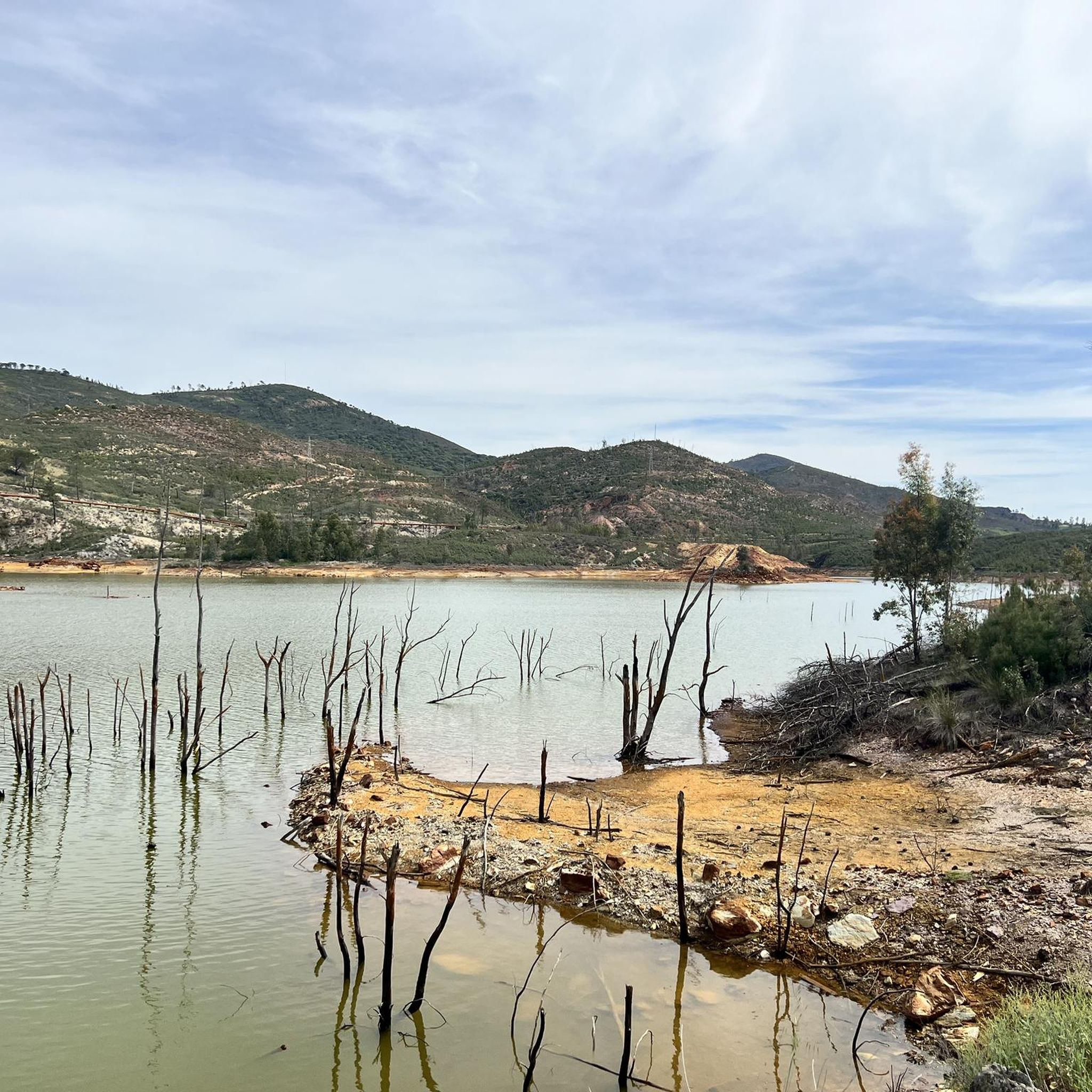
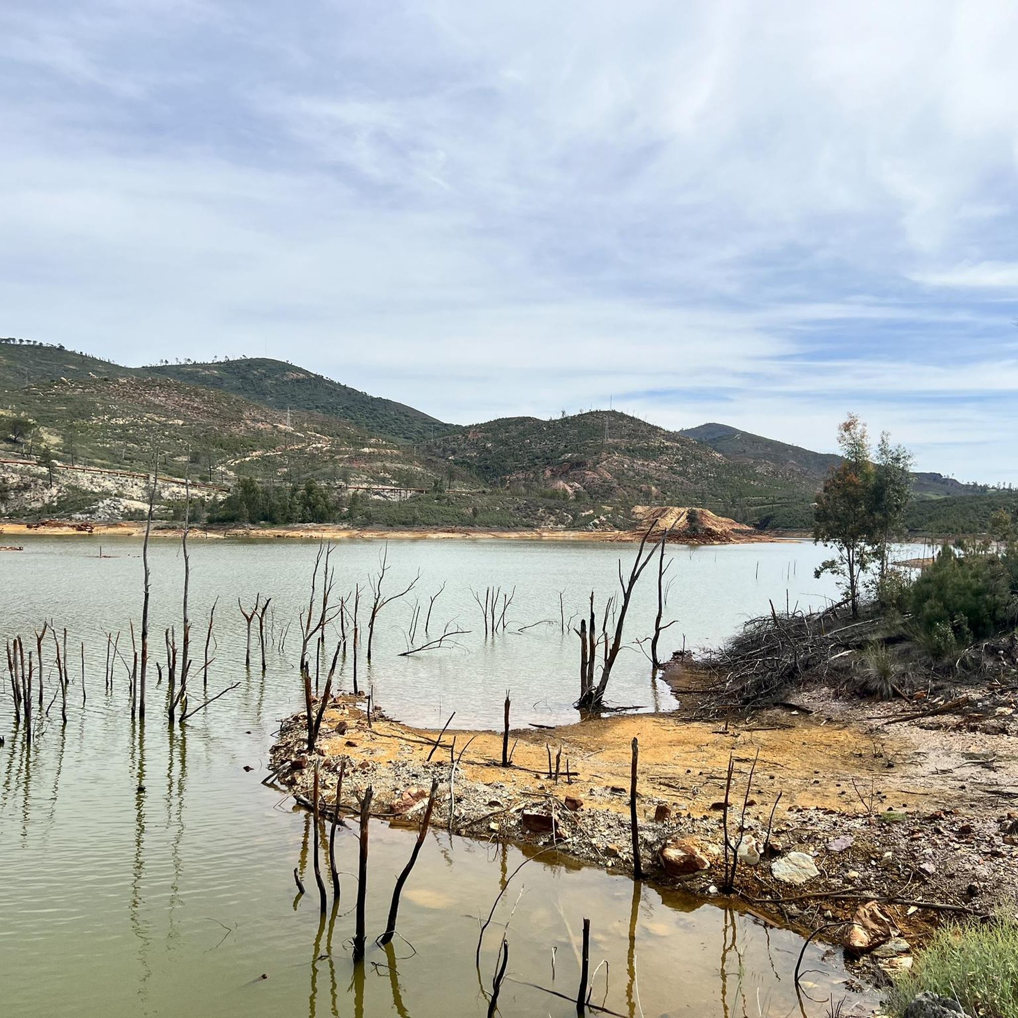
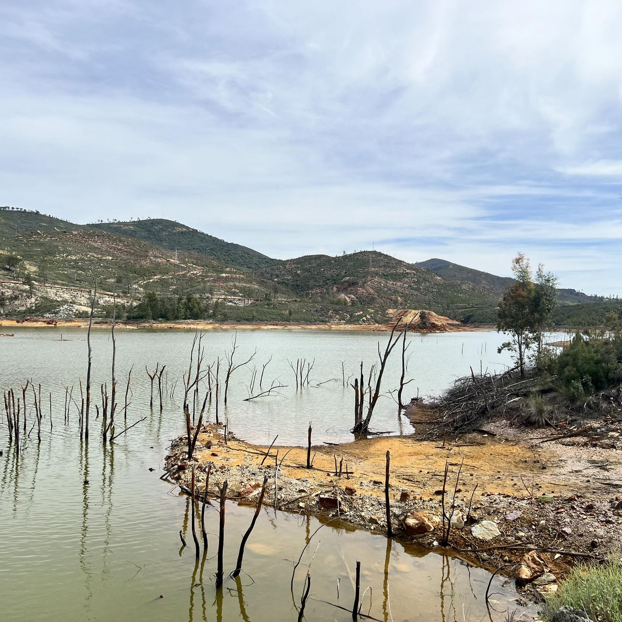
- Another must-see spot is Source of the Río Tinto, a river and natural monument. This site marks the source of the Río Tinto, known for its reddish waters caused by the weathering of minerals with a high content of heavy metal sulfides.
- Visitors also love Corta Atalaya Mine, a historical site and viewpoint. This open-pit mine was a world reference in mining and is now a tourist attraction, offering insight into the region's mining heritage.
- Campofrío is known for its historical sites, natural monuments, and mining heritage. The area offers a variety of attractions to see and explore, from ancient castles to unique geological formations.
- The attractions around Campofrío are appreciated by the komoot community, with 14 upvotes and 5 photos shared by visitors.
Last updated: June 29, 2026
Source of the Río Tinto
Highlight • River
Its name is due to the reddish color of its waters caused by the weathering of minerals with a high content of heavy metal sulfides that were found and exploited in various deposits along the riverbed.
This wonderful site and the river that is born from here is the subject of scientific studies in collaboration with NASA to analyze a possible analogy with the planet Mars.
Translated by Google •
Tip by

Aracena Castle – panoramic views
Highlight • Castle
In this location, recent archaeological studies have found remains of dwellings dating from the 10th to the 13th centuries, already prior to the Christian era, which allows us to elucidate that it was part of an Andalusian population. Some of these remains can be seen inside the castle next to the various rooms of the medieval fortress.
Translated by Google •
Tip by
Sign up now to discover places like this
Get recommendations on the best single tracks, peaks, & plenty of other exciting outdoor places.
Sign up for free
Linares de la Sierra Square
Highlight • Settlement
Translated by Google •
Tip by

Peña del Hierro
Highlight • Natural Monument
Translated by Google •
Tip by
Corta Atalaya Mine
Highlight • Structure
parquemineroderiotinto.es
Translated by Google •
Tip by
Sign up for free to discover even more attractions around Campofrío.
Sign up for free
Already have an account?
Start today with a free account
Your next adventure awaits.
Login or Signup

Tips from the Community


The entrance to the castle is included in the ticket for the cave, so it is definitely worth visiting.
1
0

The Peña del Hierro Viewpoint, located in Nerva (Huelva), is part of the Riotinto Mining Park and offers one of the most impressive views of the source of the Tinto River, as well as the mining crater of the old pyrite mine.
1
0
The source of the Tinto River is located in the municipality of Nerva, in the province of Huelva, Andalusia, and is one of the most unique landscapes in Europe due to its reddish color and its scientific and geological value.
1
0

A short route, 8 km. Very easy, it follows marked and accessible paths. You must pass through two gates closed for animal crossings, which must be re-closed. Part of the route passes by a stream and waterfalls. The other part follows a fairly wide path with trees on either side and therefore receives a lot of sun. I don't think it's a good option in summer. In short, a beautiful route and a beautiful town.
0
0

To get to the viewpoint, paid access is required. The hiking trail ends here at a fence. Nevertheless, a somewhat limited view of the opencast mine is possible
2
0
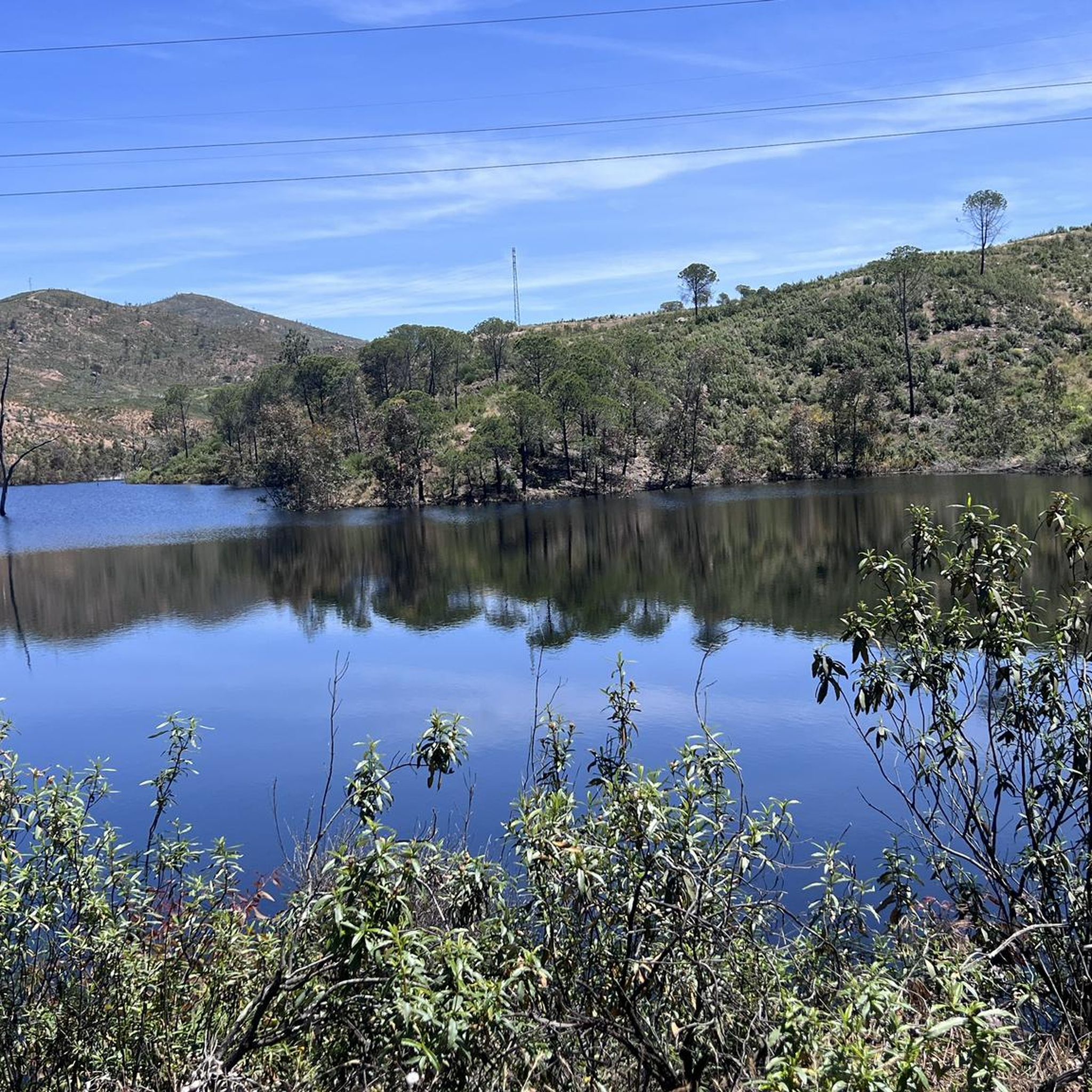
An approximately 3 kilometer long circular route leads around the natural monument Montera de Gossan. Don't miss it because of the beautiful views.
0
0

Also known as the Padre Caro mountain range, it indicates the source of the Río Tinto which runs through the interior of Huelva for about 100 km until it reaches the Odiel River. Its name is due to the reddish color of its waters, caused by the weathering of minerals with a high content of heavy metal sulfides that were found and exploited in various deposits along the riverbed.
0
0
Frequently Asked Questions
What historical landmarks can I explore in Campofrío?
Campofrío boasts several significant historical sites. You can visit the historic Plaza de Toros, one of the oldest bullrings in Spain, built between 1716 and 1718. The Aracena Castle, though slightly further afield, offers panoramic views and contains remains of dwellings dating from the 10th to 13th centuries. Additionally, the Corta Atalaya Mine provides insight into the region's rich mining heritage.
Are there any ancient Roman sites near Campofrío?
Yes, remnants of a Roman road that once connected the Río Tinto mines with Mérida Augusta can be found in the municipality, including a well-preserved bridge over the Río Odiel. Nearby, the necropolis at Risco del Tesoro has yielded significant archaeological findings, such as a Roman epitaph and coins from the Trajan and Hadrian eras.
What natural attractions are unique to the Campofrío area?
The region is known for its unique natural features, particularly those shaped by its mining past. The Source of the Río Tinto is a must-see, where the river's distinctive reddish waters begin due to the weathering of minerals. The area also sits where the Sierra meets the Andévalo regions, offering diverse landscapes.
What is the significance of the Río Tinto in this region?
The Río Tinto is central to the region's identity. Its headwaters are near Campofrío, and its striking reddish waters, caused by high concentrations of heavy metal sulfides, have made it a site of scientific study, even for its possible analogy with conditions on Mars. The river is a natural monument and a testament to the area's profound mining history.
Are there family-friendly attractions around Campofrío?
Yes, several attractions are suitable for families. The Corta Atalaya Mine is a historical site and viewpoint that offers guided tours, making it an engaging educational experience. The charming Linares de la Sierra Square, nestled in nature, is also considered family-friendly.
Where can I find panoramic views in the Campofrío area?
For breathtaking panoramic views, visit Aracena Castle, which offers expansive vistas of the town of Aracena. The Corta Atalaya Mine also provides a viewpoint over the impressive open-pit mine. Additionally, Peña del Hierro offers impressive views of the mining crater and the source of the Tinto River.
What kind of outdoor activities can I do near Campofrío?
The area around Campofrío is excellent for various outdoor activities. You can find numerous road cycling routes, such as the 'Minas de Riotinto, Aracena, Santa Ana La Real – circular route'. For running enthusiasts, there are trails like the 'Peña del Hierro y nacimiento del Río Tinto - running circular desde Nerva'. Mountain biking is also popular, with routes like the 'Corta Atalaya Mine – Embalse del Gossan loop'. You can explore more options on the Road Cycling Routes around Campofrío, Running Trails around Campofrío, and MTB Trails around Campofrío guide pages.
Are there hiking trails near Campofrío's attractions?
Yes, many of the attractions are accessible via or near hiking trails. For instance, the area around the Source of the Río Tinto and Peña del Hierro offers trails that allow you to explore the unique landscapes. Some running trails, like the 'Source of the Río Tinto loop from Nerva', are also suitable for walking. For more detailed routes, refer to the Running Trails around Campofrío guide.
What is the Iglesia de San Miguel Arcángel and its historical importance?
The Iglesia de San Miguel Arcángel, located in the Plaza de la Constitución, dates back to the 15th and 16th centuries. It features a late Baroque style from the late 18th century, with its construction completed in 1791. Its most significant historical feature is its 15th-century Gothic sacristy, making it a notable cultural site.
What is the Palacio de los Roco and its history?
The Palacio de los Roco, first referenced in 1401, was constructed in its current form in the early 17th century. It has a rich history, serving as a General Hospital and military barracks during the War of Succession. After being destroyed in the War of Independence in 1809, it was reconstructed to lodge war veterans, reflecting its enduring significance in the town's past.
What do visitors enjoy most about the attractions around Campofrío?
Visitors particularly appreciate the rich history and unique natural beauty of the area. The panoramic views from sites like Aracena Castle are highly praised. The distinctive geological formations, such as the reddish waters at the Source of the Río Tinto, also captivate many. The historical significance of the mining sites, like Corta Atalaya Mine, offers a fascinating glimpse into the region's past.
Are there any ancient settlements or archaeological sites to visit?
Beyond the Roman road and necropolis, you can explore Cerro de los Cobullos. This hill contains Iberian remains, including tombs, house ruins, and a cistern, suggesting an ancient settlement that may date back to the late Bronze Age. Legend even links it to King Solomon, drawn by the area's metallurgical wealth.
Most popular attractions around Campofrío

Get inspired with the komoot mobile app


Explore more
Still not found the Highlight you’re looking for? See guides of the top attractions in other regions:
