The best walks and hikes around Valdelageve
4.5
(84)
503
hikers
26
hikes
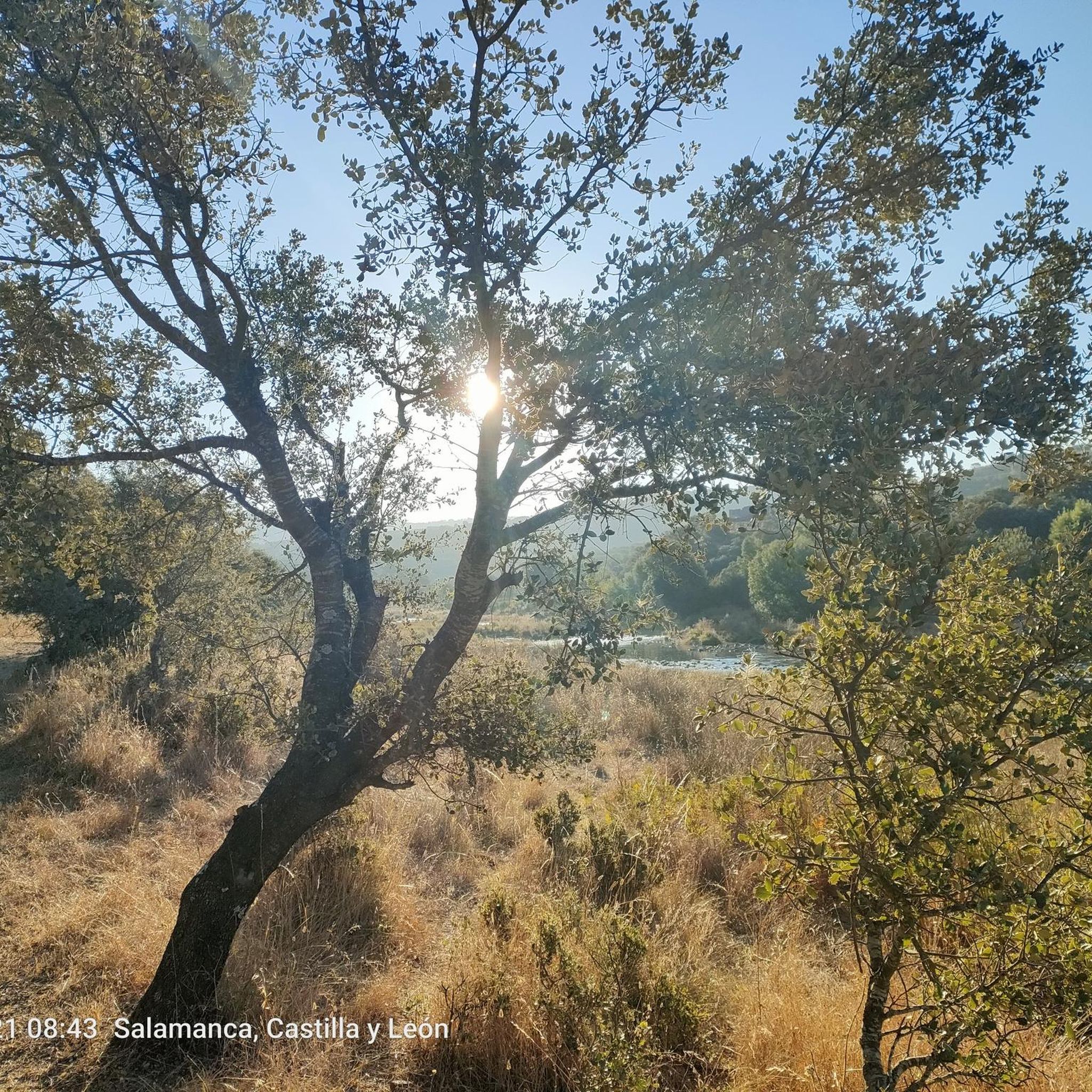
Hiking around Valdelageve offers diverse natural features within the province of Salamanca, Spain. The landscape is characterized by the River Cuerpo de Hombre Valley, featuring lush riverside vegetation and granite rock formations known as "marmitas de gigante." Hikers can explore frondose oak forests and significant geological elements such as the Canchalazo, Buitrera, and Riscos, which are large rock faces. Part of the hiking network runs parallel to a hydroelectric canal, adding a unique element to the natural scenery.
Best hiking…
Last updated: June 24, 2026
4.7
(12)
49
hikers
8.41km
02:20
160m
150m
Moderate hike. Good fitness required. Easily-accessible paths. Suitable for all skill levels.
4.0
(2)
12
hikers
Moderate hike. Good fitness required. Mostly accessible paths. Sure-footedness required.

Sign up for free
4.49km
01:19
120m
120m
Hike the easy 2.8-mile Herguijuela - Fuente Mundo Trail through olive groves and Mediterranean forest in Las Batuecas-Sierra de Francia Natu
4.7
(12)
77
hikers
Moderate hike. Good fitness required. Easily-accessible paths. Suitable for all skill levels.
4.3
(7)
59
hikers
Easy hike. Great for any fitness level. Easily-accessible paths. Suitable for all skill levels.
Get access to more routes and recommendations from other explorers.
Sign up for free
Already have an account?
Our route recommendations are based on thousands of hikes, rides, and runs completed by other people on komoot.
Start today with a free account
Your next adventure awaits.
Login or Signup

Tips from the Community

The Soto Bridge, also known as the Roman Bridge of Sotoserrano, is a historic stone structure that spans the Alagón River in the Las Batuecas-Sierra de Francia Natural Park. It is located in the town of Sotoserrano, famous for being at the confluence of three rivers: the Alagón, the Francia, and the Cuerpo de Hombre. The bridge is one of the town's symbols and a key point on several hiking and cycling routes.
1
0
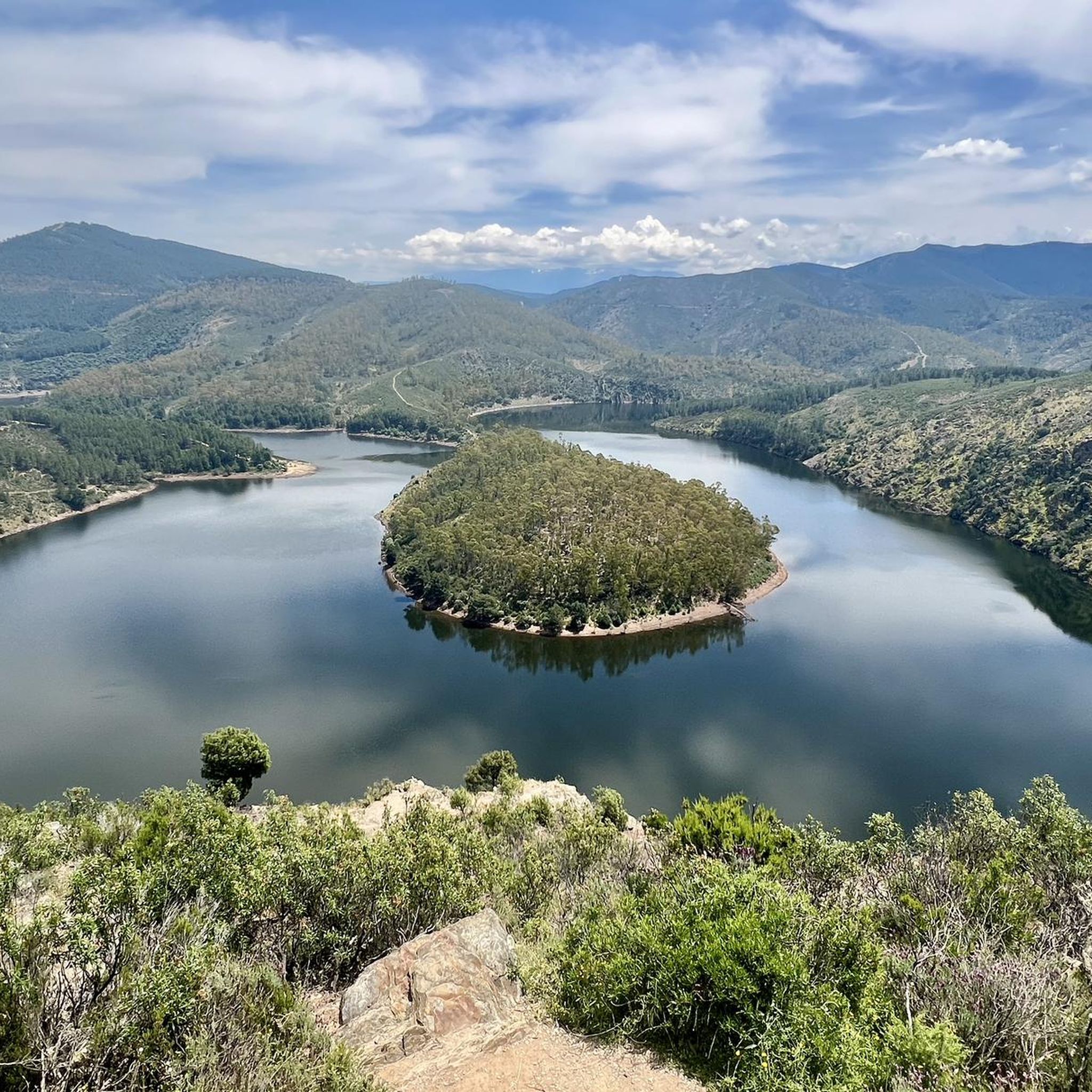
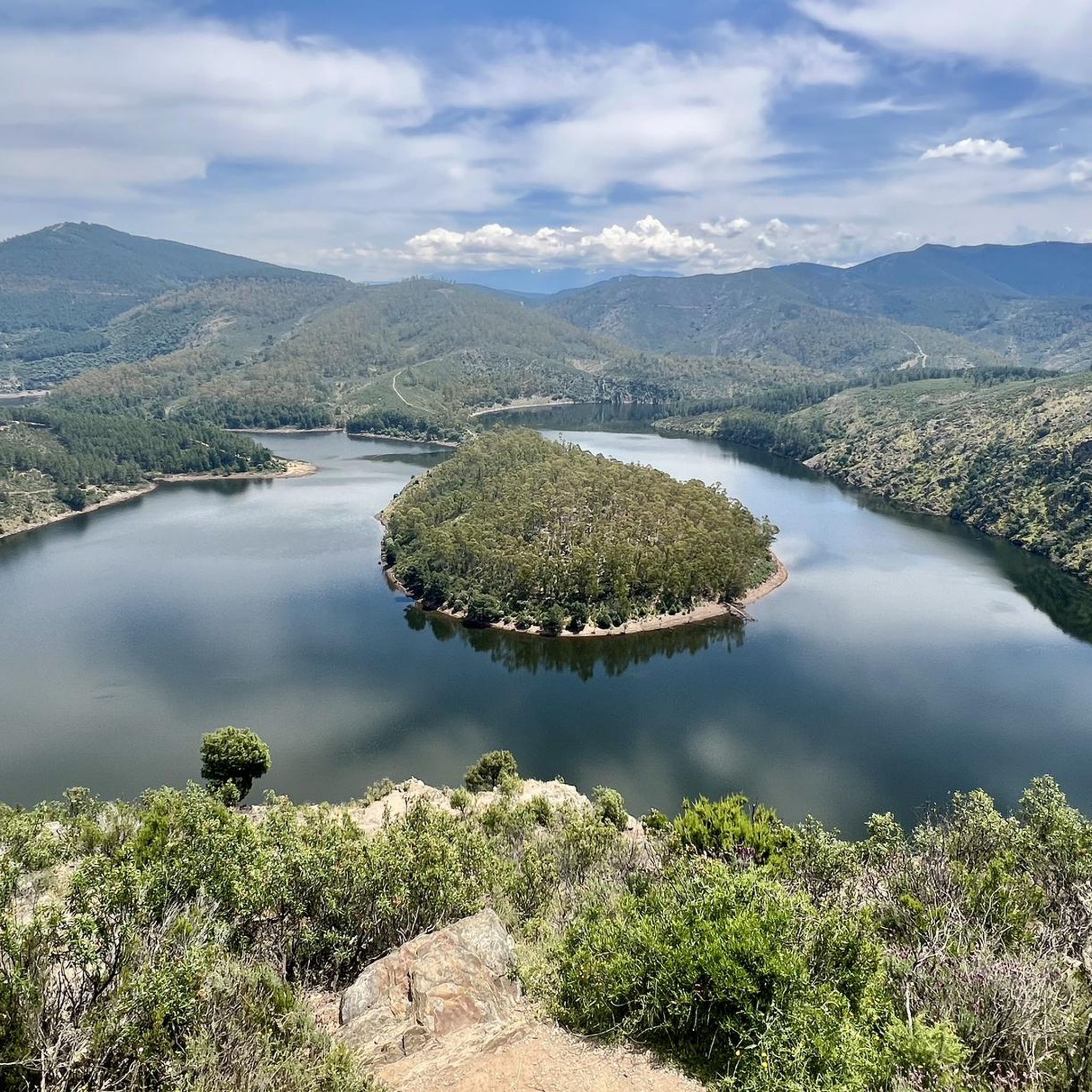
The Meandro del Melero is an impressive river formation located in the region of Las Hurdes, on the border between the provinces of Cáceres and Salamanca. This meander is created by the Alagón River, which forms a spectacular turn in its course, offering a unique panoramic view.
3
0

The current bridge is not Roman, it does not preserve any of its characteristics, not even in the foundations. But it is without a doubt a beautiful and spectacular bridge in a very beautiful enclave.
1
0
Milestone that marks 'The Mozárabe Way' between Galisteo and Riomalo below.
1
0
Long before reaching the viewpoint, we can already have impressive views. From the last parking lot to the viewpoint, there is a gentle climb along the road for almost two kilometers.
1
0
Spectacular views of the Melero Meander. You can access the same viewpoint with a wheelchair and baby strollers via a wooden ramp that zigzags down the slope.
1
0

Full of water it is spectacular, so before going I would check how the Alagón is with water.
1
0
Rebuilt in the 18th century, it is also part of the Mozarabic way to Santiago.
8
0
Frequently Asked Questions
How many hiking trails are available in Valdelageve?
Valdelageve offers a network of nearly 20 hiking trails, catering to various preferences and skill levels. You'll find a good mix of easy, moderate, and challenging routes to explore the region's diverse landscapes.
What kind of terrain can I expect on hikes around Valdelageve?
The terrain in Valdelageve is quite varied. You can expect to hike through lush riverside vegetation along the Cuerpo de Hombre river, encounter spectacular granite rock formations including "marmitas de gigante" (giant's kettles), and traverse frondose oak forests. Some routes also feature significant geological elements like the Canchalazo, Buitrera, and Riscos, and run parallel to a hydroelectric canal.
Are there hiking options for different skill levels in Valdelageve?
Yes, Valdelageve provides hiking options for all skill levels. Out of nearly 20 routes, there are 7 easy trails perfect for a leisurely walk, 11 moderate routes for those seeking a bit more challenge, and 1 difficult trail for experienced hikers looking for a strenuous adventure.
What natural features or landmarks can I see while hiking in Valdelageve?
Hikers in Valdelageve can discover a wealth of natural features. Key highlights include the picturesque River Cuerpo de Hombre Valley with its granite formations and "marmitas de gigante", extensive oak forests, and impressive rock faces like the Canchalazo, Buitrera, and Riscos. You might also encounter the unique hydroelectric canal that runs alongside some paths. For specific points of interest, consider visiting Fuente Mundo or the Caño Cachope Fountain.
Are there any circular hiking routes in Valdelageve?
Yes, Valdelageve is known for its appealing circular routes. A popular option is the Route of the Three Rivers - circular from Sotoserrano, which takes you through the Cuerpo de Hombre river valley. Another well-regarded loop is the Peñacaballera - Puente de la Magdalena – circular from Montemayor del Río by the Vía de la Plata, offering scenic views of the surrounding natural environment.
What is the best time of year to go hiking in Valdelageve?
Valdelageve offers a tranquil atmosphere year-round, but the best times for hiking are typically spring and autumn. During these seasons, the weather is mild, and the natural landscapes, from lush riverside vegetation to oak forests, are at their most vibrant. Summer can be warm, but the river areas offer opportunities for swimming, and shaded paths provide relief. While some trails may have temporary restrictions for bird nesting, the region remains an excellent destination for nature immersion.
Are there any family-friendly hiking trails in Valdelageve?
Yes, Valdelageve has several easy trails suitable for families. For instance, the Herguijuela - Fuente Mundo Trail is an easy 4.5 km path that can be completed in about 1 hour 19 minutes, making it a good option for a family outing. The diverse natural features and tranquil environment make it an enjoyable experience for all ages.
Can I bring my dog on the hiking trails in Valdelageve?
Valdelageve's natural environment is generally welcoming for dogs, but it's always recommended to keep your dog on a leash, especially in areas with wildlife or near livestock. While specific regulations for dog-friendly trails are not detailed, the tranquil atmosphere and varied terrain, including river valleys and oak forests, provide ample opportunities for walks with your canine companion. Always practice responsible pet ownership and clean up after your dog.
What do other hikers enjoy the most about hiking in Valdelageve?
The hiking trails in Valdelageve are highly rated by the komoot community, with an average score of 4.6 stars from over 70 reviews. Hikers often praise the region's diverse natural features, including the picturesque River Cuerpo de Hombre Valley, the unique granite formations, and the peaceful oak forests. The tranquil atmosphere and varied terrain are frequently highlighted as key attractions.
Are there any viewpoints or scenic overlooks on the trails?
While the region is rich in natural beauty, specific named viewpoints are not extensively detailed within Valdelageve itself. However, the elevated cliffs and peaks along the Cuerpo de Hombre river, as well as the large rock faces like the Canchalazo, Buitrera, and Riscos, naturally offer impressive vistas. For a renowned viewpoint nearby, consider the View of Meandro del Melero, which is accessible via routes like the View of the Alagón River – Melero Meander Viewpoint loop from Piscina Natural de Riomalo.
Are there any historical or cultural attractions near the hiking routes?
Valdelageve is nestled in a region with rich history and culture. While the hiking routes primarily focus on natural landscapes, you are close to charming settlements like Mogarraz and Miranda del Castañar, which offer a glimpse into traditional Spanish life. You can also find historical elements such as the Roman Bridge of La Malena over the Cuerpo de Hombre River, which is a notable landmark.
Is there parking available for hikers in Valdelageve?
While specific parking areas for hikers are not detailed, Valdelageve is a small municipality, and parking is generally available within the village or at the start points of popular trails. It's advisable to check local signage upon arrival for designated parking spots to ensure you are not obstructing local access or private property.
Most popular attractions around Valdelageve

Get inspired with the komoot mobile app


Explore more
Browse the best Hikes in other regions.
