The 6 Most Amazing Peaks around Valdemorillo
Best mountain peaks around Valdemorillo are situated in the Community of Madrid, offering diverse natural landscapes for outdoor activities. The region is located near the Sierra de Guadarrama, providing access to its foothills and numerous notable peaks. Valdemorillo itself features elevated terrain and scenic routes, including river paths and varied landscapes. These areas provide panoramic vistas and opportunities for hiking and exploring natural monuments.
Best mountain peaks around Valdemorillo
- The most popular mountain peaks is Mount Abantos, a summit…
Last updated: June 29, 2026
Mount Abantos
Highlight • Summit
Translated by Google •
Tip by

Puerto de Malagón
Highlight • Mountain Pass
Translated by Google •
Tip by
Sign up now to discover places like this
Get recommendations on the best single tracks, peaks, & plenty of other exciting outdoor places.
Sign up for free
Bear Cave
Highlight • Natural Monument
Translated by Google •
Tip by
The Lower Machota
Highlight • Summit
Translated by Google •
Tip by

Cerro de la Cabeza
Highlight • Summit
Translated by Google •
Tip by

Sign up for free to discover even more peaks around Valdemorillo.
Sign up for free
Already have an account?
Start today with a free account
Your next adventure awaits.
Login or Signup

Tips from the Community

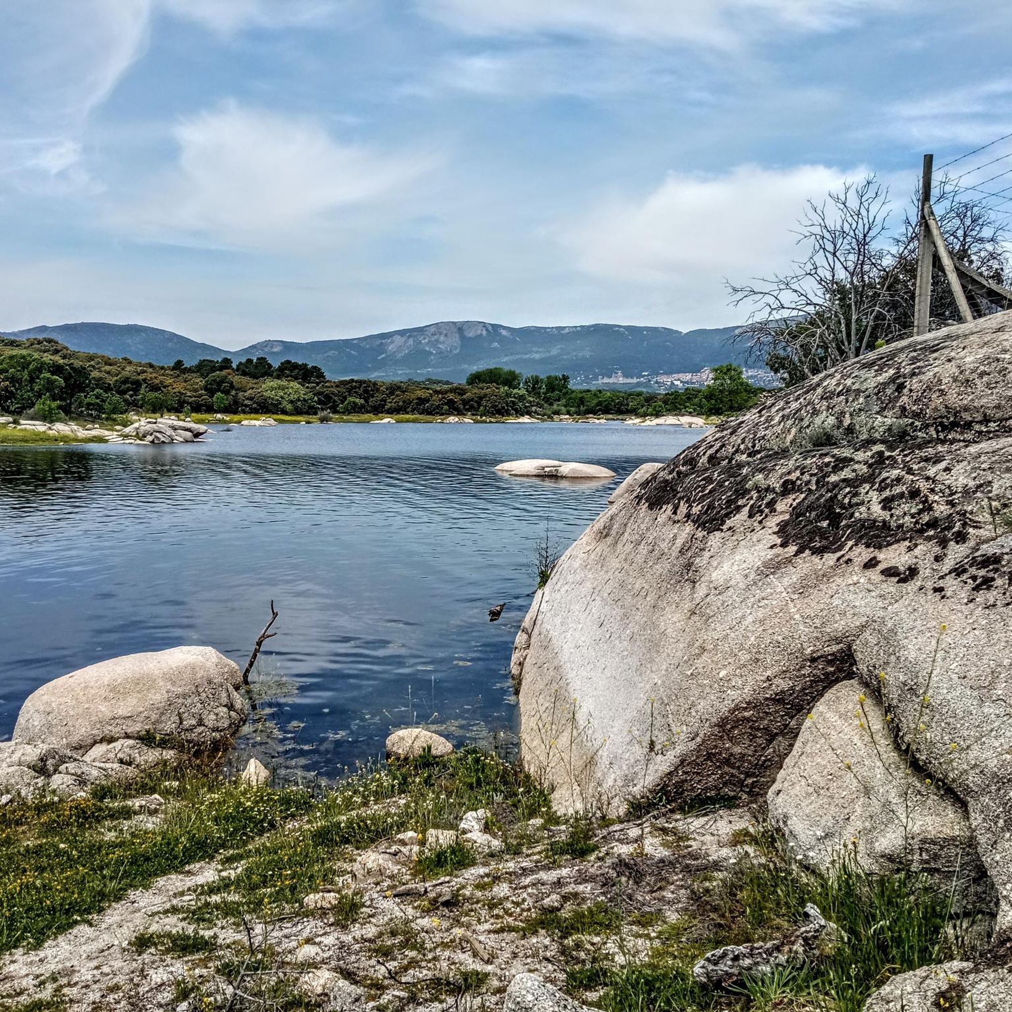
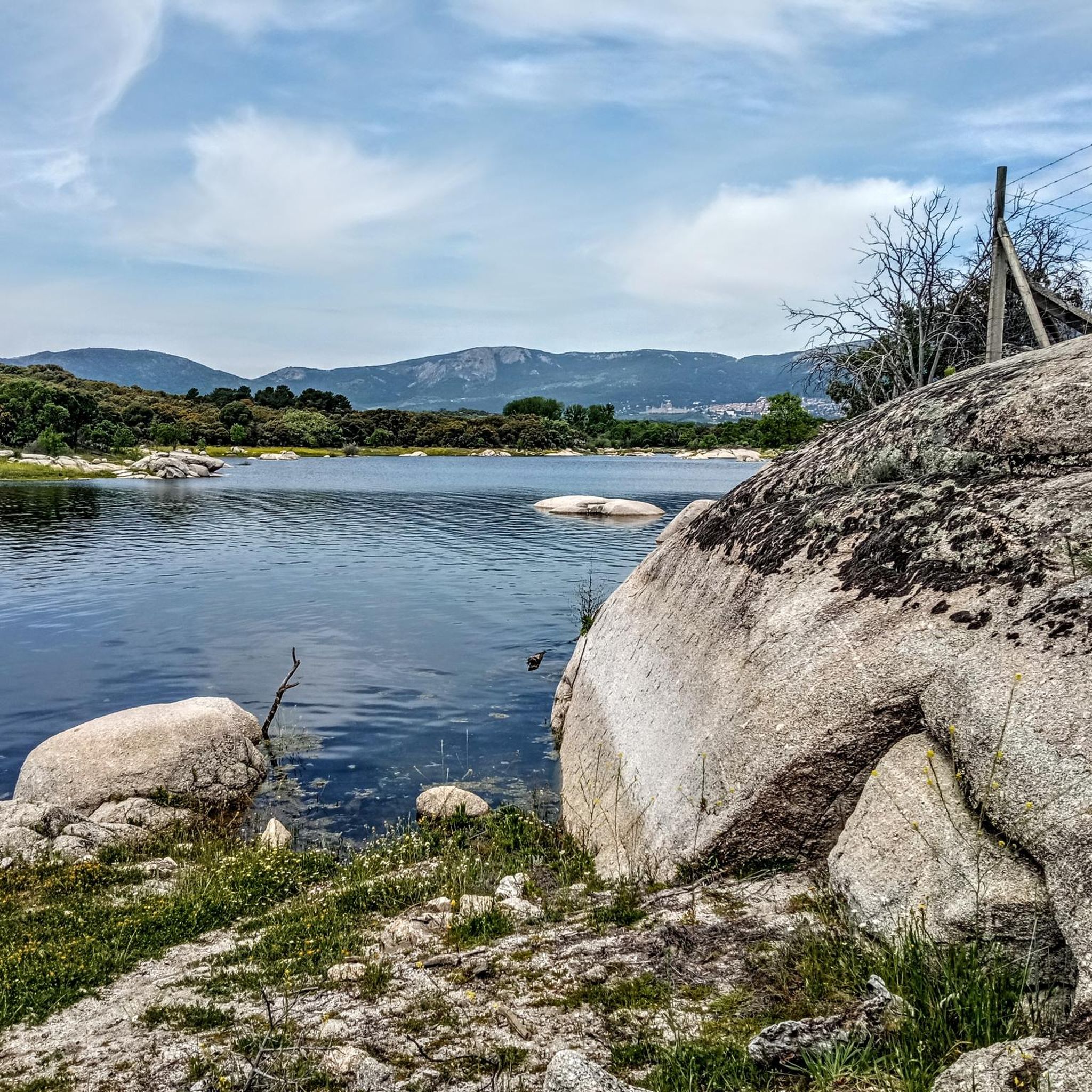
The Bear Cave in San Lorenzo de El Escorial is not a real, deep cave in the geological sense, but rather a peculiar rock formation in the Bosque de la Herrería. It is a natural cavity formed by the arrangement of large granite boulders that create a kind of shelter or "cave." It is located in the Bosque de la Herrería, a protected natural area declared a UNESCO World Heritage Site. It is on a very popular hiking trail, relatively close to the Chair of Philip II and the Fuente de los Hermanitos. Its name comes from the fact that its shape and size might evoke the idea of a bear's den, although no real bear ever lived there. Rather, it is a visual attraction, especially for children. Beyond being a "real" cave, it is a point of interest on the hiking trails in the Bosque de la Herrería.
0
0

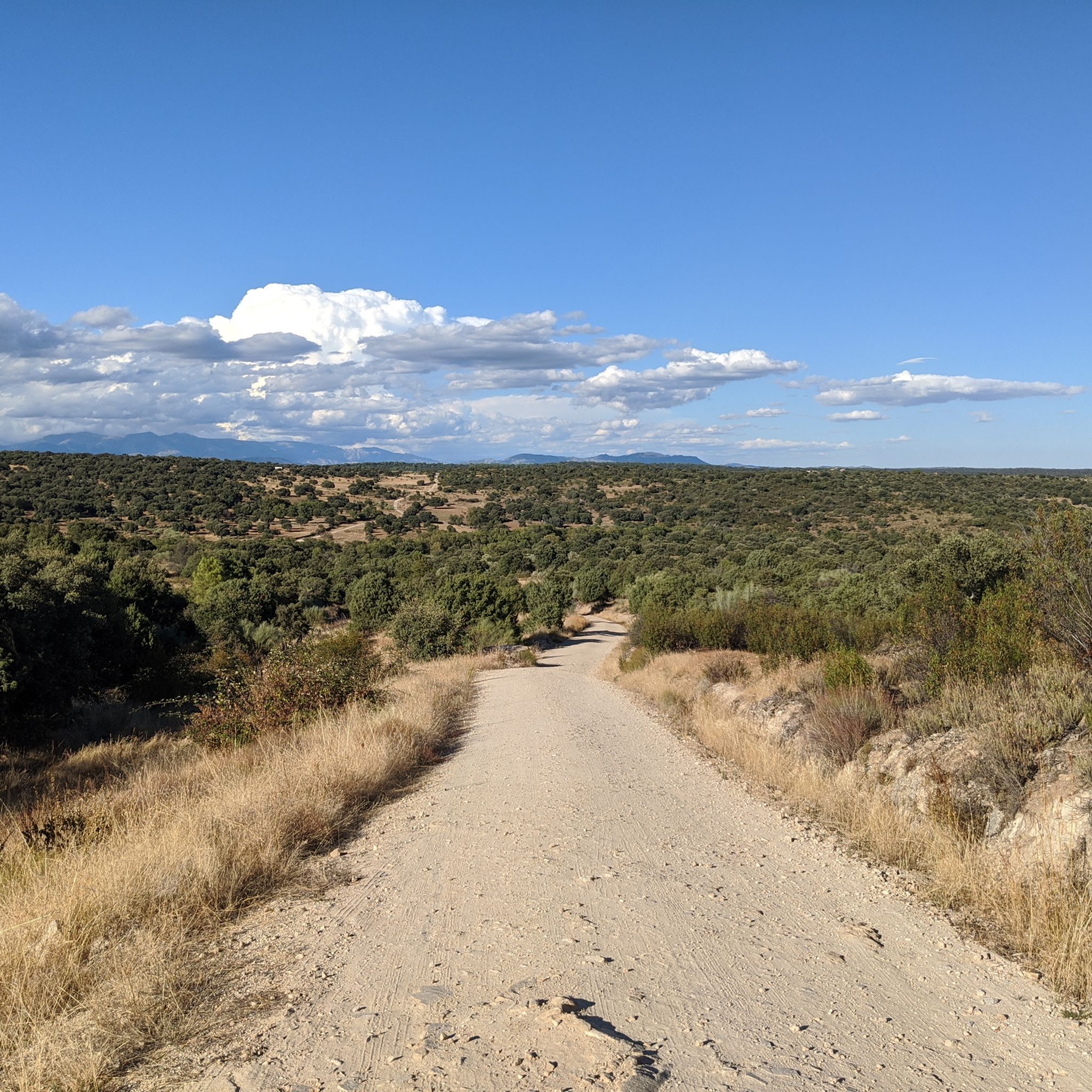
A hill that separates the town of Robledondo from Alto de Malagón in San Lorenzo del Escorial. You'll have to climb 200 meters in less than 3 kilometers if you're traveling from Robledondo. From here, there are beautiful views of both Peguerinos and its reservoir and Santa María de la Alameda, and on clear days, you can even see the Gredos Mountains.
0
0

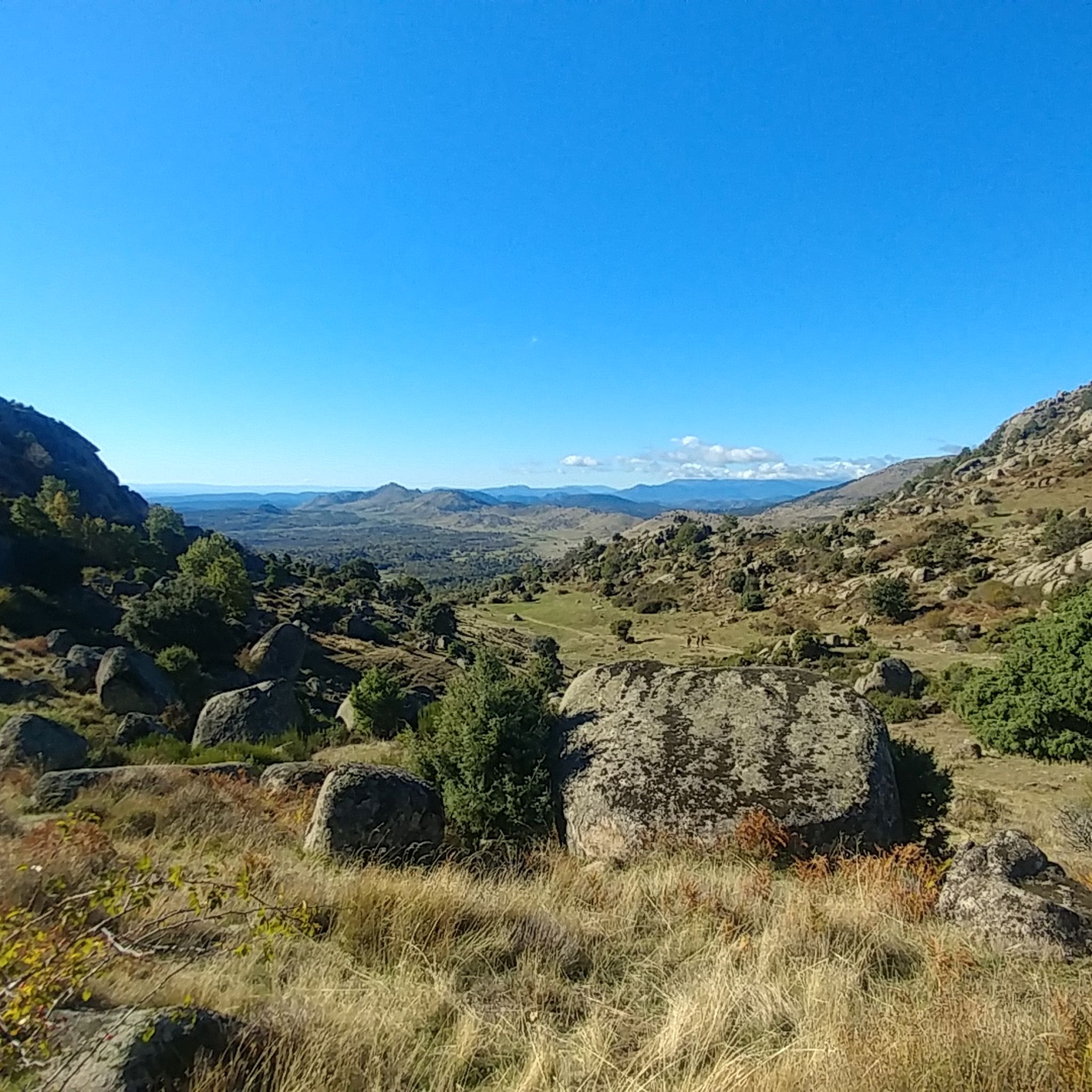
This 1,410 meter high summit is one of the two Machotas. Located outside the line of the Guadarrama mountain range, its origin is in a plutonic extrusion that took place millions of years ago. In front of her is her older sister, Machota Alta, separated by the Entre Cabezas hill.
1
0
The port of Malagón, also known as Alto de Abantos or Puerto de San Juan de Malagón, is a mountain pass located in the southwest area of the Sierra de Guadarrama. It has an altitude of 1590 meters and separates the Spanish provinces of Madrid and Ávila.
0
0

Legendary peak that not only has magnificent views but also plays a great role in the history of sports in Spain.
0
0

The port of Malagón, also known as Alto de Abantos or Puerto de San Juan de Malagón, is a mountain pass located in the southwest area of the Sierra de Guadarrama (mountain belonging to the Central System). It has an altitude of 1590 meters and separates the Spanish provinces of Madrid and Ávila. The regional road that crosses it connects the municipalities of San Lorenzo de El Escorial (Madrid) and Peguerinos (Ávila). To the west of the port extends the Malagón mountain range, which gives it its name. The mountain pass is located on the southern slope of Mount Abantos, which is why it constitutes the starting point of a path that leads to the top of said mountain.
0
0

Located on the forest track that connects Peguerinos with San Lorenzo de El Escorial, it has been crowned on several occasions by the Cycling Tour of Spain, this border port between Madrid and Ávila rewards us for the effort of the climb with amazing views of the community of Madrid. The ideal place to take a souvenir photo and enjoy the summit.
0
0

The port of Malagón is located at an altitude of 1,590 meters at a crossroads on the road between San Lorenzo de El Escorial —Madrid— and Peguerinos —Ávila—. In either direction the climb is demanding.
0
0
Frequently Asked Questions
What are some of the most recommended elevated spots or "peaks" to visit around Valdemorillo?
While Valdemorillo itself features elevated terrain and scenic routes, the broader region offers several notable spots. Mount Abantos is a classic peak in the Sierra de Guadarrama, known for its good views and popularity among hikers. Another significant point is Puerto de Malagón, a mountain pass offering magnificent views and a rich history in Spanish cycling.
Are there any family-friendly trails or natural monuments near Valdemorillo?
Yes, for a family-friendly option, consider visiting the Bear Cave in San Lorenzo de El Escorial. It's a peculiar rock formation within the Bosque de la Herrería, a protected natural area. While not a deep cave, it's a fun point of interest on a popular hiking trail, especially for children.
What kind of outdoor activities can I do near the mountain peaks around Valdemorillo?
The area around Valdemorillo is excellent for various outdoor activities. You can find numerous hiking trails, such as the easy Route of the Mills of the Perales River or the more challenging Aulencia River Canyon Trail. For cyclists, there are many road cycling and touring bicycle routes, including those passing through historic mountain passes like Cruz Verde Pass. Explore more options in the Hiking around Valdemorillo and Road Cycling Routes around Valdemorillo guides.
What are some challenging mountain hikes or elevated routes in the Valdemorillo area?
For those seeking a challenge, the Aulencia River Canyon Trail is a 14.1-mile circular route with varied terrain and potential elevation changes exceeding 3,000 feet, requiring very good fitness. Another demanding option is the Valdemorillo Civil War Cave and Picadas Canal Loop, which also involves significant elevation gain and time.
Are there any peaks or elevated points with historical significance near Valdemorillo?
Yes, Puerto de Malagón is a legendary mountain pass with significant historical importance in Spanish cycling, having been part of the Tour of Spain on many occasions. It offers not only magnificent views but also a connection to the country's sports heritage.
What is the best time of year to hike the mountain peaks and elevated trails around Valdemorillo?
The region around Valdemorillo, being close to the Sierra de Guadarrama, generally offers pleasant hiking conditions during spring and autumn when temperatures are milder. Summer can be hot, especially at lower elevations, while winter hiking in the higher peaks of the Sierra de Guadarrama (like Peñalara) may require alpine experience and specific gear due to snow and ice.
Are there any unique geological formations or viewpoints to explore?
Absolutely. The Lower Machota is a 1,410-meter high summit formed by a plutonic extrusion millions of years ago, offering a unique geological perspective. It's located outside the main Guadarrama mountain range. Additionally, many trails, including those along the Aulencia River, provide panoramic vistas and scenic beauty.
What are some moderate hiking options for those with good fitness levels?
For a moderate challenge, the Cerro Alarcón Reservoir and Puente del Pasadero Loop is a 4.1-mile trail offering scenic reservoir views and passing by a historic bridge. This route has an elevation gain of around 1,000 feet, making it suitable for those with good fitness.
Where can I find higher mountain peaks if I'm looking for more strenuous alpine experiences?
For truly high mountain peaks and more strenuous alpine experiences, you'll need to venture into the nearby Sierra de Guadarrama. Prominent summits there include Peñalara (2,428 meters), Bola del Mundo (2,265 meters), and La Maliciosa (2,227 meters). These are accessible from various points in the Community of Madrid and offer significant challenges. You can learn more about the range on Wikipedia.
What do visitors appreciate most about the elevated areas around Valdemorillo?
Visitors particularly enjoy the diverse natural landscapes, the extensive network of trails, and the panoramic views offered by the elevated terrain. The blend of natural beauty, historical elements, and varied outdoor activity opportunities, from easy river walks to challenging mountain ascents, makes the region highly appealing. The komoot community has shown its appreciation with 125 upvotes and 56 photos shared for the mountain peaks around Valdemorillo.
Are there any easy mountain trails suitable for beginners near Valdemorillo?
Yes, for an easy and accessible option, the Route of the Mills of the Perales River is a 3.2-mile circular route. It follows the Perales River, allowing visitors to explore historic mills and the Puente del Hoyo bridge, with manageable elevation gains suitable for various fitness levels.
Can I find any hidden gems or less-known elevated spots in the area?
While not a major peak, Cabeza Aguda in Colmenarejo is a promontory that offers rewarding views for those willing to explore. It's a less-trafficked spot that provides a different perspective of the local landscape, particularly if you're looking for something beyond the most popular trails.
Most popular routes around Valdemorillo
Most popular attractions around Valdemorillo

Get inspired with the komoot mobile app


Explore more
See even more amazing summits around Valdemorillo with these guides:
