The best walks and hikes around Solana De Ávila
4.6
(239)
1,492
hikers
111
hikes
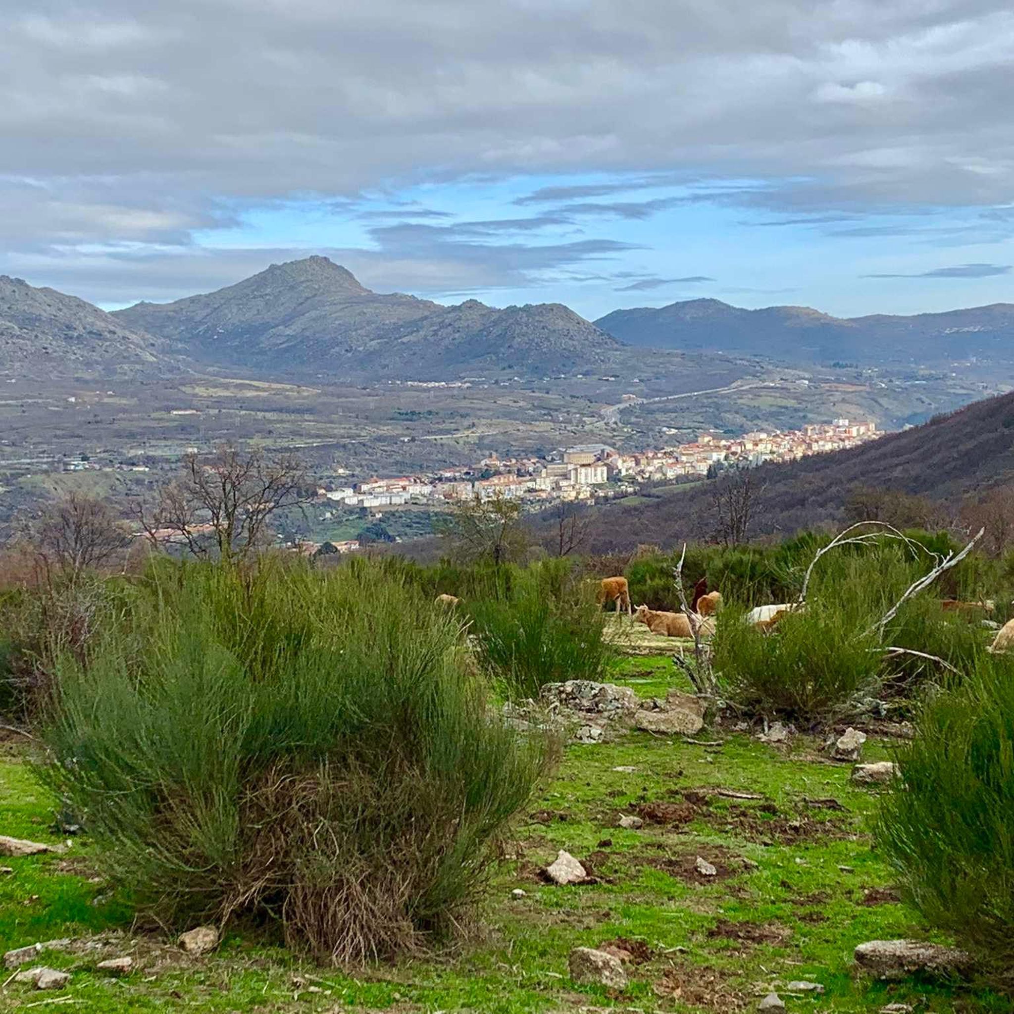
Hiking around Solana De Ávila offers diverse natural features within a mountainous landscape, situated between the Aravalle river and the Sierra de Béjar. The region is characterized by its predominantly mountainous topography, forming part of the larger Sierra de Gredos Regional Park. Key natural features include glacial lakes such as Laguna del Duque and Lagunas del Trampal, alongside peaks like Canchal Negro and Calvitero. The landscape also features sloped areas covered with broom, chestnut, and oak forests, with riparian vegetation…
Last updated: June 24, 2026
4.4
(5)
31
hikers
5.08km
02:09
240m
240m
Hike the 3.2-mile Laguna del Duque Trail to discover the largest glacial lake in Sierra de Gredos, with forest and mountain views.
5.0
(4)
54
hikers
13.9km
06:06
790m
780m
This difficult 8.7-mile circular hike in Espacio Natural de la Sierra de Candelario offers high-mountain views and challenging terrain.

Sign up for free
5.0
(2)
9
hikers
14.4km
06:24
890m
880m
Hike the difficult 8.9-mile Lagunas del Trampal circular trail in Sierra de Béjar, featuring glacial lagoons and panoramic views from Cancha
5.0
(1)
5
hikers
8.74km
03:50
510m
510m
Hike the moderate 5.4-mile Canchal Negro circular route from La Covatilla, gaining 1684 feet for panoramic views and a lunar landscape.
1
hikers
15.2km
07:11
1,040m
1,040m
This difficult 9.4-mile hike to Canchal de la Ceja and Laguna del Duque offers high-mountain views in Sierra de Béjar.
Get access to more routes and recommendations from other explorers.
Sign up for free
Already have an account?
Our route recommendations are based on thousands of hikes, rides, and runs completed by other people on komoot.
Start today with a free account
Your next adventure awaits.
Login or Signup

Tips from the Community

At a distance of just 2 km from the Collado de Los Buitres mountain pass, a good area to enjoy nature and breathe fresh air.
7
0

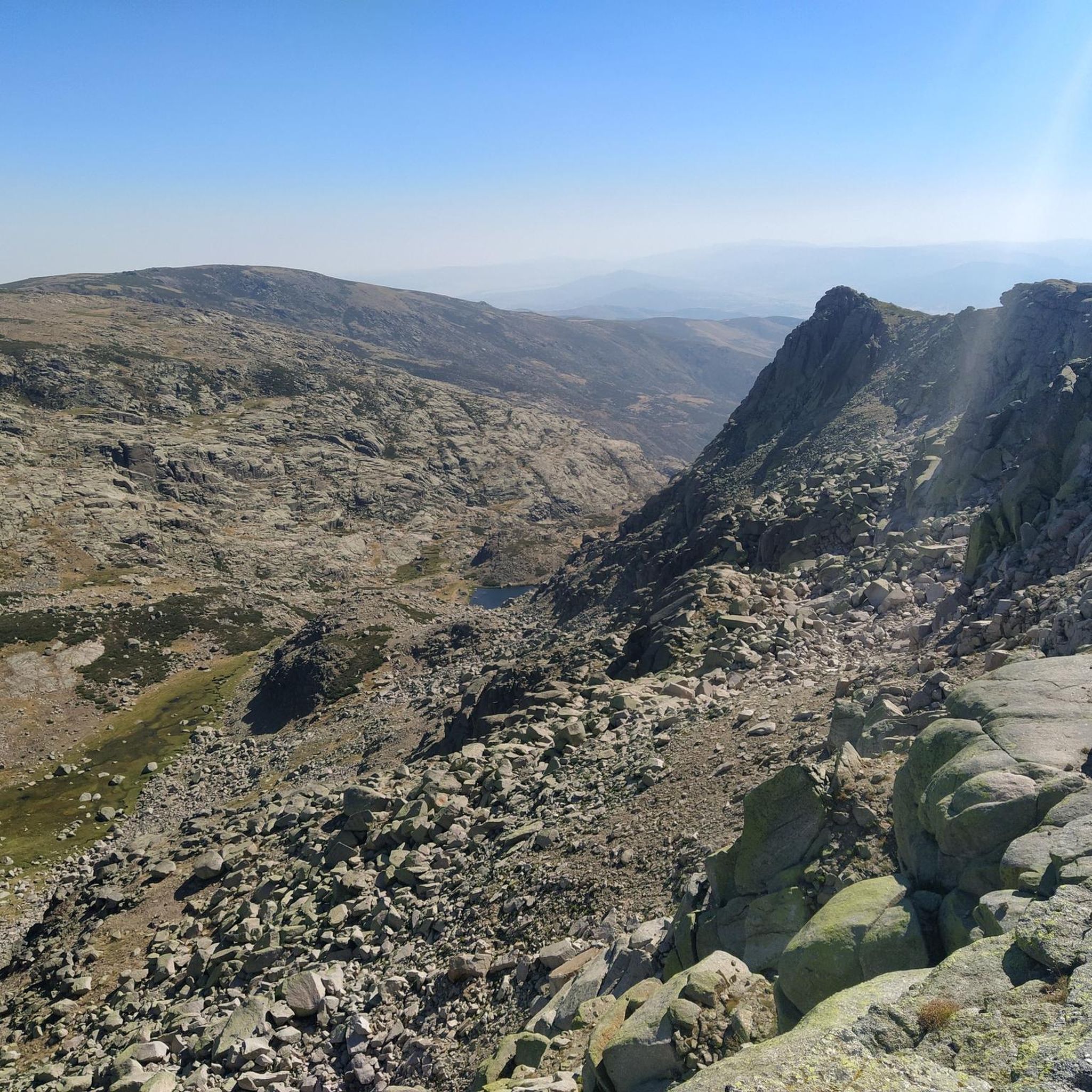
The top of Canchal Negro is located at 2,364 meters above sea level within the Sierra de Candelario Natural Area, a wonderful place worth visiting. Getting here has its price, the road can be demanding and technical in some sections, but the views are very comforting.
1
0
Another of the most important peaks of the Sierra de Candelario Park, the Calvitero rises above 2400 meters above sea level, offering wonderful panoramic views worthy of a postcard.
2
0
Beautiful place! The. Lagunas del Trampal are 3 lakes of glacial origin within the Sierra de Gredos Park and worth visiting, the landscape is wonderful at any time of the year.
1
1
It is the highest peak in the province of Salamanca at 2,427 meters above sea level. The views are amazing but to get here you will have to make a significant physical effort since the journey is very demanding. Remember that the important thing is to enjoy the road and this beautiful landscape.
2
0
Nice valley in the heart of the Sierra de Candelario with beautiful views. If you are on your way to the top of Torreón from here the journey becomes quite demanding and through technical sectors, go carefully and firmly to enjoy this beautiful place!
2
0
Popularly known as "the roof of Extremadura", the top of the Torreón or Calvitero is located at 2400 meters above sea level and without a doubt the views from there are amazing! An ascent that is demanding but with several alternatives to choose from and all of them with spectacular views.
3
0

Frequently Asked Questions
How many hiking trails are available in Solana De Ávila?
Solana De Ávila offers a wide variety of hiking opportunities, with over 110 routes recorded on komoot. These trails cater to different skill levels, from easy strolls to challenging high-mountain treks, ensuring there's something for every hiker.
What kind of natural landmarks can I expect to see while hiking in Solana De Ávila?
The region is rich in natural beauty. You can explore stunning glacial lakes like Laguna del Duque and Lagunas del Trampal, or ascend peaks such as Canchal Negro and Calvitero for panoramic views. The landscape also features diverse forests of birch, ash, hawthorn, oak, and pine, alongside the riparian vegetation of the Aravalle river. Notable highlights include Torreón (Calvitero Summit) and Hoya Moros.
Are there any circular hiking routes in Solana De Ávila?
Yes, Solana De Ávila features several rewarding circular routes. For a challenging high-mountain experience, consider the Calvitero and Hoya Moros Loop, an 8.7-mile path with demanding terrain. Another option is the Canchal Negro Loop from La Covatilla, a moderate 5.4-mile route offering panoramic views of a unique lunar landscape.
What is the best time of year to go hiking in Solana De Ávila?
The mountainous terrain of Solana De Ávila, particularly within the Sierra de Gredos Regional Park, means that conditions can vary significantly with seasons. Spring and autumn generally offer pleasant temperatures and vibrant landscapes, ideal for hiking. Summer can be warm, especially at lower altitudes, while winter brings colder temperatures and potential snow in higher elevations, making some routes more challenging or inaccessible.
Are there any easy or moderate hiking trails suitable for less experienced hikers?
Absolutely. While the region is known for its challenging high-mountain treks, there are also plenty of moderate options. The Laguna del Duque Trail is a moderate 3.2-mile hike that offers beautiful views of forests and mountains, traversing through diverse tree species. This route is a great way to experience the area's natural beauty without extreme difficulty.
What do other hikers say about the trails in Solana De Ávila?
The hiking trails in Solana De Ávila are highly regarded by the komoot community, boasting an average rating of 4.6 stars from over 200 reviews. Hikers often praise the stunning mountainous landscapes, the diverse natural features including glacial lakes and forests, and the variety of routes available for different fitness levels.
Are there any challenging high-mountain hikes in the area?
Yes, for experienced hikers seeking a challenge, Solana De Ávila offers several demanding high-mountain routes. The Calvitero and Lagunas del Trampal Loop Trail is a difficult 9.4-mile route that takes you through rugged terrain to stunning glacial lakes. Another strenuous option is the Canchal de la Ceja and Laguna del Duque Loop, also a difficult 9.4-mile hike with significant elevation gain.
Are there any waterfalls along the hiking trails in Solana De Ávila?
While the region is characterized by its mountainous topography and glacial lakes like Laguna del Duque and Lagunas del Trampal, explicit mentions of prominent waterfalls along the main hiking routes are not common. The area's beauty lies more in its high-mountain vistas, diverse forests, and the serene glacial water bodies.
Is Solana De Ávila part of a larger natural park?
Yes, Solana De Ávila is nestled in the southwest of the Ávila province and is part of the larger Sierra de Gredos Regional Park. This designation highlights the area's significant natural value and its powerful magnetism for nature lovers, offering protected landscapes and diverse ecosystems for exploration.
What are the typical elevations and terrains encountered on hikes here?
Hikes in Solana De Ávila vary significantly in elevation and terrain. You can expect sloped areas covered with broom, chestnut, and oak forests at lower altitudes, transitioning to rocky areas and high-altitude landscapes with sparser vegetation as you ascend. Peaks like Calvitero rise over 2400 meters, offering demanding climbs and significant elevation changes, while routes to glacial lakes involve traversing through forests and mountain paths.
Are there options for public transport to reach hiking trailheads in Solana De Ávila?
Solana De Ávila is a rural mountainous region. While local bus services might connect some villages, direct public transport to specific hiking trailheads can be limited. It is generally recommended to have private transportation to access the more remote starting points for many of the region's diverse hiking routes.
Are there any specific viewpoints or mountain passes worth visiting?
The region offers several impressive viewpoints and mountain passes. The summit of Canchal Negro provides panoramic views and a unique lunar landscape. You can also explore mountain passes like Hell's Pass or Puerto del Tremedal, which offer stunning vistas of the surrounding Sierra de Béjar and Sierra de Gredos mountains.
Most popular routes around Solana De Ávila
Most popular attractions around Solana De Ávila

Get inspired with the komoot mobile app


Explore more
Browse the best Hikes in other regions.
