The best walks and hikes around Fuente El Fresno
4.5
(52)
402
hikers
27
hikes
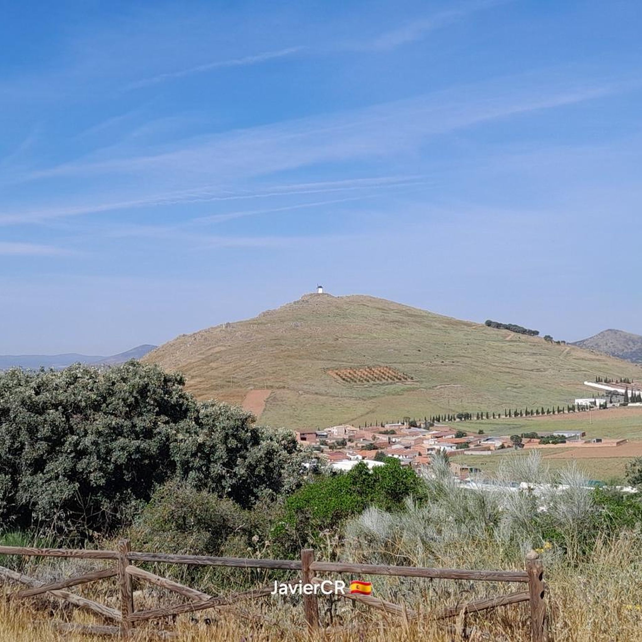
Hiking around Fuente El Fresno offers a variety of trails through the landscapes of Ciudad Real. The region is characterized by rolling hills, particularly within the Sierra de Malagón and Sierra Calderina, alongside flatter areas often associated with local waterways. These physical features provide diverse environments for outdoor activities. The terrain includes both open expanses and areas with some elevation gain.
Best hiking trails around Fuente El Fresno
- The most popular hiking route is Isla del Pan Trail, an…
Last updated: July 8, 2026
4.9
(7)
108
hikers
2.94km
00:45
10m
10m
Easy 1.8-mile (2.9 km) hike on wooden walkways through the wetlands of Tablas de Daimiel National Park, perfect for nature observation.
4.5
(2)
26
hikers
8.23km
02:38
340m
330m
Moderate hike. Good fitness required. Easily-accessible paths. Suitable for all skill levels.

Sign up for free
5.0
(2)
6
hikers
12.9km
03:45
340m
340m
Moderate hike. Good fitness required. Easily-accessible paths. Suitable for all skill levels.
1
hikers
Hard hike. Very good fitness required. Easily-accessible paths. Suitable for all skill levels.
Easy hike. Great for any fitness level. Easily-accessible paths. Suitable for all skill levels.
Get access to more routes and recommendations from other explorers.
Sign up for free
Already have an account?
Our route recommendations are based on thousands of hikes, rides, and runs completed by other people on komoot.
Start today with a free account
Your next adventure awaits.
Login or Signup

Tips from the Community

A classic climb for local cyclists, with stunning views, although you'll have to work up a sweat to enjoy them.
0
1

The route also includes several wildlife observatories from which you can see ducks and other waterfowl. It's an excellent way to enjoy the biodiversity and unique landscapes of this wetland.
24
0
Bread Island is one of the best-known hikes in Las Tablas de Daimiel National Park. This circular trail, approximately 2 kilometers long and lasting 1 to 1.5 hours, takes you through several islands connected by wooden walkways. During the hike, you'll pass the islands of La Entradilla, El Descanso, del Pan, de los Tarayes, and del Maturro. Each island offers different opportunities to observe the park's flora and fauna. For example, on Bread Island, you can see a tamarisk forest where various birds such as the green woodpecker, the hoopoe, and the long-eared owl nest.
26
0
In Las Tablas de Daimiel National Park, there are several wildlife observatories where you can enjoy bird and animal watching. Observatories at the Permanent Lagoon: This 800-meter linear trail takes you to a lagoon from whose observatories you can see various aquatic birds depending on the season. Observatories on the Prado Ancho Tower Route: This 4-kilometer trail includes four wildlife observatories and ends at a two-story tower that offers impressive panoramic views of the wetland. Observatories on the Bread Island Route: This 2.5-kilometer circular trail is the most popular in the park and has several observatories where you can see ducks and other aquatic birds.
30
0
The Acclimatization Lagoon in Las Tablas de Daimiel National Park is a small, enclosed lagoon used for the recovery of sick birds, their breeding, and their subsequent release into the park. It is located on the Isla del Pan trail, a 2.5-kilometer, easy-to-follow circular route. This trail is very easy to follow and allows you to observe a wide variety of aquatic birds. The lagoon is covered with a mesh netting that prevents birds from flying out of the enclosure.
2
0

There are fantastic observation opportunities here. It is advisable to have a telephoto lens with you.
9
2
Very beautiful wooden walkways provide impressive insights into the flora and fauna of the wetland.
8
2
The Bañuelos River Bridge from Roman times surprises us with its ten eyes, today battered awaiting rehabilitation, formed by brick vault arches, joined with lime and sand mortar. On the right bank of the river next to the bridge is the Carrillo Mill, named after its first owner. It is a construction from 1713, made with masonry walls and thick cylindrical buttresses, covered with wooden trusses and curved tiles that preserve the original machinery.
35
0
Frequently Asked Questions
Are there easy and family-friendly hiking trails in Fuente El Fresno?
Yes, Fuente El Fresno offers 12 easy hiking routes, many of which are suitable for families and beginners. A great option is the Isla del Pan Trail, which is a gentle 1.8-mile (2.9 km) path that takes about 45 minutes to complete.
What is the typical duration of hikes in Fuente El Fresno?
Hikes in Fuente El Fresno vary in length and duration. Easy trails, like the Isla del Pan Trail, can be completed in under an hour. Moderate routes, such as the Sierra de Malagón, typically take around 2.5 to 3 hours, while longer, more challenging routes can extend to 6 hours or more.
Are there circular hiking routes available in Fuente El Fresno?
Yes, several circular routes are available, allowing you to start and end your hike at the same point. An example is the challenging Ascent to the Plaza de los Moros via the Sierra de Malagón, which is a circular trail from Malagón. Another easy circular option is the Puente del Molino Carrillo por el Canal de Gasset.
What natural attractions or landmarks can I visit while hiking in the area?
The region offers several notable attractions. You can explore the wetlands of Tablas de Daimiel National Park, a significant natural monument. There are also various viewpoints, such as the Observation point, offering panoramic views of the landscape, and religious buildings like the Hermitage of the Virgin of the Encarnación.
What kind of terrain can I expect on the hiking trails around Fuente El Fresno?
The terrain around Fuente El Fresno is diverse, featuring rolling hills within the Sierra de Malagón and Sierra Calderina, as well as flatter areas often found near local waterways. You'll encounter both open expanses and sections with noticeable elevation changes, providing varied environments for hiking.
When is the best time of year to go hiking in Fuente El Fresno?
The best time for hiking in Fuente El Fresno is typically during spring (April to June) and autumn (September to November) when temperatures are milder and the landscape is vibrant. Summers can be very hot, making early mornings or late afternoons preferable, while winters are generally mild but can be chilly.
Are there good viewpoints along the hiking trails?
Yes, the hilly terrain, particularly in the Sierras, provides opportunities for scenic viewpoints. For instance, you can find an Observation point that offers expansive views of the surrounding area, including the Tablas de Daimiel.
What do other hikers enjoy most about hiking in Fuente El Fresno?
The hiking routes in Fuente El Fresno are highly rated by the komoot community, with an average score of 4.7 stars from over 30 reviews. Hikers often praise the varied terrain, from the rolling hills to the tranquil areas near water features, and the options available for different ability levels.
Can I reach hiking trails in Fuente El Fresno using public transport?
While Fuente El Fresno is a rural area, public transport options to the immediate trailheads might be limited. It is generally recommended to use a car to access many of the hiking starting points, especially for trails further from the town center. Check local bus schedules for connections to nearby villages if planning to rely on public transport.
Are dogs allowed on the hiking trails in Fuente El Fresno?
Generally, dogs are welcome on many of the hiking trails in Fuente El Fresno, especially in natural, open areas. However, it's always advisable to keep them on a leash, particularly in areas with wildlife or near livestock, and to check for any specific restrictions in protected natural parks or reserves like Tablas de Daimiel National Park.
Are there suitable trails for winter hiking in Fuente El Fresno?
Yes, winter hiking is possible in Fuente El Fresno as the climate is generally mild. The region rarely experiences heavy snow, making many trails accessible. However, it's always wise to check local weather forecasts, dress in layers, and be prepared for cooler temperatures and potentially muddy conditions, especially after rain.
What kind of wildlife can I expect to see while hiking?
The diverse landscapes of Fuente El Fresno, including its sierras and wetlands, support various wildlife. You might spot birds of prey, waterfowl in areas like Tablas de Daimiel, and various small mammals. Keep an eye out for local flora and fauna, especially during quieter times of day.
Most popular attractions around Fuente El Fresno

Get inspired with the komoot mobile app


Explore more
Browse the best Hikes in other regions.
