The best running trails around Berberana
4.7
(6)
295
runners
36
runs
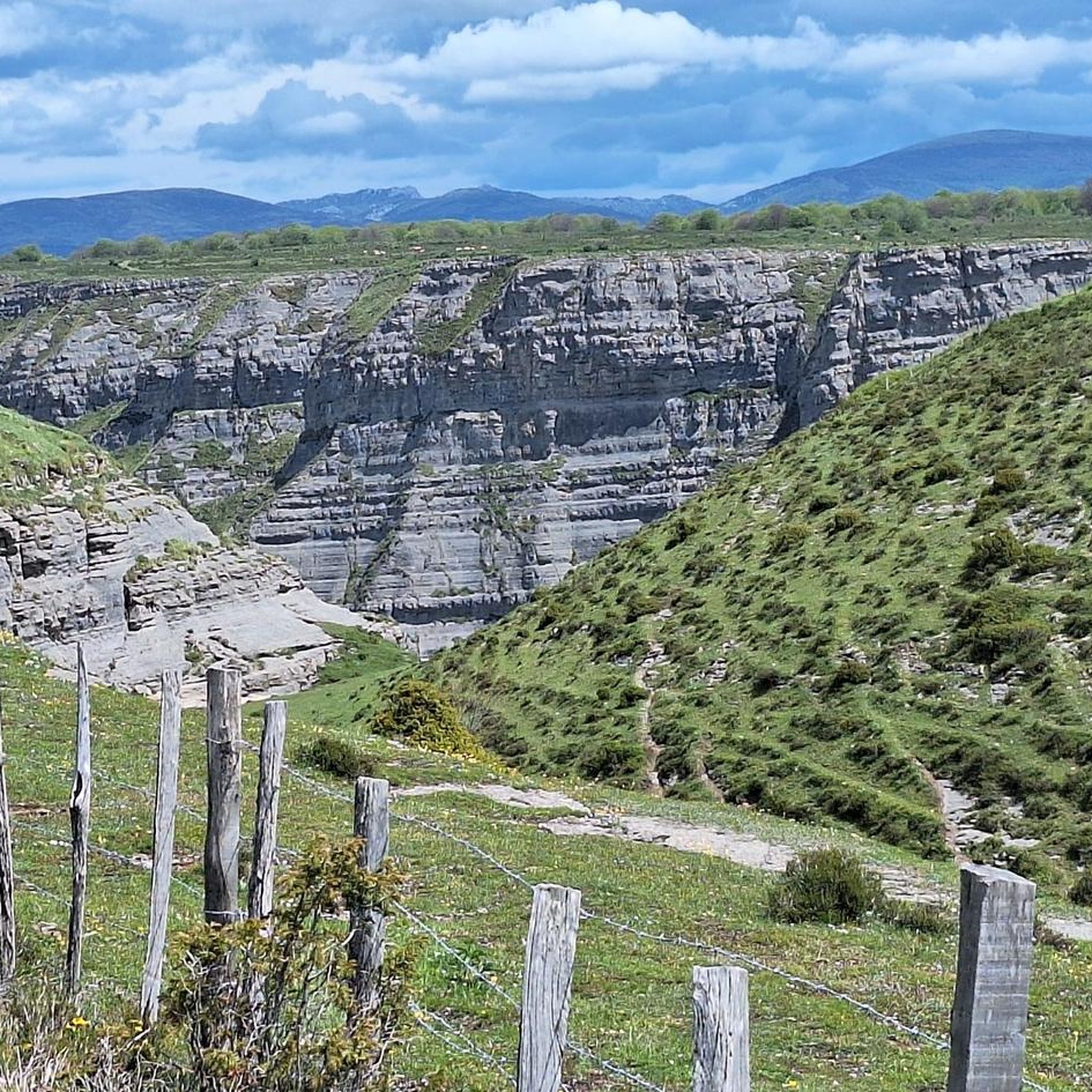
Jogging routes around Berberana traverse a landscape shaped by karstic erosion, featuring the dramatic limestone crests of the Sierra Salvada. The region is characterized by rolling hills and diverse forests of beech, oak, and holm oak. Water features like the Salto del Nervión waterfall and various caves and sinkholes add to the dynamic topography, providing a varied backdrop for running.
Best jogging routes around Berberana
- The most popular jogging route is Sierra Salvada y Pico del Fraile — circular by…
Last updated: June 28, 2026
8.25km
00:57
120m
120m
Moderate run. Good fitness required. Mostly accessible paths. Some sure footedness required.
26
runners
Moderate run. Good fitness required. Mostly paved surfaces. Suitable for all skill levels.

Sign up for free
18
runners
9.89km
01:05
110m
110m
Moderate run. Good fitness required. Mostly paved surfaces. Suitable for all skill levels.
4.0
(1)
12
runners
9.77km
01:17
330m
330m
Hard run. Very good fitness required. Mostly paved surfaces. Suitable for all skill levels.
7
runners
18.2km
02:39
780m
780m
Hard run. Very good fitness required. Sure-footedness, sturdy shoes and alpine experience required.
Get access to more routes and recommendations from other explorers.
Sign up for free
Already have an account?
Our route recommendations are based on thousands of hikes, rides, and runs completed by other people on komoot.
Start today with a free account
Your next adventure awaits.
Login or Signup

Tips from the Community

A fantastic waterfall, if the Rio Nervión is flowing. If not, the viewpoint is still spectacular.
2
0

Unfortunately, the Nervión has no water today, 2.5.25, so the spectacular waterfall was only a viewpoint in the canyon
4
0

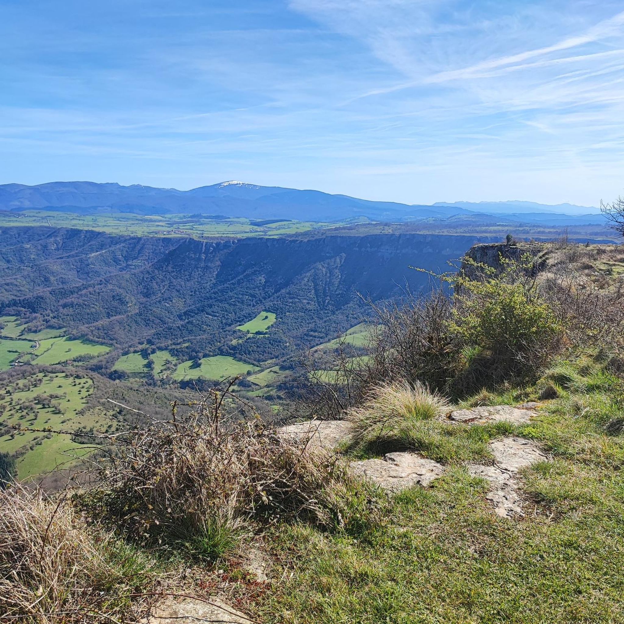
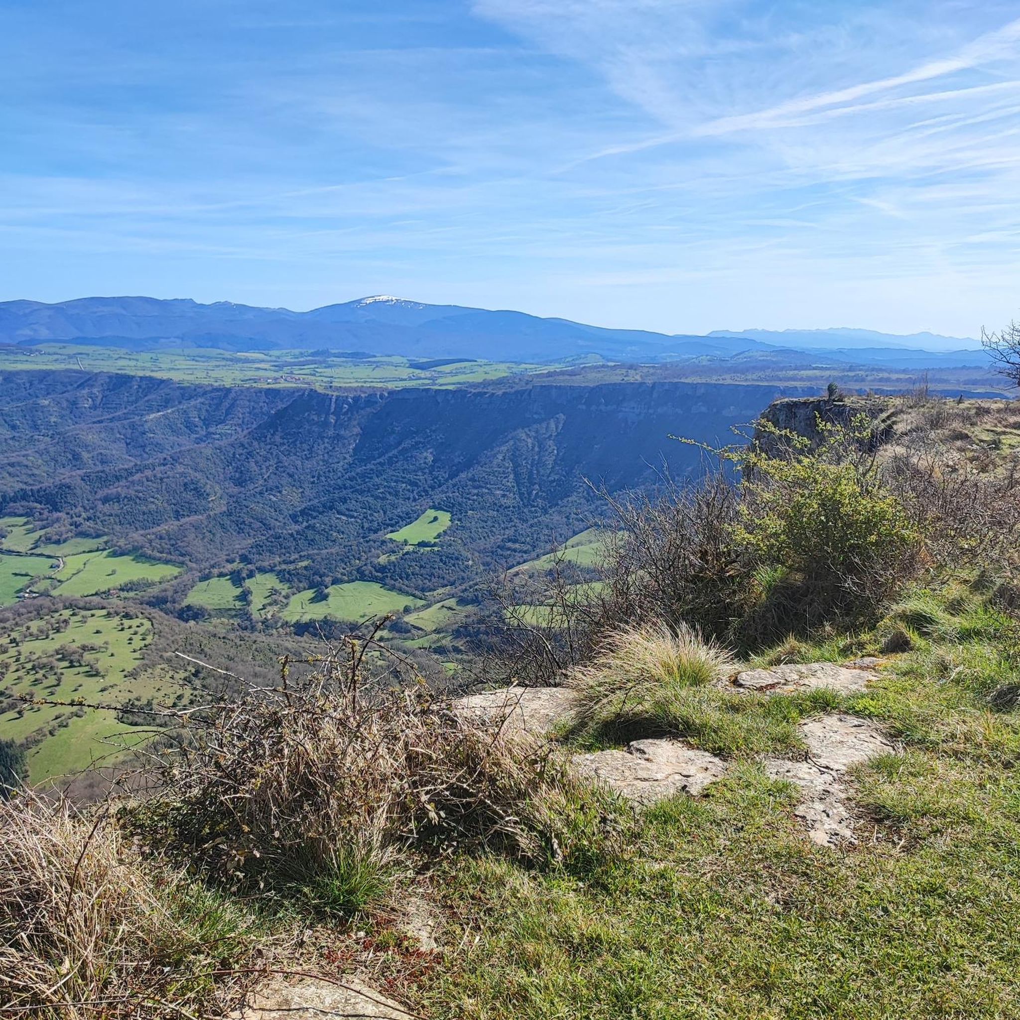
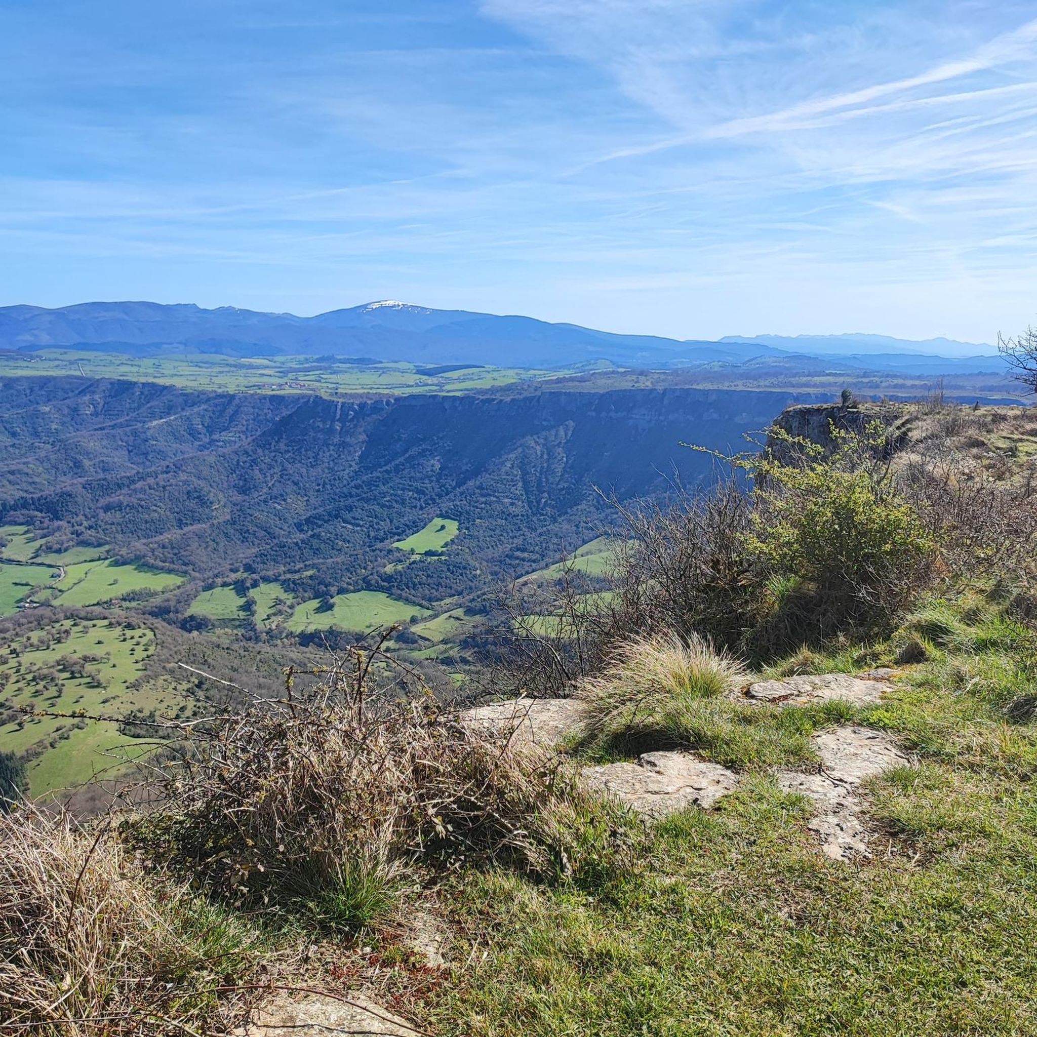
Views of the valley where the Nervión River runs on its way to Bilbao, with Orduña in the background.
1
0


very beautiful view here
9
0
Pico del Fraile (864 m) is a mountain in the Cordillera. There is a path to the top. The nearest mountain refuge is Refugio del Tolope, located 1,037 m/3,402 ft NNW from the summit.
3
0

The Mirador is spectacular but not a drop of water from the waterfall when I went. Of course, I heard the water but I didn't see anything. The cuts are very worth it
2
0

Impressive viewpoint, especially if the waterfall carries water, something that doesn't happen much.
6
0
Frequently Asked Questions
How many running routes are available around Berberana?
Berberana offers a wide selection of running routes, with over 40 trails to explore. These routes cater to various fitness levels, ranging from easy paths to more challenging runs through the diverse landscape.
Are there any easy or beginner-friendly jogging routes in Berberana?
Yes, Berberana has options for beginners. The region research mentions shorter, less strenuous routes like the PR-BU 41 and PR-BU 42, which are about 1.7 to 2 kilometers long and lead to viewpoints. These are excellent for casual jogging amidst beautiful natural surroundings.
Where can I find long-distance running trails near Berberana?
For a longer and more demanding running experience, consider the GR 282, also known as the Senda de los Miradores (Path of the Viewpoints). This trail follows the cliff edge northward, offering continuous stunning vistas over the valley of Orduña. Another challenging option is the Txolope Summit loop from Artomaña, which is over 18 km long.
Are there any circular running routes in the Berberana area?
Yes, there are several circular running routes. The Sierra Salvada y Pico del Fraile — circular by the ZEC Monte Santiago is a popular 8.2 km moderate trail. Another option is the Esquina de Rubén Viewpoint – Salto del Nervión Viewpoint loop from Monumento Natural del Monte Santiago, a 9.4 km moderate path. The region research also highlights a 6.4 km circular trail combining PR-BU 41+45+42, starting from Fuente Santiago parking lot.
What natural attractions or viewpoints can I see along the running trails?
The Berberana area is rich in natural beauty. You can encounter the majestic Nervión River, which forms the impressive Salto del Nervión waterfall, Spain's highest. Trails also offer Views of Pico del Fraile, the Purón River Gorge, and the Corraladas Waterfall. Many routes lead to conditioned viewpoints for observing the deep cliff face of the Salto del Nervión.
Is the Salto del Nervión waterfall visible from the running routes?
Absolutely. Many running routes in the area are designed to offer views of the Salto del Nervión. The Esquina de Rubén Viewpoint – Salto del Nervión Viewpoint loop provides panoramic views of the waterfall and its surrounding natural monument. The Senda de los Miradores also offers continuous stunning vistas along the cliff edge.
What is the best time of year to go jogging in Berberana?
The Salto del Nervión waterfall, a major attraction, is most spectacular during periods of heavy rainfall or snowmelt, typically in late winter or spring. However, the diverse forests of beech, oak, and holm oak provide shade, making it pleasant for jogging during warmer months. The varied topography ensures a dynamic and scenic backdrop year-round, though conditions will vary with seasons.
Are there any running routes suitable for families with children?
While specific 'family-friendly' routes aren't detailed, the shorter, less strenuous paths mentioned in the region research, such as the 1.7 to 2 km routes leading to viewpoints (PR-BU 41 and PR-BU 42), would be suitable for families looking for an easier jog or walk. These paths are well-marked and offer scenic views without significant difficulty.
What do other runners enjoy most about the trails in Berberana?
The running trails in Berberana are highly rated by the komoot community, with an average score of 4.7 stars from over 6 reviews. Runners often praise the varied terrain, from comfortable tracks to paths bordering dramatic cliffs, and the opportunity to experience the impressive Salto del Nervión waterfall and diverse forests.
Are there any routes that offer a unique perspective of the Salto del Nervión?
Yes, the Senda Verde de Delika trail provides a unique perspective, allowing visitors to view the Salto del Nervión from below and explore the captivating Delika Canyon. This offers a different visual experience of the waterfall and a picturesque path for a jog.
Is parking available near the running routes in Berberana?
Yes, the region research indicates that routes like the PR-BU 41, PR-BU 42, and the longer PR-BU 41+45+42 circular trail start from the Fuente Santiago parking lot, making access convenient for runners. The Running loop from Aparcamiento de Hoyalante also suggests parking availability at its starting point.
What kind of terrain can I expect on the running trails around Berberana?
The terrain around Berberana is highly varied, shaped by karstic erosion. You can expect dramatic limestone crests of the Sierra Salvada, rolling hills, and diverse forests of beech, oak, and holm oak. Paths range from comfortable tracks to those bordering dramatic cliffs, offering a dynamic and engaging experience for runners.
Most popular attractions around Berberana

Get inspired with the komoot mobile app


Explore more
Browse the best Running Trails & Routes in other regions.
