The best walks and hikes around Sorihuela
4.5
(130)
626
hikers
66
hikes
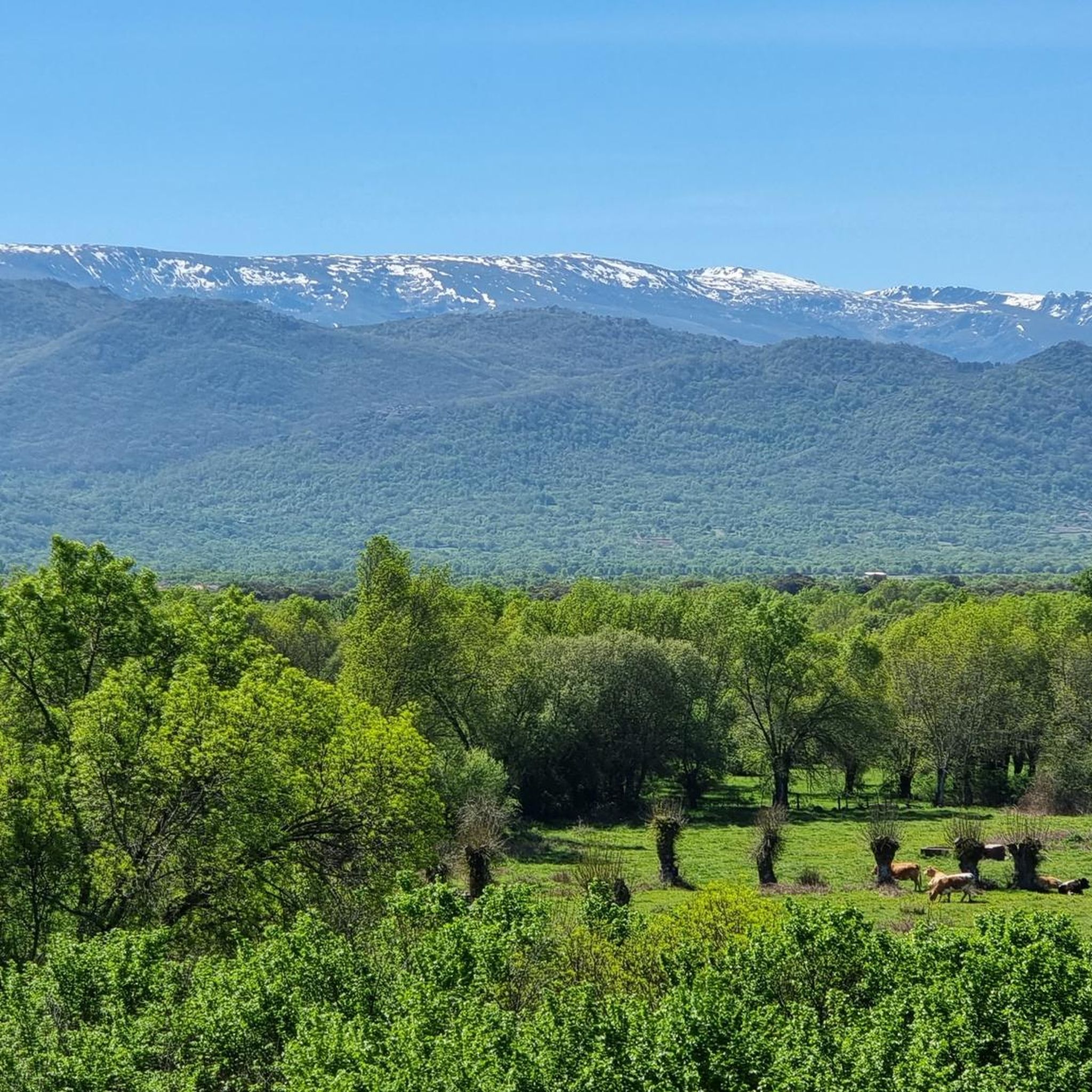
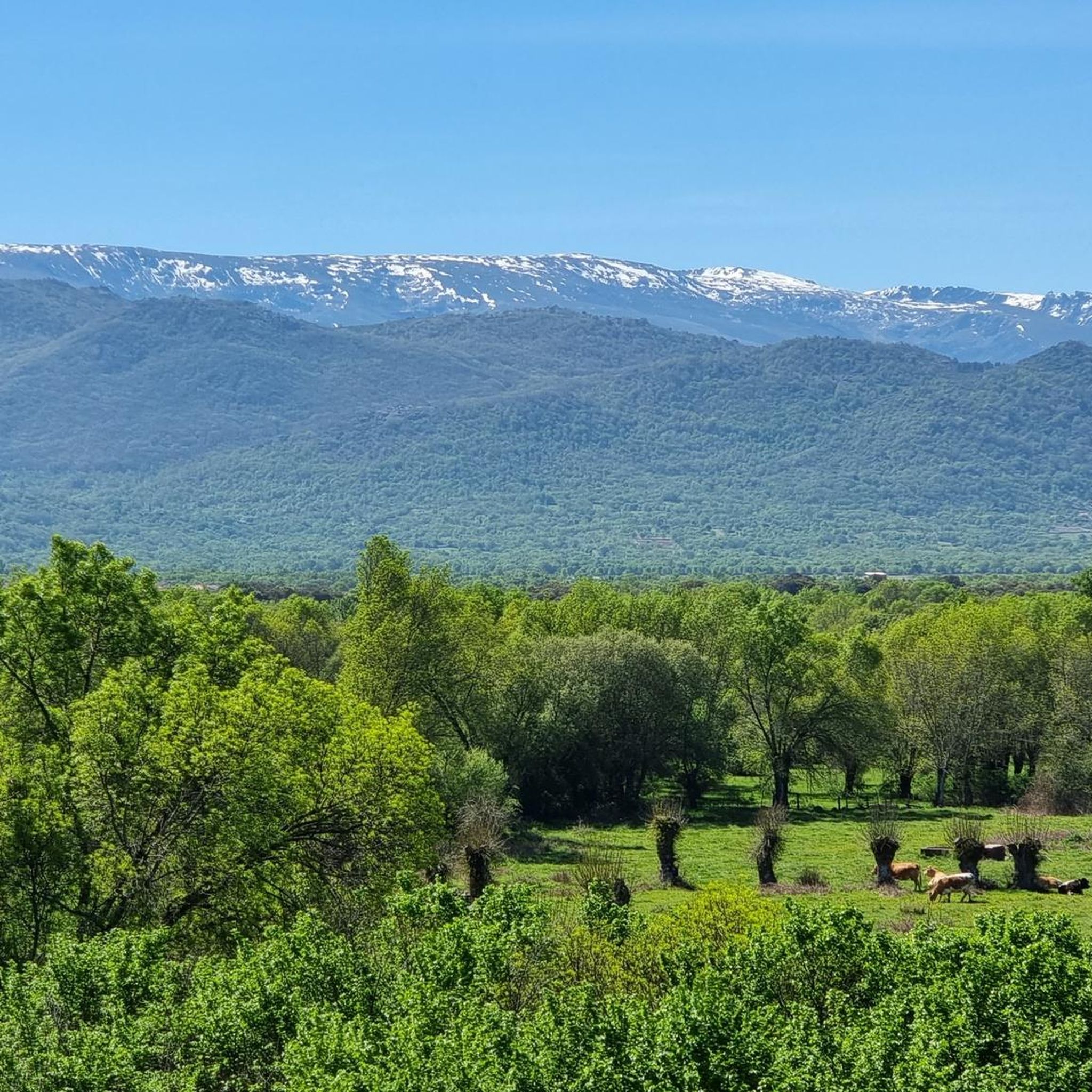
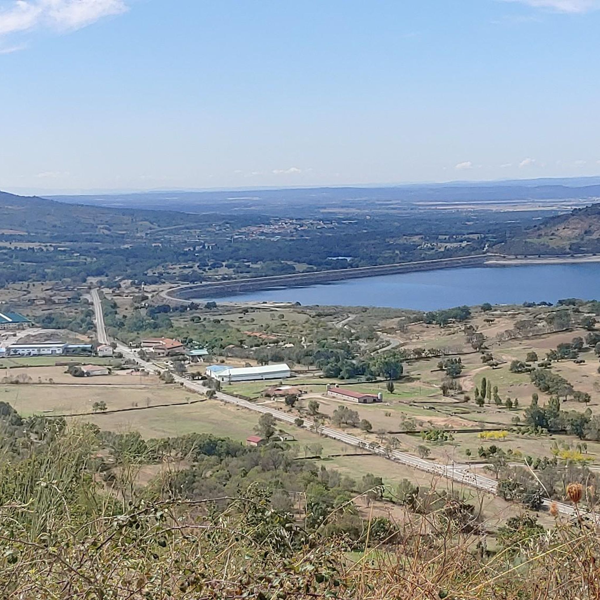
Hiking around Sorihuela offers diverse landscapes within the Sierra de Béjar region. Lower elevations feature meadows, orchards, and a river, transitioning to hills covered with oaks, ash, and elm trees. Higher mountainous areas present rugged, accidented terrain characterized by granite rocks and sparser vegetation, providing panoramic views. This varied topography makes the area suitable for a range of hiking experiences.
Best hiking trails around Sorihuela
- The most popular hiking route is Canchal Negro Loop from La Covatilla, a 5.4…
Last updated: June 28, 2026
5.0
(1)
5
hikers
8.74km
03:50
510m
510m
Hike the moderate 5.4-mile Canchal Negro circular route from La Covatilla, gaining 1684 feet for panoramic views and a lunar landscape.
4.5
(2)
7
hikers
Moderate hike. Good fitness required. Easily-accessible paths. Suitable for all skill levels.

Sign up for free
5.0
(1)
1
hikers
Hard hike. Great for any fitness level. Sure-footedness, sturdy shoes and alpine experience required.
4.21km
01:25
180m
180m
Hike the difficult 2.6-mile Santuario de Nuestra Senora del Castanar from Bejar trail, gaining 602 feet to reach the historic sanctuary.
4.6
(5)
34
hikers
10.7km
03:03
250m
250m
Moderate hike. Good fitness required. Easily-accessible paths. Suitable for all skill levels.
Get access to more routes and recommendations from other explorers.
Sign up for free
Already have an account?
Our route recommendations are based on thousands of hikes, rides, and runs completed by other people on komoot.
Start today with a free account
Your next adventure awaits.
Login or Signup
Tips from the Community

The Peña de la Cruz shelter has 20 beds and offers traditional cuisine for both guests and passers-by. According to its own promotion, it is an ideal place to go and see the stars with friends.
1
0

The bullring of the city of Béjar, in the province of Salamanca (Spain), better known as La Ancianita, is the oldest bullring preserved in Spain, inaugurated in 1711.2 Located on the Castañar mountain next to the Sanctuary of the Virgen del Castañar, two kilometers from Béjar.3
0
0

This hermitage receives the visitor as soon as they enter the Villa de Candalario and is called the hermitage of Santo Cristo del Refugio, on a large esplanade presided over by the Terminus Cross. Inside rests the Cristo del Refugio, of great devotion by the residents of the town.
2
0

Located on the outskirts of Béjar in the middle of the Sierra de Candelario forest, this magnificent Sanctuary was built after the apparition of the Virgin in 1496. It is a very picturesque building and it is also worth visiting inside.
1
1
A very popular place in the area and with good reason it is. Next to the cross is the viewpoint that offers beautiful panoramic views of the entire Sierra de Béjar valley and the town below. A few meters away is the refuge and an area with tables to take a break and enjoy this wonderful place.
1
1
The top of Canchal Negro is located at 2,364 meters above sea level within the Sierra de Candelario Natural Area, a wonderful place worth visiting. Getting here has its price, the road can be demanding and technical in some sections, but the views are very comforting.
1
0
The group of three crosses is located in the upper part of a mountain that presides over the town of Candelario. Originally there was only one cross. Due to the growth of the Pinos, a larger cross and a third cross were added to the complex in the sixties. On May 1, the pilgrimage to the Cruz del Herrerito is celebrated at this point.
2
0
Located at the top of some stairs that lead from the town hall, the church is not only the scene of Sunday mass, but also of performances such as the "Typical Wedding" held in August or the "Via Crucis" in Holy Week.
1
0
Frequently Asked Questions
How many hiking trails are available around Sorihuela?
There are over 60 hiking routes available around Sorihuela, offering a wide range of experiences. These include 13 easy trails, 37 moderate routes, and 14 more challenging options, ensuring there's something for every skill level.
What kind of terrain can I expect on hikes near Sorihuela?
The terrain around Sorihuela is quite varied. You'll find lower elevations with meadows, orchards, and a river, transitioning to hills covered with oaks, ash, and elm trees. Higher mountainous areas feature rugged, accidented terrain with granite rocks and sparser vegetation, providing stunning panoramic views. This diverse landscape is characteristic of the Sierra de Béjar region.
Are there any circular hiking routes in the Sorihuela area?
Yes, there are several circular routes. For example, the Peña de la Cruz – circular by the Espacio Natural de la Sierra de Candelario is a moderate 4.2-mile path that takes you through varied terrain. Another option is The Route of the Fountains of Candelario - circular through the Natural Space of the Sierra de Candelario, a 3.6-mile trail.
Are there easy hiking options suitable for beginners or families?
Yes, Sorihuela offers 13 easy hiking trails that are suitable for beginners or families. These routes often traverse the lower elevations with meadows and orchards, providing a gentler experience. While specific family-friendly routes aren't detailed, the easier trails are generally a good starting point.
What natural features or landmarks can I see while hiking near Sorihuela?
Hikers can discover a variety of natural and historical landmarks. You might encounter the Cedro de la Francesa, or the Risco Gordo – Cardosa Balcony for panoramic views. The village itself features the historic 'Ruta de los Caños y las Pozas' and a 17th-century church built with local granite. You can also find the Ermita del Humilladero nearby.
Are there any waterfalls or significant water features on the trails?
While the region features a river in its lower elevations and historical water sources like the 'Ruta de los Caños y las Pozas' within Sorihuela, a notable waterfall is the Garganta del Oso, which can be explored as part of the natural monuments around Sorihuela.
What do other hikers enjoy most about hiking in Sorihuela?
The hiking routes in Sorihuela are highly rated by the komoot community, with an average score of 4.6 stars from over 100 reviews. Hikers often praise the diverse landscapes, ranging from meadows and forests to rugged granite mountains, and the stunning panoramic views from higher elevations. The variety of routes for different ability levels is also frequently appreciated.
Is there public transport available to reach trailheads around Sorihuela?
Information on specific public transport routes directly to trailheads in Sorihuela is limited. It's generally recommended to have private transportation to access the more remote starting points for hikes in the Sierra de Béjar region. However, the town of Béjar, which has some trail access like the Béjar - El Castañar Trail, may have more public transport connections.
What is the best time of year to go hiking in Sorihuela?
The varied elevations around Sorihuela mean that hiking is possible for much of the year. Spring and autumn generally offer pleasant temperatures and vibrant scenery, ideal for exploring both lower and higher trails. Summer can be warm, especially at lower altitudes, while higher mountain areas might offer cooler conditions. Winter hiking is possible, but higher, rugged areas may require appropriate gear due to colder temperatures and potential snow.
Are there any longer, more challenging hikes for experienced trekkers?
Yes, for experienced trekkers, there are 14 difficult routes available. One example is the Fuente de la Hoja – Ermita del Humilladero loop from Béjar, which is a substantial 9.8-mile (15.7 km) hike with over 500 meters of elevation gain, offering a more demanding experience in the wider region.
Can I find places to eat or stay near the hiking trails in Sorihuela?
Sorihuela is a small municipality, but you can find local establishments within the village. For a wider selection of cafes, pubs, and accommodation, the nearby town of Béjar offers more options. The region is also known for its culinary traditions, particularly the Guijuelo Jamón District, which is a short distance away.
Most popular attractions around Sorihuela

Get inspired with the komoot mobile app


Explore more
Browse the best Hikes in other regions.
