The best walks and hikes around Mancera De Abajo
26
hikers
13
hikes
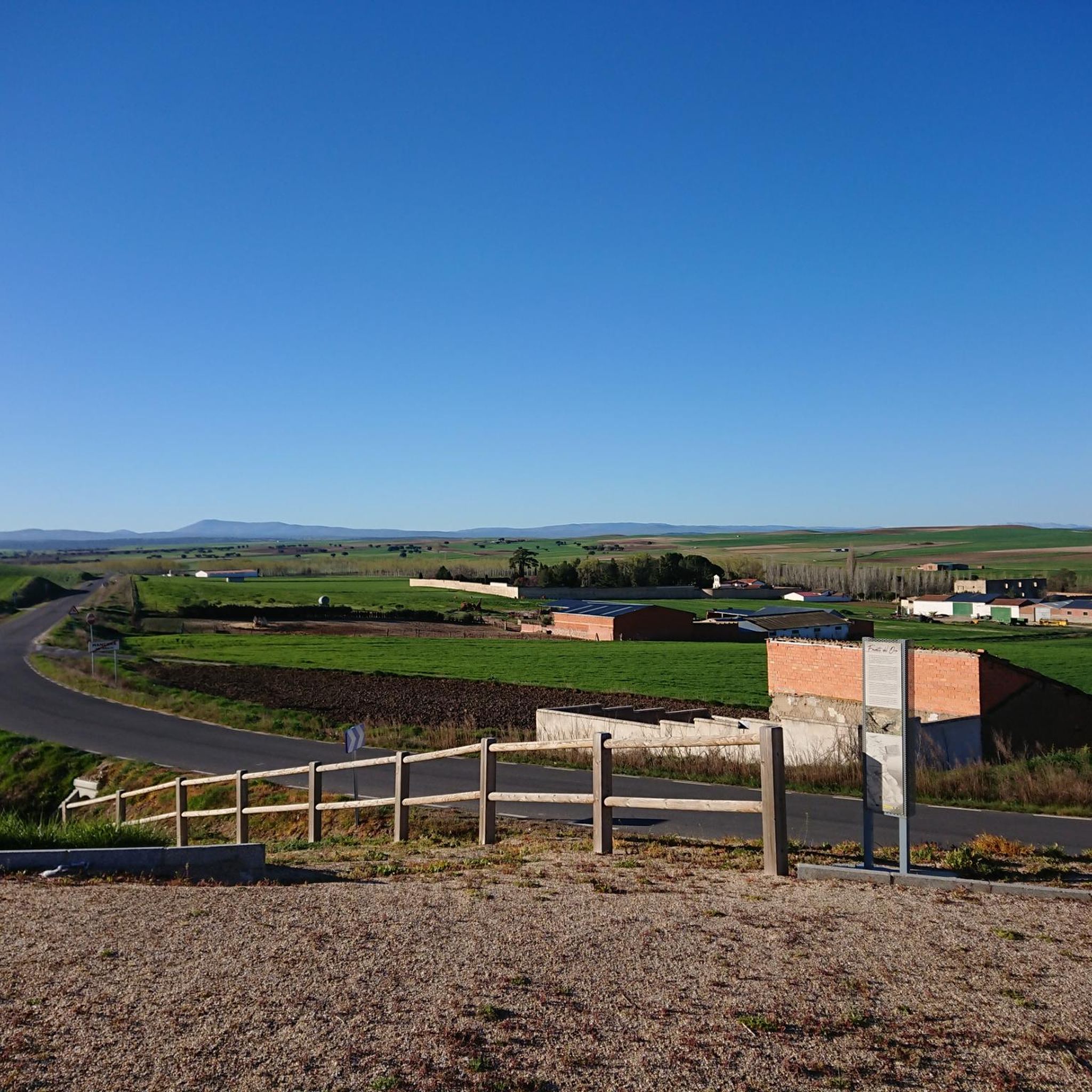
Hiking around Mancera De Abajo offers access to the diverse landscapes of the Sierra de Francia mountain range and the Natural Park of Las Batuecas-Sierra de Francia. The region features mountainous terrain, characterized by peaks and hidden valleys, alongside extensive forests of Pyrenean oak, chestnut, and pine. The Navazamplón River also contributes to the local natural features.
Best hiking trails around Mancera De Abajo
- The most popular hiking route is Peñaranda de Bracamonte and Cantaracillo Loop, a 6.6 miles…
Last updated: June 28, 2026
6
hikers
10.6km
02:43
40m
40m
Moderate hike. Good fitness required. Easily-accessible paths. Suitable for all skill levels.
4
hikers
11.5km
02:58
60m
60m
Moderate hike. Good fitness required. Easily-accessible paths. Suitable for all skill levels.

Sign up for free
3
hikers
9.53km
02:27
50m
50m
Moderate hike. Good fitness required. Easily-accessible paths. Suitable for all skill levels.
3
hikers
10.1km
02:36
40m
40m
Moderate hike. Good fitness required. Easily-accessible paths. Suitable for all skill levels.
2
hikers
13.3km
03:25
70m
70m
Moderate hike. Good fitness required. Easily-accessible paths. Suitable for all skill levels.
Get access to more routes and recommendations from other explorers.
Sign up for free
Already have an account?
Our route recommendations are based on thousands of hikes, rides, and runs completed by other people on komoot.
Start today with a free account
Your next adventure awaits.
Login or Signup

Tips from the Community

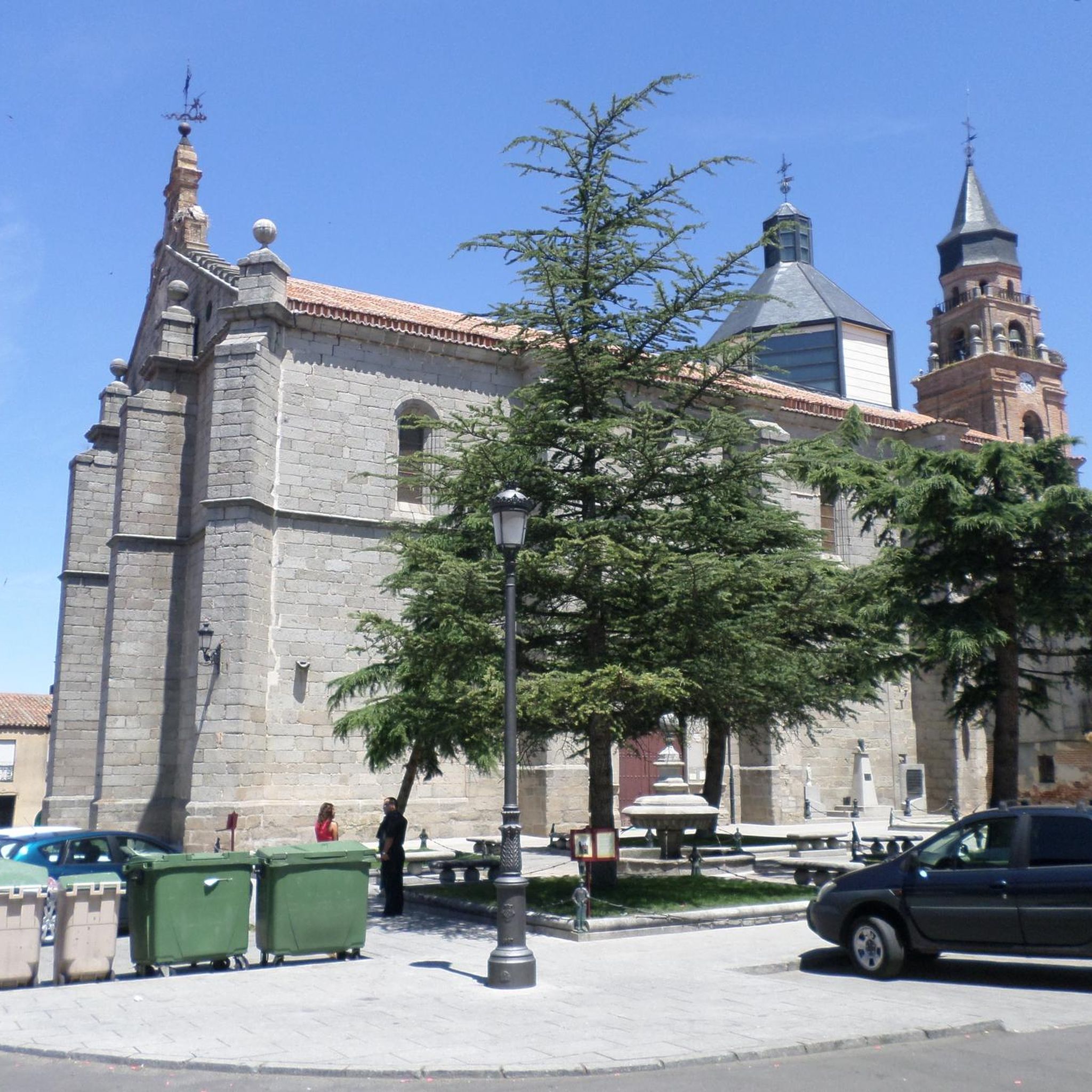
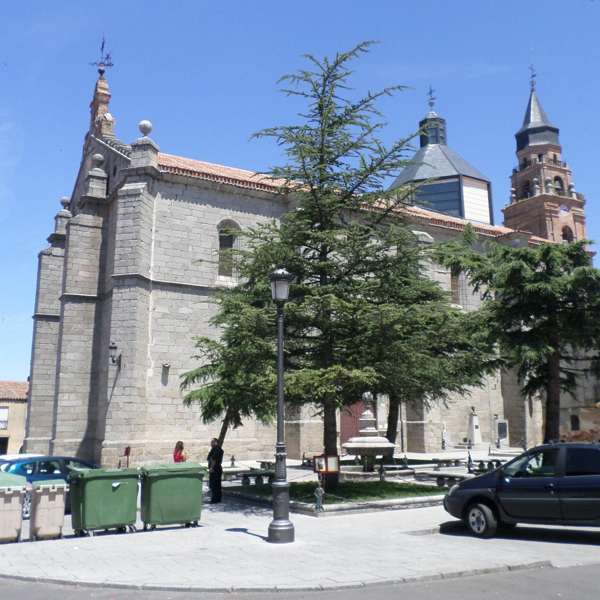
The Church of San Miguel in Peñaranda de Bracamonte is a beautiful classicist-style temple, built in quarry stone. Although its interior was severely damaged in 1971, its imposing exterior façade remains a testament to its history. After the fire of 1971, only the main altar chapel was saved, where the main altarpiece was located, a baroque masterpiece made by Sebastián Ducete and Esteban de Rueda. The chapel of San Antonio is also preserved, and in it you can see the Cristo de la Cama, an object of great local devotion. The stone baptismal font is original and was remodeled under the direction of Fernando Pulín, who received the National Restoration Award for his work. If you ever visit Peñaranda de Bracamonte, be sure to admire this architectural gem. 🌟🏰
2
0

The patronage of this place of worship “Santa Maria Asunción” or “Nuestra Señora de La Asunción” (in German-speaking countries it is called “Assumption of Mary”) refers to one of the many memorial or feast days in honor of the Blessed Mother Mary in the church year. It goes back to the festival of her physical assumption into heaven, which the (Catholic) Church celebrates annually on August 15th. In the Orthodox churches the festival is celebrated under the name “Assumption of the Virgin Mary”. In rural areas, depending on the region, it is part of the local custom that bundles of herbs are collected by the population on this day and blessed in the festival service.
2
0
This church was dedicated to the Archangel Michael "San MIGUEL". The name (coming from the Hebrew language) means "Who is like God?". He is often depicted - in paintings or as a statue - with a flaming sword, and occasionally a lance. Michael / Miguel is - along with Raphael, Gabriel and Uriel - one of the four archangels who (according to human understanding) occupy the highest rank in the heavenly hierarchy of angelic beings. Their common feast day in the saints' calendar is September 29th.
1
0

Church of Nuestra Señora de La Asunción is a Mudejar-style church, renovated in the 16th century. From the first construction phase (12th - 13th centuries), only part of the central apse remains. Its tower stands out, called "La Buena Moza", visible from several kilometers.
2
0

A good park with a physical exercise machine
0
0

The history of this town is linked to the fact that it is the head of a region, Tierra de Peñaranda, also known as Campo de Peñaranda. Its churches and streets are very beautiful!
0
0
The Renaissance-style parish church of San Miguel has existed since the mid-15th century as a church-fortress. Its interior was almost completely destroyed in 1971 after a fire.
4
0
Frequently Asked Questions
What kind of natural features can I expect to see on hikes around Mancera de Abajo?
Hiking around Mancera de Abajo offers a diverse landscape. You'll encounter the mountainous terrain of the Sierra de Francia, featuring peaks like Hastiala and Peña de Francia, alongside lush woodlands of Pyrenean oak, chestnut, and pine. The region is also known for its hidden valleys within the Natural Park of Las Batuecas-Sierra de Francia, and the Navazamplón River adds to the local natural charm.
Are there any waterfalls to visit on hikes in the region?
Yes, the wider Sierra de Francia region, accessible from Mancera de Abajo, features impressive waterfalls such as the Meancera and Chorro waterfalls. These offer scenic destinations for hikers exploring the area's natural beauty.
What is the general difficulty level of hikes in Mancera de Abajo?
The hiking trails around Mancera de Abajo primarily offer moderate difficulty options. Out of the 8 available routes, 7 are rated as moderate, with one easy trail. This means most paths are suitable for hikers with a reasonable level of fitness, exploring varied rural terrain and open countryside.
Are there any circular walks available in the area?
Yes, the Sierra de Francia region is home to unique 'Caminos de Arte en la Naturaleza' (Nature Art Paths), which are typically circular routes ranging from 7 to 10 km. These trails integrate various works of art into the landscape, offering a distinctive hiking experience. Examples include the Camino de los Prodigios and Camino del Agua.
Are there family-friendly hiking options around Mancera de Abajo?
While most routes are moderate, the region's diverse network includes paths suitable for different ability levels. The presence of one easy trail suggests there are options that could be more suitable for families. Exploring the less strenuous sections of the 'Caminos de Arte en la Naturaleza' or paths through traditional villages might also be enjoyable for families.
Can I bring my dog on the hiking trails?
The Natural Park of Las Batuecas-Sierra de Francia, which is a protected natural space, generally welcomes dogs on trails, but it's always advisable to keep them on a leash to protect local wildlife and ensure a pleasant experience for all hikers. Specific regulations might apply in certain sensitive areas, so checking local signage is recommended.
What is the best time of year to go hiking in Mancera de Abajo?
The Sierra de Francia region, near Mancera de Abajo, is known for its excellent weather, making it suitable for hiking for much of the year. Spring and autumn are particularly pleasant, with mild temperatures and vibrant natural colors. Summer can also be good, especially in the mornings or late afternoons, to avoid the midday heat.
Are there any unique art trails in the area?
Yes, the Sierra de Francia is renowned for its 'Caminos de Arte en la Naturaleza' (Nature Art Paths). These are original routes where hikers can discover various works of art seamlessly integrated into the natural landscape. Notable examples include the Camino de los Prodigios, Asentadero-Bosque de los Espejos, Camino de las Raíces, and Camino del Agua.
Are there any pilgrimage routes in the area?
Mancera de Abajo is part of the historical 'De la Cuna al Sepulcro' route, a significant pilgrimage path connected to Santa Teresa de Jesús. This offers a unique walking experience that combines spiritual journey with exploration of the region's landscapes and cultural heritage.
What do other hikers enjoy the most about hiking in Mancera de Abajo?
The area is highly rated by the komoot community, with an average score of 5.0 stars. Hikers often praise the varied terrain, which includes open countryside, agricultural lands, and the natural surroundings of charming villages. The opportunity to explore diverse landscapes, from river valleys to lush woodlands, is a key draw.
Are there any challenging hiking routes near Mancera de Abajo?
While most routes directly around Mancera de Abajo are moderate, the broader Sierra de Francia mountain range features significant peaks like Hastiala (1,735 meters) and Peña de Francia (1,723 meters). These offer more challenging climbs and panoramic views for experienced hikers seeking greater elevation gain and rugged terrain.
How many hiking trails are there around Mancera de Abajo?
There are 8 hiking trails available around Mancera de Abajo. These routes offer a range of experiences, from easy strolls to moderate excursions through the region's diverse landscapes.
Can I find circular routes that explore the countryside?
Absolutely. Many routes in the area are designed as loops, allowing you to start and end in the same location. For example, the La Charca loop from Macotera is a moderate 9.5 km path that takes you through varied rural terrain. Another option is the Church of the Assumption loop from Peñaranda de Bracamonte, covering 12.6 km.

Get inspired with the komoot mobile app


Explore more
Browse the best Hikes in other regions.
