The best walks and hikes around Pegalajar
4.5
(69)
452
hikers
45
hikes
Hiking around Pegalajar offers diverse terrain within the province of Jaén, Spain. The region is characterized by its location at the foot of the Sierra Mágina mountains, with a significant portion lying within the Sierra Mágina Natural Park. This landscape features rugged limestone mountains, Mediterranean forests of holm oaks and pines, and notable water features like La Charca and Fuente de la Reja. Trails traverse varied elevations, from the lower orchards to higher mountain viewpoints.
Best hiking trails around Pegalajar
…Last updated: October 14, 2026
4.8
(4)
16
hikers
10.1km
03:14
440m
430m
Hike the moderate 6.3-mile Cruz de la Chimba Trail, featuring coffee plantations, artistic sculptures, and views near Santa Ana.
4
hikers
10.0km
03:44
680m
690m
Hike the Cerro Almadén circular route in Sierra Mágina Natural Park, a moderate 6.2-mile trail with panoramic views and diverse terrain.

4.0
(2)
7
hikers
16.2km
05:13
710m
710m
Hard hike. Very good fitness required. Easily-accessible paths. Suitable for all skill levels.
4.8
(8)
42
hikers
Easy hike. Great for any fitness level. Easily-accessible paths. Suitable for all skill levels.
4.4
(7)
30
hikers
13.1km
03:55
410m
410m
Moderate hike. Good fitness required. Easily-accessible paths. Suitable for all skill levels.
Get access to more routes and recommendations from other explorers.
Already have an account?
Our route recommendations are based on thousands of hikes, rides, and runs completed by other people on komoot.
Start today with a free account
Your next adventure awaits.

Tips from the Community

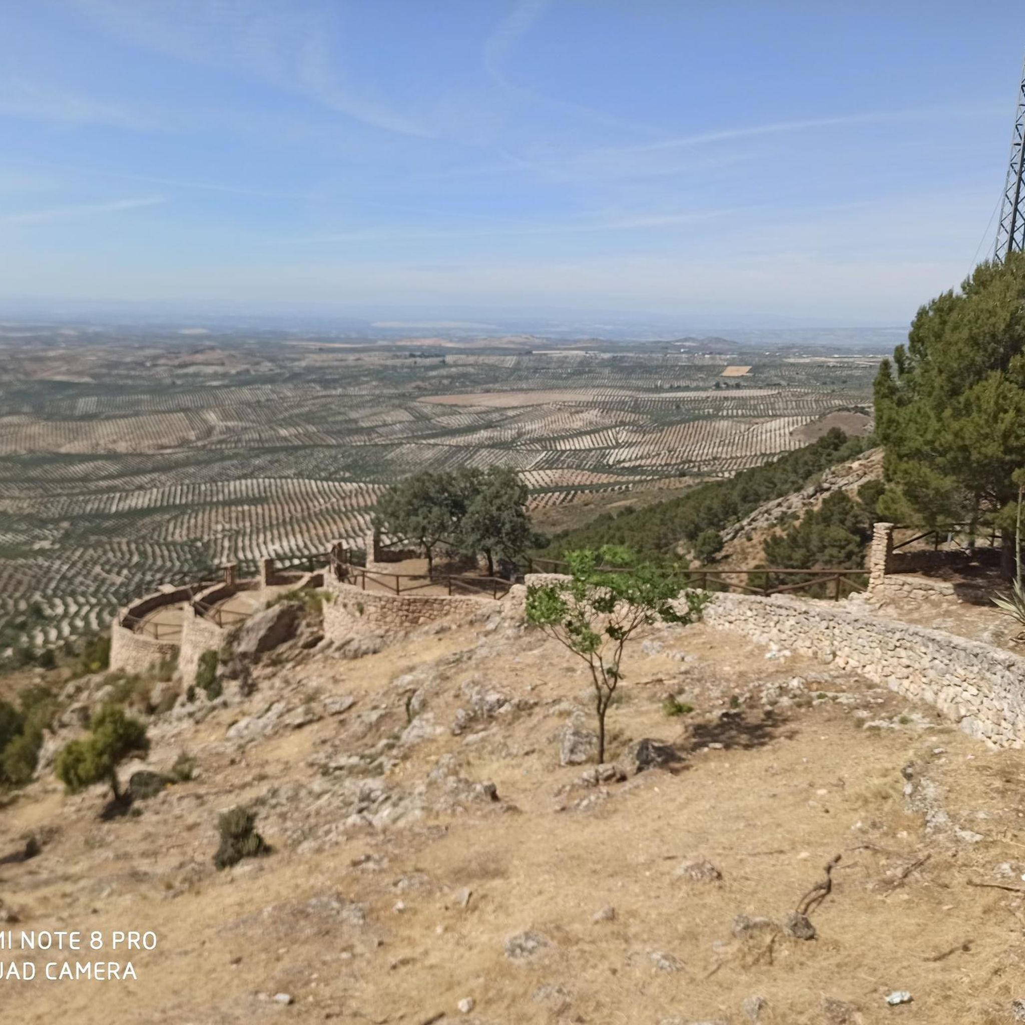
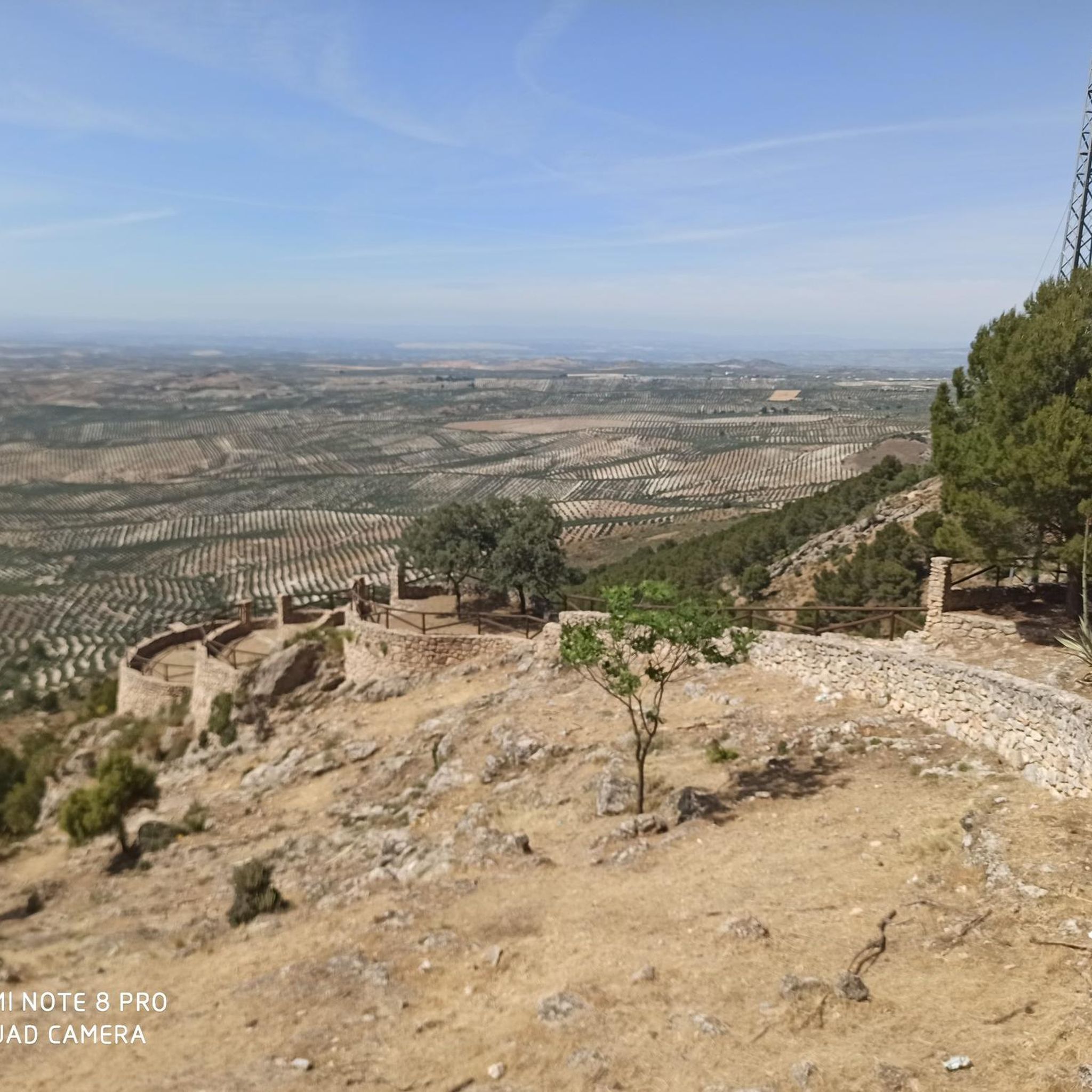
From this viewpoint, you can contemplate the impressive views of the Quiebrajano valley, the Otiñar, and the horizon can be seen: the Jabalcuz mountain range, Jaén, and the majestic La Pandera mountain range.
1
0
It is an easy and pleasant trail through trees that leads to the Chimba peak. In some sections the views of the rocky walls and the ledges of the surrounding mountains are incredible.
0
0


La Charca park is a great stop on a hot summer day. The pond and the irrigation system and the importance of this spring are collected in the Chronicles of Constable Iranzo which, already in the year 1469, mention the Old Fountain and the irrigation of the Huertas de Pegalajar.
1
0

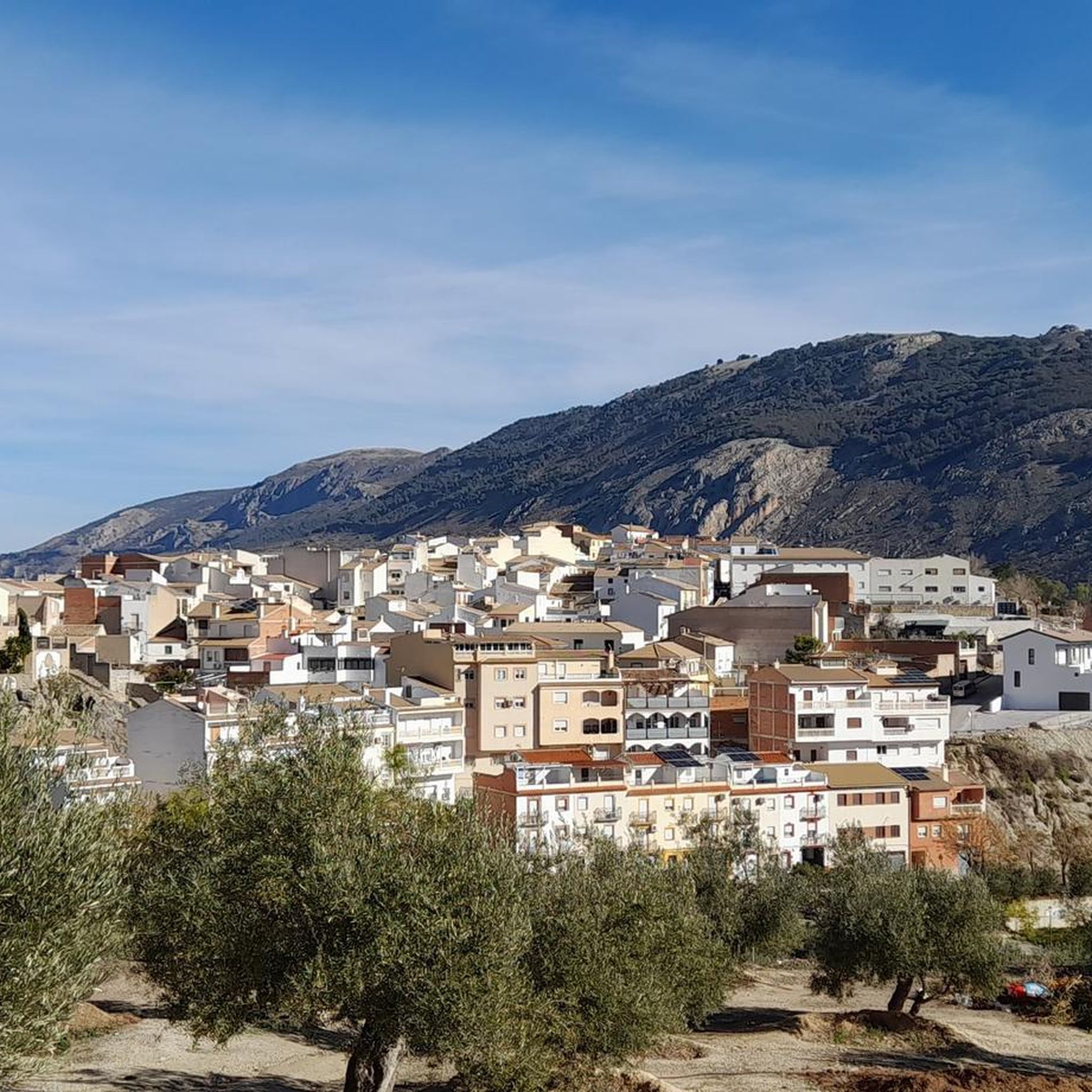
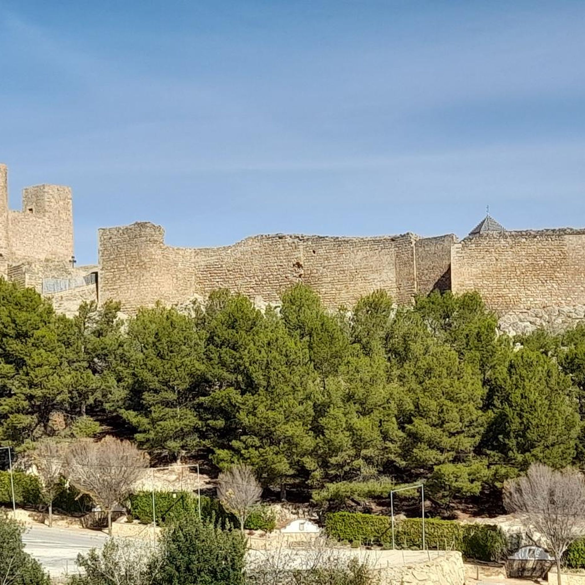
Population located in the province of the same name, in the region of Sierra Mágina, province of Jaén. A part of its municipal territory is located within the Sierra Mágina Natural Park. Among other points of interest we find the Encarnación, which is a 15th century Gothic building and the church dedicated to the Holy Cross, a 16th century Renaissance temple, which suffered great damage in the Spanish civil war and in which its bell tower stands out. which is a remainder of the old medieval fortress.
1
0
Small refuge at 1154 meters altitude, near the famous Cañada de las Hazadillas. Easily accessible and in a setting of singular beauty, it has become one of the most frequented routes in the Sierra Sur.
1
0
Hill located in the natural park of Sierra Mágina in the province of Jaén. Its altitude is 2,078m It is linked to the main massif of Mágina by the port of La Mata
2
0
Peak where the municipalities of Pegalajar, Mancha Real and Torres meet, and from which there are spectacular views of the Bercho shade, one of the steepest and wildest areas in the municipality of Pegalajar. We can also enjoy incredible views of the Sierra de Jaén.
2
1
Frequently Asked Questions
How many hiking trails are available in Pegalajar?
There are over 40 hiking trails around Pegalajar, offering a wide range of options for different skill levels. You'll find everything from easy strolls through orchards to more challenging mountain ascents within the Sierra Mágina Natural Park.
What types of terrain can I expect on Pegalajar's hiking trails?
Pegalajar's trails feature diverse terrain, including rugged limestone mountains, dense Mediterranean forests of holm oaks and pines, and paths winding through historic orchards. The region is characterized by its location at the foot of the Sierra Mágina mountains, offering varied elevations and scenic landscapes.
Are there any easy hiking trails suitable for families in Pegalajar?
Yes, Pegalajar offers several easy routes perfect for families. The "Sendero de la Huerta de Pegalajar" is an excellent choice, starting from La Charca and winding through the town's ethnologically significant orchards. Another easy option is the Cruz de la Calamba Refuge – Cruz de la Chimba Refuge loop, which is about 6.3 km long.
What are some challenging hikes around Pegalajar?
For those seeking a challenge, the region offers more demanding ascents within the Sierra Mágina Natural Park. A notable difficult route is the Mojon Blanco - circular from Mancha Real, which is over 16 km long and involves significant elevation gain.
What natural features or points of interest can I see while hiking in Pegalajar?
Pegalajar is rich in natural beauty. You can explore the dramatic limestone mountains of Sierra Mágina, visit the historic La Charca de Pegalajar and Fuente de la Reja spring, or discover caves like Cueva de Aro. The Pico Mágina Summit (2,167 m) offers panoramic views, and the Ojo de buey is another interesting natural monument.
Are there any circular hiking routes in Pegalajar?
Yes, Pegalajar features several circular routes. The "Sendero de la Serrezuela" is a popular well-marked loop around the slopes of the Serrezuela mountain. Another great option is the Cerro Almadén Loop Trail, which provides excellent views of the surrounding mountains and valleys.
What is the best time of year to hike in Pegalajar?
The best time to hike in Pegalajar is generally during spring (March to May) and autumn (September to November) when temperatures are milder and the natural landscapes are at their most vibrant. Summers can be very hot, especially at lower elevations, while winters offer cooler, sometimes crisp, conditions.
What do other hikers enjoy most about hiking in Pegalajar?
The hiking experience in Pegalajar is highly rated by the komoot community, with an average score of 4.4 stars from over 60 reviews. Hikers often praise the diverse terrain, the stunning views of the Sierra Mágina, and the well-preserved natural environment, including the unique water features like La Charca.
Are there any historical landmarks or castles near Pegalajar's hiking trails?
Yes, the region has historical significance. The Albanchez de Mágina Castle is a notable landmark nearby, offering a glimpse into the area's past and often providing scenic views from its location.
Can I find trails that offer great viewpoints in Pegalajar?
Absolutely. The Serrezuela mountain, very close to the town center, serves as a natural viewpoint offering extensive views of the Alto Valle del Río Guadalquivir. The "Sendero de la Serrezuela" includes access to the "Peña de los Buitres" viewpoint, which provides interpretive information about the landscape.
Are there any trails that pass by water features or springs?
Yes, the existence of Pegalajar is closely tied to its water features. The "Sendero de la Huerta de Pegalajar" winds through orchards irrigated by the Fuente de la Reja spring and its reservoir, La Charca. You can also find the Río Frío Spring among the nearby natural attractions.
How difficult are the hiking trails in Pegalajar generally?
The trails in Pegalajar offer a range of difficulties. Out of over 40 routes, 3 are considered easy, 33 are moderate, and 5 are difficult. This means there are plenty of options for both casual walkers and experienced hikers looking for a challenge.
Most popular routes around Pegalajar
Most popular attractions around Pegalajar

Get inspired with the komoot mobile app


Explore more
Browse the best Hikes in other regions.
